The best walks and hikes around Vals
4.7
(418)
3,140
hikers
61
hikes
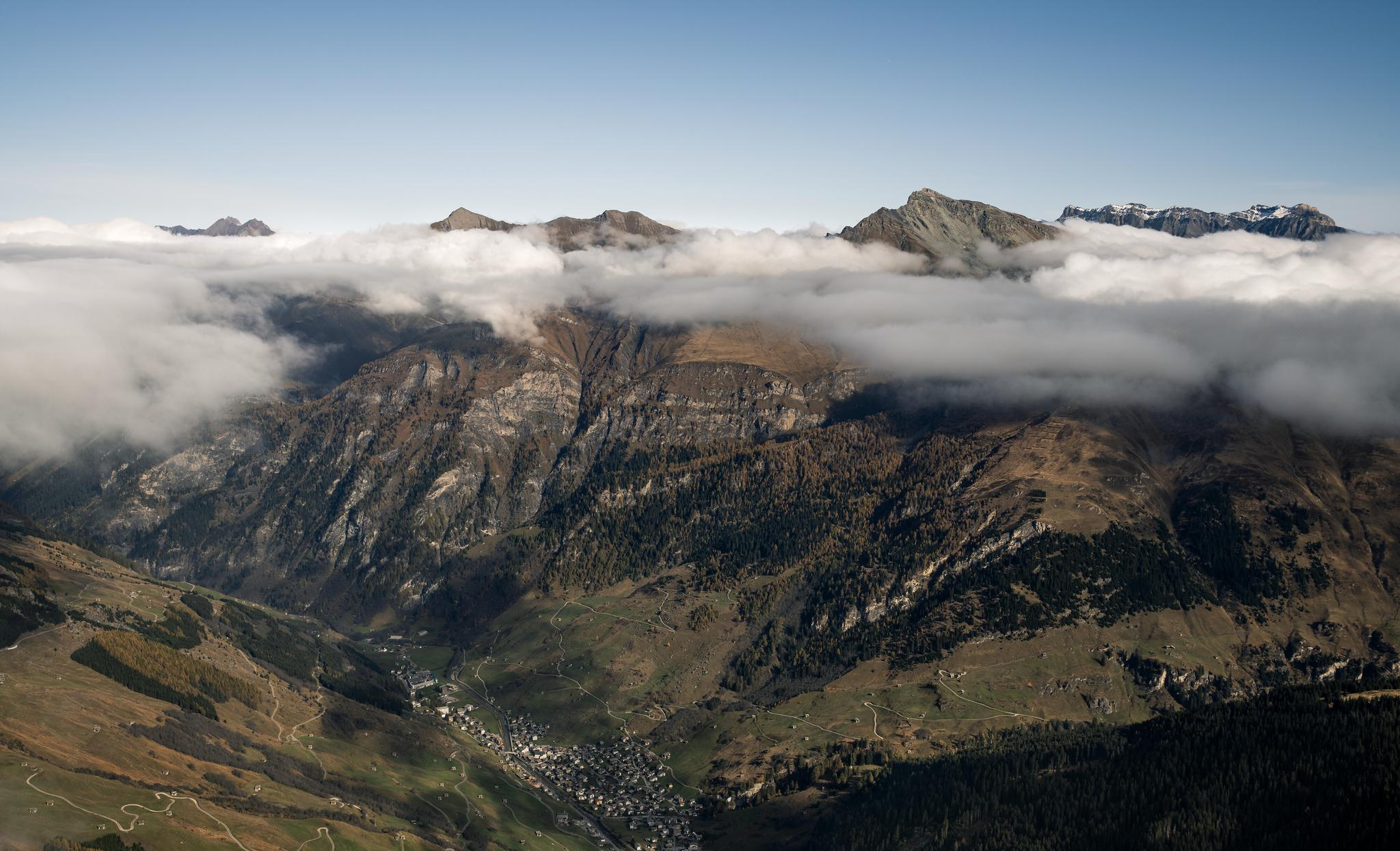
Hiking around Vals offers access to a diverse mountain landscape, characterized by the deeply incised Vals valley extending into the glaciated main ridge of the Alps. The region features high-altitude corrie lakes, alpine meadows, and wild forests. Trails traverse varied terrain, from accessible paths to rugged mountain routes, providing views of prominent peaks and the opportunity to encounter unique alpine flora and fauna.
Best hiking trails around Vals
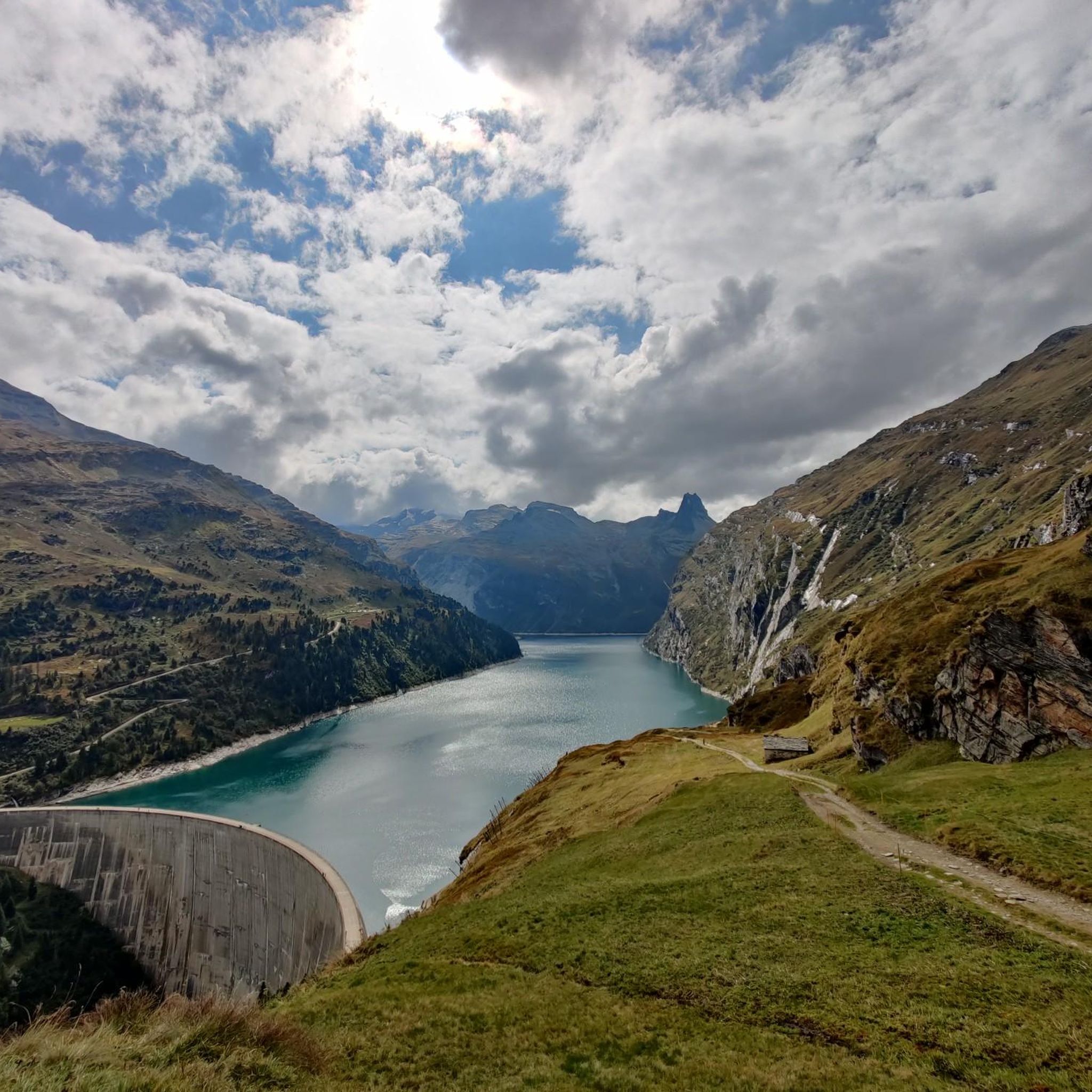
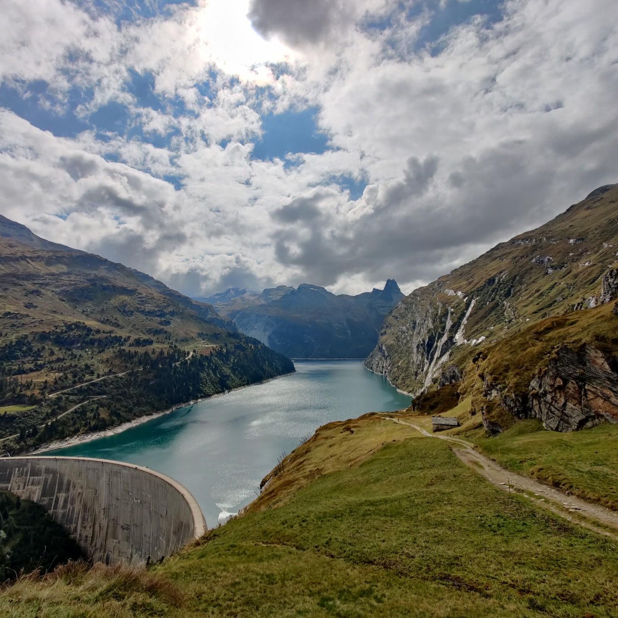
- The most popular hiking route is St. Anna Chapel on Frunt – View of Lake Zervreila loop from Zervreila, a 5.6 miles (9.1 km) trail that takes 2 hours 52 minutes to complete. This moderate loop offers views of Lake Zervreila and the St. Anna Chapel.
- Another top favourite among local hikers is Vals village square – View of Lake Zervreila loop from Vals, Ronastäg, a difficult 10.6 miles (17.0 km) path. This challenging route provides expansive views over Lake Zervreila with significant elevation gain.
- Local hikers also love the View of Lake Zervreila – St. Anna Chapel on Frunt loop from Gadastatt, a 4.8 miles (7.8 km) trail leading through the area around Lake Zervreila and St. Anna Chapel, often completed in about 2 hours 14 minutes.
- Hiking around Vals is defined by high-altitude corrie lakes, alpine meadows, and glaciated mountain ridges. The extensive network offers options for various ability levels, from easy walks to challenging mountain treks.
- The routes in Vals are highly rated by the komoot community with an average score of 4.7 stars from more than 350 reviews. More than 3000 hikers have used komoot to explore Vals's varied terrain.
Last updated: September 28, 2026
5.0
(2)
42
hikers
18.7km
08:21
1,000m
1,000m
Hard hike. Very good fitness required. Mostly accessible paths. Sure-footedness required.
5.0
(2)
17
hikers
7.48km
04:01
1,160m
10m
Hard hike. Very good fitness required. Mostly accessible paths. Sure-footedness required.

10
hikers
6.89km
04:14
1,200m
Hard hike. Very good fitness required. Sure-footedness, sturdy shoes and alpine experience required.
5.0
(1)
11
hikers
11.4km
05:52
1,190m
140m
Hard hike. Very good fitness required. Sure-footedness, sturdy shoes and alpine experience required.
1
hikers
7.92km
03:58
1,070m
0m
Hard hike. Very good fitness required. Sure-footedness, sturdy shoes and alpine experience required.
Get access to more routes and recommendations from other explorers.
Already have an account?
Our route recommendations are based on thousands of hikes, rides, and runs completed by other people on komoot.
Start today with a free account
Your next adventure awaits.

Other adventures around Vals

Tips from the Community

Impressively beautiful, an experience!
2
0
An experience, despite the beauty, you have to pay a little attention to the path.
0
0

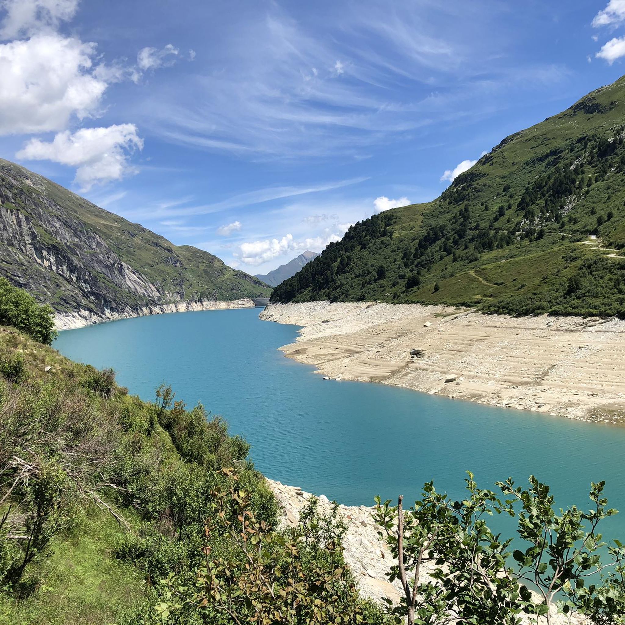
The Zervreilasee, also spelled Zerfreilasee, is idyllically located in the Valsertal valley and is the starting point for many summit hikes.
0
0
You can hike from the Valsertal to the Val Lumnezia via the Fuorcla da Patnaul pass.
0
0
Despite its 3,000 meters, the Faltschonhorn is an easily accessible peak in the Valsertal.
0
0
The bus stop is the starting point for many hikes in the Valsertal.
1
0
From Pradätsch you can continue hiking towards Alp Tomül and Tomülpass. Or up to the Valser local mountain "Höreli" (Hora).
0
0
The Furggelti is a breathtaking pass between the Zervreilahorn and the Furggeltihorn.
0
0
Frequently Asked Questions
How many hiking trails are there in Vals?
Vals offers an extensive network of over 60 hiking trails. These range from easy walks to challenging mountain treks, catering to various fitness levels and preferences.
What types of terrain can I expect on hikes in Vals?
The terrain in Vals is incredibly diverse. You can expect to traverse high-altitude corrie lakes, alpine meadows, moorland, and wild forests. The deeply incised Vals valley extends into the glaciated main ridge of the Alps, offering everything from accessible paths to rugged mountain routes.
Are there any easy hiking trails suitable for beginners or families in Vals?
Yes, Vals has 11 easy hiking trails. While specific family-friendly routes are not detailed here, easy trails are generally suitable for beginners. For a moderate option with beautiful views, consider the View of Lake Zervreila – St. Anna Chapel on Frunt loop from Gadastatt, which is 4.8 miles (7.8 km) long.
What are some notable natural features or landmarks to see while hiking in Vals?
Vals is rich in natural beauty. You can encounter stunning alpine lakes, such as those on the famous '3-lake hike,' and impressive peaks like the Faltschonhorn and Fanellhorn. The region also features unique flora and fauna, and natural wonders like the Valser Tüüfelstei. Highlights like Lago di Luzzone and Luzzone Dam and the Greina Plateau are also nearby.
Are there any circular hiking routes in Vals?
Yes, many routes in Vals are circular. For example, the St. Anna Chapel on Frunt – View of Lake Zervreila loop from Zervreila is a moderate 5.6-mile (9.1 km) loop offering views of Lake Zervreila. Another challenging circular option is the Vals village square – View of Lake Zervreila loop from Vals, Ronastäg, which is 10.6 miles (17.0 km) long.
What do other hikers enjoy most about hiking in Vals?
The komoot community highly rates hiking in Vals, with an average score of 4.7 stars from over 370 reviews. Hikers frequently praise the breathtaking mountain scenery, diverse trails, and the unique natural features like the high-altitude corrie lakes and alpine meadows. The opportunity to spot wild animals and hear marmots is also a highlight for many.
Are there any challenging hikes for experienced mountaineers in Vals?
Vals offers 20 difficult hiking trails, including high-altitude tours in the rear Vals valley, extending into the glaciated main ridge of the Alps. These routes often require sure-footedness and alpine experience. An example is the View of Zervreila Reservoir – Amperfreila Alpine Huts loop from Zervreila, a challenging 11.9-mile (19.1 km) route.
Can I access hiking trails in Vals using public transport?
While specific public transport details for trailheads are not provided, Vals is generally accessible. The Vals gondola also offers convenient access to higher mountain landscapes, allowing quicker access to some trails and stunning views.
Are there places to eat or stay near the hiking trails in Vals?
Yes, there are options for refreshments and accommodation. For example, the Gadastatt Panorama Restaurant is a highlight near some trails, offering a place to rest and enjoy views. The region also has various accommodation options catering to hikers.
What kind of wildlife can I expect to see while hiking in Vals?
The hiking trails in Vals provide opportunities to encounter unique alpine flora and fauna. Hikers often spot shy wild animals and can hear the distinctive whistle of marmots, especially in the higher alpine regions.
Are there any routes that offer panoramic views of Lake Zervreila?
Absolutely. Lake Zervreila is a prominent feature in many Vals hikes. The St. Anna Chapel on Frunt – View of Lake Zervreila loop from Zervreila and the View of Lake Zervreila – St. Anna Chapel on Frunt loop from Gadastatt both offer excellent views of the lake.
Are there any guided hiking tours available in Vals?
Yes, Vals offers guided full-day and half-day hikes with mountain guides. These guided experiences provide an excellent opportunity to explore the breathtaking landscape surrounded by high peaks with expert local knowledge.
Most popular attractions around Vals

Get inspired with the komoot mobile app


Explore more
Browse the best Hikes in other regions.
