The best walks and hikes around Stutton
4.5
(969)
6,965
hikers
12
hikes
Hikes around Stutton are set on the Shotley Peninsula, a landscape defined by its proximity to the River Stour and the large Alton Water reservoir. The terrain consists of gentle undulations through woodlands, across meadows, and along waterside paths. The area is part of the Suffolk & Essex Coast & Heaths National Landscape, offering a mix of rural and coastal scenery for walkers.
Best hiking trails around Stutton
- The most popular hiking route is the Alton Water loop — Suffolk…
Last updated: August 3, 2026
4.9
(42)
387
hikers
15.8km
04:02
60m
60m
The Alton Water Loop is a moderate hike covering 9.8 miles (15.8 km) with an elevation gain of 197 feet (60 metres). You can expect to spend around 4 hours…
4.8
(4)
20
hikers
6.01km
01:34
40m
40m
This easy 3.7-mile (6.0 km) hike around Holbrook Creek offers diverse scenery, views of Holbrook Bay, and birdwatching opportunities.

Sign up for free
5.0
(1)
29
hikers
7.24km
01:51
20m
20m
Easy hike. Great for any fitness level. Easily-accessible paths. Suitable for all skill levels.
5.0
(1)
11
hikers
4.99km
01:18
30m
30m
Easy hike. Great for any fitness level. Easily-accessible paths. Suitable for all skill levels.
11
hikers
4.42km
01:08
20m
20m
Easy hike. Great for any fitness level. Easily-accessible paths. Suitable for all skill levels.
Get access to more routes and recommendations from other explorers.
Sign up for free
Already have an account?
Our route recommendations are based on thousands of hikes, rides, and runs completed by other people on komoot.
Start today with a free account
Your next adventure awaits.
Login or Signup
Tips from the Community

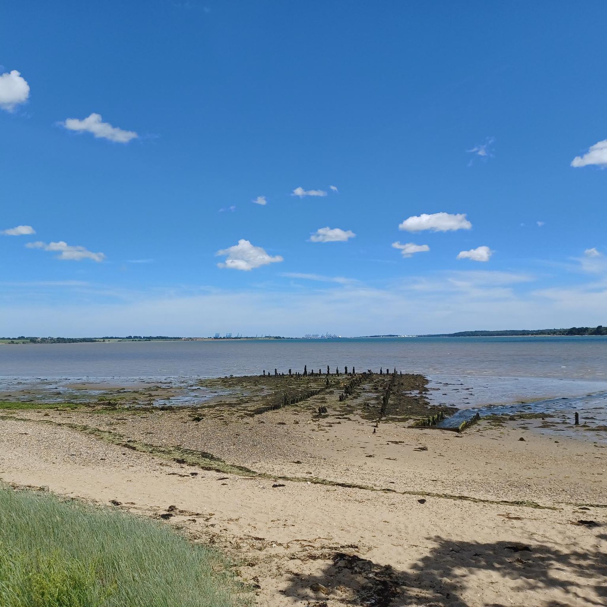
Clean, tidy beach. People probably haven't had time to litter here yet.
2
0

From this point you can access a beautiful sand and shingle riverside beach with gorgeous views across the water to Wrabness on the other side.
2
0

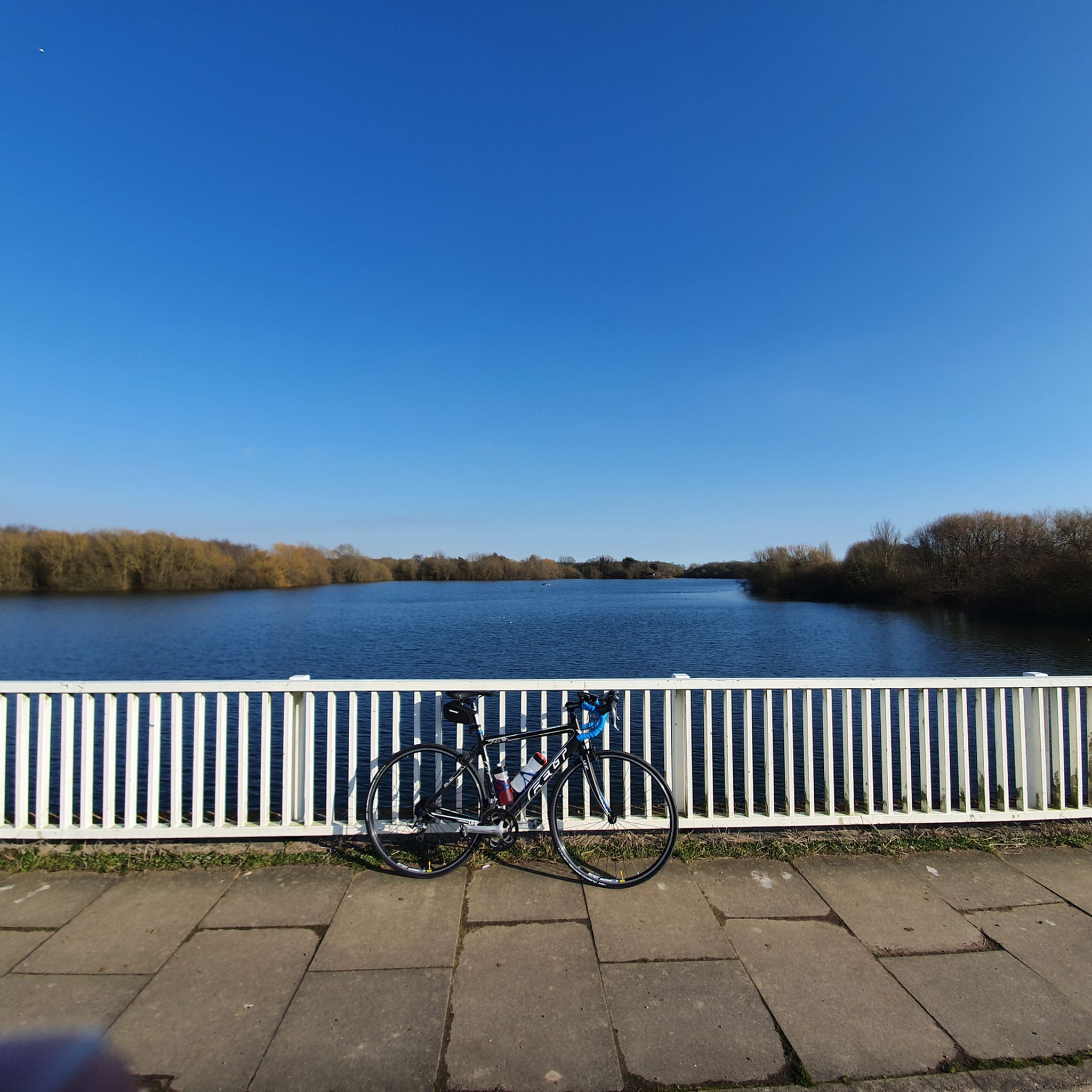
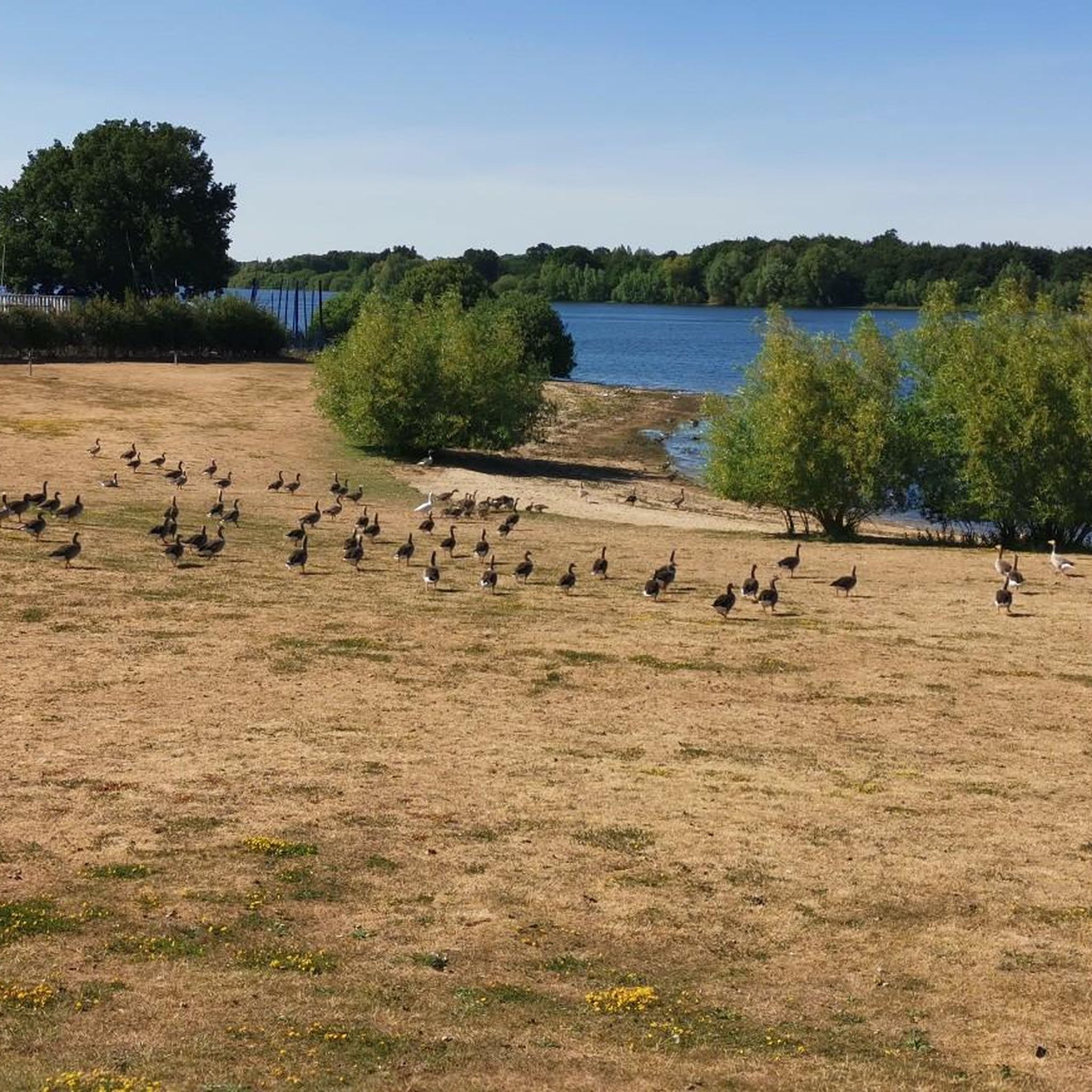
The road is a dead end but the lakeside view is very nice. Worth it if you want somewhere scenic to stop although not always very tranquil in the summer with the watersports centre, neighbouring campsite and playground.
0
0

the welcome cafe had great flapjacks for refuelling
0
0

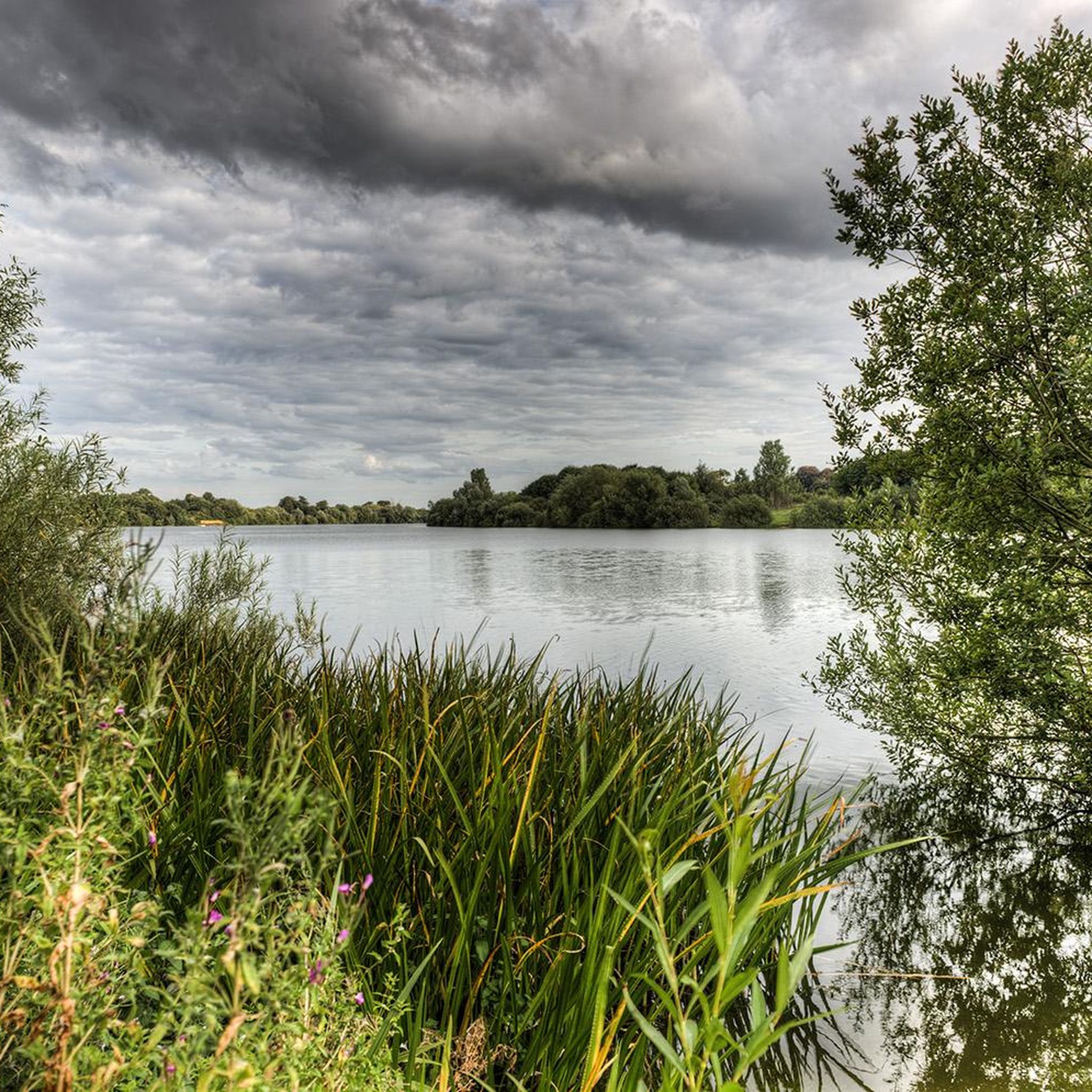
Completed in 1987, Alton Water is a hive of outdoor activity from watersports, cycling, walking, running, birdwatching and fishing. There is a cafe and toilets at the watersports centre plus camping if you would like to extend your visit.
0
0
Low and high tide Holbrook Creek have a very different feel, but both are equally beautiful. At low tide you can explore the rock pools and look for interesting pebbles and shells on the shore. You will rarely find many other people hiking here, despite its charm. A real Suffolk secret.
2
0
Completed in 1987, Alton Water is a hive of outdoor activity from watersports, cycling, walking, birdwatching and fishing. There is a cafe and toilets at the watersports centre plus camping if you would like to extend your visit.
1
0
Alton Water is a popular place for outdoor activity, but really exists as a water source for the people of Ipswich. The dam wall blocks the River Gripping and the water treatment works below the dam can treat up to 10 million imperial gallons of water a day!
3
0
Frequently Asked Questions
Are the hiking trails around Stutton suitable for dogs?
Yes, the area is generally dog-friendly. The wide, open paths around Alton Water and through the local woodlands are great for walking with dogs. However, always be mindful of wildlife, especially in the nature reserve areas, and keep your dog on a lead where required, particularly near livestock or during bird nesting season.
Where can I park for walks around Stutton?
For walks around the reservoir, the main car parks are at Alton Water. There are several pay-and-display car parks located around the water park, providing direct access to the main circular trail. For other walks on the Shotley Peninsula, you may find limited on-street parking in villages like Stutton or Holbrook, but be sure to park considerately.
What is a good family-friendly walk in the area?
The Alton Water Dam Wall loop from Holbrook is an excellent choice for families. It's a relatively short and easy walk with mostly flat terrain, offering lovely views of the water without committing to the full reservoir loop. The area also has facilities like cafes and playgrounds near the main visitor centre.
Are there any challenging hikes near Stutton?
The terrain on the Shotley Peninsula is characterized by gentle undulations rather than steep climbs, so you won't find truly challenging mountain hikes. For a longer, more moderate day out, the full Alton Water loop is a good option, covering nearly 10 miles.
Can I get to the trails using public transport?
Yes, Stutton is accessible by bus, with services connecting to larger towns like Ipswich and Manningtree. From the village, you can access several footpaths directly. Check local bus timetables for routes that stop in or near Stutton and Holbrook to plan your journey to the trailheads.
What is the typical terrain like on the trails?
Most trails feature a mix of surfaced paths, grassy tracks through meadows, and woodland footpaths. Routes around Alton Water are generally well-maintained, though some sections on the northern shore can be muddy after rain. Coastal paths along the estuaries might include shingle beaches and earth tracks.
Are there any good circular walks available?
Yes, the area is great for circular walks. A popular shorter option is the Holbrook Creek loop from Stutton, which provides lovely estuary views. Many routes are designed as loops, allowing you to start and finish in the same place without retracing your steps.
What kind of wildlife might I see while hiking?
The Shotley Peninsula is a haven for wildlife. The estuaries are internationally important for overwintering birds like geese and waders. Around Alton Water and in the surrounding woodlands, you might spot various bird species, including nightingales and avocets. The area is part of the Suffolk & Essex Coast & Heaths National Landscape, known for its rich biodiversity.
Are there any pubs or cafes on the walking routes?
While there are no pubs directly on the main reservoir path, you can find them in the nearby villages of Stutton and Holbrook, just a short detour from the trails. The Alton Water visitor centre also has a cafe, which is a convenient stop for refreshments before or after your walk.
What's the scenic difference between walking at Alton Water versus along the River Stour?
Walks around Alton Water offer serene, enclosed views across the vast freshwater reservoir, with paths winding through woodlands and meadows. In contrast, trails along the River Stour, like the Holbrook Creek loop, provide expansive, tidal estuary views, with salt marshes, mudflats, and the sight of boats and distant ports.
Can I walk a section of a long-distance path near Stutton?
Yes, the Stour and Orwell Walk, a long-distance footpath, runs along the Shotley Peninsula. You can easily join a section of this trail to experience the beautiful coastline of the River Stour or River Orwell estuaries. Many of the shorter circular walks in the area incorporate parts of this larger route.
What do other hikers enjoy most about the trails in Stutton?
The area is highly rated by the komoot community, with an average score of 4.6 stars. Reviewers often praise the peaceful atmosphere, the beautiful waterside scenery of both the reservoir and the estuaries, and the well-maintained paths that make for pleasant and accessible walking.
Most popular attractions around Stutton

Get inspired with the komoot mobile app


Explore more
Browse the best Hikes in other regions.
