The best walks and hikes around Portrush
4.6
(620)
6,274
hikers
62
hikes
Hikes around Portrush explore the Causeway Coast of Northern Ireland. The region is characterized by long sandy beaches, such as the East and West Strands, and rugged cliff-top paths with views across the Atlantic Ocean. Most routes follow the coastline, offering a mix of relaxed beach strolls and more extensive coastal treks with minimal elevation change.
Best hiking trails around Portrush
- The most popular hiking route is Portrush & East Strand Beach loop — Causeway Coast, a 3.5 mile…
Last updated: October 10, 2026
5.0
(1)
44
hikers
5.72km
01:28
30m
30m
Hike the easy 3.6-mile Causeway Coast Way: Portrush Loop, featuring East Strand Beach, Ramore Head views, and the Portrush National Nature R
4.3
(3)
19
hikers
21.6km
05:34
100m
100m
Hard hike. Very good fitness required. Easily-accessible paths. Suitable for all skill levels.

3.6
(8)
95
hikers
Moderate hike. Good fitness required. Easily-accessible paths. Suitable for all skill levels.
4.5
(2)
30
hikers
8.64km
02:16
70m
70m
Moderate hike. Good fitness required. Easily-accessible paths. Suitable for all skill levels.
5.0
(1)
28
hikers
Easy hike. Great for any fitness level. Easily-accessible paths. Suitable for all skill levels.
Get access to more routes and recommendations from other explorers.
Already have an account?
Our route recommendations are based on thousands of hikes, rides, and runs completed by other people on komoot.
Tips from the Community


Beautiful walk along the seafront, overlooking the town, the beach and the cliffs in the distance. Lots of shops and restaurants nearby.
1
0

This scenic viewpoint is located nearby to the dock Portstewart Harbour and the grassland Atlantic Circle. You can enjoy good views of Portstewart and down towards benone beach, as well as over to Donegal, and, on a clear day, Scotland in the distance
2
0
This is a large concrete arrow originally painted white. It was used to help direct the bombers towards the target during WW2.
3
0
West Strand Promenade is a wonderful attraction located along the famous Causeway Coast. You can enjoy picturesque surroundings along with a number cafés, restaurants, and shops
2
0
Portrush National Nature Reserve is located on the Portrush headland and within the Causeway Coast Area of Natural Beauty, between Portandoo Harbour and the Blue Pool. The area has been granted a nature reserve due to its historic importance because of the fossils that you can see in the exposed rock on the seashore.
2
0
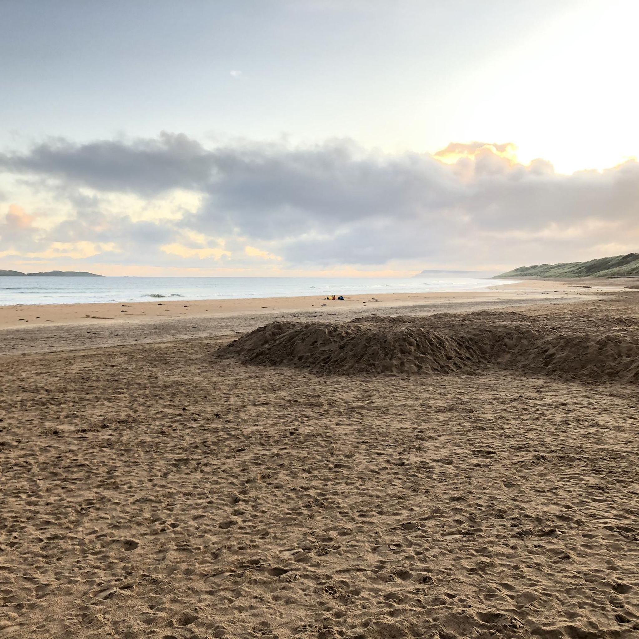
East Strand Beach is famous for its beautiful golden sands, extensive dune systems, and wonderful views over The Skerries and Causeway headlands. From this point, you can access the beach from the footpath. Chuck your shoes in your bag and enjoy some barefoot walking along the sand, or pull up a picnic blanket and enjoy the views.
2
0

Frequently Asked Questions
What kind of scenery can I expect on hikes around Portrush?
The hiking trails around Portrush are defined by their stunning coastal scenery. You can expect to walk along vast sandy beaches like the East and West Strands, follow dramatic cliff-top paths, and stroll along seaside promenades with uninterrupted views across the Atlantic Ocean. Most routes have minimal elevation change, making the spectacular views accessible to many.
Are there any easy, family-friendly walks in the area?
Yes, Portrush is great for family walks. A perfect option is the Portrush & East Strand Beach loop. It's a relatively flat 3.5-mile (5.7 km) walk along the beach, making it suitable for all fitness levels and a fun outing for the whole family.
Can I find any good circular walks starting from Portrush?
Certainly. While many routes follow the coast in one direction, there are excellent circular options. For a shorter loop with great views, consider the View of Portrush Harbour – Viewpoint Over Rocky Coastline loop from Portstewart. It's an easy 3.1-mile (5 km) walk that showcases the beautiful harbour and rugged coastline.
Are dogs allowed on the hiking trails around Portrush?
Dogs are generally welcome on the coastal paths and beaches around Portrush. However, be aware of seasonal restrictions on beaches, especially during summer. It's always best to keep dogs on a lead, particularly on cliff-top paths and near farmland where livestock may be present.
What are some of the best viewpoints on the Portrush coastal walks?
The area is full of incredible vistas. Ramore Head is a highly-regarded spot right in Portrush offering panoramic views. For a walk with consistently amazing scenery, the Portstewart Cliff Walk is a local favorite. Further along the coast, the Shepherd's Steps provide access to a clifftop path with breathtaking views toward the Giant's Causeway.
How can I walk to Dunluce Castle from Portrush?
You can walk to the iconic Dunluce Castle by following the Causeway Coast Way east from Portrush. The route takes you along the Whiterocks Coastal Path, past beautiful limestone cliffs and sandy coves. It's a scenic section of the larger coastal trail and offers fantastic photo opportunities of the castle as you approach.
Is there a challenging long-distance hike starting from Portrush?
Yes, for those seeking a longer challenge, the Portrush to Portstewart route is a great choice. This 13.4-mile (21.6 km) hike connects the two towns and takes over five hours to complete, offering a full day of varied coastal scenery.
How can I get to the trailheads using public transport?
Portrush is well-connected by train and bus services, making it easy to start your hike without a car. Many coastal walks, like the path to Portstewart or Dunluce Castle, can be started directly from the town centre. Regional bus services run along the Causeway Coastal Route, allowing you to hike one way and catch a bus back.
Where can I park for hikes starting in Portrush?
There are several pay-and-display car parks in Portrush town centre, which are convenient for starting hikes along the East or West Strands. For walks heading east towards Dunluce Castle, you can find parking near Whiterocks Beach. Arrive early during peak season as spaces can fill up quickly.
Are there toilets and cafes along the main coastal paths?
Facilities are readily available in the main towns of Portrush and Portstewart, with plenty of public toilets and cafes near the promenades and harbours. However, once you are on the more remote cliff-top sections of the Causeway Coast Way, such as between Portrush and Dunluce Castle, facilities become scarce. It's wise to plan ahead and use the amenities in town before you set off.
What do other hikers enjoy most about the trails in Portrush?
The area is highly rated by the komoot community, with an average score of 4.6 stars. Reviewers often praise the spectacular, ever-present sea views and the mix of terrain, from long sandy beaches to dramatic cliff-top paths. The accessibility of the trails from the town is also a frequently mentioned highlight.
Are the coastal paths accessible for wheelchairs or strollers?
Some sections are accessible. The promenades along the West Strand in Portrush and in Portstewart are paved and flat, making them suitable for wheelchairs and strollers. However, the cliff-top paths and beach sections of the Causeway Coast Way involve uneven ground, steps, and soft sand, and are not considered accessible.
Most popular attractions around Portrush

Get inspired with the komoot mobile app


Explore more
Browse the best Hikes in other regions.
