The best road cycling routes around Ballyreagh Upper
5.0
(1)
180
riders
24
rides
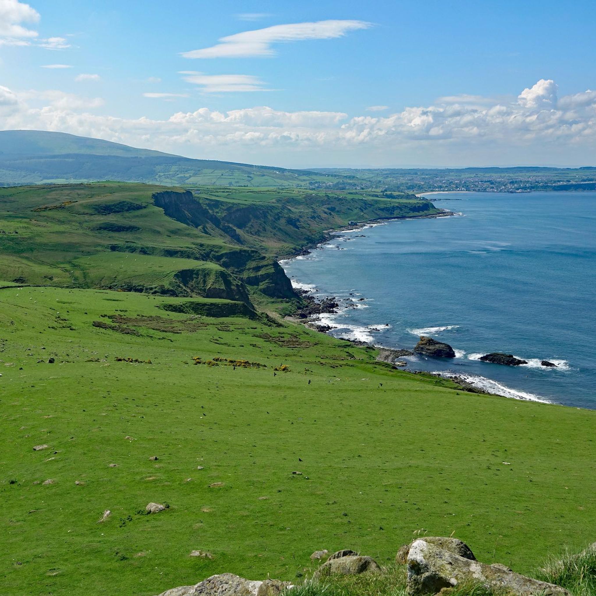
Road cycling routes around Ballyreagh Upper traverse a diverse landscape featuring both flat, scenic paths and more challenging coastal sections. The region is characterized by gently rolling green meadows inland and dramatic cliffs along the North Atlantic coast. Basalt formations and historical landmarks are present, offering varied terrain for road cyclists.
Best road cycling routes around Ballyreagh Upper
- The most popular road cycling route is Cushendun Village – View of Torr Head loop from Ballycastle, a 33.0 miles (53.2…
Last updated: May 17, 2026
22
riders
53.6km
02:47
930m
930m
Hard road ride. Very good fitness required. Some segments of this route may be unpaved and difficult to ride.
18
riders
83.7km
03:52
940m
940m
Hard road ride. Very good fitness required. Mostly well-paved surfaces and easy to ride.

Sign up for free
19
riders
42.6km
02:02
390m
390m
Moderate road ride. Good fitness required. Mostly well-paved surfaces and easy to ride.
16
riders
57.9km
02:46
740m
740m
Moderate road ride. Good fitness required. Mostly well-paved surfaces and easy to ride.
10
riders
84.3km
03:43
800m
800m
Moderate road ride. Good fitness required. Some segments of this route may be unpaved and difficult to ride.
Get access to more routes and recommendations from other explorers.
Sign up for free
Already have an account?
Our route recommendations are based on thousands of hikes, rides, and runs completed by other people on komoot.
Start today with a free account
Your next adventure awaits.
Login or Signup
Popular around Ballyreagh Upper

Tips from the Community


Nice harbour, with ferries to Rathlin Island (opposite, half an hour away) that leave every hour. Lots of ice cream shops nearby and a nice park, very relaxing area.
0
0

An old-fashioned marina in a fishing village. An idyllic place to stop during the long walk on this stretch of the CCR.
2
0

Beautiful little harbour located in the seaside village of Cushendun. The Mary McBrides across the road from here sells delicious food and real ales. There is also a café and convenience store nearby where you can pick up some snacks and take a respite on the sandy shore nearby.
2
0

The Round Tower was built as a freestanding bell towe in the 11th or 12th century.
1
0

Designed by young people
0
0
Frequently Asked Questions
How many road cycling routes are available around Ballyreagh Upper?
There are over 25 road cycling routes around Ballyreagh Upper, offering a diverse range of experiences from moderate to difficult. The komoot community has rated these routes highly, with an average score of 5.0 stars.
What kind of terrain can I expect on road cycling routes in Ballyreagh Upper?
Road cycling in Ballyreagh Upper features a mix of terrain. You'll find gently rolling green meadows inland and dramatic cliffs along the North Atlantic coast. Expect diverse landscapes with basalt formations and varied elevation profiles, including some challenging climbs.
Are there any family-friendly road cycling options in the Ballyreagh Upper area?
While many routes in Ballyreagh Upper are moderate to difficult, the broader region offers options suitable for families. The Newry Canal Towpath, for example, provides a flat and picturesque ride through green meadows, ideal for a relaxed family outing. For routes directly in Ballyreagh Upper, consider those with lower elevation gain for an easier experience.
What are some notable landmarks or viewpoints I can see while road cycling?
The region is rich in natural beauty and historical sites. You can enjoy stunning coastal views, including those of Torr Head, on routes like the Cushendun Village – View of Torr Head loop from Ballycastle. Other highlights include the dramatic cliffs of the Antrim Coast & Glens AONB, and historical sites like Kinbane Castle perched on a cliff edge.
Are there any circular road cycling routes available?
Yes, many of the road cycling routes around Ballyreagh Upper are designed as loops. For instance, the Cushendun Village – View of Torr Head loop from Ballycastle and the Ballycastle Beach – View of Glendun Valley loop from Ballycastle are popular circular options, allowing you to start and finish in the same location.
Where can I find parking for road cycling routes?
Many routes start from towns like Ballycastle, where public parking is generally available. For specific routes, it's advisable to check the route details on komoot for suggested starting points and parking information, especially for popular areas like the Torr Head Coastal Road.
What is the best time of year to go road cycling in Ballyreagh Upper?
The region's weather can be variable. Generally, late spring to early autumn (May to September) offers the most favorable conditions for road cycling, with milder temperatures and longer daylight hours. However, the coastal routes can be enjoyed year-round, though you should be prepared for changing weather.
Are there any long-distance road cycling routes in the area?
Yes, Ballyreagh Upper offers several longer routes for experienced cyclists. The Ballycastle Beach – View of Glendun Valley loop from Ballycastle is a challenging 51.9-mile (83.6 km) path, providing extensive views and a significant distance for endurance riders.
Can I find cafes or pubs along the road cycling routes?
Charming towns and villages like Ballycastle, which serve as starting points for many routes, offer various options for refreshments, including cafes and pubs. Along some regional routes, such as the Newry Canal Towpath, you might find stops like Scarva Village with coffee shops.
What do other road cyclists enjoy most about road cycling in Ballyreagh Upper?
The area is highly rated by the komoot community, with an average score of 5.0 stars. Reviewers often praise the stunning coastal vistas, the challenge of the climbs, and the diverse scenery that ranges from rugged cliffs to serene green meadows.
Are there any challenging road bike climbs in Ballyreagh Upper?
Absolutely. The coastal routes, particularly those around Torr Head, are known for their challenging ascents and descents, offering significant elevation gain. Routes like the Cushendun Village – View of Torr Head loop from Ballycastle feature over 900 meters of elevation gain, providing a demanding ride for experienced cyclists.
What are some scenic routes that offer great views?
Many routes in Ballyreagh Upper are incredibly scenic. The Ballycastle Beach – View of Glendun Valley loop from Ballycastle offers extensive views of the Glendun Valley and the dramatic coastal scenery. The Causeway Coast Cycle Route (National Cycle Network Route 93) also provides breathtaking coastal vistas and iconic landmarks, though it includes some on-road sections.
Most popular routes around Ballyreagh Upper
Most popular attractions around Ballyreagh Upper

Get inspired with the komoot mobile app


Explore more
Browse the best Road cycling routes in other regions.
