The best road cycling routes around Carnanee
5.0
(2)
345
riders
23
rides
Road cycling around Carnanee, Ireland, offers diverse topography with significant elevation gains and varied terrain. The region features mountainous areas, including the Sperrins, alongside dramatic coastal scenery. Cyclists encounter a mix of well-paved surfaces and some unpaved segments on more challenging routes. This landscape provides a range of experiences from moderate rides to very challenging ascents.
Best road cycling routes around Carnanee
- The most popular road cycling route is Glenarm Castle – Carnlough Harbour loop from Waterfoot, a 48.3…
Last updated: October 29, 2026
5.0
(1)
92
riders
75.5km
03:16
420m
420m
Moderate road ride. Good fitness required. Mostly well-paved surfaces and easy to ride.
17
riders
60.7km
02:50
660m
660m
Moderate road ride. Good fitness required. Mostly well-paved surfaces and easy to ride.

14
riders
24.6km
01:02
170m
170m
Easy road ride. Mostly well-paved surfaces and easy to ride.
10
riders
39.6km
01:57
540m
540m
Moderate road ride. Good fitness required. Some segments of this route may be unpaved and difficult to ride.
16
riders
98.7km
04:34
1,090m
1,090m
Hard road ride. Very good fitness required. Mostly well-paved surfaces and easy to ride.
Get access to more routes and recommendations from other explorers.
Already have an account?
Our route recommendations are based on thousands of hikes, rides, and runs completed by other people on komoot.
Tips from the Community

Not as impressive in nature anymore, some trees or branches have been removed.
0
0

The tower is an exact replica of an Irish round tower and is 27 m high and 7.5 m wide at the base.
2
0

The Chaine Memorial Tower, or "The Pencil" as it is known locally, is an impressive lighthouse made of Irish granite, built in 1887 as a memorial to James Chaine, the developer of Larne Harbour. The tower was converted into a lighthouse by the Commissioners of Irish Lights in March 1899.
3
0


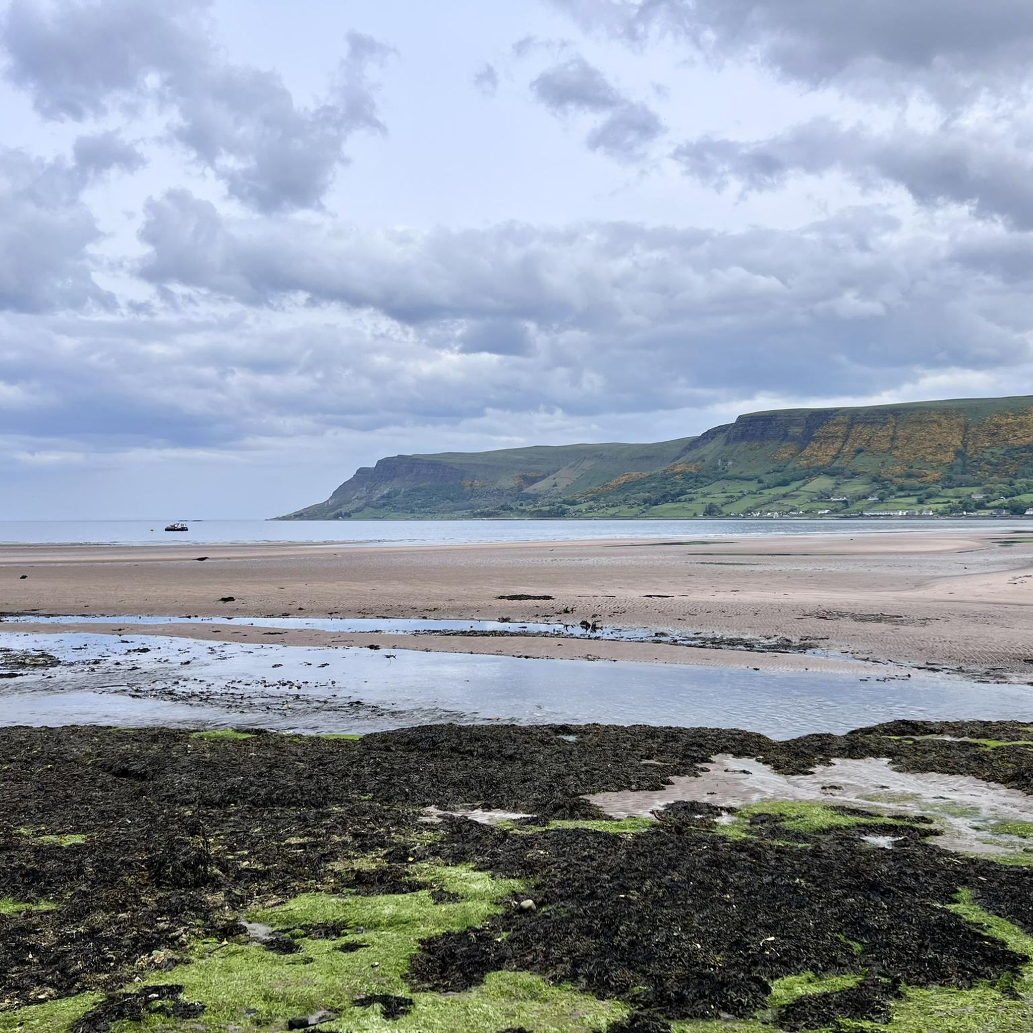
For walkers, Waterfoot is a pleasant alternative to the main road, as it passes close to the beach and behind the dunes, with beautiful views and no traffic.
1
0

An old-fashioned marina in a fishing village. An idyllic place to stop during the long walk on this stretch of the CCR.
2
0
Frequently Asked Questions
How many road cycling routes are available in Carnanee?
Carnanee offers a wide selection of road cycling routes, with over 30 options available for you to explore. These routes cater to various fitness levels, from easy to very challenging.
What types of terrain can I expect on road cycling routes in Carnanee?
Road cycling in Carnanee features diverse topography, including significant elevation gains and varied terrain. You'll encounter mountainous areas, such as the Sperrins, alongside dramatic coastal scenery. While most surfaces are well-paved, some more challenging segments might include unpaved sections.
Are there any easy road cycling routes for beginners in Carnanee?
Yes, Carnanee has options for beginners. There are 2 easy road cycling routes available. For a moderate option that's a good step up, consider the Waterfoot Beach – Cushendun Picnic Area loop from Waterfoot, which covers 29.9 km with 321 m of elevation gain.
Where can I find challenging road cycling routes in Carnanee?
For those seeking a challenge, Carnanee offers 11 difficult road cycling routes. The region's mountainous areas, like the Sperrins, provide significant elevation gains. Routes such as the 'Draperstown, Gortin and Plumbridge loop' (102km with 1,350m elevation gain) or the 'Lough Lark – Goles Stone Row loop from Feeny Road Bus Stop' (109km with 1,720m of elevation gain) are known for their rigor.
What scenic attractions can I see along the road cycling routes in Carnanee?
Carnanee's routes often pass through stunning landscapes. You can expect dramatic coastal scenery, including the Causeway Coast Area of Outstanding Natural Beauty. Keep an eye out for historical sites like Carnlough Harbour, or natural wonders like the Cushendun Caves and the Torr Head Coastal Road.
Are there any waterfalls accessible from the road cycling routes in Carnanee?
Yes, the region is home to impressive waterfalls. While cycling, you might be near areas that lead to the Inver River Waterfall or Cranny Falls, often nestled within beautiful forest settings like Glenariff Forest. These are typically reached via short detours or hiking trails.
What do other cyclists say about road cycling in Carnanee?
The road cycling routes in Carnanee are highly rated by the komoot community, with an average score of 5.0 stars from 1 review. Over 400 road cyclists have used komoot to explore the region's varied terrain, often praising the diverse topography and dramatic coastal scenery.
Are there any circular road cycling routes in Carnanee?
Many of the road cycling routes in Carnanee are designed as loops, offering circular journeys. For example, the popular Glenarm Castle – Carnlough Harbour loop from Waterfoot is a 77.7 km circular route, and the Glenariff Descent – Glenarm Castle loop from Waterfoot is another great option.
What is the best time of year for road cycling in Carnanee?
The region's weather can be variable. While specific seasonal advice isn't provided, the diverse landscapes are enjoyable in many conditions. For the most pleasant experience, consider cycling during milder months to avoid the harshest winter weather, which can include unpaved segments on some routes.
Are there any routes that offer views of Lough Neagh?
Yes, some routes in the broader region combine mountain climbs with scenic views of Lough Neagh. The 'Lough Neagh loop from Dungiven' (96.5km with 1,110m elevation gain) is a notable example that offers this combination of challenging terrain and picturesque lake views.
What are some notable historical landmarks along the road cycling routes?
Beyond natural beauty, you can encounter historical charm. Carnlough Harbour is a picturesque historical site, and Dunluce Castle, though slightly further afield, offers spectacular views towards Donegal and the Skerries, providing a rich historical backdrop to your ride.
How long do road cycling routes typically take in Carnanee?
The duration of routes varies significantly based on distance and difficulty. For instance, the Glenarm Castle – Carnlough Harbour loop from Waterfoot (77.7 km) typically takes around 3 hours 19 minutes, while a shorter, moderate option like the Waterfoot Beach – Cushendun Picnic Area loop from Waterfoot (29.9 km) can be completed in about 1 hour 21 minutes.
Most popular routes around Carnanee
Most popular attractions around Carnanee

Get inspired with the komoot mobile app


Explore more
Browse the best Road cycling routes in other regions.
