The best cycling routes around Stratfield Turgis
4.6
(199)
1,767
riders
295
rides
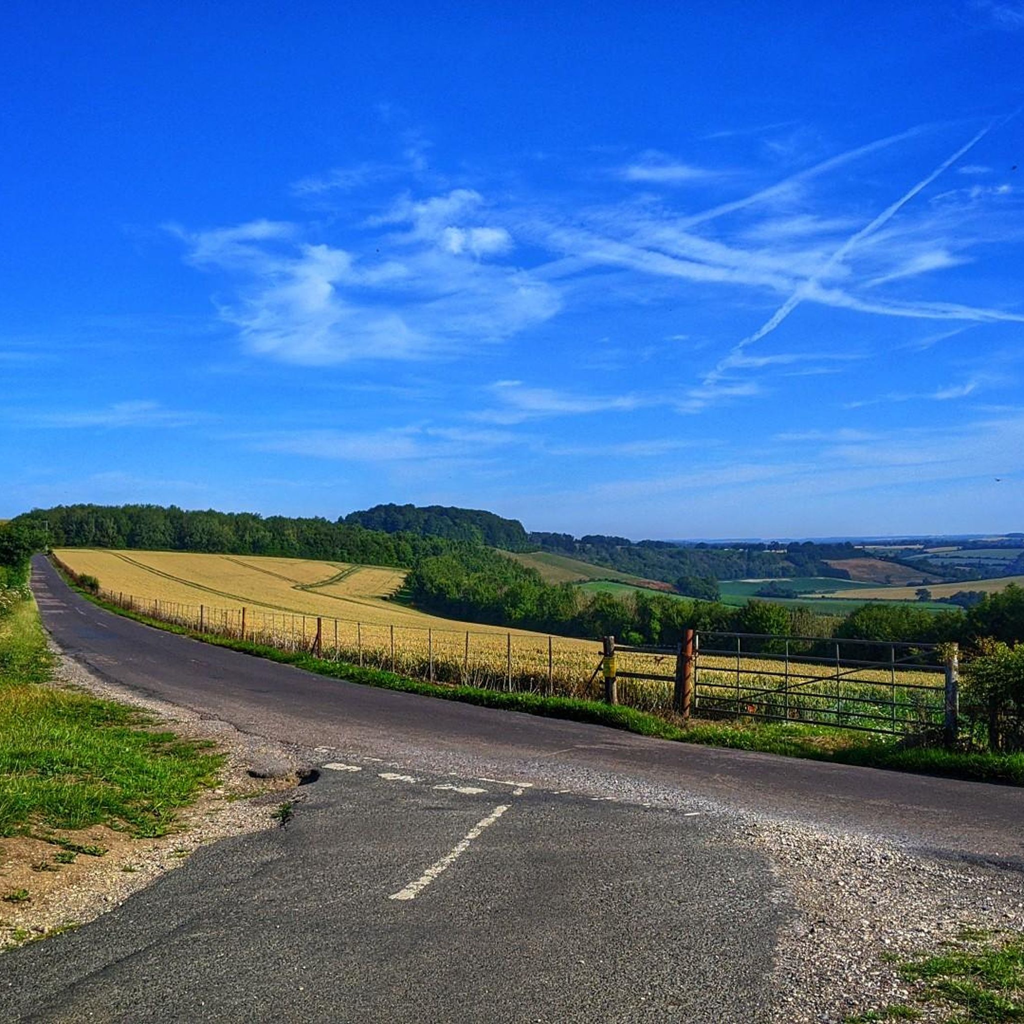
Touring cycling routes around Stratfield Turgis benefit from the village's location in northeast Hampshire, characterized by a tranquil rural environment. The River Loddon meanders through the parish, offering scenic paths alongside woodlands. The wider Hampshire region provides varied terrain, including rolling hills, extensive woodlands, and proximity to chalk downlands. This landscape offers a range of cycling opportunities from gentle riverside paths to more challenging routes through the countryside.
Best touring cycling routes around Stratfield Turgis
- The most popular touring cycling…
Last updated: November 3, 2026
5.0
(1)
40
riders
87.9km
05:30
460m
460m
Hard bike ride. Very good fitness required. You may need to push your bike for some segments of this route.
4.0
(1)
19
riders
46.1km
02:39
150m
150m
Moderate bike ride. Good fitness required. Mostly paved surfaces.

4.0
(1)
4
riders
Easy bike ride. Mostly paved surfaces.
3
riders
20.4km
01:13
110m
110m
Easy bike ride. Mostly paved surfaces.
5
riders
19.9km
01:14
130m
130m
Hard bike ride. You may need to push your bike for some segments of this route.
Get access to more routes and recommendations from other explorers.
Already have an account?
Our route recommendations are based on thousands of hikes, rides, and runs completed by other people on komoot.
Start today with a free account
Your next adventure awaits.
Tips from the Community

Peaceful church in historic location. Open when I passed mid-afternoon on a Friday in May 2026
0
0
Open and busy when I passed middle of a Friday afternoon in May 2026. They have a pilgrim stamp, and apart from the cafe also a well-stocked (if ££) shop, you could get the makings of a meal or 2 here instead of/as well as enjoying either a snack (as I did) or a full meal.
0
0
Church was open when I passed mid-afternoon on a Friday of May 2026. Peaceful atmosphere, tranquil setting. Cannot recall it if it has a pilgrim stamp, but definitely worth including a Camino Inglés itinerary
0
0

All cyclists are able to pass the toll bridge for free
0
0

Christchurch Bridge is one of those post-2010 structures that still looks vaguely futuristic if you squint through the drizzle, all brushed metal and angled cables, stretched over the Thames like someone thought Reading needed a statement piece on a budget. Built in 2015 to connect the town centre with the north bank, it was meant to be a step toward sustainable transport. These days, it’s more of a tactical crossing point. At 138 metres long, it offers a decent line across the water, provided you can navigate the walkers, the slow, unpredictable pedestrians who drift across both lanes like confused drones. They’ll stop dead, veer diagonally, or pull a 180 with no warning. Bells are useless. Polite coughs do nothing. Try “on your right” and you’ll get a sideways glance that says, “You chose threat.” The bridge itself is solid, no major structural issues, not yet, and the view isn’t bad if you’re into Reading riverside aesthetics or watching trains roll by in the middle distance. There’s usually a breeze, and sometimes the air carries a strange scent, incense and diesel or something like that, perhaps old factories nearby were smouldering. Two wheels have to treat the crossing like an obstruction. You ride steady, but ready, always prepared to dodge a wayward commuter or canine unit on a retractable leash stretched to trip-wire length. There’s no room to be indecisive, and definitely no time for mid bridge photo shoots unless you’re ready to become a cautionary anecdote. The incline is gentle, but if you’re hauling supplies or riding on a loaded frame, you’ll feel it by the halfway mark. Still, it’s a crucial part of the west-east route along the Thames Path. If you’re avoiding roads and staying off-grid, this bridge is your best shot across the river without backtracking for miles. At dawn or dusk, you might get lucky and cross it clean, no walkers, no noise, just the creak of your drivetrain and the water below, quiet and grey. At peak times, though, it’s a gauntlet. Urban survival, one careful pedal stroke at a time.
0
0
I arrived at the old station, having to ride out a few kilometers west to the Vastern Road area near the river in Tilehurst. The signage appeared to pretend this was a gateway to somewhere worth going. Stainless steel fixtures dulled by time, built in that sleek late-capitalist optimism style. Fake clean. Surveillance cameras blinked overhead — working or not, who knows. I pushed past the bins that no longer had lids, down the cracked concrete that once passed for a plaza, heading toward the river path. The concrete there was smooth once. Still is, in patches. But it’s slick with algae now, and streaked with goose scat. Probably goose. Definitely not rain. The roundabouts were relentlessly busy — or at least that’s how it felt. Zs in battered cars circled endlessly, tires scraping the cracked concrete like it was a ritual. But sometimes, between the noise and the haze, I caught glimpses of something else — distant echoes of old festival revellers, laughter and music bouncing off the concrete barriers, a fading pulse beneath the relentless circling. The lines between past and present blurred, the city’s decay tangled with memories of better days. The traffic spun on, a ceaseless loop of movement and stillness sharing the same broken rhythm. The goose scat got thicker past the bridge. Sometimes it’s dry and crunchy under tires. Sometimes it’s wet, and that’s worse. The path dips unexpectedly. Puddles collect. There’s no drainage. There’s no budget for real upkeep or sustainable transport improvements. No plan to make this path anything more than a patchwork for cyclists and pedestrians to navigate as best they can. But even along the Thames, there are occasional stretches that hint at something better — patches where the breeze is fresher, the water glimmers, and for a moment, the city’s weight feels a little less crushing. Ahead, the suspension bridge hung like a relic of better speeches. A millennium structure. Another optimistic gesture. It still worked. Locals crossed it daily — crackles, Zs, traders moving quietly, heads down, eyes flicking up just long enough to check you weren’t a threat. It’s a corridor now, not a landmark. A place to move through, not think about. I wasn’t there to scavenge. Not that day. This was about securing reliable wheels for the group. The vehicle was a pre-EV Golf — Mk7.5, diesel, with a recently renewed DSG transmission. Someone had actually taken care of it. That counted for something. The Golf was cached in a cul-de-sac just past the edge of the river path, in an old industrial area that had slipped into decay even before things broke down. Rusted loading bays and cracked tarmac replaced what might once have been a hive of activity. The map said number 12 — red brick, side garage. It was all still there. Tires a bit soft, one headlight lens fogged, but otherwise intact. Luck, or good planning. Hard to tell anymore. The tow ball rear Thule rack was still intact, making it easy to strap the pushbike recon unit on for the ride back. I checked the interior. No needles, no surprises. Just a stale whiff of diesel mixed with an old Halfords air freshener trying to remember what “Black Ice” was supposed to smell like. The keys were where they’d said — taped behind the fascia of the old electric meter box. I started the engine. It turned over like it had something left to prove. For the first time in a while, I wasn’t pushing a bike through river shit or dodging scooter gangs in shopping centre undercrofts. I was behind the wheel, with four functioning tires and a full tank of unknown provenance. That’s mobility. That’s currency. The Golf pulled away slow but steady. DSG shifted like a rumour — not smooth, but competent. I took the long route back through side streets and forgotten service roads, staying off-grid. Past boarded shops, sagging bus shelters, and those weird chalk sigils some of the smaller sects have started leaving on the kerbs. No one stopped me. No one even looked up. This wasn’t a supply run. This was infrastructure repair. Quiet, vital work. And for now, at least, we had wheels.
0
0
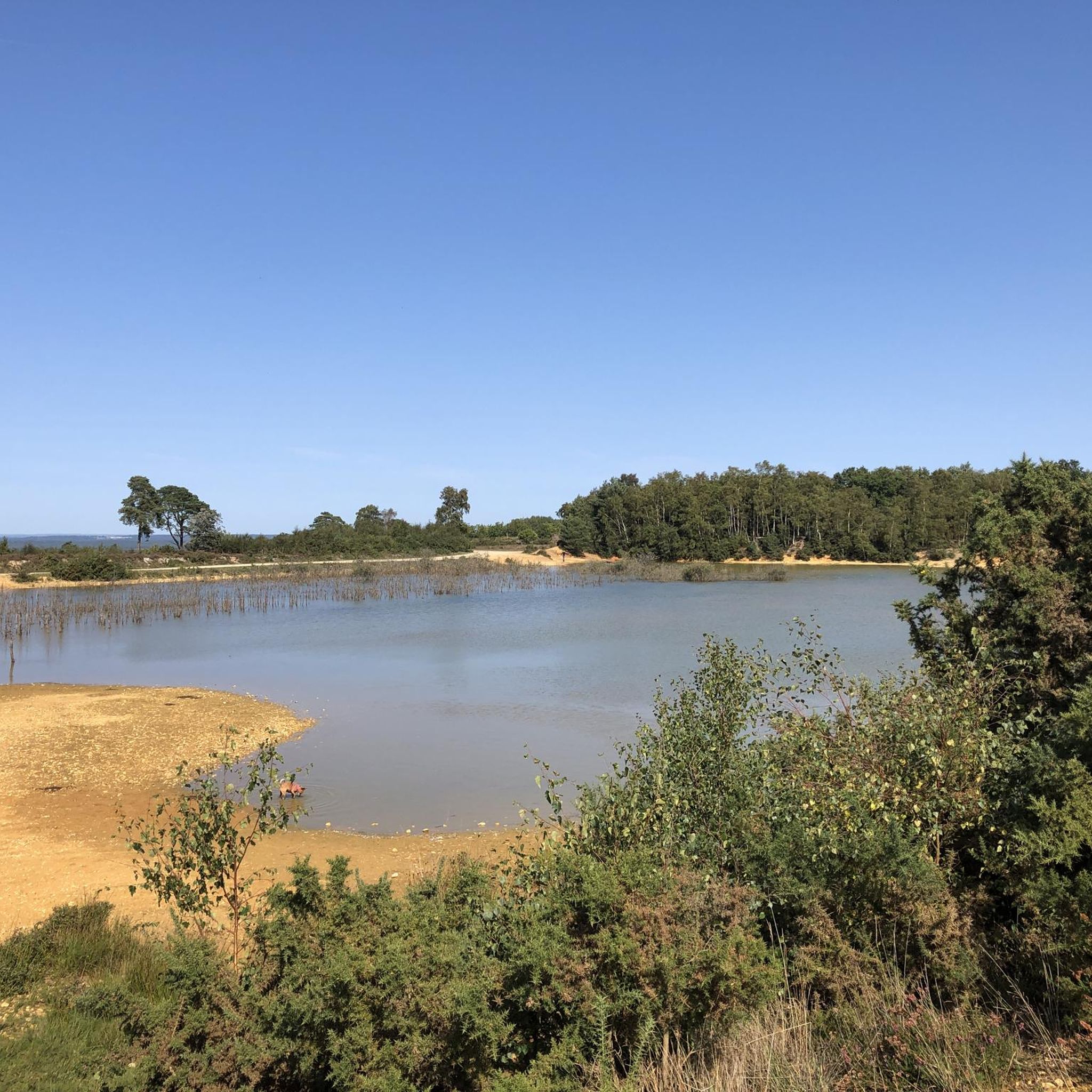
Make time to stop and listen to the birds enjoying the gravel pit
0
0
Frequently Asked Questions
How many touring cycling routes are available around Stratfield Turgis?
There are over 300 touring cycling routes around Stratfield Turgis, catering to various skill levels. This includes approximately 100 easy routes, 114 moderate routes, and 92 difficult routes, offering a wide range of options for exploration.
What kind of terrain can I expect on touring cycling routes near Stratfield Turgis?
The terrain around Stratfield Turgis is diverse, featuring rolling hills, extensive woodlands, and scenic paths alongside the River Loddon. You'll find routes that traverse chalk downlands, quiet country lanes, and some challenging climbs, particularly in areas like the North Wessex Downs. The region also offers flatter sections along waterways such as the Basingstoke Canal and the Test Way Path.
Are there routes suitable for beginners or families?
Yes, Stratfield Turgis and the wider Hampshire area offer many routes suitable for families and less experienced cyclists. These often include flat, easy-going paths, such as those found on disused railway lines or along river towpaths. For an easy option, consider The Barn Farm Shop & Bistro – Bramley Village Bakery loop from Sherfield Park, which is just over 9 km long.
What historical sites or natural features can I see along the cycling routes?
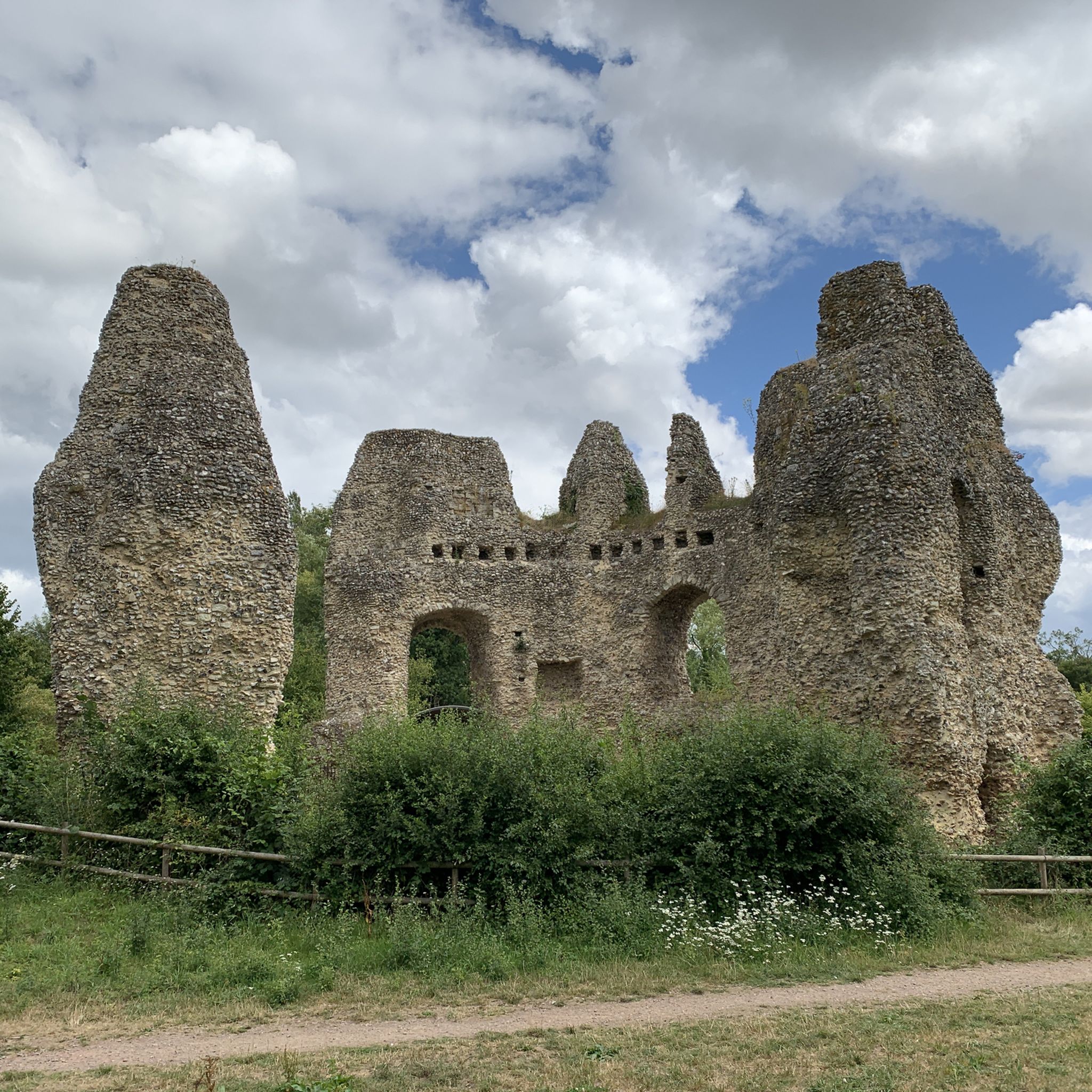
Cycling routes in the area often pass by significant historical and natural attractions. You can explore sites like the Roman town of Calleva Atrebatum, including the Calleva Atrebatum: Roman town and city walls. Other notable points of interest include the 16th-century country house The Vyne and the 13th-century Odiham Castle Ruins. Natural features include various lakes and ponds like Hosehill Lake and Bramshill Quarry Pond, and scenic woodlands such as Coombes Lane.
Are there any circular touring cycling routes?
Yes, many of the touring cycling routes around Stratfield Turgis are designed as loops, allowing you to start and finish at the same point. An example of a circular route is The Leather Bottle – Ford and Old Mill Waterway loop from Mattingley, an easy 15.2 km ride.
Where can I find parking for touring cycling routes?
While specific parking details for every route vary, many routes start from villages or near attractions where public parking is available. For routes passing through historical sites like Silchester Amphitheatre, parking is often provided. It's advisable to check local council websites or specific route descriptions for detailed parking information before your trip.
Is public transport available to reach cycling trails?
Stratfield Turgis is a small village, so direct public transport links to specific trailheads might be limited. However, the wider Hampshire region has bus and train services connecting to larger towns like Basingstoke, from which you might be able to cycle to nearby routes. For detailed public transport information, it's best to consult local transport providers.
Are there places to eat or drink along the routes?
Yes, many touring cycling routes in the area pass through villages or near farm shops and pubs. For instance, the Wokingham Lane Path – Wellington Farm Shop loop from Rotherwick includes the Wellington Farm Shop, which often has a cafe. You'll also find traditional pubs in many of the small villages scattered throughout the Hampshire countryside.
What is the best time of year for touring cycling in Stratfield Turgis?
The spring and summer months (April to September) generally offer the most pleasant conditions for touring cycling in Stratfield Turgis, with warmer weather and longer daylight hours. Autumn can also be beautiful with changing foliage. While cycling is possible year-round, winter months may bring colder temperatures, shorter days, and potentially wetter conditions, especially on unpaved sections.
Are touring cycling routes around Stratfield Turgis dog-friendly?
Many of the public paths and bridleways in the Hampshire countryside are dog-friendly, provided dogs are kept under control, especially around livestock. However, specific rules can vary depending on the land ownership (e.g., private estates, nature reserves). It's always best to check local signage or specific route guidelines if you plan to cycle with your dog.
What do other touring cyclists enjoy the most about touring cycling in Stratfield Turgis?
The touring cycling experience around Stratfield Turgis is highly rated by the komoot community, with an average score of 4.7 stars from over 170 reviews. Cyclists often praise the tranquil rural environment, the scenic paths along the River Loddon, and the varied terrain that offers everything from gentle rides through woodlands to more challenging routes across rolling hills. The blend of natural beauty and historical points of interest is also frequently highlighted.
Most popular attractions around Stratfield Turgis

Get inspired with the komoot mobile app


Explore more
Browse the best Cycling routes in other regions.
