The 5 Most Amazing Peaks around Alderwasley
Best mountain peaks around Alderwasley are found within Derbyshire's rolling hills, characterized by woodlands, valleys, and elevated terrain. While not featuring towering mountains, the area offers notable elevated features and viewpoints. These locations provide natural beauty and recreational opportunities for visitors. Exploring these elevated spots offers rewarding perspectives of the quintessential English rural scene.
Best mountain peaks around Alderwasley
- The most popular mountain peaks is High Tor and Giddy Edge, a viewpoint that offers a thrilling experience along its…
Last updated: October 11, 2026
High Tor and Giddy Edge
Highlight (Segment) • Viewpoint
Tip by

Alport Heights Summit
Highlight • Viewpoint
Tip by

Sign up now to discover places like this
Get recommendations on the best single tracks, peaks, & plenty of other exciting outdoor places.
Bolehill Trig Point
Highlight • Monument
Tip by

Ashover Rock (The Fabrick) Trig Point and Doomsday Bunker
Highlight • Summit
Tip by

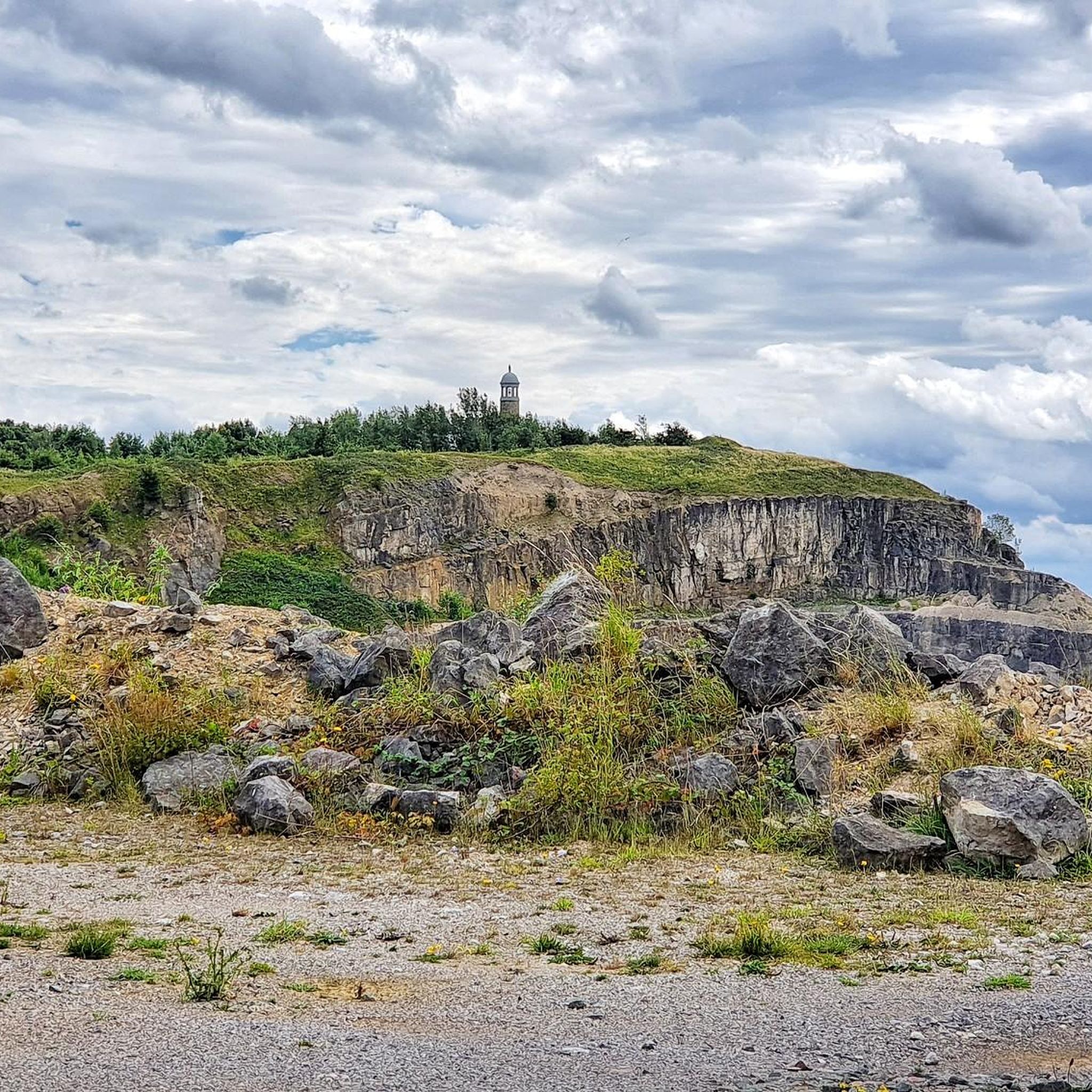
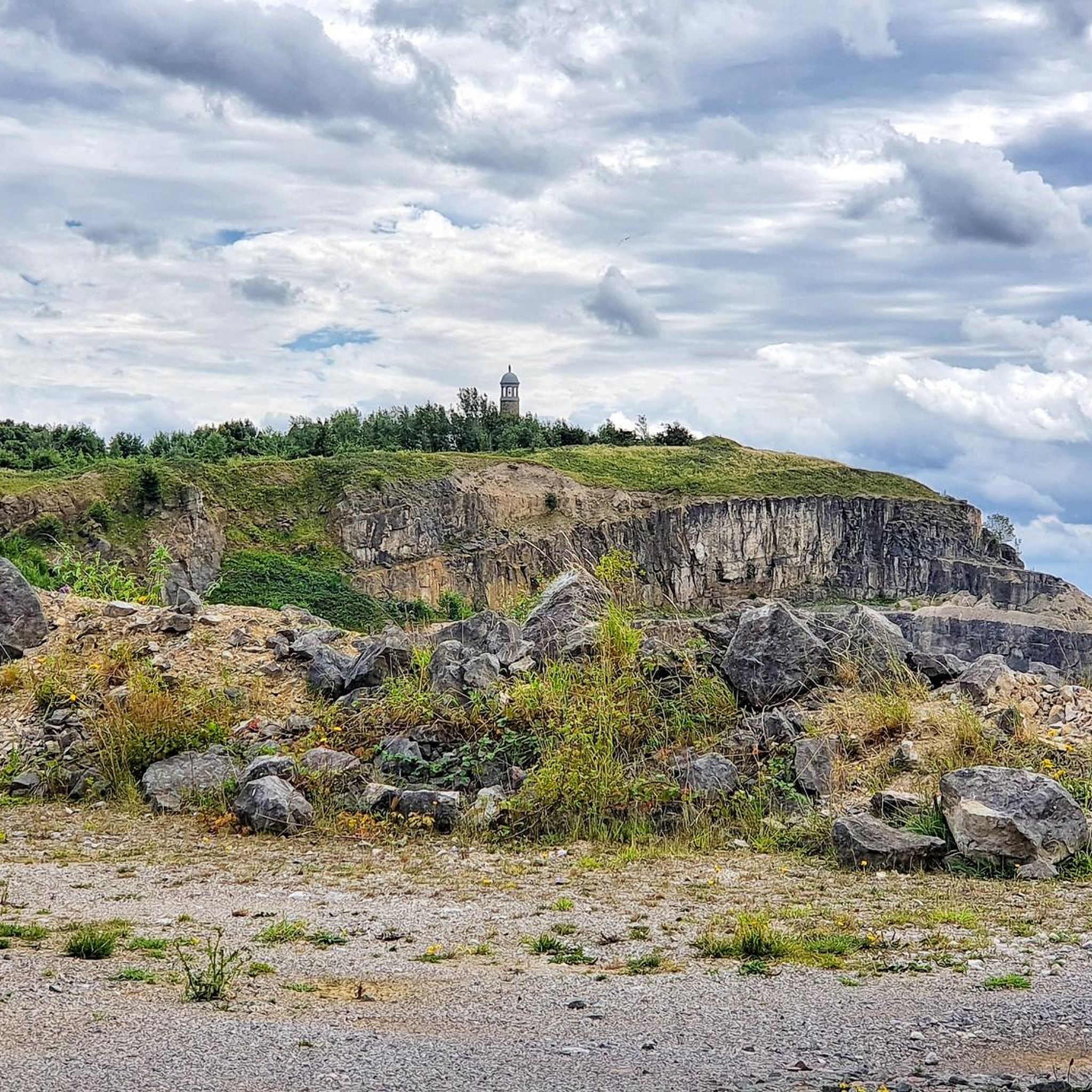
Crich Stand (Sherwood Foresters Regiment Memorial)
Highlight • Historical Site
This is perhaps the most famous landmark in Derbyshire and is situated over 340 metres above sea level. The Stand is the memorial of the Sherwood …
Tip by
Sign up for free to discover even more peaks around Alderwasley.
Already have an account?
Start today with a free account
Your next adventure awaits.

Other adventures around Alderwasley

Tips from the Community

TP0905 - Ashover | TrigpointingUK https://share.google/eE5DBfWbZ91rT7YxV
0
0


19th century pleasure ground which exploited the dramatic qualities of the Derwent valley. Peter Arkwright of Willersley Castle enclosed the grounds c 1860 and constructed pedestrian paths from a new entrance on the south side approached from the bridge to Matlock Bath railway station. The entrance from Starkholmes Road was retained and could be used by carriages. A pathway was formed through Fern Cave (scheduled ancient monument) and another on a narrow ledge along part of the cliff face. In 1879 the grounds were leased to the Matlock and High Tor Recreation Grounds Company Ltd and Milner of London was retained to supervise landscaping. Arkwright's Grand Walk, also used by carriages, was created, leading south to the summit from a gateway in Pig Tree Lane, now Pic Tor Lane. A refreshment room was erected near the summit, tennis and quoit or skittle grounds were constructed close to a modified southern entrance and additional paths put in with a broad flight of steps.
0
0

That's what it is! I thought it was a hobbit house or similar lol
1
0

Alas, the previously awesome views from the trig point are long gone due to tree growth. Today the trig point is a waypoint only; for views head over to Black Rocks.
0
0
There is a Trig point and a Doomsday Bunker, which is locked from the inside to prevent access, The shaft and ventilation shaft was clad in Derbyshire stone, but locals say that the stone that was used to build it was stolen long ago, hence the reason for it being locked. At 299m above sea level, the (Rock) Fabrick is the highest point in the area and the views are stunning.
1
0
Bolehill (Cromford Moor) is 323 metres high and is one of the 95 Ethels (Peak District Hills).
0
0

There are eight transmitter masts visible on the top of the hill (one of them is shorter).
1
0
Frequently Asked Questions
What are the most popular elevated viewpoints around Alderwasley?
Among the most popular elevated features in the Alderwasley area are High Tor and Giddy Edge, known for its thrilling footpath and impressive views over Matlock Bath. Another favorite is Crich Stand (Sherwood Foresters Regiment Memorial), a historical landmark offering expansive views from over 340 meters above sea level.
Are there any family-friendly elevated spots or viewpoints near Alderwasley?
Yes, Alport Heights Summit is considered family-friendly. It's the highest point in the local area, managed by the National Trust, and offers rewarding views all around. The path to the top is a gravel path, making it accessible for many.
What historical sites can be found on high ground around Alderwasley?
The region features several historical sites on elevated terrain. Crich Stand (Sherwood Foresters Regiment Memorial) is a famous landmark over 340 meters above sea level. Additionally, Ashover Rock (The Fabrick) Trig Point and Doomsday Bunker includes a historical Doomsday Bunker at 299 meters above sea level.
Where can I find walking trails with good views near Alderwasley?
For walking trails with good views, consider the area around Bolehill Trig Point, which offers trails through Big Plantation and across Cromford Moor. Shining Cliff Woods also provides various walking trails with splendid vistas over the Derwent Valley. You can find more options in the Easy hikes around Alderwasley guide.
What kind of natural features can I expect to see on the elevated terrain around Alderwasley?
The elevated terrain around Alderwasley is characterized by gritstone outcrops like Black Rocks, woodlands, and valleys. You'll find diverse landscapes offering dramatic rock formations and expansive viewpoints, particularly over the Derwent Valley and surrounding pastoral scenes.
Are there any challenging elevated walks or climbs in the Alderwasley area?
For a more challenging experience, the footpath along the summit of High Tor and Giddy Edge is known to be thrilling and unfenced in parts, offering a significant challenge with spectacular views. Black Rocks also presents a steep ascent and is a popular spot for rock climbers.
What outdoor activities can I do near the elevated features of Alderwasley?
Besides hiking and enjoying viewpoints, the area around Alderwasley offers opportunities for mountain biking and cycling. You can explore various routes detailed in the MTB Trails around Alderwasley and Cycling around Alderwasley guides.
What do visitors enjoy most about the elevated features around Alderwasley?
Visitors frequently appreciate the impressive views, especially from spots like High Tor and Giddy Edge, which offers spectacular vistas over Matlock Bath. The rewarding feeling of reaching high points like Alport Heights Summit and exploring the diverse walking trails are also highly valued.
Are there any trig points or notable summits to visit near Alderwasley?
Yes, you can visit Bolehill Trig Point, which stands at 323m and offers walking trails. Another notable summit is Ashover Rock (The Fabrick) Trig Point, the highest point in its immediate area at 299m, providing stunning views.
What are the general characteristics of the elevated terrain in Alderwasley?
The Alderwasley area is characterized by rolling hills, woodlands, and valleys, with elevated terrain ranging between 600 and 750 feet above sea-level around the village. While not traditional towering mountains, it features notable gritstone outcrops, dramatic rock formations, and expansive viewpoints that offer natural beauty and recreational opportunities.
Can I find tranquil nature escapes on the elevated trails near Alderwasley?
Yes, Shining Cliff Woods, located on the western bank of the River Derwent, offers a tranquil escape into nature. It features various walking trails winding through leafy canopies and along babbling brooks, providing splendid vistas over the Derwent Valley.
Most popular routes around Alderwasley
Most popular attractions around Alderwasley

Get inspired with the komoot mobile app


Explore more
See even more amazing summits around Alderwasley with these guides:
