Routes

Planner

Features

Updates

App

Login or Signup

Get the App

Login or Signup

Routes
Running Trails
United Kingdom
England
Yorkshire And The Humber

Barmston

The best running trails around Barmston

5.0

(18)

2,363

runners

98

runs

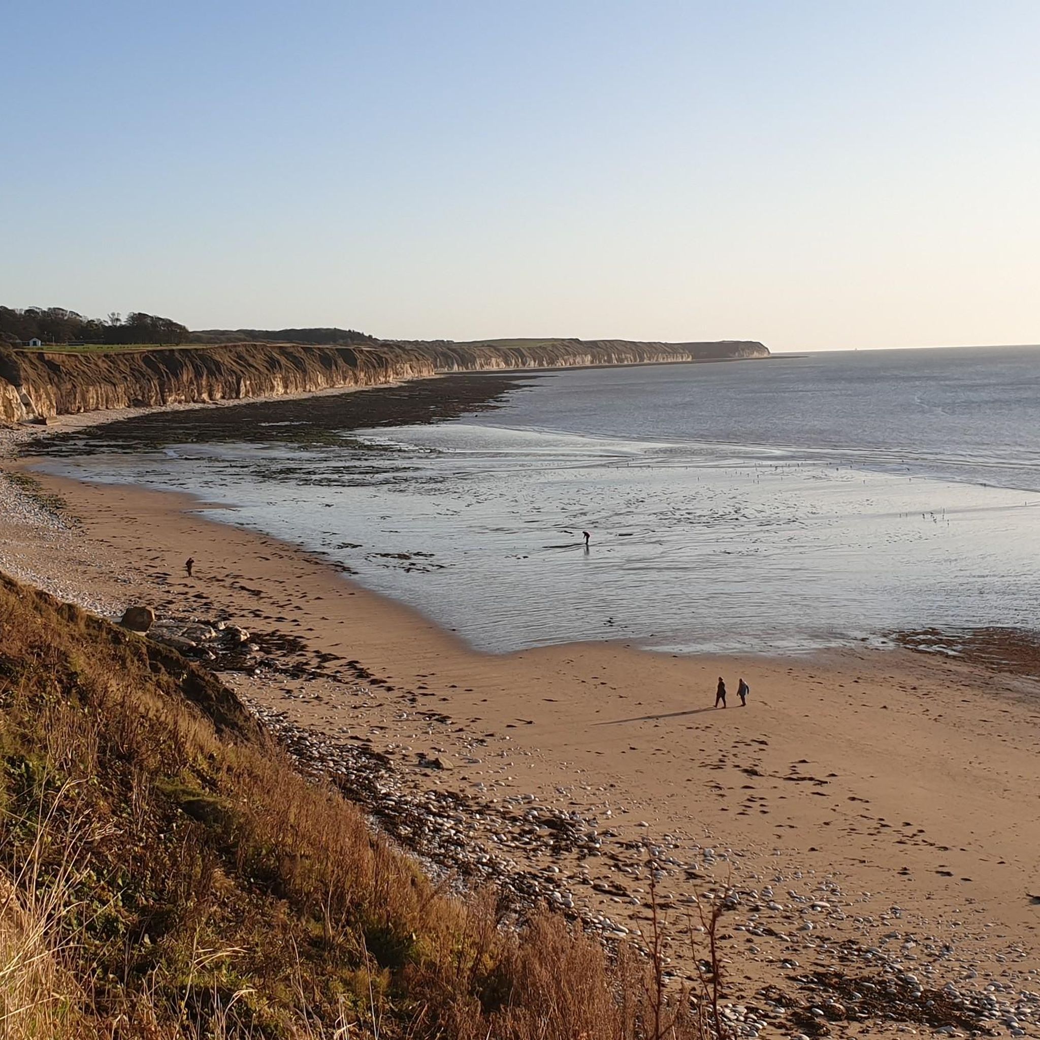
Jogging routes around Barmston offer diverse terrain along the Holderness coast in the East Riding of Yorkshire. The area features expansive sandy beaches and dynamic clay cliffs, providing scenic coastal running opportunities. Inland, the landscape transitions to low-lying agricultural land, which includes quiet country roads and public footpaths. Barmston also features a tranquil village pond with a footpath, suitable for shorter, peaceful runs.

Best jogging routes around Barmston

  • The most popular jogging route is Dane's Dyke & Flamborough Head Lighthouse loop from Bridlington, a 13.1 miles (21.2 km) trail that takes 2 hours 12 minutes to complete. This difficult route offers extensive coastal views and passes the historic Flamborough Head Lighthouse.
  • Another top favourite among local runners is King Charles III England Coast Path: Bridlington to Flamborough Head, a difficult 13.7 miles (22.1 km) path. This route follows the coastline, showcasing the distinctive clay cliffs and North Sea vistas.
  • Local runners also love the Bridlington Golf Club & Harbour loop, a 4.9 miles (7.8 km) trail leading through the golf club area and along the harbour, often completed in about 49 minutes.
  • Jogging around Barmston is defined by accessible coastal paths, low-lying agricultural land, and tranquil village routes. The network offers options for various ability levels, from moderate loops to more challenging coastal runs.
  • The routes in Barmston are highly rated by the komoot community with an average score of 5.0 stars from more than 10 reviews. More than 2000 runners have used komoot to explore Barmston's varied terrain.

Last updated: July 8, 2026

56

runners

#1.

Dane's Dyke & Flamborough Head Lighthouse loop from Bridlington

21.2km

02:12

120m

120m

Embark on the Dane's Dyke & Flamborough Head Lighthouse loop from Bridlington, a difficult jogging route that spans 13.1 miles (21.2 km). You will experience diverse coastal and woodland scenery, including dramatic white chalk cliffs and the historic Flamborough Head Lighthouse. The trail involves a total elevation gain of 400 feet (122 metres) and typically takes around 2 hours and 12 minutes to complete, offering a vigorous workout amidst stunning natural beauty.

This challenging route is best suited for experienced joggers due to its varied and often demanding terrain. Expect to encounter cliff-top paths, woodland trails, and minor roads, with sections of rough ground, potentially boggy grass, and scree. Be prepared for numerous steep inclines and flights of steps, making proper footwear and hydration essential for your visit.

As you jog, you will pass through the enchanting woodland of Dane's Dyke Nature Reserve and witness the active Flamborough Head Lighthouse, which has guided ships since 1806. Keep an eye out for its older chalk tower nearby and listen for the sounds of a seal colony that sometimes gathers near the lighthouse. The area is also home to thousands of nesting seabirds, adding to the rich natural tapestry of the Flamborough Headland Heritage Coast.

Navigate with device

Send to Phone

Save

Hard

Embark on a demanding jogging adventure along the King Charles III England Coast Path from Bridlington to Flamborough Head. This difficult route stretches for 13.7 miles (22.1 km), guiding you along the dramatic Flamborough Headland Heritage Coast. You will experience near-constant sea views and gain 433 feet (132 metres) in elevation, with the entire journey taking approximately 2 hours and 18 minutes to complete. Keep an eye out for the unique

Hard
guide_signup
Let us show you the way with the komoot mobile app
With a free komoot account, you can easily find, customize, and navigate endless outdoor adventures.

Sign up for free

5.0

(1)

23

runners

Embark on a moderate jogging experience with the Bridlington Golf Club & Harbour loop, a 4.9-mile (7.8 km) route that takes about 48 minutes to complete. You will encounter scenic views as you jog past the Bridlington Golf Club, offering outstanding vistas of the surrounding countryside and Bridlington Bay. The trail also leads you along the Bridlington Harbour, providing picturesque coastal and harbor-side scenery. With a gentle elevation gain of just 68 feet (21 metres), this loop combines green golf course landscapes with refreshing seaside air, making it an enjoyable outing for those with a good level of fitness.

This moderate running trip is suitable for individuals who have a good level of fitness but are not looking for an overly challenging route. While specific terrain details are not provided, moderate running trails often feature a mix of accessible paths. Prepare for a pleasant jog that balances effort with rewarding views.

The primary appeal of this loop lies in its connection to both the historic Bridlington Golf Club and the vibrant Bridlington Harbour. The golf course, designed in 1905 by five-time Open Champion J.H. Taylor, adds a touch of history and high standards to the green landscapes you will pass. This blend of historical golf grounds and picturesque coastal scenery creates a varied and enjoyable backdrop for your jog.

Moderate

Embark on an easy jogging adventure along the Bridlington Golf Club and Princess Mary Promenade Loop. This route offers a refreshing blend of coastal views and green spaces, perfect for a quick workout. You will experience invigorating sea air as you jog past sandy beaches, including the peaceful North Beach, before transitioning to the manicured landscapes around the golf club. Covering 2.8 miles (4.5 km) with a gentle 42 feet (13 metres) of elevation gain, this loop is designed for an easy 27-minute run.

Planning your visit is straightforward, as the paths along the Princess Mary Promenade are paved and easily accessible, providing a smooth surface for your jog. While the central beaches can get busy, especially during peak season, you will find more tranquil sections along the route. Convenient parking is generally available near the Bridlington seafront, making it simple to start your journey.

This route stands out for its delightful combination of classic British seaside charm and open, well-maintained areas. It provides a unique opportunity to enjoy coastal vistas and the calming sound of the waves, contrasted with the serene environment of the golf club. The trail offers a pleasant and accessible experience for joggers of all levels, allowing you to enjoy the diverse scenery Bridlington has to offer.

Easy

2

runners

The National Byway Bridlington Loop offers a moderate jogging experience across 6.8 miles (11.0 km) of varied Yorkshire scenery. You will gain 228 feet (69 metres) in elevation, which typically takes about 1 hour and 9 minutes to complete. Expect to jog past expansive sandy beaches and dramatic chalk cliffs that meet the North Sea. The route also takes you through tranquil narrow dales and fertile farmlands, providing a pleasant mix of coastal and countryside views. Make sure to take in the historic Bridlington Harbour and the sweeping vistas of Bridlington Bay as you go.

This jogging route is designed to begin and end in a market town, making it easy to access. You will generally find convenient parking options, along with cafes and restaurants nearby for refreshments before or after your run. There are no specific warnings about closures or permits mentioned for this particular route, so you can plan your visit with ease. Consider starting your jog early to enjoy the coastal views in quieter conditions.

This loop is part of the broader National Byway network, which connects significant historical and natural sites across the UK. The design of these routes often highlights both the natural beauty and cultural heritage of the area, making them more than just a path. You will experience the unique blend of coastal drama and peaceful countryside that defines this part of Yorkshire. It's a great way to explore the region's diverse landscape and history while staying active.

Moderate
Sign up for free to see 94 more runs around Barmston.

Get access to more routes and recommendations from other explorers.

Sign up for free

Already have an account?

Our route recommendations are based on thousands of hikes, rides, and runs completed by other people on komoot.

Start today with a free account

Your next adventure awaits.

Login or Signup
Popular around Barmston

Hiking around Barmston

Road Cycling Routes around Barmston

Cycling around Barmston

MTB Trails around Barmston

Tips from the Community

RichD
December 22, 2024, Flamborough Lighthouse

Lots of parking, very quiet in winter, and cracking routes along the south and north of Flamborough Head. Take the north route past North Landing and Thornwick Bay, much more scenic than the southerly route.

2

0

Nice views over the bay and to Bridlington.

0

0

Sewerby hall gardens offers a wide range of activities. Each Saturday they host a FREE park run for all to attend. Adults and Children welcomed. This starts at 9am outside the hall. Free parking on site. They also have a small animal collection on site including penguins and farm animals. Based near the sea, its a great day out. They have a cafe and toilets on site.

0

0

Marker board signifying Bridlington end (or start) of the Way of the Roses route.

0

0

A few good places to eat here. BUT watch the seagulls. There's also a speedboat and pirate ship which leaves at regular intervals.

3

0

The monument is the former Flamborough Head lighthouse and includes an octagonal tower constructed of coursed chalk rubble with stone dressings. It was built in 1674 as a business venture by Sir John Clayton, but never used.

1

0

Need to climb over wooden fence.

1

0

TP3194 - Flamborough S6327 County of Yorkshire Trig Pillar

0

0

Frequently Asked Questions

What types of running routes can I find around Barmston?

Barmston offers a variety of running experiences. You can explore the expansive, dog-friendly shores of Barmston Beach and the dynamic Holderness coastline for invigorating runs with sea views. Inland, there are routes through low-lying agricultural land, featuring quiet country roads and public footpaths. For a more tranquil option, the Barmston village pond has a charming footpath ideal for shorter, peaceful jogs.

Are there running routes suitable for beginners in Barmston?

Yes, Barmston has routes suitable for various ability levels. Out of over 100 available routes, 10 are classified as easy. An example of an easier route is the Bridlington Golf Club and Princess Mary Promenade Loop, which is 4.5 miles (7.2 km) long and takes about 28 minutes to complete.

What are the difficulty levels of the running trails in the Barmston area?

The running trails around Barmston cater to a range of fitness levels. You'll find 10 easy routes, 78 moderate routes, and 12 difficult routes, offering options from gentle village loops to more challenging coastal runs with significant elevation changes.

Can I bring my dog on the running routes in Barmston?

Yes, Barmston Beach is known for its dog-friendly shores, making it a great place for runs with your canine companion. Many of the public footpaths through agricultural land are also suitable for dogs, but always ensure they are under control, especially near livestock.

Are there any family-friendly running options in Barmston?

For families, the tranquil footpath around the Barmston village pond offers a charming and contained spot for a peaceful jog. Additionally, some of the easier, flatter routes through the low-lying agricultural land or along the promenade in nearby Bridlington could be suitable for families.

What kind of terrain can I expect on coastal running paths near Barmston?

Coastal running paths near Barmston, particularly along the Holderness coastline, feature expansive sandy beaches and distinctive clay cliffs. The landscape is dynamic due to ongoing coastal erosion, so runners should be mindful of changing conditions and potential hazards near the cliffs. These routes often offer extensive sea views.

Are there any notable landmarks or attractions to see while running in Barmston?

While Barmston itself is a tranquil village, nearby attractions can enhance your run. You might pass by the Princess Mary Promenade, or explore routes that lead towards Bridlington Harbour and Bridlington Seafront. Further afield, the historic Burton Agnes Hall and Gardens is also an interesting point of interest in the wider area.

What do other runners say about the jogging routes in Barmston?

The running routes in Barmston are highly regarded by the komoot community, holding an average rating of 5.0 stars from more than 10 reviews. Over 2000 runners have used komoot to explore the varied terrain, often praising the accessible coastal paths, tranquil village routes, and diverse options for different ability levels.

Is there parking available for accessing running trails in Barmston?

Yes, the presence of caravan parks near Barmston Beach and a newly refurbished footpath near a parking area suggest convenient access points for runners. While specific car parks for each route aren't detailed, general parking facilities are available in the village and at popular coastal access points.

How long are the running routes around Barmston?

The running routes around Barmston vary significantly in length. For example, the Bridlington Golf Club & Harbour loop is 4.9 miles (7.8 km), while more challenging coastal paths like the Dane's Dyke & Flamborough Head Lighthouse loop from Bridlington extend to 13.1 miles (21.2 km).

Are there any circular running routes in the Barmston area?

Yes, there are several circular running routes available. An example is the Bridlington Golf Club & Harbour loop, which offers a moderate 4.9-mile (7.8 km) circuit. The Dane's Dyke & Flamborough Head Lighthouse loop from Bridlington is another popular, longer circular option.

What should I consider regarding weather when running on the Barmston coast?

When running along the Barmston coast, be mindful of the dynamic nature of the Holderness coastline. Weather conditions can change rapidly, and the ongoing coastal erosion means the landscape near the cliffs can shift. Always check local forecasts and be aware of potential hazards, especially during strong winds or after heavy rain.

Is public transport available to reach Barmston for running?

While Barmston is a village, it is approximately 6 miles south of Bridlington, a larger coastal town which likely offers more extensive public transport links. From Bridlington, local bus services or taxis would be options to reach Barmston and its running routes. For detailed information on public transport, it's best to check local bus schedules.

Most popular routes around Barmston

Hiking around Barmston

Most popular attractions around Barmston

Places to see

Store rating

Get inspired with the komoot mobile app

With a free komoot account, you can easily find, customize, and navigate endless outdoor adventures.

or

Join komoot Now

Store rating

Explore more

Browse the best Running Trails & Routes in other regions.

North YorkshireCravenEast Riding of YorkshireBridlingtonSheffieldLeedsBemptonYorkBeverleyBradfordCalderdaleBoyntonWakefieldBishop BurtonKirkleesNorth East LincolnshireBarnsleyRotherhamHorton In RibblesdaleNorth LincolnshireMalham MoorMalhamKingston upon HullIngletonHalton EastGrindaleThorpeSkiptonDoncasterHessleHazlewood With StorithsStirton With ThorlbyBeamsleyBolton AbbeyEllerkerSouth CaveSkidbyFlamboroughMolescroftDraughtonKildwickHanlithBurnsallHartlingtonKirkby MalhamLangcliffeFangfossPocklingtonHalton GillElloughton Cum BroughSouth CliffeSkefflingThornton In LonsdaleBishop WiltonBurton In LonsdaleRowleyFarnhillBroomfleetNunburnholmeHothamSproatleyLong PrestonTicktonNorth FerribyBurton ConstableSettleWarterSouth FerribyGunnessHebdenSanctonBardenEllerbyLintonElstronwickConistonKirk EllaHumberstonCracoeBiltonBuckdenLawklandNew WalthamEasingtonKeadby With AlthorpeBugthorpeSwineCottinghamBurringhamEmbsay With EastbyGlusburn And Cross HillsFlasby With WinterburnHorkstowWold NewtonAshby ParklandHornseaHawkswickMillingtonBroughtonMessinghamWinteringhamEshtonKilpinSkirlaughMartons BothAldbroughFimberHolmeYaphamDriffieldBottesfordBradleys BothCarletonWalkingtonWeltonMarket WeightonBeelsbyWest RavendaleNorth DaltonAustwickWoodmanseyIrbyBradleyGrassingtonBarton-Upon-HumberNewbaldGargraveWetwangKirkburnGartonKettlewell With StarbottonBarnoldby Le Beck CPGiggleswickAtwickRylstoneApplebySwinefleetBarmby MoorUlromeAshby Cum FenbyKirby UnderdaleEast RavendaleEast GartonHumbletonBewholmeLondesboroughGooleWhittonAppletreewickWest HaltonWelwickReednessWorlabyWawneRiseMiddletonBrigsleyNorth FrodinghamFlixboroughSaxby All SaintsWithernwickSpaldingtonClapham Cum NewbyThreshfieldMantonArncliffeNaffertonEastringtonRathmellGoodmanhamAylesbyPrestonShipton ThorpeGisburn ForestPaullElslackSuttonWattonLittonCaltonScawbyGarthorpe And FockerbyWressleNorth CaveBaintonHowdenWalthamLevenRudstonSwanlandBurton FlemingCattonBriggNewton On DerwentSeatonHawerby Cum BeesbyHellifieldFull SuttonHetton-Cum-BordleyRistonCottamCherry BurtonBurstwickLockingtonHookWillerbySkipseaRouthPatringtonConiston ColdWrootCadneyFridaythorpeSnaith And CowickHatfieldCottingwithRimswellDalton HolmeCononleyHedonSutton Upon DerwentLaxtonSkerne And WansfordThornton In CravenOtterburnWilberfossKirmingtonHollymWithernseaBank NewtonAllerthorpeHatcliffeSkirpenbeckStamford BridgeHutton CranswickGowdallHolmptonAirtonRawcliffeNewport

Nearby adventure guides

Things to Do around Ulrome

background

Get ready to conquer new peaks

Sign up for Free

Explore
RoutesRoute plannerFeaturesHikesMTB TrailsRoad cycling routesBikepackingSitemap
Download the app
Follow Us on Socials

© komoot GmbH

Privacy Policy