The best walks and hikes around Ponte In Valtellina
4.3
(390)
2,514
hikers
53
hikes
Hiking around Ponte In Valtellina offers diverse landscapes within the Italian Alps, characterized by majestic Alpine peaks, deep valleys, and the Adda and Mallero rivers. The region features sun-kissed vineyards and apple orchards on the Rhaetian Alps' slopes, alongside significant protected areas like Stelvio National Park. This varied terrain provides a wide range of hiking opportunities, from river valleys to high mountain routes.
Best hiking trails around Ponte In Valtellina
- The most popular hiking route is Briotti Decauville Loop,…
Last updated: August 3, 2026
4.8
(4)
11
hikers
10.2km
03:12
390m
390m
Hike the moderate 6.3-mile Briotti Decauville Loop in Parco delle Orobie Valtellinesi, exploring villages, geological formations, and ruins.
4.3
(3)
16
hikers
9.96km
04:51
970m
970m
Hard hike. Very good fitness required. Mostly accessible paths. Sure-footedness required.

Sign up for free
3
hikers
20.9km
09:40
1,730m
1,730m
Hard hike. Very good fitness required. Sure-footedness, sturdy shoes and alpine experience required.
4.0
(2)
8
hikers
13.3km
05:49
970m
970m
This difficult 8.3-mile circular hike from Rifugio Alpini to Laghi di Santo Stefano offers challenging terrain and rewarding Alpine views.
6
hikers
18.5km
08:56
1,440m
1,440m
Hike the Val Fontana High Trail, a difficult 11.5-mile route with 4732 feet of elevation gain through wild landscapes and to Lake Rogneda.
Get access to more routes and recommendations from other explorers.
Sign up for free
Already have an account?
Our route recommendations are based on thousands of hikes, rides, and runs completed by other people on komoot.
Start today with a free account
Your next adventure awaits.
Login or Signup


Tips from the Community

In bad conditions or with little experience, the path to Bivacco Corti is recommended to go down. After a descent shortly before Baita Cuai, you can then traverse at altitude and then ascend again. This path is also very exposed and technically demanding, but significantly easier to walk.
0
0
In the main hut there is a gas stove, a stove for heating and all the necessary kitchen utensils. It is very clean and well-maintained. The key can be picked up from the hut warden in Briotti by arrangement. There is no electricity in the hut for charging devices. However, there is light, which is powered by a solar cell. There is tapped drinking water next to the hut in a well. However, as of July 2026, this was defective. In the main hut and in the winter room, however, there is also drinking water from a tap. This was working at the time. Swimming is possible in the nearby lake if the cold temperatures do not bother you. The path past Pizzo Biorco is maintained, but it is very demanding and has an increased risk of rockfall. A helmet is highly recommended.
0
0
There is also an unlocked winter room with several beds, blankets, a stove for heating, and a toilet. There is also piped drinking water in the winter room. There is no electricity in the winter room.
0
0

The refuge is located on a mountain pasture that offers a splendid panorama and is located on the high side of the Orobie Valtellinesi. The Gino and Massimo refuge has been renovated and used as a refuge with an adjoining small bivouac since 2013.
0
0

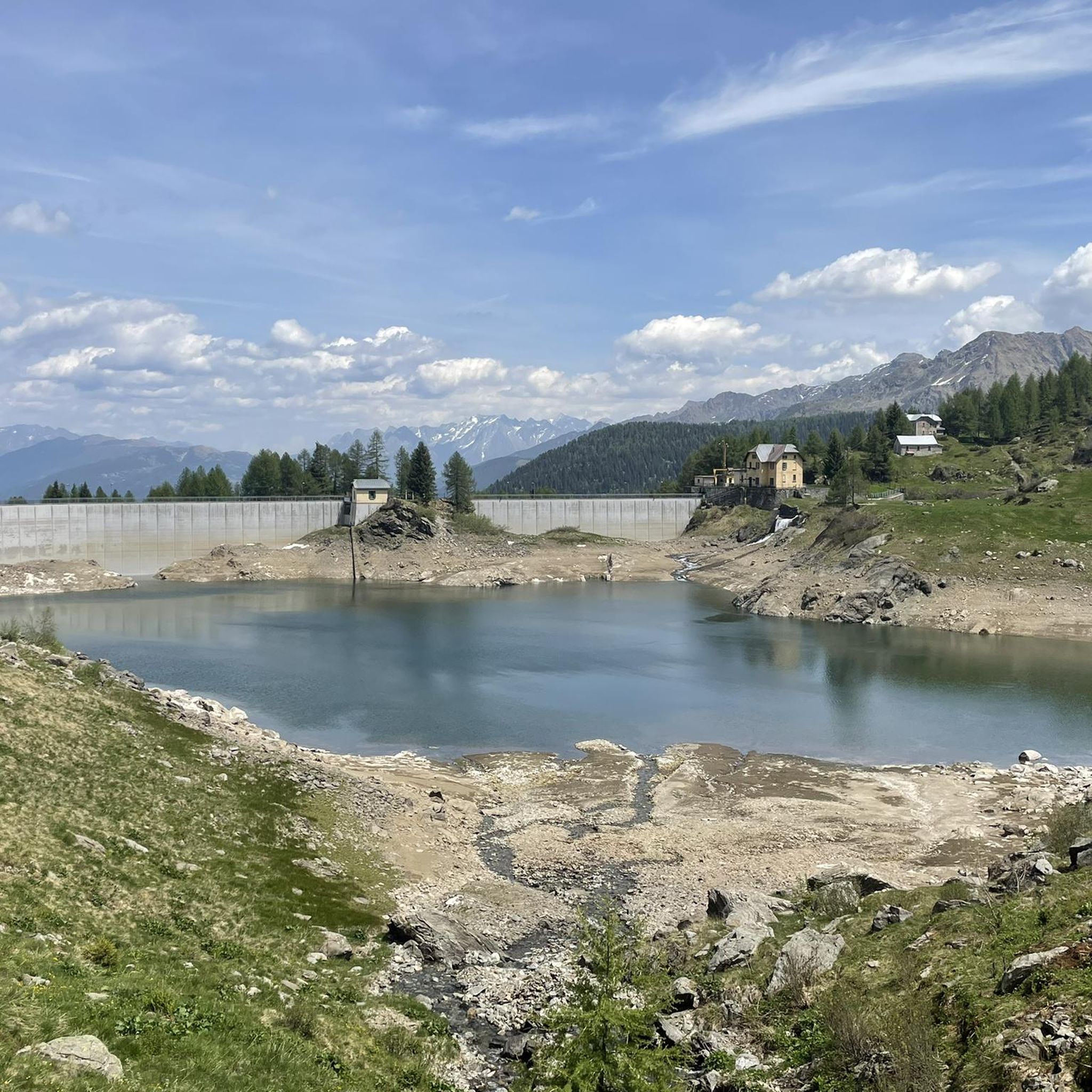
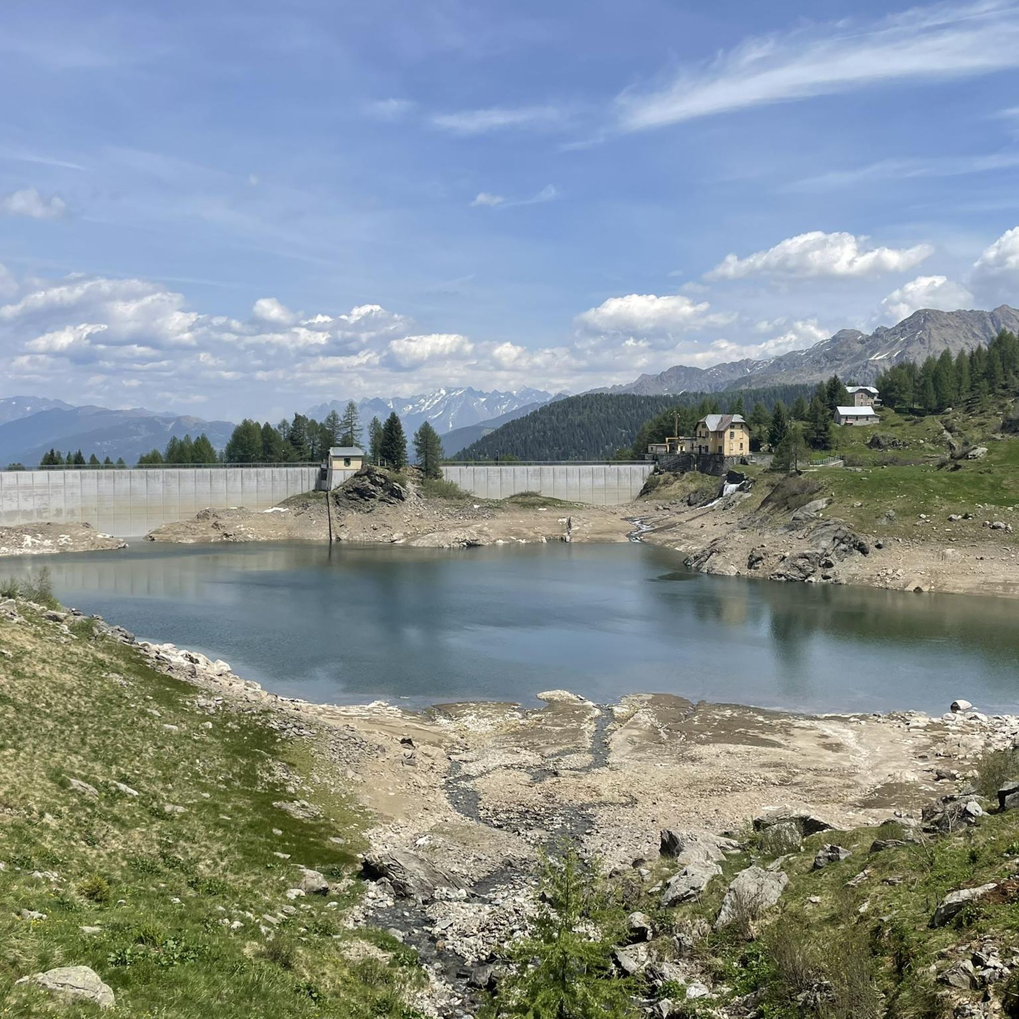
Located in Val d'Arigna in the Orobie Valtellinesi, Lake Santo Stefano di Mezzo is an artificial basin (like the lower one, while the upper one is natural).
1
0
Bettoli is a large rural nucleus. Today only 34 people live there and many houses are now overgrown and almost completely ruined.
1
0
Briotti is a small village in the Orobie Valtellinesi Park from which several treks start.
1
0
The Gino e Massimo Refuge is located in the Gironi area. It is a now renovated cabin (used as a refuge since 2013). The refuge, with an adjoining small bivouac, is dedicated to Gino Berniga, from Piateda, and Massimo Donati, from Castello dell'Acqua.
1
0
Frequently Asked Questions
How many hiking trails are available around Ponte in Valtellina?
Ponte in Valtellina offers a wide variety of hiking opportunities, with over 50 trails available. These range from easy paths to challenging long-distance treks, catering to different fitness levels and preferences.
What types of landscapes can I expect to see while hiking around Ponte in Valtellina?
The region around Ponte in Valtellina is characterized by diverse and stunning landscapes. You'll encounter majestic Alpine peaks, deep river valleys carved by the Adda and Mallero, sun-kissed vineyards, and apple orchards on the Rhaetian Alps' slopes. Protected areas like Stelvio National Park also contribute to the rich natural beauty.
Are there any challenging long-distance hikes in the area?
Yes, for experienced hikers seeking a challenge, Ponte in Valtellina offers several demanding routes. The Val Fontana High Trail is an 18.5 km route with significant elevation gain, often taking nearly 9 hours to complete. Another difficult option is the From Cà Pizzini to Rifugio baita Pesciola – loop tour, which involves over 960 meters of ascent.
Are there any circular hiking routes around Ponte in Valtellina?
Yes, there are several excellent loop trails. A popular moderate option is the Briotti Decauville Loop, a 10.2 km route that traverses villages, geological formations, and ruins. For a more challenging experience, consider the Lakes of Santo Stefano Loop, a difficult 13.3 km trek.
What unique attractions or landmarks can I visit near the hiking trails?
The region boasts several unique attractions. The Big Bench No. 182, Sondrio offers panoramic views over the Valtellina Valley. You can also explore natural wonders like the Gleno Dam and Lake or the Barbellino Reservoir. The famous Ponte nel Cielo (Bridge in the Sky) in the nearby Tartano Valley is a 234-meter-long pedestrian suspension bridge offering breathtaking views.
Are there any waterfalls in the Ponte in Valtellina area?
Yes, the region is home to natural water features. You can find the impressive Serio Falls, which is a notable natural monument in the vicinity.
What do other hikers enjoy most about hiking in Ponte in Valtellina?
The area is highly rated by the komoot community, with an average score of 4.4 stars from over 300 reviews. Hikers often praise the diverse terrain, from river valleys to high mountain routes, and the well-maintained network of trails that cater to various fitness levels.
Are there any easy or family-friendly walks around Ponte in Valtellina?
Yes, among the over 50 trails, there are 8 routes classified as easy, making them suitable for families or those looking for a more relaxed walk. These paths often wind through vineyards or along riverbanks, offering gentle gradients and scenic views.
What is the best time of year to go hiking in Ponte in Valtellina?
The best time for hiking in Ponte in Valtellina is generally from late spring through early autumn (May to October). During these months, the weather is typically pleasant, and the trails are most accessible. The region's sun-kissed vineyards are particularly beautiful in late summer and early autumn.
Are there mountain huts or refuges along the trails in Ponte in Valtellina?
Yes, the landscape around Ponte in Valtellina is dotted with numerous mountain huts and refuges, such as the Antonio Curò Mountain Hut and Alpe Piazza refuge. These provide excellent resting points, offer local cuisine, and allow hikers to enjoy panoramic views amidst their adventures.
Can I find trails that combine hiking with cultural or historical exploration?
Absolutely. Many trails in the region weave through historic villages, past ancient castles like Grumello and Mancapane, and along ancient religious routes. The Via dei Terrazzamenti is a recommended long-distance hike that specifically offers a blend of cultural and scenic views, showcasing the area's rich heritage.
Most popular routes around Ponte In Valtellina
Most popular attractions around Ponte In Valtellina

Get inspired with the komoot mobile app


Explore more
Browse the best Hikes in other regions.
