The 20 Most Amazing Peaks around Porto Valtravaglia
Best mountain peaks around Porto Valtravaglia are found in a picturesque landscape of hills and mountains on the eastern shore of Lake Maggiore. This region, part of the Varese Prealps, offers diverse opportunities for hiking and enjoying panoramic views. Visitors can explore elevated areas that blend wilderness with stunning vistas over Lake Maggiore and the surrounding region.
Best mountain peaks around Porto Valtravaglia
- The most popular mountain peaks is Cross at Pizzoni di Laveno, a summit that offers a…
Last updated: October 9, 2026
View from Sasso del Ferro
Highlight • Viewpoint
Translated by Google •
Tip by

Cross at Pizzoni di Laveno
Highlight • Summit
Translated by Google •
Tip by

Sign up now to discover places like this
Get recommendations on the best single tracks, peaks, & plenty of other exciting outdoor places.
Monte Chiusarella — Summit and Summit Cross
Highlight • Summit
Translated by Google •
Tip by

Cuvignone Pass
Highlight • Mountain Pass
Translated by Google •
Tip by

Monte Piambello
Highlight • Summit
Translated by Google •
Tip by

Sign up for free to discover even more peaks around Porto Valtravaglia.
Already have an account?
Start today with a free account
Your next adventure awaits.
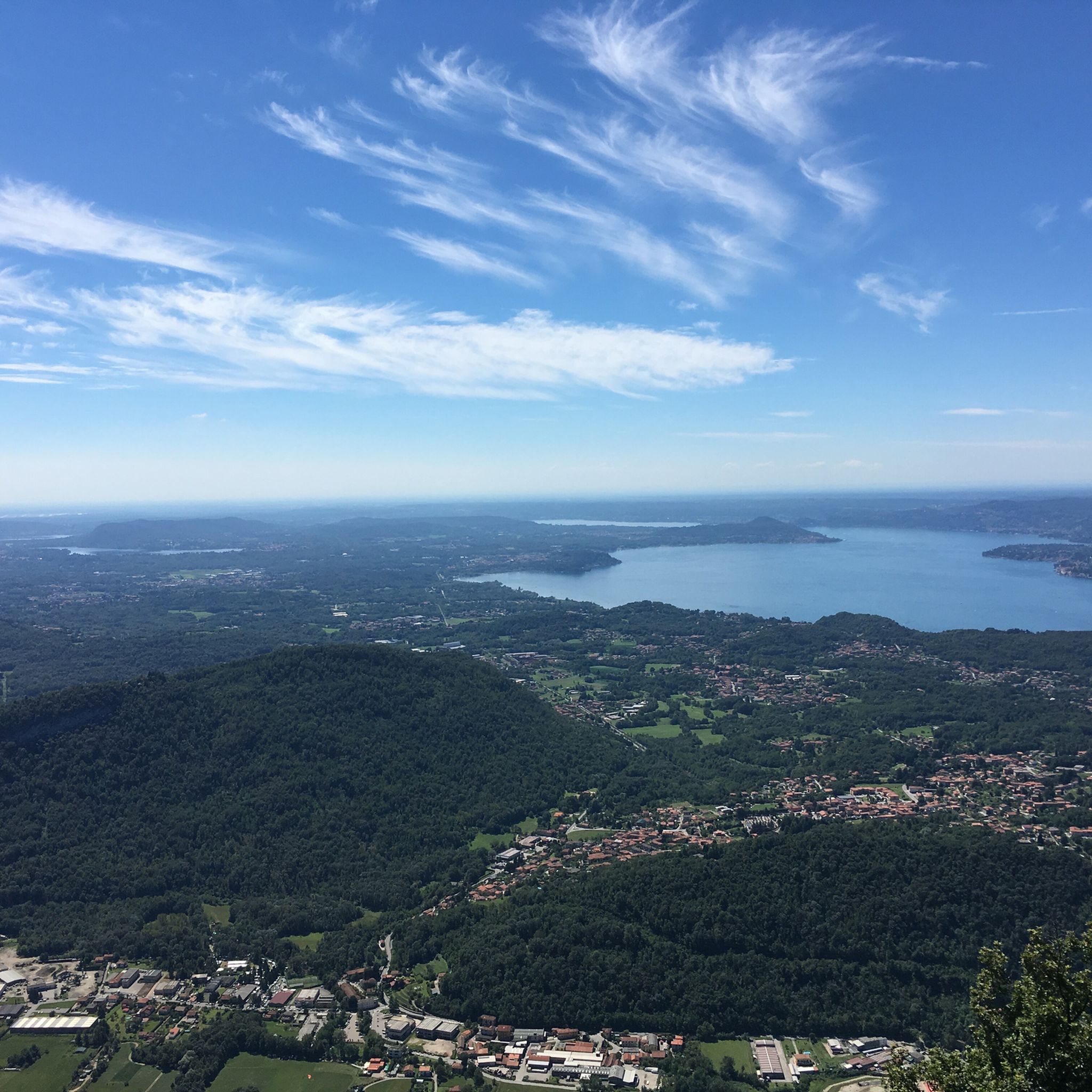
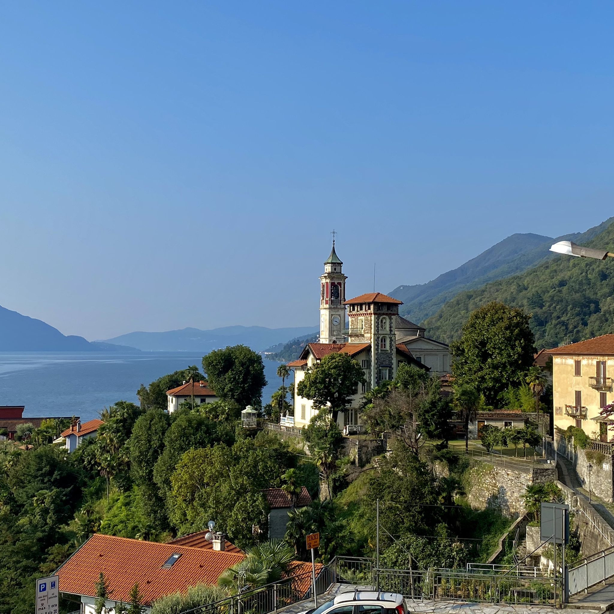
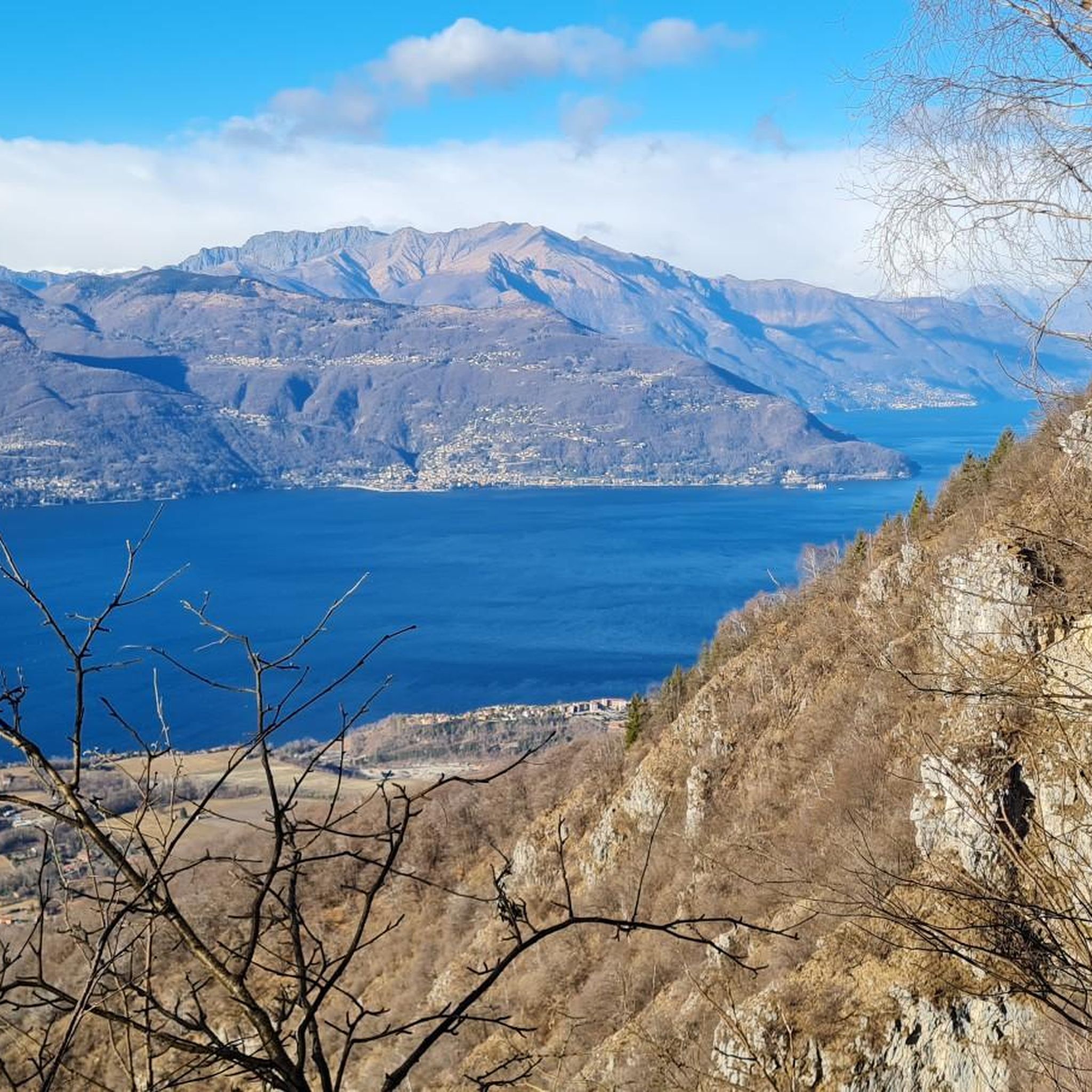

Tips from the Community

Passo S. Antonio Vararo / Cuvignone 1,036 m Passage at 1,036 meters above sea level From the South: Cittiglio to the North: Porto Valtravaglia About 200 hairpin bends on asphalt Strada Provinciale 8 https://stradedamoto.it/strade.asp?RicPas=4281
10
0
Passo del Monte Cuvignone Via Vararo, Cittiglio / Castelveccana VA The Cuvignone Pass (1,036 m above sea level) is a pass near Vararo, in the Varese area between Valcuvia and Luinese. In cycling, it is known for its demanding climb, which can be tackled from various sides (directly from Cittiglio or Castelveccana, or indirectly after climbing Sant'Antonio or crossing the San Michele Pass). It has been used for training since the time of Alfredo Binda (originally from the area) and offers particularly technical and demanding descents. Ivan Basso also trained there. The pass is also famous in the automotive world, as it has been the most selective timed section of the "ACI Varese Rally" since the 80s, today the "Rally dei Laghi". Even in motorsport, as in cycling, it has been tackled in all directions, and in all directions it has always stood out for its difficulty, consisting of fast sections, others slower but very technical, narrow hairpin bends uphill and downhill – all over a length of about 12/14 km at the discretion of the organizer. Text / Source: wikipedia.org/wiki/Passo_del_Cuvignone https://it.wikipedia.org/wiki/Passo_del_Cuvignone
10
0

Attention. If you descend towards Cuasso al monte towards the disused hospital, former sanatorium, the road is then blocked by a huge, insurmountable gate. Apparently, there is a path to the left of the hospital buildings. Right in front of the gate to exit, you can climb onto the low wall (there are steps) which is quite high and by doing so, following it for 20 meters, you avoid this barrier. Be careful, especially if you have a bike, of brambles and not falling.
0
0

Getting to the top is exciting.
0
0


a classic from the Varese area. It's worth it.
2
0


Pleasant. Be very careful when cutting through the woods or taking the short route. The gentlest route, starting from Rasa keeping to the right, is suitable for practically everyone.
0
0
Frequently Asked Questions
What are some of the most scenic viewpoints around Porto Valtravaglia?
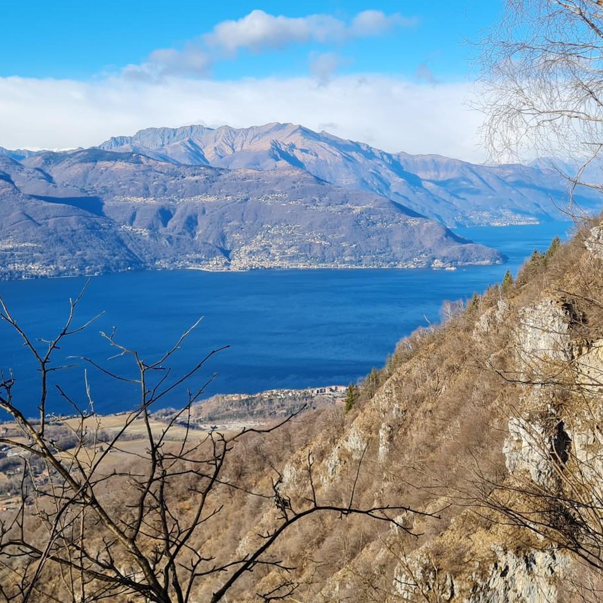
For breathtaking vistas, consider visiting View from Sasso del Ferro, which offers a magnificent panorama over Lake Maggiore and the surrounding area. Another excellent spot is Monte Chiusarella — Summit and Summit Cross, providing a 360° view of the lakes and the Alpine and pre-Alpine belt.
Are there any mountain peaks near Porto Valtravaglia with historical significance?
Yes, Monte San Martino is notable for its historical context, accessible via a forest hike from Arcumeggia Painted Village. It features World War I history and a chapel dedicated to San Martino in Culmine, built on the foundations of a 12th-century Romanesque church, honoring partisans who fell there in 1943. Additionally, Monte della Colonna offers insights through tunnels and fortifications from World War I.
What are some family-friendly mountain walks in the area?
A moderate loop tour around Monte Pian Nave is approximately 3.98 km long and takes about 1 hour and 30 minutes, making it suitable for various fitness levels with mostly accessible paths. Monte Chiusarella — Summit and Summit Cross is also categorized as family-friendly, offering a rewarding experience with its characteristic summit meadow.
Which mountain peaks offer challenging climbs for experienced hikers?
For a more challenging ascent, the Cross at Pizzoni di Laveno involves climbing over large boulders and a steep path, rewarding hikers with a magnificent panorama over Lake Maggiore. Monte Carza, located above Cannobio, also presents a moderate climbing route from Cannero Riviera, approximately 7.68 km long.
What kind of outdoor activities can I do near these mountain peaks?
Beyond hiking, the region offers diverse outdoor activities. You can explore various gravel biking routes, such as the 'Madonna dei Ciclisti Shrine – Lake Ghirla loop from Luino', or challenging MTB trails like the 'Tresa River – Artificial lake loop from Porto Valtravaglia'. For runners, there are several running trails, including the 'Church of Santa Maria Assunta – View of Lake Maggiore loop from Porto Valtravaglia'. You can find more details on these activities in the respective guides: Gravel biking around Porto Valtravaglia, MTB Trails around Porto Valtravaglia, and Running Trails around Porto Valtravaglia.
Are there any mountain passes worth visiting for views or hiking trails?
The Cuvignone Pass, situated at an altitude of 1,050 meters, connects Valcuvia with Luinese. It's accessible from three different sides, with various hiking trails starting from it that offer views of Lake Maggiore. While the pass itself might not have direct views, the roads leading to it are very scenic.
What is the best time of year to hike the mountain peaks around Porto Valtravaglia?
The Varese Prealps, including the peaks around Porto Valtravaglia, are generally enjoyable for hiking from spring through autumn. Spring offers lush greenery and pleasant temperatures, while autumn provides vibrant foliage. Summer can be warm, but higher elevations offer cooler air. Winter hiking is possible on some trails, but requires appropriate gear and checking conditions.
Can I find trails that combine nature and historical elements?
Yes, Monte San Martino offers a blend of beautiful natural scenery and World War I history, including a historic chapel. Similarly, Monte della Colonna features historical tunnels and fortifications from World War I alongside stunning views over Lake Maggiore, providing a rich experience for those interested in both nature and history.
Are there any easy mountain hikes near Porto Valtravaglia suitable for beginners?
For easier options, the hills above Porto Valtravaglia provide access to trails leading to Monte Borgna and Passo di Forcora. These routes are ideal for nature walks and offer expansive views over Lake Maggiore and the nearby alpine foothills, without requiring advanced hiking experience.
What do visitors particularly enjoy about the mountain peaks in this region?
Visitors frequently praise the magnificent panoramic views over Lake Maggiore and the surrounding Alpine landscape. Many appreciate the diverse hiking trails, ranging from moderate walks to challenging climbs, and the blend of natural beauty with historical elements like WWI fortifications and ancient churches. The region's natural habitats, such as the 'Prati Magri' meadows on Monte Chiusarella, are also highly valued.
Where can I find a summit with a distinctive cross?
Both Monte Chiusarella — Summit and Summit Cross and Monte Carza feature summit crosses. Monte Chiusarella has a characteristic summit meadow and a cross protected by an imposing stone bastion. Monte Carza, above Cannobio, also has an iron cross marking its summit, offering incredible panoramic views.
Are there any volcanic features among the peaks?
While not a primary volcanic region, Monte Piambello is noted in its categories as having volcanic aspects, alongside being a historical site and offering forest trails and viewpoints. It's part of a multi-day trail tracing fortifications of the Cadorna del Varese line.
Most popular routes around Porto Valtravaglia
Most popular attractions around Porto Valtravaglia

Get inspired with the komoot mobile app


Explore more
See even more amazing summits around Porto Valtravaglia with these guides:
