The best road cycling routes around Pieranica
3.9
(351)
6,077
riders
212
rides
Road cycling routes around Pieranica are situated in Italy's Lombardy region, an area known for diverse cycling terrain. The landscape features rolling hills, which provide varied gradients for cyclists. Nearby river valleys offer flatter routes, while the proximity to the Bergamo Alps introduces more challenging mountainous sections. This region provides a mix of terrain suitable for different road cycling preferences.
Best road cycling routes around Pieranica
- The most popular road cycling route is Climb to Roncola – Roncola village center…
Last updated: May 17, 2026
5.0
(3)
136
riders
98.8km
04:20
850m
850m
Moderate road ride. Good fitness required. Mostly well-paved surfaces and easy to ride.
2.6
(9)
130
riders
52.0km
02:10
60m
60m
Moderate road ride. Good fitness required. Mostly well-paved surfaces and easy to ride.

Sign up for free
88
riders
122km
05:22
1,000m
1,000m
Hard road ride. Very good fitness required. Mostly well-paved surfaces and easy to ride.
4.5
(4)
28
riders
60.3km
02:28
100m
100m
Moderate road ride. Good fitness required. Mostly well-paved surfaces and easy to ride.
5.0
(1)
26
riders
45.7km
01:51
60m
60m
Easy road ride. Great for any fitness level. Mostly well-paved surfaces and easy to ride.
Get access to more routes and recommendations from other explorers.
Sign up for free
Already have an account?
Our route recommendations are based on thousands of hikes, rides, and runs completed by other people on komoot.
Start today with a free account
Your next adventure awaits.
Login or Signup




Tips from the Community

classic water refill point on arrival or departure in Selvino
0
0

The main inhabited center of Roncola is situated on a ridge at about 854 meters above sea level, near which flows the Valdimagnino loop. The remaining hamlets, including Roncola Alta, San Defendente, and Cà Maltroti, occupy the northern slope of this ridge, at altitudes ranging from 600 to over 1000 meters.
0
0

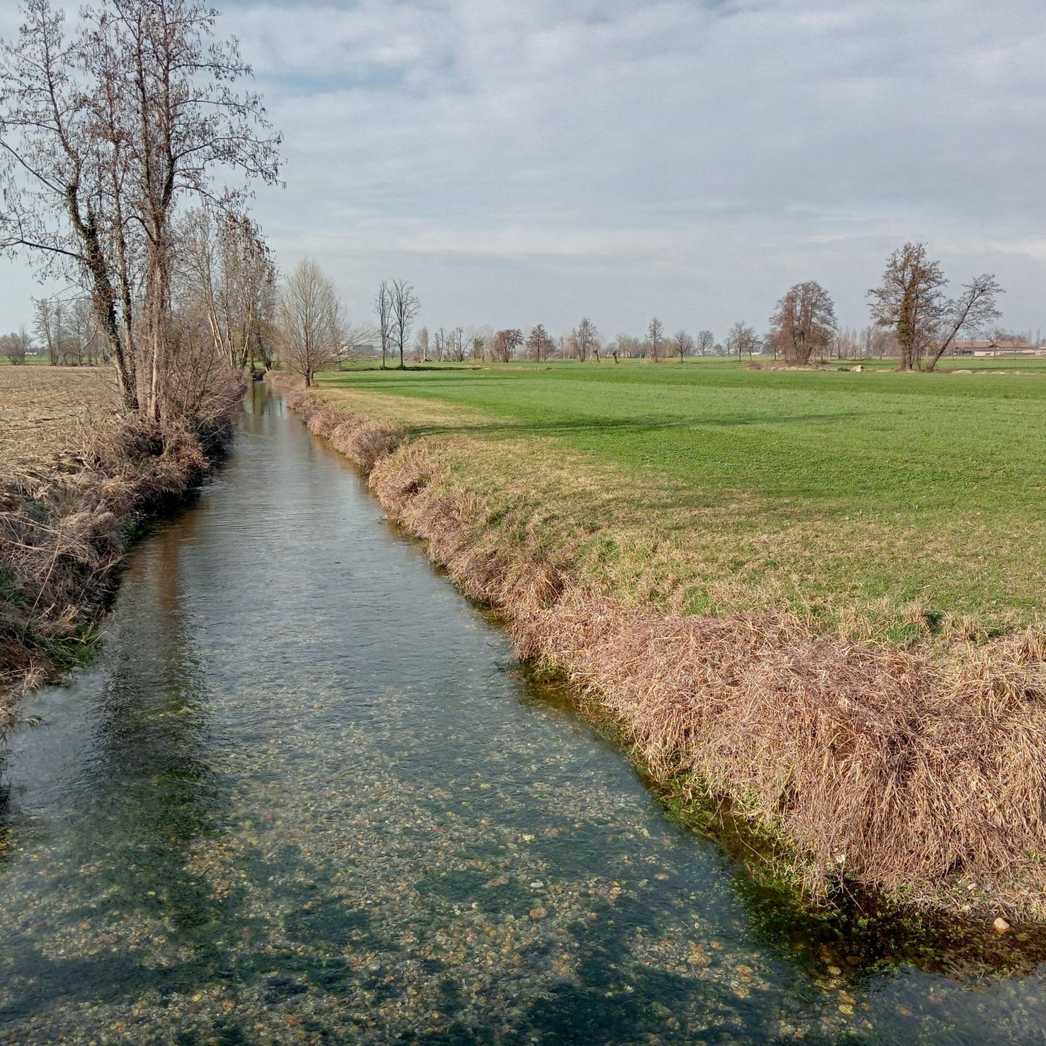
The Muzza Canal is the oldest in Europe and this year, its 800th anniversary was celebrated by the Municipality of Paullo in collaboration with the Pro Loco and other Municipalities. Its origin dates back to the year 1220, when Frederick II of Swabia, crowned emperor of the Holy Roman Empire, issued an imperial edict that granted the people of Lodi the right to use the waters flowing through their territory. The current route, about 60 km long, receives the waters of the Adda at Cassano d’Adda, at an altitude of 120 m above sea level, crosses the Lodi territory for about 40 km up to near Castiglione d’Adda, at an altitude of 45 m above sea level, and here it releases them back into the Adda. It has a regulated water regime, with a flow rate, depending on the seasons, of about 200,000 liters of water per second; an initial width of 50 meters which reduces to a few meters at the end of its course and an average depth of 2 meters.
0
0
The Muzza canal (61 km long in total) is a branch of the Adda River and has recently celebrated its 800th anniversary, making it one of the oldest in Europe. Its name, with slight variations over the centuries, still recalls the Roman family Mutia who moved here in 90 BC, starting the first land reclamation works. Smaller watercourses branch off from the wide canal, winding through the countryside for a total length of about 1000 kilometers, mainly intended for agricultural irrigation. The surrounding landscape of countryside and farmhouses is evocative, with a succession of tree-lined rows and open fields. It is also very interesting from a naturalistic point of view as it attracts many aquatic birds that can be observed along the route.
1
0

I rode there so I'm not sure, but the entrance seemed very narrow for a bike, if it has wide handlebars in my opinion it won't fit
0
0

Be careful on the steps when the ground is wet! This passage allows you to cross the right bank of the Muzza.
2
0

nice spot to refill your bottles and chill for a bit
0
0

suggestive and well preserved
1
0
Frequently Asked Questions
How many road cycling routes are available around Pieranica?
There are nearly 200 road cycling routes around Pieranica, offering a wide range of options for different skill levels and preferences. These include routes through rolling hills, river valleys, and more challenging mountainous sections.
What kind of terrain can I expect on road cycling routes near Pieranica?
The region around Pieranica offers diverse terrain. You'll find routes traversing rolling hills, providing varied gradients. Flatter rides are available in scenic river valleys, while the proximity to the Bergamo Alps introduces more challenging mountainous sections for experienced cyclists.
Are there any easy road cycling routes suitable for beginners around Pieranica?
Yes, the area offers routes suitable for beginners. Many of the routes through river valleys provide a more relaxed ride. For example, the Cascine Capri – Chiesa di Scannabue loop from Casaletto Vaprio is a moderate 32.3-mile path that offers a more relaxed experience through the local countryside.
Where can I find challenging road cycling routes with significant elevation near Pieranica?
For challenging rides, look towards routes that venture into the Bergamo Alps or feature substantial climbs. The Tower of the Fallen, Bergamo – Selvino Switchbacks loop from Casaletto Vaprio is a difficult 75.5-mile route with nearly 1000 meters of elevation gain, providing a demanding experience.
What are some notable landmarks or attractions I can see along road cycling routes?
Along your rides, you can explore various points of interest. The Vacchelli Canal in the Moso Agricultural Park and the Vacchelli Canal Cycle Path offer picturesque sections. You might also encounter historical sites like the Church of Saint Catherine in Moso or natural areas like the Palata Menasciutto Reserve.
Are there any circular road cycling routes around Pieranica?
Yes, many of the road cycling routes in the area are designed as loops, allowing you to start and finish at the same point. Examples include the Climb to Roncola – Roncola village center loop from Capralba and the View of the Bergamo Hills – Upper Town of Bergamo loop from Casaletto Vaprio.
What do other road cyclists enjoy the most about road cycling in Pieranica?
The area is highly rated by the komoot community, with an average score of 4.1 stars from over 300 reviews. Reviewers often praise the varied terrain, which caters to different skill levels, and the well-maintained paths that make for an enjoyable cycling experience.
Can I find routes that offer scenic views of the Bergamo Hills?
Absolutely. Several routes provide excellent views of the surrounding landscape. The View of the Bergamo Hills – Upper Town of Bergamo loop from Casaletto Vaprio is specifically designed to offer panoramic vistas towards Bergamo as you cycle through rolling hills.
Are there any routes that follow river valleys for a more relaxed ride?
Yes, the region includes scenic river valleys like Valle Brembana and Val Seriana, which offer flatter routes ideal for more relaxed and picturesque cycling tours. These routes often provide a gentler gradient compared to the hillier sections.
What is the best time of year for road cycling around Pieranica?
While specific seasonal conditions can vary, the Lombardy region generally offers pleasant cycling conditions during spring and autumn when temperatures are moderate. Summer can be warm, especially in the valleys, while winter might present colder conditions, particularly in higher elevations.
Are there any routes that pass by vineyards?
The wider Lombardy area is known for its vineyards. While specific routes directly through vineyards near Pieranica are not detailed, the regional context suggests that cyclists can find routes that traverse local vineyards, offering a blend of natural beauty and cultural landscape.
Are there options for long-distance road cycling routes?
Yes, the area offers several longer routes for endurance cyclists. For instance, the Climb to Roncola – Roncola village center loop from Capralba is a substantial 61.5-mile (99 km) route, and the Adda River at Trezzo sull'Adda – Cascine Capri loop from Casaletto Vaprio covers 69 miles (111 km), providing ample distance for longer rides.
Most popular attractions around Pieranica

Get inspired with the komoot mobile app


Explore more
Browse the best Road cycling routes in other regions.
