The best running trails around Rivamonte Agordino
4.4
(5)
573
runners
34
runs
Jogging routes Rivamonte Agordino traverse the scenic foothills of the Dolomites, characterized by varied terrain that includes forested paths, mountain trails, and valley routes. The region offers a mix of challenging ascents and more gradual paths, often featuring views of the surrounding peaks and valleys. Runners can expect to encounter a landscape shaped by alpine geology, with opportunities to explore both natural and rural settings.
Best jogging routes around Rivamonte Agordino
- The most popular jogging route is Running loop from…
Last updated: May 25, 2026
47
runners
10.3km
01:54
670m
670m
Hard run. Very good fitness required. Sure-footedness, sturdy shoes and alpine experience required.
29
runners
6.89km
00:55
230m
230m
Hard run. Good fitness required. Sure-footedness, sturdy shoes and alpine experience required.

Sign up for free
16
runners
12.5km
02:04
750m
750m
Hard run. Very good fitness required. Sure-footedness, sturdy shoes and alpine experience required.
19
runners
10.7km
01:14
200m
200m
Moderate run. Good fitness required. Mostly paved surfaces. Suitable for all skill levels.
4.0
(1)
13
runners
11.4km
01:16
230m
230m
Moderate run. Good fitness required. Mostly paved surfaces. Suitable for all skill levels.
Get access to more routes and recommendations from other explorers.
Sign up for free
Already have an account?
Our route recommendations are based on thousands of hikes, rides, and runs completed by other people on komoot.
Start today with a free account
Your next adventure awaits.
Login or Signup
Tips from the Community

Malga Luna is located along the paths that lead to the Gurekian Refuge. It is an excellent place as an emergency shelter but also as a place to take a solitary and relaxing break.
0
0
Reachable from Fressenè (BL) along the path that leads to the Scarpa Gurekian Refuge. On clear days there is a fantastic view.
0
0

Easily visible from afar thanks to a cross at the summit, Col di Luna is located at an altitude of 1,747 meters and can be reached via paths that climb through the beech forests. From the summit you have a splendid view of the Agordo Valley and peaks such as Civetta and Moiazza.
2
1

Nice walkway to take you towards the hamlet of Forno di Val where there is a bar, an excellent point for a refreshment break.
0
0
Legend has it that upon the death of San Lucano, while the body of the Saint was being taken to Belluno for burial in the cathedral of the capital, when they reached Ponte Alto a mysterious force blocked the horses and cart in that place and no one was better able to proceed. It seems that the solution was found only by cutting off the saint's arm and burying him in that place, managing to resume the journey. The capital still present today was built in the place of the alleged event. Inside there is a fine painting by Giuliano De Rocco which portrays the scene.
0
0

A visit to the Agordo square is always a must! Gorgeous place!
0
0

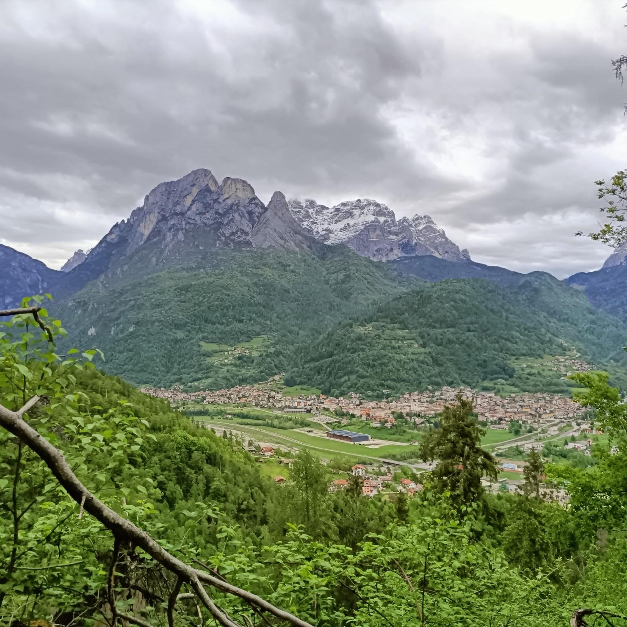
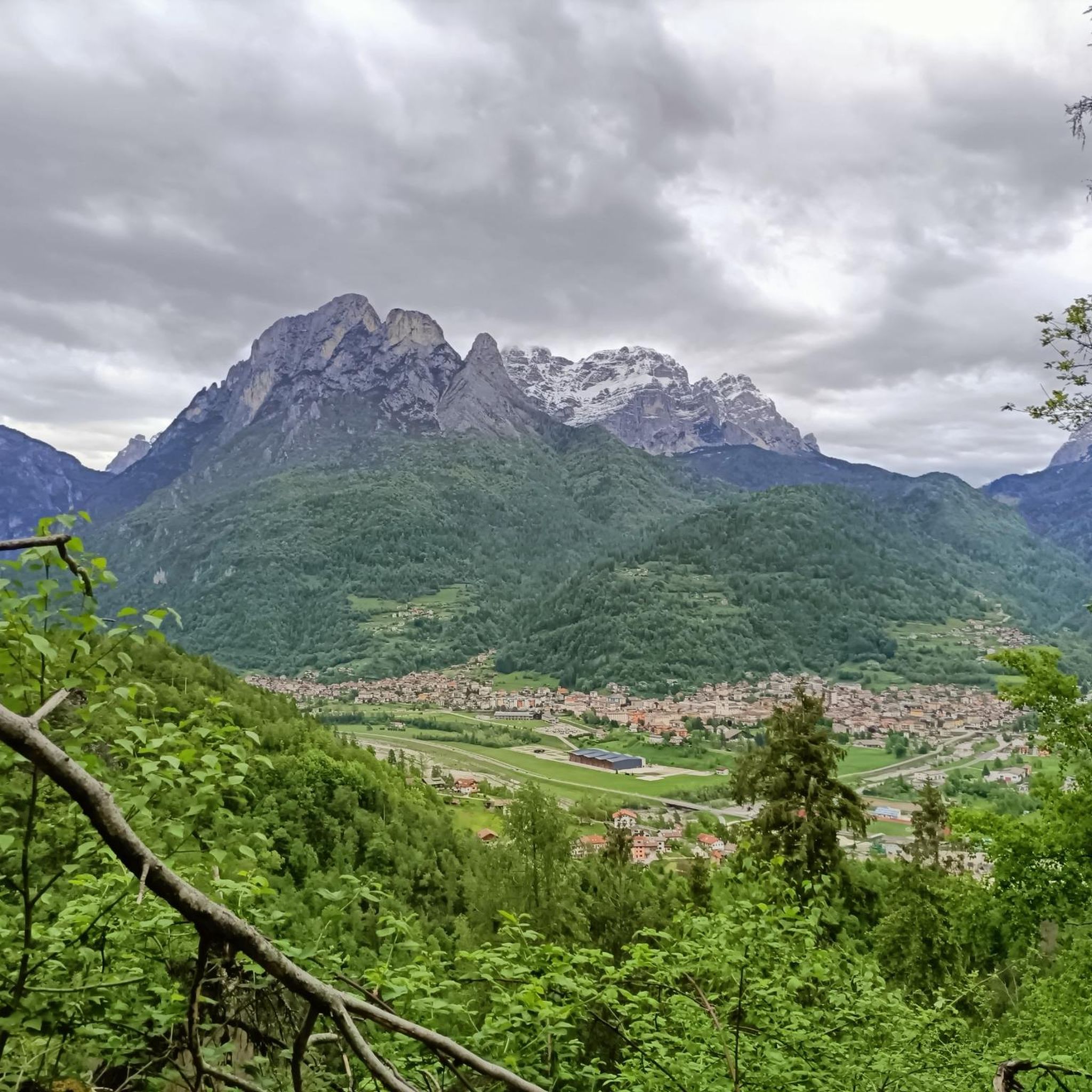
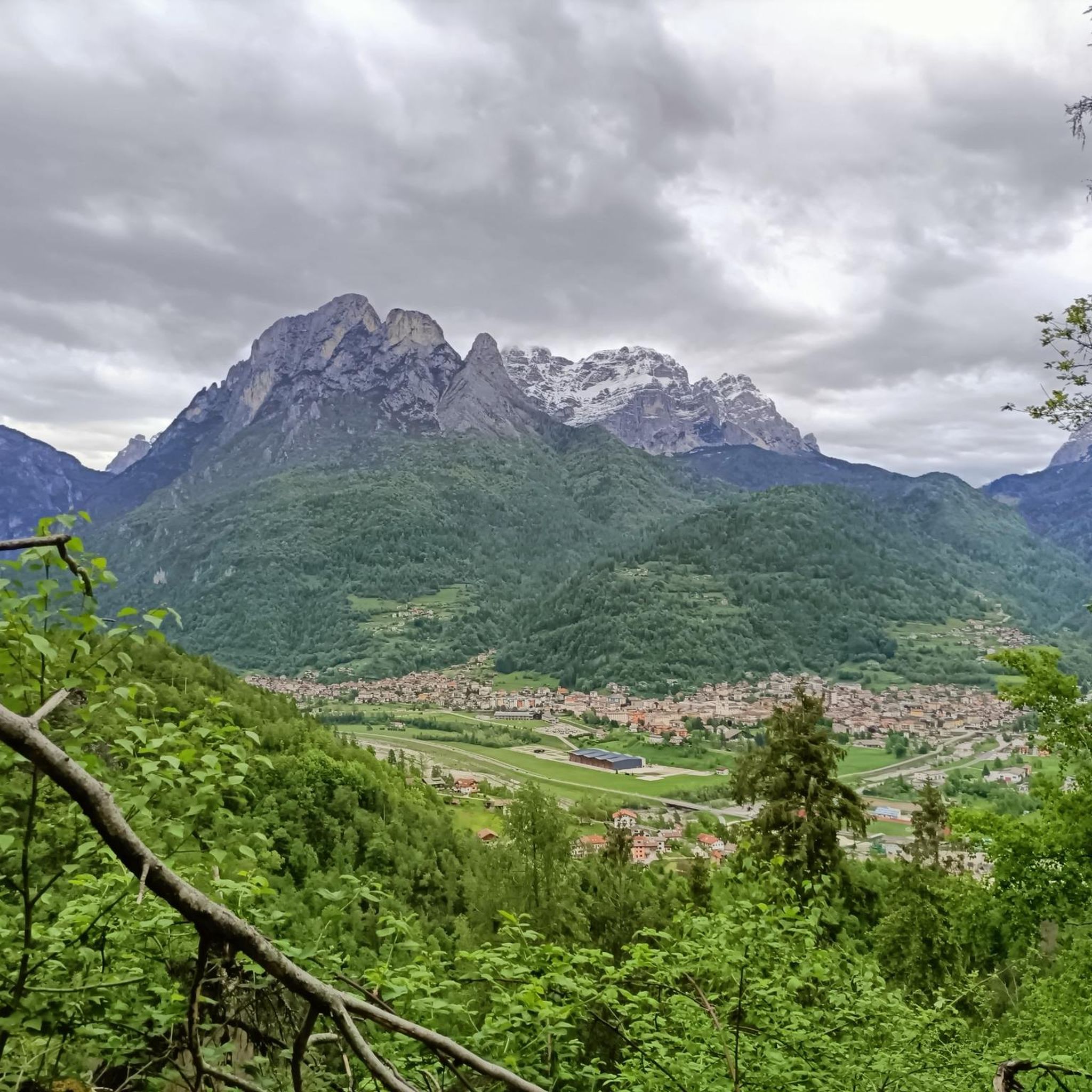
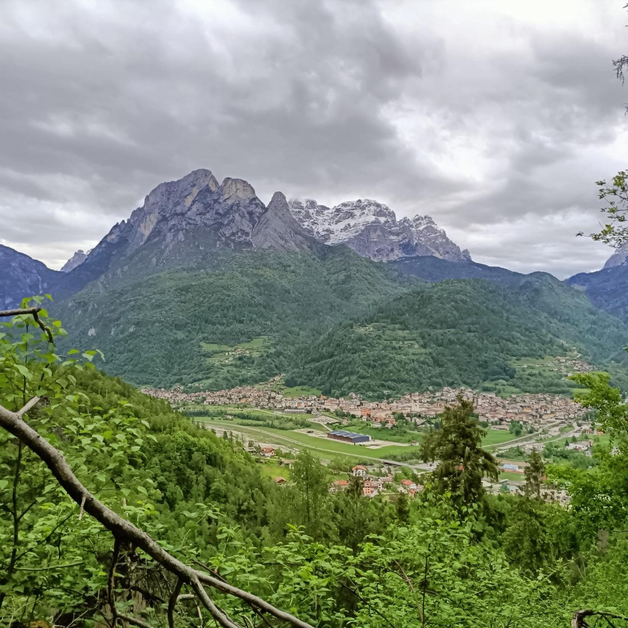
The town of Àgordo rises in a basin between the mountains of the Catena del San Sebastiano, the Agnèr, the Moiazza, Monte Celo, the Pale di San Lucano, the Monti del Sole, in the valley of the Cordevole torrent.
0
0
Forcella Aurine was an uninhabited transit area, frequented for grazing and haymaking. With the construction of the first hotel in 1921, it gradually became a tourist destination. The hairpin bends are surrounded by a suggestive landscape and the road is not excessively frequented by motor vehicles.
2
0
Frequently Asked Questions
How many running routes are available in Rivamonte Agordino?
There are over 35 running routes around Rivamonte Agordino, offering a diverse range of options for different skill levels. The komoot community has explored these trails over 1000 times.
Are there easy running routes suitable for beginners in Rivamonte Agordino?
While many routes in Rivamonte Agordino feature challenging ascents typical of the Dolomites, there are a few easier options. For example, the Lago delle Peschiére loop from Dolomites is a moderate 6.7-mile (10.7 km) path with less elevation gain, making it a good choice for those looking for a less strenuous run.
What is the typical length of running trails in Rivamonte Agordino?
The running trails in Rivamonte Agordino vary in length, but many popular routes range from 4 to 8 miles (6 to 13 km). For instance, the Forcella Franche loop from Rivamonte Agordino is about 4.3 miles (6.9 km), while the Col di Luna loop from Voltago Agordino extends to nearly 7.9 miles (12.7 km).
Can I find circular running routes in Rivamonte Agordino?
Yes, many of the running paths in Rivamonte Agordino are circular, allowing you to start and finish at the same point. Examples include the popular Running loop from Forcella Aurine and the Running loop from Voltago Agordino.
Are the running trails in Rivamonte Agordino dog-friendly?
Generally, dogs are welcome on the running trails in Rivamonte Agordino, especially on the mountain and forest paths. It's always recommended to keep your dog on a leash, especially in areas with wildlife or near livestock, and to carry water for both of you.
What kind of scenery can I expect on the running routes?
The running routes in Rivamonte Agordino offer stunning Dolomite scenery. You'll encounter forested paths, mountain trails with panoramic views of surrounding peaks and valleys, and routes through rural settings. The region is characterized by alpine geology and natural beauty.
Are there any interesting landmarks or natural attractions along the running routes?
Yes, the area around Rivamonte Agordino is rich in natural and historical sites. You might pass by highlights such as the beautiful Soffia Waterfall or historical sites like the Monte Celo World War I Bunker. The region also features several mountain huts and summits like Monte Pizzocco summit.
When is the best time of year to go running in Rivamonte Agordino?
The best time for running in Rivamonte Agordino is typically from late spring through early autumn (May to October). During these months, the weather is generally mild, and the trails are clear of snow, offering ideal conditions to enjoy the mountain scenery.
What do other runners enjoy most about jogging in Rivamonte Agordino?
The komoot community highly rates the running experience in Rivamonte Agordino, with an average score of 4.4 stars from over 10 reviews. Runners often praise the varied terrain, the challenging ascents with rewarding views, and the opportunity to explore both natural and rural settings within the Dolomites.
Are there any running routes that offer views of lakes or water features?
Yes, some routes incorporate water features. For example, the Lago delle Peschiére loop from Dolomites is a moderate route that takes you past the scenic Lago delle Peschiére, offering beautiful lakeside views during your run.
Is parking generally available near the trailheads in Rivamonte Agordino?
Yes, parking is typically available near the starting points of many running routes in Rivamonte Agordino, especially in villages like Forcella Aurine, Voltago Agordino, or Rivamonte Agordino itself. It's advisable to check local signage for specific parking regulations.
Most popular routes around Rivamonte Agordino
Most popular attractions around Rivamonte Agordino

Get inspired with the komoot mobile app


Explore more
Browse the best Running Trails & Routes in other regions.
