The best road cycling routes around Straning-Grafenberg
4.6
(38)
613
riders
132
rides
Road cycling routes around Straning-Grafenberg are set within Lower Austria, at the confluence of the Weinviertel and Waldviertel regions. The landscape features rolling hills, forests, and vineyards, offering varied terrain for road cyclists. The region includes the Grafenberg, an elevation of 512 meters, providing panoramic views. This area is characterized by a transition zone between the Weinviertel's agricultural lands and the Waldviertel's forested areas.
Best road cycling routes around Straning-Grafenberg
- The most popular road cycling route is Jaidhof Castle –…
Last updated: November 1, 2026
3.0
(2)
36
riders
104km
05:23
1,520m
1,520m
Hard road ride. Very good fitness required. Mostly well-paved surfaces and easy to ride.
5.0
(1)
15
riders
115km
05:21
1,360m
1,360m
Hard road ride. Very good fitness required. Mostly well-paved surfaces and easy to ride.

5.0
(2)
13
riders
66.4km
03:16
980m
980m
Hard road ride. Very good fitness required. Mostly well-paved surfaces and easy to ride.
5.0
(1)
11
riders
33.7km
01:36
300m
300m
Moderate road ride. Some segments of this route may be unpaved and difficult to ride.
8
riders
Moderate road ride. Good fitness required. Mostly well-paved surfaces and easy to ride.
Get access to more routes and recommendations from other explorers.
Already have an account?
Our route recommendations are based on thousands of hikes, rides, and runs completed by other people on komoot.
Start today with a free account
Your next adventure awaits.

Tips from the Community

Gars am Kamp is first mentioned in documents as a market town in 1279, and the market rights were confirmed in 1403. Gars Castle was expanded by the Kuenringers; later lords of the castle included the Maissauers and the Counts of Lamberg. The large Renaissance castle built in the 16th century fell into ruin in the 19th century due to the burden of the roof tax.
0
0
Gföhl was first mentioned in documents around 1180 and looks back on a long history as a market town and centre of the Waldviertel. The most important milestones Antiquity and settlement: Prehistoric finds (like from the Bronze Age) prove early traces of humans on the Gföhl plateau. Before German settlement from the 12th century onwards, there was a Slavic presence. First mention (1180): The place name is presumably derived from a topographical depression in the ground. Elevation to market town (1314/1493): In 1314, Gföhl is mentioned as a market town. In 1493, Emperor Frederick III granted the town official market rights and a coat of arms. War hardship and crises: In 1426, the Hussites destroyed the town and church. The population also suffered severely during the Peasants' War (1595) and the Thirty Years' War (1645), as well as from the plague (1679/1681).
0
0

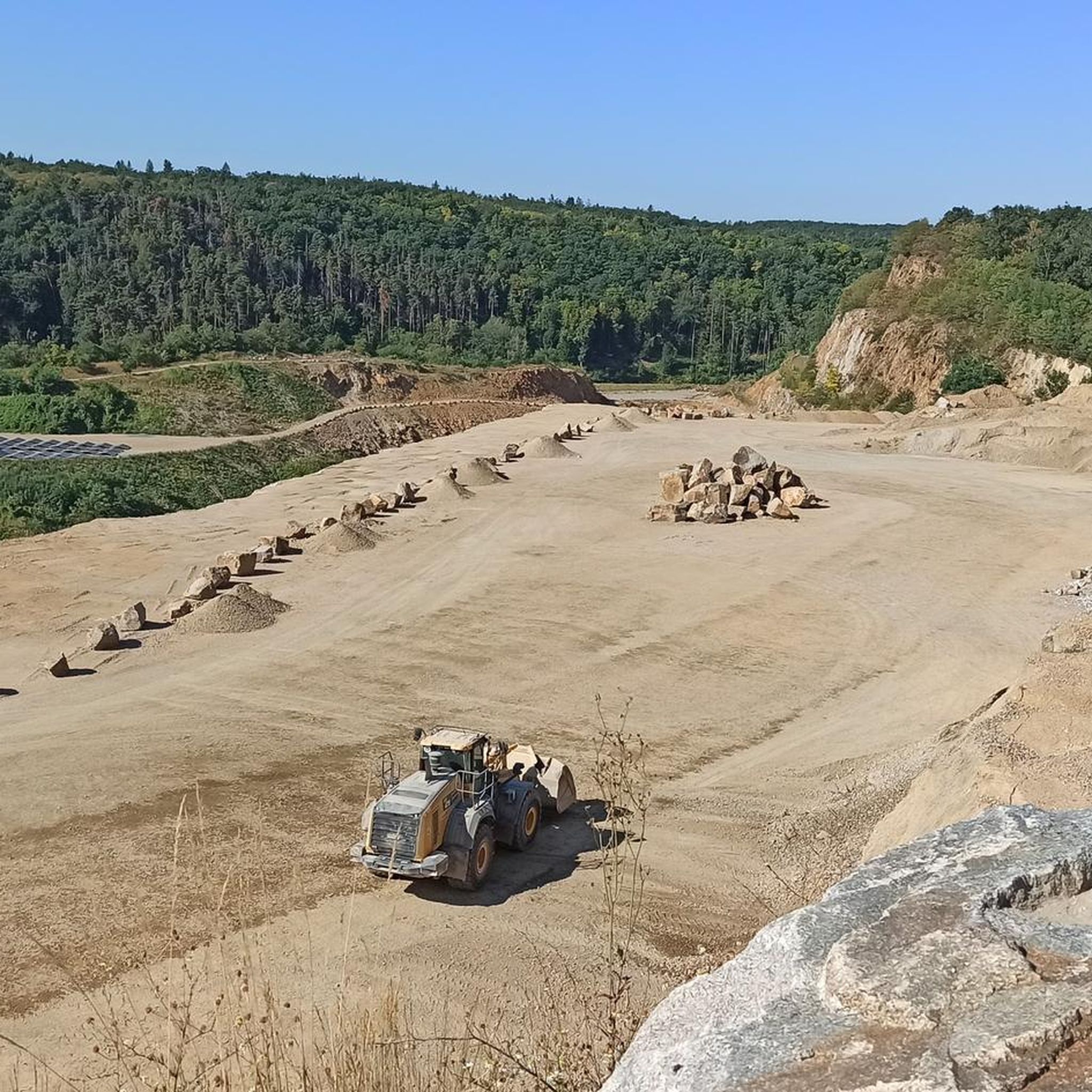
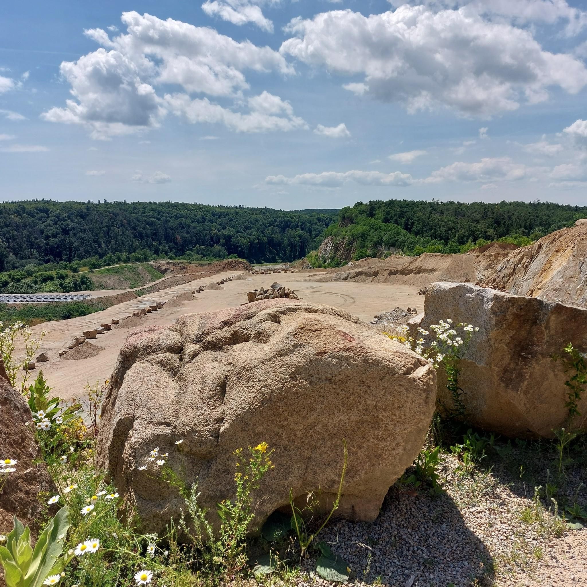
Impressive old quarry next to the "Wald & Reben" bike tour.
0
0
The town of Eggenburg, whose origins date back to the 13th century, was once one of the best-fortified towns in the country. The town walls were expanded over time with towers and gates, and Eggenburg's importance as a political center was underscored by events such as the proclamation of Duke Albrecht V. as ruler of the land.
1
0
The parish church of St. Stephen is a Roman Catholic church in the town of Eggenburg. The church is a widely visible building towering over the town, with a nave featuring a high gable roof and a choir flanked by two towers. To the north, it is connected to the former rectory by a covered walkway. The church building is a listed monument.
0
0

A trip to Jaidhof Castle is particularly worthwhile due to the combination of historical architecture, spiritual tranquility, and nature experience.
0
0
After historical decay, the complex was extensively renovated in the 20th century through private initiative and saved from ruin status. As it is privately owned, it can usually only be viewed from the outside.
0
0
In 1451, St. John Capistrano visited Eggenburg. The enthusiastic citizens then founded a Franciscan monastery in 1460. The church was consecrated in 1466 and richly furnished with artworks during the Baroque period. In 1786, the monastery was dissolved by Emperor Joseph II and subsequently converted into a cotton factory. Due to the great city fire in 1808, which reduced 203 houses to rubble and ashes, this building also became a ruin. It was only rebuilt in 1833 by the Redemptorists. Among the many members of this order house, Brother Johann Baptist Stöger, who has already been beatified, stands out particularly. His remains rest in a high tomb in the family chapel of the monastery church.
0
0
Frequently Asked Questions
What kind of terrain can I expect on road cycling routes in Straning-Grafenberg?
The region offers a diverse landscape characterized by rolling hills, lush forests, and expansive views. You'll find a mix of gentle climbs and descents, making it suitable for various cycling preferences. The area is a transition zone between the Weinviertel's vineyards and the Waldviertel's forests, providing varied scenery throughout your ride.
Are there road cycling routes for all skill levels in Straning-Grafenberg?
Yes, Straning-Grafenberg offers a range of road cycling routes catering to different abilities. You can find options for easy, moderate, and difficult skill levels. For example, the Eggenburg town centre – Kellergasse loop from Limberg-Maissau is a moderate route, while the Jaidhof Castle – Krumau Castle loop from Eggenburg presents a more difficult challenge.
What natural features and landmarks can I see along the road cycling routes?
Road cycling routes in Straning-Grafenberg often pass by notable natural features and historical sites. You might encounter the characteristic Cellar Lanes (Kellergassen) of the Weinviertel, such as the Öhlberg-Kellergasse in Pillersdorf. The region also features the Grafenberg, offering panoramic views, and geological points of interest like the Kogelsteine rock formations. For specific historical sites, consider routes that pass by castles like Burg Maissau or the Ruins near Sachsendorf.
Are there any scenic viewpoints along the road cycling routes?
Absolutely. The Grafenberg, at 512 meters above sea level, provides magnificent panoramic vistas of the surrounding area. Additionally, the Keltenturm Sandberg offers superb views and a glimpse into 2,500 years of history. Many routes are designed to showcase the picturesque landscape, including the transition zone between vineyards and forests.
What is the best season for road cycling in Straning-Grafenberg?
The rolling hills and varied landscapes of Straning-Grafenberg are enjoyable throughout much of the year. Spring and autumn generally offer pleasant temperatures and beautiful scenery, with spring bringing blooming vineyards and autumn showcasing vibrant fall foliage. These seasons also tend to have more stable weather conditions for cycling.
How many road cycling routes are available in Straning-Grafenberg?
There are over 150 road cycling routes available around Straning-Grafenberg, offering a wide selection for cyclists. These routes are highly rated by the komoot community, with an average score of 4.6 stars from over 20 reviews.
Can I find family-friendly road cycling routes in the area?
While the region features rolling hills, many routes offer gentle climbs and descents on quiet roads, which can be suitable for families. Look for routes categorized as 'easy' or 'moderate' for a more relaxed experience. The varied scenery, including forests and vineyards, provides an engaging backdrop for family rides.
Are there cafes or restaurants along the road cycling routes for a break?
The Weinviertel region, where Straning-Grafenberg is located, is known for its hospitality. You'll find opportunities for breaks in local villages and towns. Some cellar lanes, like the Öhlberg-Kellergasse in Pillersdorf, may offer wine tastings or local refreshments. It's advisable to check opening times in advance, especially in smaller communities.
What do other road cyclists enjoy most about road cycling in Straning-Grafenberg?
The area is highly rated by the komoot community, with an average score of 4.6 stars. Reviewers often praise the varied terrain, which combines rolling hills with picturesque vineyards and forests, and the quiet roads that allow for an enjoyable cycling experience away from heavy traffic. The panoramic views from elevated points like the Grafenberg are also frequently highlighted.
Where can I park my car when starting a road cycling tour?
While specific parking locations for each route are not detailed, towns and villages within the Straning-Grafenberg municipality, such as Eggenburg or Limberg-Maissau, typically offer public parking options. It's recommended to check local parking availability at your chosen starting point before your tour.
Are there any routes that pass by castles?
Yes, several routes incorporate historical castles. For instance, the difficult Jaidhof Castle – Krumau Castle loop from Eggenburg connects two notable castles. Another option is the View of Raabs Castle – Viewpoint of Raabs Castle loop from Eggenburg, which offers views of Raabs Castle.
Can I access road cycling routes using public transport?
Straning-Grafenberg is located in Lower Austria. While specific public transport connections directly to route starting points are not detailed, regional bus and train services connect larger towns in the area. It's advisable to research public transport options to your desired starting location, keeping in mind that carrying a road bike on public transport may have restrictions or require special tickets.
Most popular routes around Straning-Grafenberg
Most popular attractions around Straning-Grafenberg

Get inspired with the komoot mobile app


Explore more
Browse the best Road cycling routes in other regions.
