The best MTB trails around Brugine
4.2
(404)
2,243
riders
151
rides
Mountain bike trails around Brugine offer access to diverse cycling experiences, from the flat plains surrounding the town to the more dynamic terrain of the nearby Euganean Hills. The Euganean Hills, a short distance from Brugine, are characterized by their volcanic origin, providing varied landscapes with both challenging ascents and descents. This region features an extensive network of trails and forest roads, catering to different skill levels. The immediate area around Brugine provides flatter routes suitable for general outdoor recreation.
…Last updated: July 15, 2026
4.8
(25)
141
riders
Moderate mountain bike ride. Good fitness required. Advanced riding skills necessary.
4.5
(12)
53
riders
Moderate mountain bike ride. Good fitness required. Suitable for all skill levels.

Sign up for free
4.4
(10)
54
riders
51.2km
03:06
50m
50m
Moderate mountain bike ride. Good fitness required. Advanced riding skills necessary.
3.0
(3)
31
riders
75.5km
05:01
570m
570m
Hard mountain bike ride. Very good fitness required. Advanced riding skills necessary.
4.3
(12)
35
riders
52.1km
03:07
50m
50m
Moderate mountain bike ride. Good fitness required. Suitable for all skill levels.
Get access to more routes and recommendations from other explorers.
Sign up for free
Already have an account?
Our route recommendations are based on thousands of hikes, rides, and runs completed by other people on komoot.
Start today with a free account
Your next adventure awaits.
Login or Signup

Tips from the Community

Boschettona Beach—also known as Paduan Beach—is a stretch of lagoon located in the municipality of Codevigo, and is the only stretch of coast still suitable for swimming in the province of Padua.
0
0

Great for a break
1
0

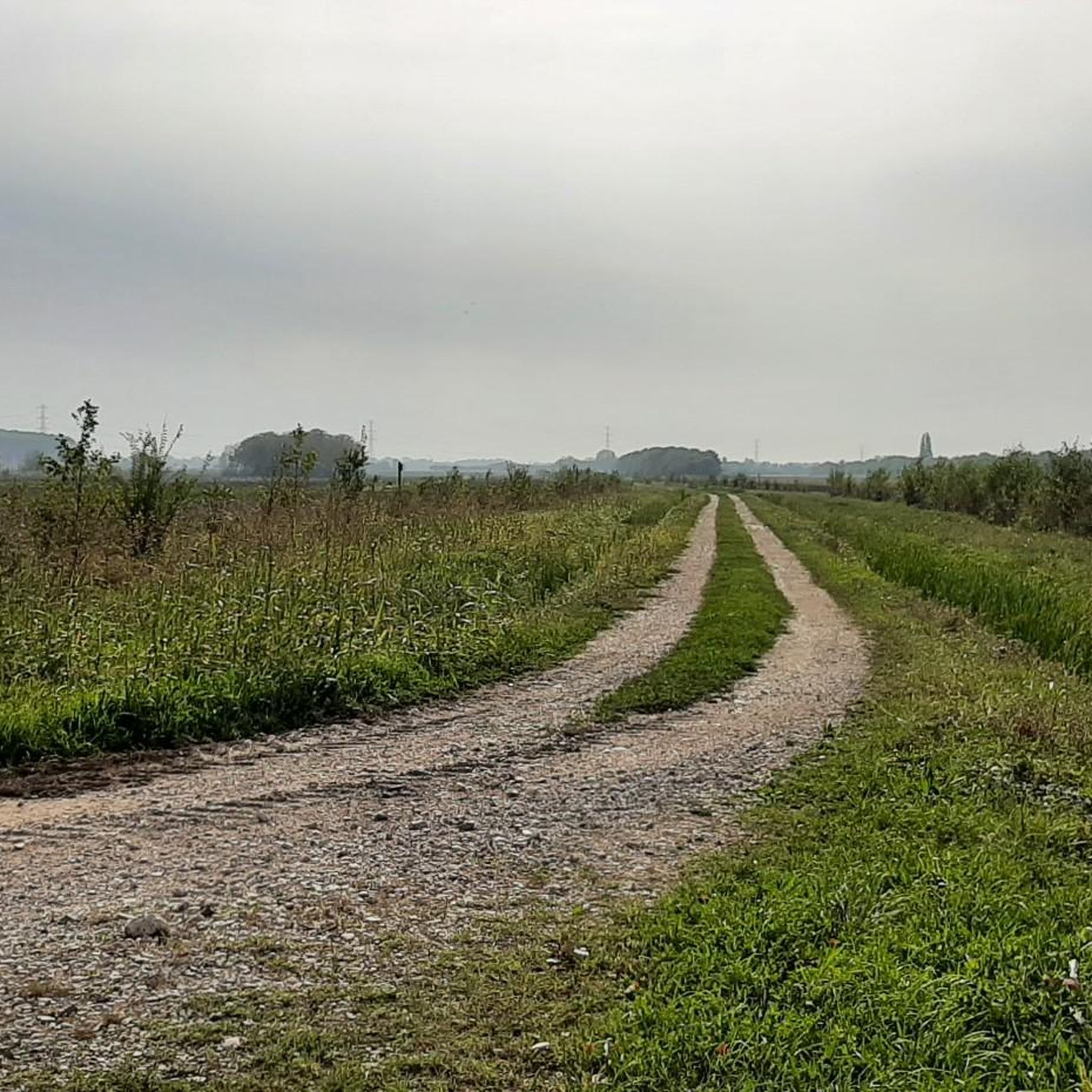
Many embankments and roads with little traffic
0
0

One of the major projects completed during the Fascist era is the Sottomarina Dam, which, together with the Ca' Roman Dam built a few years earlier, completes the mouth of the Port of Chioggia. Construction began in the years following the First World War. Like the Murazzi (sea walls), the dam was constructed of brick and boulders of local Istrian stone and, in addition to finally completing the entrance to the Port of Chioggia, also allowed for a further expansion of the beach. The inauguration, as mentioned, took place in the midst of the Fascist regime on April 28, 1935, in the presence of the Duke of Aosta. The dam was immediately embraced by the local population, especially the residents of Sottomarina, a popular destination for their walks, so much so that many refer to it as "Sailors' Square." Text / Source: Lidi di Chioggia https://www.lididichioggia.it/la-diga-murazzi/
15
0
The Dam and the Walls, Sottomarina The Dam and the Walls The Walls are Istrian stone walls built by the Republic of Venice starting in the late 18th century to protect the inhabited centers of the lagoon from marine erosion. They are divided into three sections: one on the island of Lido, a second on the island of Pellestrina as far as Cà Roman, and a third along the coast of Sottomarina, running from Forte San Felice to the center of Sottomarina at a height of approximately 1200 meters. The famous War of Chioggia led to the complete destruction of Sottomarina, which became an uninhabited area, exposed to the sea without any protection and subject to frequent flooding. Reconstruction, which included the construction of the Walls, did not begin until 1600. The Walls along Via San Felice were more than 5 kilometers long and over 300 meters wide. They were built from square stones, primarily Istrian stone, erected on stilts extending to the Pellestrina coast and, of course, the Sottomarina coast. Initially, given the scale of the project and the lack of adequate equipment, construction seemed impossible, so it took thirty-eight years to complete in 1770. Legend has it that the inscription "Ausu romano, aere veneto" (With Roman boldness, with Venetian money) was already in place. The inscription is still visible when passing by on the Chioggia-Pellestrina vaporetto. The Murazzi ceased to function between the late 19th and early 20th centuries when the receding sea revealed an unexpected beach, thus forming a symbolic dividing line between "old" and "new" Sottomarina. Today, the Murazzi di Sottomarina are located about one kilometer from the sea: this has allowed for a large-scale revival of coastal tourism. The Murazzo now connects the entire Venetian coast, especially the outer islands, like a cordon, leaving only the three bays open, thus preserving the lagoon's waters. Text / Source: Lidi di Chioggia https://www.lididichioggia.it/la-diga-murazzi/
15
0

Getting to the Casone Rosso on Via Fiumicello is easy, as it's just a short walk from the center of Piove di Sacco. More specifically, the Casone Rosso is located in Corte, one of the hamlets of Piove di Sacco. It was built in 1800 and was inhabited by one family until the early 1990s. Since 1993, it has been open to visitors only, following a careful renovation following a fire in 1993. The reconstruction was carried out meticulously, taking into account the original features of the structure, respecting the distinctive features of the original typology and the materials used. This modestly sized dwelling has a characteristic thatched roof and, after the last restoration in 1998, its exterior plaster was made with red clay, although the original structure was pink; this is precisely why it's called the Casone Rosso. Before the renovation, the Casone had only four original rooms; As was common at the time, there was a kitchen, a storage room, and two bedrooms. In 1975, the decision was made to expand the Casone, adding additional rooms. To keep the rooms warm in the winter and cool in the summer, the windows were small. Surrounding the Casone is a very characteristic and original garden, featuring benches and other tools typical of rural and peasant life of the past. https://saccisica.it/item/casone-rosa-di-via-fiumicello-attuale-casone-rosso/
1
0

Second Casone of the ring.
1
0
Boschettona Beach is the only beach in the Province of Padua and remains a destination for sports and nature enthusiasts thanks to its unique characteristics. Kitesurfers will appreciate the strong and constant wind throughout the year. Cyclists, and especially mountain bikers, will appreciate the surrounding areas, the well-trodden roads that transform into challenging dirt tracks in the winter. Nature lovers will admire the lagoon landscape, the characteristic "stravedamento" on dry, sunny days, and the absolutely unique flora and fauna. https://saccisica.it/item/spiaggia-della-boschettona/
1
0
Frequently Asked Questions
What kind of terrain can I expect on mountain bike trails around Brugine?
The mountain bike trails around Brugine offer a mix of terrain. The immediate area features flatter routes suitable for general outdoor recreation. However, a short distance away, the Euganean Hills provide a more dynamic landscape with varied terrain due to their volcanic origin, including challenging ascents and thrilling descents, as well as extensive networks of forest roads.
Are there mountain bike trails suitable for beginners or less experienced riders?
Yes, the region offers options for various skill levels. While the Euganean Hills have more demanding sections, there are also many easy, accessible paths. Around Brugine itself, you'll find flatter routes that are ideal for beginners or those looking for a more relaxed ride. Overall, there are 57 easy routes available in the wider area.
Where can I find more challenging mountain bike trails near Brugine?
For more challenging mountain biking, head towards the Euganean Hills. This area is known for its volcanic terrain, offering demanding downhill sections and technical segments. Towns like Galzignano Terme within the Euganean Hills are recognized for their specialized bike parks with trails ranging from straightforward to technically challenging descents through wooded areas and vineyards. There are 10 difficult routes in the broader region.
Are there any circular mountain bike routes available?
Yes, many routes in the area are circular. For example, you can explore the Casoni della Fogolana – Cason delle Sacche loop from Arzergrande, a moderate 51.9 km trail. Another option is the challenging Vineyard Road to Monte Fasolo – Mottolone Plateau loop from Pontelongo, which covers 75.5 km and offers significant elevation changes.
What are some scenic viewpoints or natural features I can see while mountain biking?
The Euganean Hills offer stunning natural scenery, including lush forests, sprawling vineyards, and breathtaking panoramic viewpoints. Monte Venda, the highest peak, provides particularly remarkable views. Many routes also weave through areas of biodiversity, preserving Mediterranean scrub and rare plant species. In Brugine itself, the hamlet of Pontemanco offers picturesque natural views along the Biancolino Canal.
What historical or cultural landmarks can I encounter on mountain bike routes?
Many mountain biking routes in the Euganean Hills integrate with rich historical and cultural sites. You can encounter landmarks such as the Camaldolese Monastery on Monte Rua and the historic Villa Giovannelli Colonna. Charming medieval villages like Arquà Petrarca and Monselice also add to the region's appeal. Closer to Brugine, you might pass the Pontemanco Water Mill or the Corte Benedettina di Correzzola.
What do other mountain bikers say about the trails around Brugine?
The mountain bike trails around Brugine are highly rated by the komoot community, with an average score of 4.2 stars from over 300 reviews. More than 1800 mountain bikers have used komoot to explore the varied terrain, often praising the diverse options from flat plains to the dynamic Euganean Hills.
Is there parking available near the mountain bike trails?
While specific parking information for every trailhead isn't provided, the region is well-equipped for outdoor activities. Towns within the Euganean Hills, such as Galzignano Terme, often have amenities like bike washes, suggesting dedicated facilities for cyclists, which typically include parking. For routes starting in or near towns like Arzergrande or Piove di Sacco, you can usually find public parking options.
What is the best time of year for mountain biking in the Brugine area?
The Euganean Hills and surrounding areas are enjoyable for mountain biking across multiple seasons. Spring and autumn generally offer pleasant temperatures and vibrant scenery, making them ideal. Summer can be warm, but shaded forest trails provide relief. Winter riding is also possible, though conditions may vary, especially in the higher elevations of the Euganean Hills.
Are there any family-friendly mountain bike trails?
Yes, the flatter routes in the immediate area around Brugine are well-suited for families and casual riders. These paths offer a gentle introduction to cycling in a pleasant outdoor setting. Within the Euganean Hills, there are also easy, accessible paths designed to accommodate diverse abilities, including those suitable for families.
How many mountain bike trails are there in total around Brugine?
There are over 130 mountain bike trails available in the wider Brugine area, offering a wide range of options for different skill levels and preferences.
Most popular attractions around Brugine

Get inspired with the komoot mobile app


Explore more
Browse the best MTB trails in other regions.
