The best running trails around Sant'Olcese
4.3
(480)
14,222
runners
326
runs
Jogging around Sant'Olcese offers diverse landscapes, situated between the Ligurian Sea and the Apennine mountains. The region features a hilly environment with varied running routes, including natural paths, gravel, and asphalt sections. Many running trails in Sant'Olcese provide significant elevation changes and lead to panoramic views over Valpolcevera and Genoa. Green spaces like Parco delle Mura also offer renovated paths suitable for running.
Best jogging routes around Sant'Olcese
- The most popular jogging route is View of Forte Fratello Minore –…
Last updated: July 28, 2026
4.6
(17)
347
runners
10.2km
01:09
270m
270m
Moderate run. Good fitness required. Mostly paved surfaces. Suitable for all skill levels.
4.2
(10)
180
runners
11.9km
01:45
580m
580m
Hard run. Very good fitness required. Sure-footedness, sturdy shoes and alpine experience required.

Sign up for free
29
runners
Moderate run. Good fitness required. Mostly accessible paths. Some sure footedness required.
38
runners
12.9km
01:26
240m
240m
Moderate run. Good fitness required. Mostly paved surfaces. Suitable for all skill levels.
43
runners
4.82km
00:34
120m
120m
Moderate run. Good fitness required. Mostly paved surfaces. Suitable for all skill levels.
Get access to more routes and recommendations from other explorers.
Sign up for free
Already have an account?
Our route recommendations are based on thousands of hikes, rides, and runs completed by other people on komoot.
Start today with a free account
Your next adventure awaits.
Login or Signup
Tips from the Community


May 14, 2025 Crossed today. Unfortunately, the bridge is very dirty and was closed at the end. However, you can get off via a ladder that leads to the road.
1
1


Stunning panorama and departure for the DH descent towards the start of the military road to the Diamond
0
0

I recommend a sufficient supply of water in the summer period
1
0

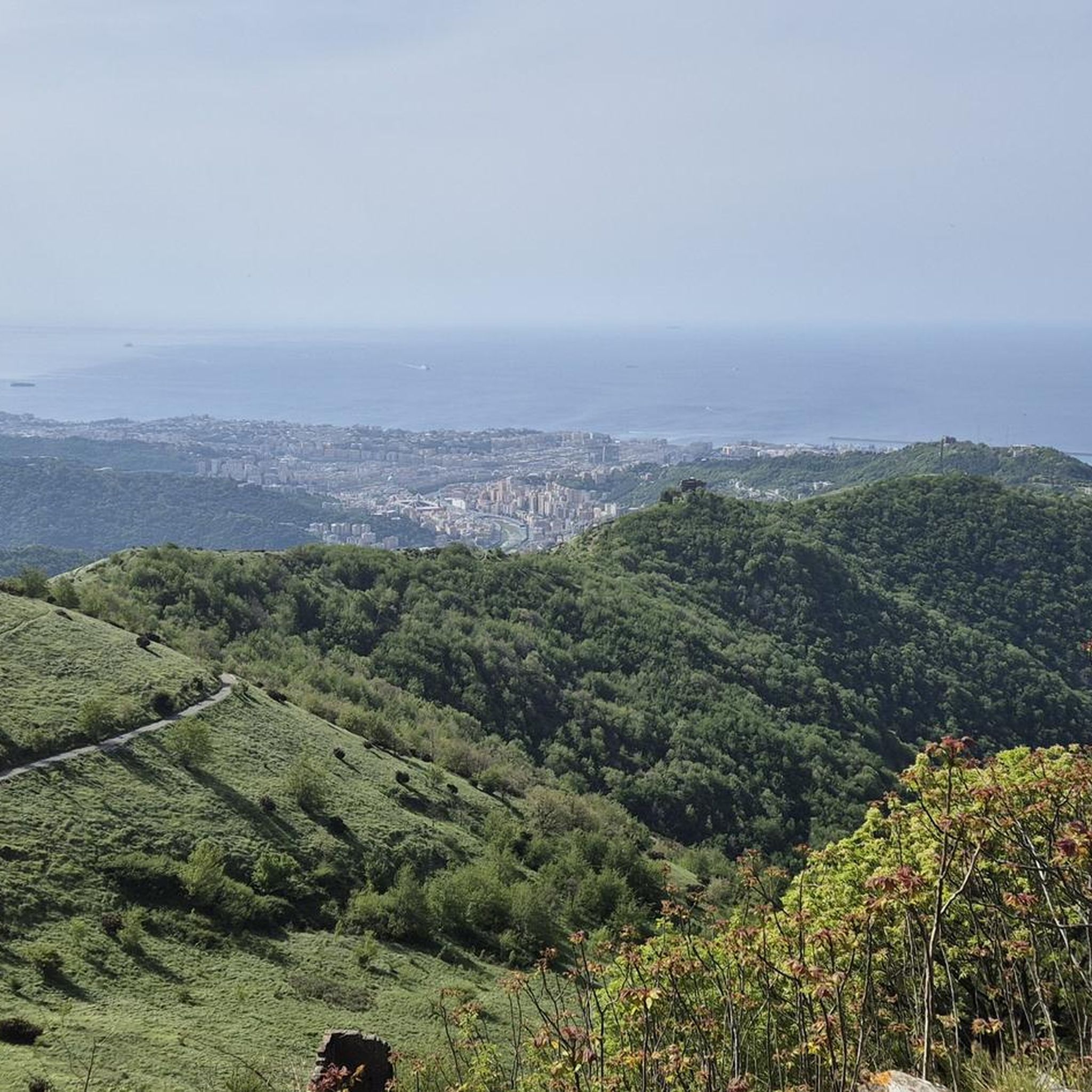
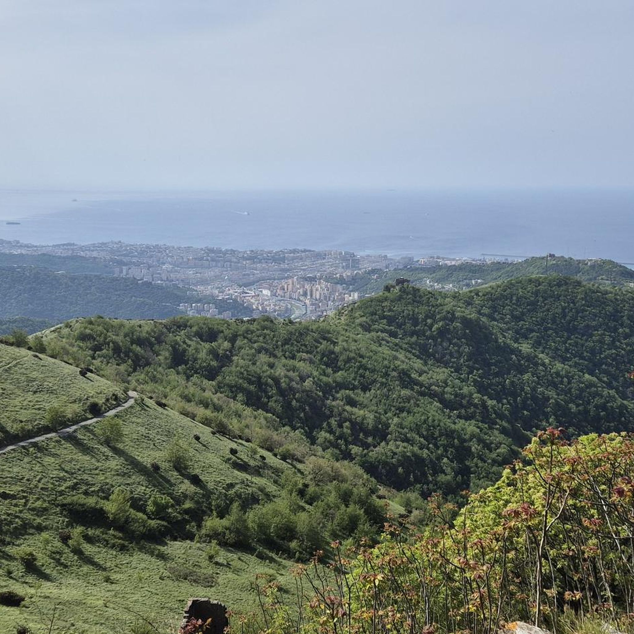
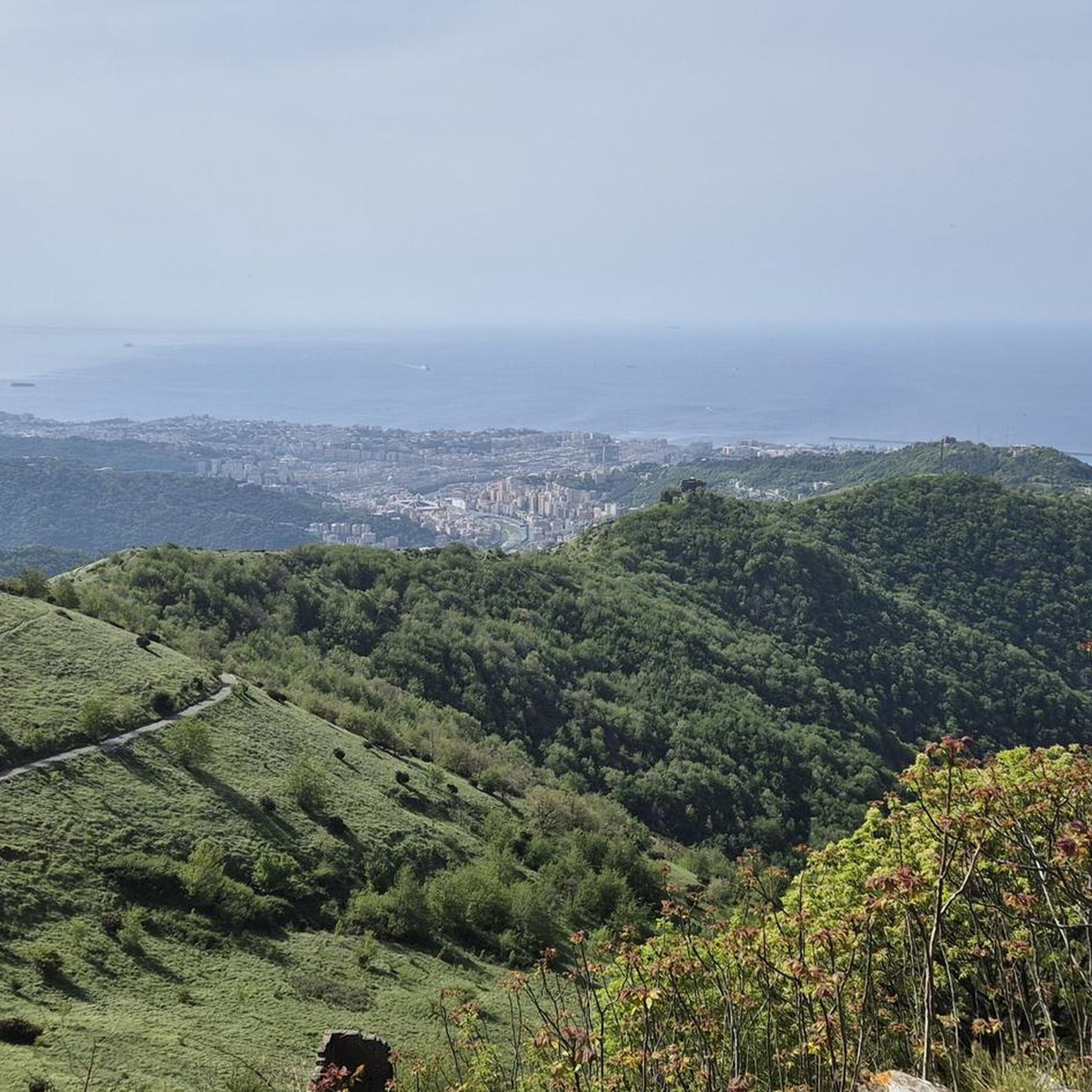
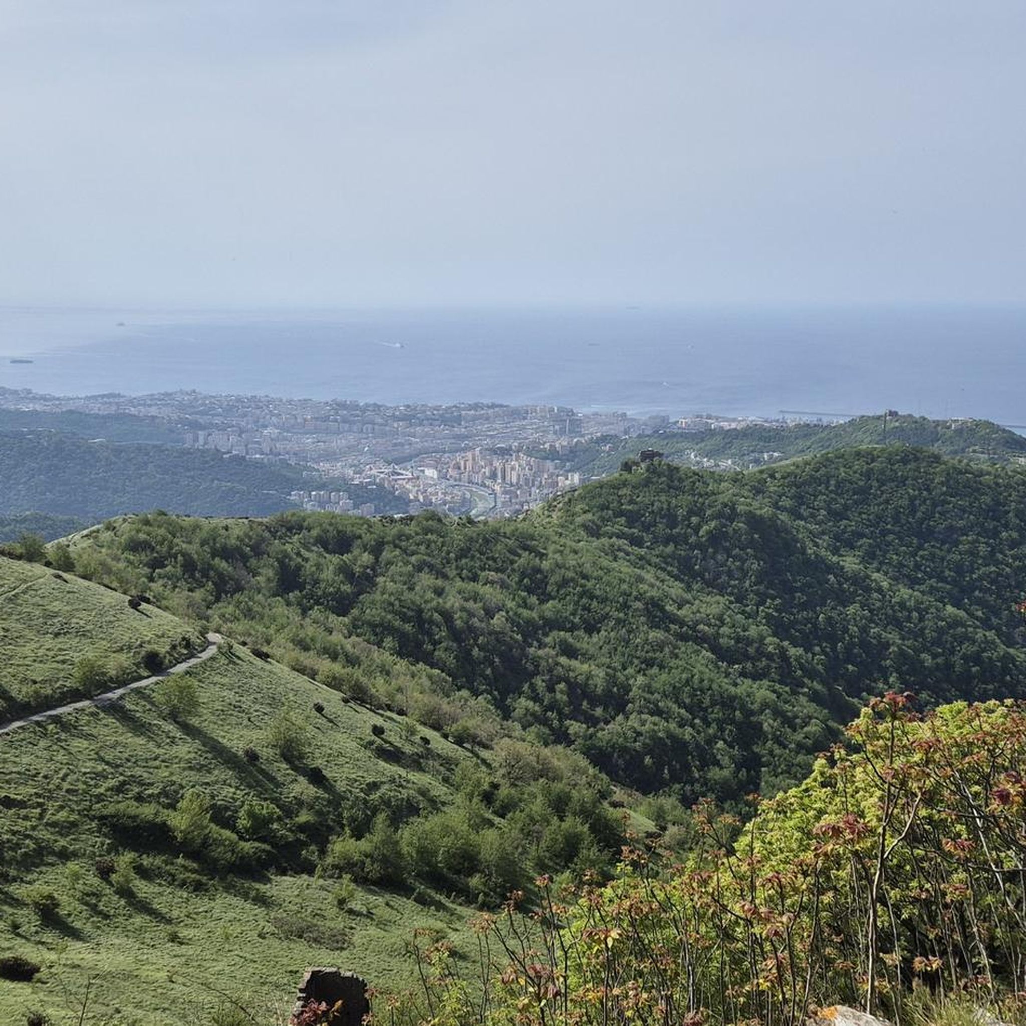
Forte Fratello Minore is part of the fortification system of Genoa, and is currently in a state of total abandonment and degradation. It is only possible to visit it from the outside as the entrance is unusable. The Municipality of Genoa has arranged some redevelopment interventions within the natural area of the Parco delle Mura: the paths of the Righi - Fratello Minore relationship have already been almost completely renovated and can be walked on comfortably. The fort can therefore be reached starting from the terminus of the Zecca-Righi funicular proceeding north, or via the path that starts from Begato (terminus of line 272), from which you can enjoy a magnificent panorama of Valpolcevera. It is located a few minutes walk from Fort Puin and Fort Diamante.
0
0

Panoramic view of Genoa and its Gulf
0
0
Frequently Asked Questions
How many running routes are available in Sant'Olcese?
Sant'Olcese offers a wide selection of running routes, with over 260 different trails to explore. These routes cater to various fitness levels, including easy, moderate, and difficult options.
What kind of terrain can I expect on the running trails around Sant'Olcese?
The running trails in Sant'Olcese feature diverse terrain, ranging from natural paths and gravel sections to asphalt. The region is characterized by its hilly and mountainous environment, providing challenging ascents and descents. Many routes offer a mix of these surfaces, ensuring a varied running experience.
Are there any easy or beginner-friendly running routes in Sant'Olcese?
Yes, Sant'Olcese has options for all levels. While many routes involve significant elevation changes, there are 17 easy running routes available, perfect for beginners or those looking for a less strenuous jog. These routes often feature renovated paths in green spaces like Parco delle Mura.
Can I find running routes with panoramic views in Sant'Olcese?
Absolutely. Many running routes in Sant'Olcese lead to stunning panoramic views. From higher elevations like Righi, you can enjoy vistas of Valpolcevera, Genoa, and even glimpse Corsica on clear days. The best visibility is often in the morning light. A great example is the View of Genoa – Fort Puin loop from Diamante.
Are there any historical landmarks or forts I can see while running?
Yes, Sant'Olcese is rich in history, with several ancient forts integrated into popular running routes. You can encounter landmarks such as Forte Diamante, known for its stunning views, and Forte Fratello Minore. The View of Forte Fratello Minore – Forte Diamante loop from Trensasco is a popular route connecting these historic sites.
Are the running trails in Sant'Olcese suitable for families?
While many routes are challenging, some paths, particularly those in green spaces like Parco delle Mura, are renovated and comfortable for walking and jogging, making them potentially suitable for families. For specific family-friendly options, it's best to look for routes categorized as 'easy' or those with minimal elevation gain.
Are there dog-friendly running routes in the Sant'Olcese area?
Many natural trails in the Sant'Olcese region are generally dog-friendly, allowing you to enjoy a run with your canine companion. However, it's always advisable to check local regulations and ensure your dog is well-behaved and on a leash, especially in more populated areas or nature reserves.
Are there circular running routes available in Sant'Olcese?
Yes, many running routes in Sant'Olcese are designed as loops, offering a convenient way to start and end your run at the same point. Examples include the View of Forte Fratello Minore – Forte Diamante loop from Trensasco and the Monticello Tower – Trensasco loop from Cappuccio.
How accessible are the trailheads in Sant'Olcese by public transport or car?
Some starting points for running routes in Sant'Olcese are accessible by public transport, making it convenient for visitors. Additionally, many trailheads offer parking facilities for those arriving by car. It's recommended to check specific route details for precise information on public transport connections and parking availability.
What is the best time of year to go running in Sant'Olcese?
Sant'Olcese offers good running conditions for much of the year. Spring and autumn generally provide pleasant temperatures and beautiful scenery. While summer can be warm, early mornings or late afternoons are ideal. Winter running is also possible, though some higher elevation trails might require more suitable gear.
What do other runners say about the trails in Sant'Olcese?
The running routes in Sant'Olcese are highly regarded by the komoot community, boasting an average rating of 4.3 stars from over 370 reviews. Runners frequently praise the diverse landscapes, the challenging hilly terrain, and the breathtaking panoramic views of Valpolcevera and Genoa.
Are there any longer, more challenging running routes for experienced runners?
Absolutely. Sant'Olcese's hilly environment provides excellent opportunities for experienced runners seeking a demanding workout. Many routes feature significant elevation changes and technical terrain. For instance, the Monticello Tower – Trensasco loop from Cappuccio is a difficult 16.2 km trail with substantial elevation gain, often completed in under two hours.
Most popular routes around Sant'Olcese
Most popular attractions around Sant'Olcese

Get inspired with the komoot mobile app


Explore more
Browse the best Running Trails & Routes in other regions.
