The best walks and hikes around Agghju/Aggius
4.4
(1400)
6,215
hikers
170
hikes
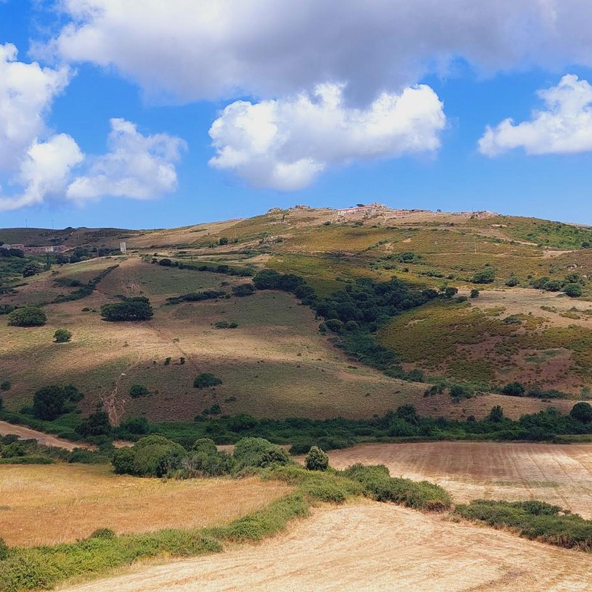
Hiking around Agghju/Aggius offers access to a landscape characterized by distinctive granite formations and Mediterranean flora. The region features unique geological environments, including the surreal Valle della Luna with its large, rounded granite boulders, and Monte Pulchiana, Sardinia's largest granite monolith. Trails often wind through cork oak forests and Mediterranean scrub, providing varied terrain for outdoor activities. Lake Santa Degna also provides a tranquil setting for walks.
Best hiking trails around Agghju/Aggius
- The most popular hiking route is Lake Santa Degna loop from Agghju/Aggius, a 3.6 miles (5.8 km) trail that takes 1 hour 53 minutes to complete. This easy route explores the peaceful surroundings of Lake Santa Degna.
- Another top favourite among local hikers is Lake Santa Degna loop from Agghju/Aggius, an easy 2.7 miles (4.4 km) path. This trail offers views of the granite landscape and Mediterranean flora around the lake.
- Local hikers also love the Rest Spot Under the Tree – Rock Formation loop from Agghju/Aggius, a 0.5 miles (0.8 km) trail leading through granite rock formations, often completed in about 22 minutes.
- Hiking around Agghju/Aggius is defined by granite formations, Mediterranean scrub, and the unique Valle della Luna. The network offers options for different ability levels, from easy walks to more challenging routes.
- The routes in Agghju/Aggius are highly rated by the komoot community with an average score of 4.3 stars from over 1300 reviews. More than 6000 hikers have used komoot to explore Agghju/Aggius's varied terrain.
Last updated: August 4, 2026
2.1
(9)
19
hikers
5.84km
01:53
250m
250m
Easy hike. Great for any fitness level. Easily-accessible paths. Suitable for all skill levels.
3.8
(4)
20
hikers
Easy hike. Great for any fitness level. Easily-accessible paths. Suitable for all skill levels.

Sign up for free
3.0
(3)
12
hikers
4.57km
01:21
130m
130m
Easy hike. Great for any fitness level. Easily-accessible paths. Suitable for all skill levels.
4
hikers
10.4km
02:48
140m
140m
Moderate hike. Good fitness required. Easily-accessible paths. Suitable for all skill levels.
3
hikers
Easy hike. Great for any fitness level. Easily-accessible paths. Suitable for all skill levels.
Get access to more routes and recommendations from other explorers.
Sign up for free
Already have an account?
Our route recommendations are based on thousands of hikes, rides, and runs completed by other people on komoot.
Start today with a free account
Your next adventure awaits.
Login or Signup
Other adventures around Agghju/Aggius

Tips from the Community

The building has a rectangular floor plan, with 3 levels and a total area of approx. 540 sq m. The main facade is symmetrical and has a length of approx. 39.50 m and a height of approx. 14.70 m. The tripartite division of the main facade, with the central part slightly protruding, is marked by visible granite ashlar quoins. This material is used for the composition of the plinth, the string courses and the cornice, which again divide the facade horizontally. A large central balcony and a wavy pediment, with a clock, also in the center, mark the main entrance and the centrality of the building in the square. The balcony and the simple and small tympanums (linear or triangular), which continue next to the jambs of the openings and which form the finishes of doors and windows, are also made of granite; the only exception is the complete frame that defines the main portal. (c) https://catalogo.beniculturali.it/detail/SARDEGNA/ArchitecturalOrLandscapeHeritage/2000234656
0
0
Alfredo Graziani was born in Tempio on January 2, 1892. At the front from the very first days of the Great War, he fought with the infantry of the 151st Regiment Brigata Sassari, commander of the 12th company, but paradoxically continuing to wear his cavalry uniform, he is the famous lieutenant "Grisoni" told in the book by Emilio Lussu "A Year on the Altipiano". Appreciated and esteemed throughout the Brigade for having attacked by surprise and conquered "the tangle's tooth", a solid advanced trench on the Carso (also called "Trincea Zeta"), defended by a battalion of Hungarians. For this action, he was awarded the bronze medal and silver medal for military valor to the survivors. In this action, 30 men went on the attack and 12 returned. Equipped with a camera, he documented the life of the Brigade even in tragic moments. After the First World War, he returned to civilian life and continued his profession as a lawyer, which, however, he interrupted in 1935 to return as a volunteer to East Africa and shortly after to Spain. He also enlisted as a volunteer in the Second World War, fighting in Greece. He wrote the book: "Sardinian Infantry in the Shadow of the Tricolour". He died in Tempio in 1950. (c) https://rete.comuni-italiani.it/wiki/Tempio_Pausania/Parco_della_Rimembranza_con_Monumento_alla_Brigata_Sassari_e_al_Tenente_Alfredo_Graziani
0
0
The San Lorenzo Park is characterized by a small church in the middle of the woods. The walk is suggestive and worth doing to reach the summit. The little church is often closed, and sometimes used for weddings, precisely because of its unique and exclusive location in the harmony of Nature. On August 10th, it is celebrated with a mass and a free outdoor lunch.
0
0
Beautiful panorama over Aggius, Monte de la Cruzi and Monte Fraili from Tempio Pausania.
0
0
Dedicated to the memory of Alessio Pirino, a young boy from Aggius who became an angel, too soon. He now guards this beautiful park, perfectly maintained and adjacent to a drinking water source. Equipped, well-kept, and clean. Open in the evening too.
0
0

Is worth more than Tempio. Very beautiful old mountain village
0
0

In almost every village, hikers and walkers encounter such a monument. For many generations, it was mostly referred to as a "war memorial," but in more recent German-speaking regions, the term "memorial to the fallen" has become somewhat more common, in order to emphasize less the heroic aspect of the war (this was a particularly strong focus during the so-called "interwar period," when many of these monuments were erected). In recent decades, however, attention has increasingly been drawn to the misery and suffering of the soldiers who fell in the war, whose names are inscribed here. For they ultimately paid for their service to their country with their lives.
0
0

Granite town in the mountains. Beautiful.
0
0
Frequently Asked Questions
How many hiking trails are available around Agghju/Aggius?
There are over 150 hiking trails around Agghju/Aggius, offering a wide range of options for different fitness levels and preferences.
What kind of terrain can I expect on hikes in Agghju/Aggius?
The region is characterized by its unique granite formations, Mediterranean scrub, and cork oak forests. You'll encounter trails winding through surreal landscapes like the Valle della Luna with its large, rounded boulders, and areas dominated by Monte Pulchiana, Sardinia's largest granite monolith. Expect varied paths, from gentle strolls around lakes to more rugged routes through rocky terrain.
Are there any easy hiking trails suitable for beginners or families?
Yes, Agghju/Aggius offers many easy trails. For instance, the Lake Santa Degna loop from Agghju/Aggius is an easy 3.6-mile (5.8 km) path that explores the peaceful surroundings of the lake. Another easy option is the Lake Santa Degna loop from Agghju/Aggius, which is 2.7 miles (4.4 km) and offers views of the granite landscape.
What are some notable natural features or landmarks to see while hiking?
The region is rich in natural wonders. You can explore the fascinating Valle della Luna (Valley of the Moon), known for its surreal granite boulders, or marvel at Monte Pulchiana, Sardinia's largest granite monolith. The area also features numerous unique rock disaggregation formations like tafoni and tors. For a tranquil spot, visit Lake Santa Degna, an oasis for relaxation.
Are there any circular hiking routes in Agghju/Aggius?
Yes, many trails in Agghju/Aggius are designed as circular routes. Popular options include the Lake Santa Degna loop from Agghju/Aggius and the Rest Spot Under the Tree – Rock Formation loop from Agghju/Aggius, which takes you through distinctive granite rock formations.
What is the best time of year to go hiking in Agghju/Aggius?
The Mediterranean climate makes spring and autumn ideal for hiking, with pleasant temperatures and blooming flora. Summer can be hot, but early mornings or late afternoons are still suitable, especially on trails with shade from cork oak forests. Winter offers cooler, crisp air, though some paths might be damp after rain.
Are there any dog-friendly hiking trails in the area?
Many trails in Agghju/Aggius are suitable for dogs, especially those winding through the Mediterranean scrub and cork oak forests. It's always advisable to keep dogs on a leash, especially near wildlife or livestock, and to carry enough water for both yourself and your pet.
What do other hikers enjoy most about hiking in Agghju/Aggius?
The area is highly rated by the komoot community, with an average score of 4.3 stars from over 1300 reviews. Hikers often praise the unique granite landscapes, the tranquility of places like Lake Santa Degna, and the variety of trails that cater to different abilities, from easy walks to more challenging routes.
Are there any archaeological sites or historical points of interest along the trails?
Yes, the region has a rich history. Within the Valle della Luna, you can find the Nuraghe Izzana, one of Sardinia's most imposing Nuragic structures. The area around Monte Pulchiana also contains numerous Nuragic archaeological sites and prehistoric tombs within tafoni, offering a glimpse into ancient Sardinian culture.
What attractions are nearby that I can visit after a hike?
Beyond the trails, you can explore nearby attractions such as the historic town of Tempio Pausania (Sardinia). For coastal beauty, consider visiting Cala Li Cossi Beach or the striking Red Rock Formations at Capo Canneddi.
Are there trails with good viewpoints for panoramic scenery?
Absolutely. The region's granite formations often provide excellent vantage points. The summit of Monte Pulchiana, for example, offers spectacular views from its 673-meter height. The panoramic road to Trinità d'Agultu and Vignola also provides excellent views of the Valle della Luna.
What is the difficulty range of hikes in Agghju/Aggius?
Hiking routes in Agghju/Aggius range from easy to difficult. There are 79 easy trails perfect for a relaxed stroll, 57 moderate routes for those seeking a bit more challenge, and 18 difficult trails for experienced hikers looking for a strenuous adventure.
Most popular routes around Agghju/Aggius
Most popular attractions around Agghju/Aggius

Get inspired with the komoot mobile app


Explore more
Browse the best Hikes in other regions.
