The best cycling routes around Tzaramonte/Chiaramonti
5.0
(11)
86
riders
20
rides
Touring cycling around Tzaramonte/Chiaramonti features a landscape characterized by rolling hills and varied terrain, with routes often including significant elevation gains. The region offers a mix of rural roads, views over valleys, and proximity to water features like river deltas and lakes. These routes are generally long-distance, catering to cyclists seeking challenging rides through diverse environments.
Best touring cycling routes around Tzaramonti/Chiaramonti
- The most popular touring cycling route is Church of the Rosary of Osilo – View over the Anglona loop from Òsile/Osilo, a 17.5 miles (28.1 km) trail that takes 1 hour 59 minutes to complete. This route offers panoramic views over the Anglona region.
- Another top favourite among local touring cyclists is Bulzi – Abandoned Railway Station loop from Perfugas - Erula, a difficult 34.7 miles (55.9 km) path. This route winds through rural landscapes, passing an abandoned railway station.
- Local touring cyclists also love the Coghinas River Delta – View of Lake Casteldoria loop from Pèifugas/Perfugas, a 28.1 miles (45.3 km) trail leading through the Coghinas River Delta and offering views of Lake Casteldoria, often completed in about 3 hours 8 minutes.
- Touring cycling around Tzaramonte/Chiaramonti is defined by hilly terrain, rural roads, and scenic views over valleys and water bodies. The network offers options primarily for advanced cyclists, with several challenging routes available.
- The routes in Tzaramonte/Chiaramonti are highly rated by the komoot community with an average score of 4.9 stars from over 10 reviews. More than 100 touring cyclists have used komoot to explore Tzaramonte/Chiaramonti's varied terrain.
Last updated: May 11, 2026
4.9
(9)
31
riders
Hard bike ride. Very good fitness required. Mostly paved surfaces. Suitable for all skill levels.
5.0
(1)
18
riders
42.8km
02:57
700m
700m
Hard bike ride. Very good fitness required. Mostly paved surfaces. Suitable for all skill levels.

Sign up for free
10
riders
58.1km
04:01
920m
920m
Hard bike ride. Very good fitness required. Mostly paved surfaces. Suitable for all skill levels.
4
riders
Hard bike ride. Very good fitness required. Mostly paved surfaces. Suitable for all skill levels.
4
riders
53.9km
03:41
950m
960m
Hard bike ride. Very good fitness required. Mostly paved surfaces. Suitable for all skill levels.
Get access to more routes and recommendations from other explorers.
Sign up for free
Already have an account?
Our route recommendations are based on thousands of hikes, rides, and runs completed by other people on komoot.
Start today with a free account
Your next adventure awaits.
Login or Signup
Popular around Tzaramonte/Chiaramonti
Tips from the Community

In the Middle Ages it was part of the Giudicato of Torres, in the Curatorship of Anglona, and from the thirteenth century it was ruled by the Benedictine monks of Montecassino. At the fall of the Giudicato (1259) it passed to the Doria, the Malaspina and later (mid-14th century) to the Aragonese. The Doria built two important castles near Bulzi and Perfugas. In the eighteenth century the town was incorporated into the Principality of Anglona, first under the rule of the Pimentel and then of the Tellez-Giron, to whom it was bought back in 1839 with the abolition of the feudal system.
1
0
The surface area of the lake is 400,000 km² with an average depth of 20 metres. The water quality is not the best because the lake is located between fields and pastures and therefore receives high concentrations of nutrients (phosphorus and nitrogen) from agriculture. At the mouth of the Monte Ruiu gorge towards the sea are the thermal baths of Casteldoria, from whose springs water gushes that reaches a temperature of 70°C, whose properties were already known to the Romans who passed through Anglona.
1
0
Lake Casteldoria is an artificial reservoir with a capacity of about 8 million m³ of water for almost exclusive hydroelectric use, created by artificially damming the Coghinas river with the construction of a dam in 1956. It is located at the foot of Mount Ruiu. The lake is not only fed by the river, but is also hydraulically connected to the larger and more famous Lake Coghinas.
1
0
Although there is no environmental education center on site that offers birdwatching guides, you can do this activity on your own and in complete freedom. In fact, you can observe some animal species, especially birds that stop, hibernate and nest. You can identify moorhens (Gallinula chloropus), kingfishers (Alcedo atthis), grey herons (Ardea cinerea) and ducks such as mallards (Anas platyrhynchos) and coots (Fulica atra). The kestrel (Falco tinnunculus) and the marsh harrier (Circus aeruginosus) are also present. Tree frogs (Hyla sarda), the grass snake (Natrix natrix) and the grass snake (Hierophis viridiflavus) live in and near the waters. Some local sports clubs also offer kayak and canoe trips on this lake.
1
0

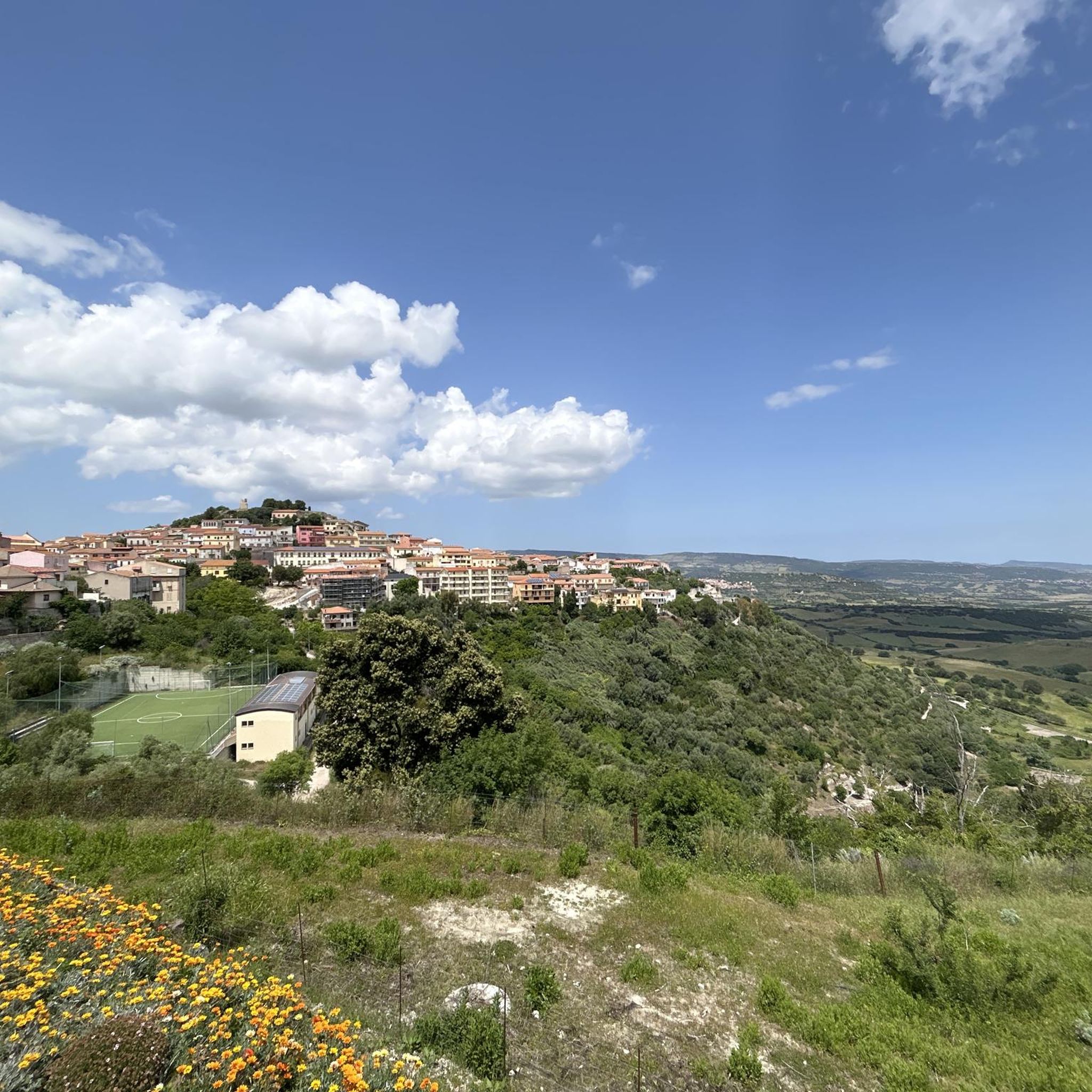
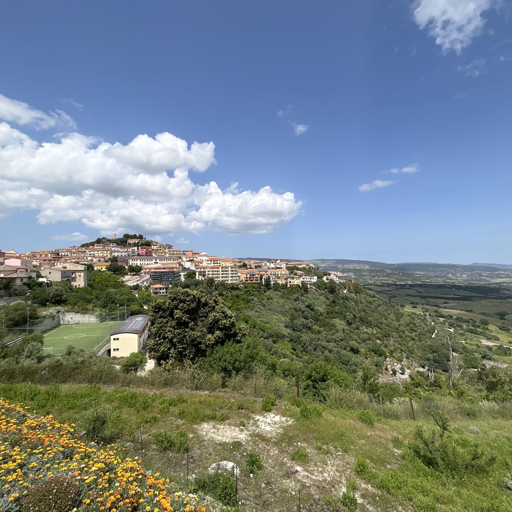
The Doria Castle in Chiaramonti is located at the top of the hill overlooking the town and dominates the Anglona territory. Reachable from the narrow streets of the historic center of the town, the remains of the castle built in the 14th century by the Genoese Doria family are visible.
0
0
Frequently Asked Questions
How many touring cycling routes are available around Tzaramonte/Chiaramonti?
There are over 20 touring cycling routes available in the Tzaramonte/Chiaramonti region. These routes are generally long-distance and cater to cyclists seeking challenging rides through diverse environments.
What is the typical difficulty level for touring cycling routes in Tzaramonte/Chiaramonti?
The majority of touring cycling routes in Tzaramonte/Chiaramonti are classified as difficult, with 17 out of 20 routes falling into this category. There are also 3 moderate routes, but no easy options, indicating a landscape best suited for experienced cyclists.
Are there any circular touring cycling routes in the area?
Yes, many of the touring cycling routes in Tzaramonte/Chiaramonti are designed as loops. For example, the Church of the Rosary of Osilo – View over the Anglona loop from Òsile/Osilo and the Coghinas River Delta – View of Lake Casteldoria loop from Pèifugas/Perfugas are popular circular options.
What kind of terrain can I expect on touring bike trails in Tzaramonte/Chiaramonti?
You can expect a landscape characterized by rolling hills and varied terrain, often including significant elevation gains. Routes frequently feature rural roads and offer scenic views over valleys and water bodies like river deltas and lakes.
What are some scenic viewpoints or natural attractions I can see along the routes?
The region offers numerous scenic views, including panoramic vistas over the Anglona region, views of Lake Casteldoria, and the Coghinas River Delta. You might also encounter natural monuments such as the Cascata Pilchina di li Caaddaggi or the Cascata di Triulintas, both waterfalls, or the Petrified Forest of Martis.
Are there any historical or cultural sites to explore near the touring routes?
Yes, the area is rich in historical and cultural sites. You can visit the Fairies’ Houses, ancient burial sites, or the Grotta di San Michele (Ethnographic Museum). The Necropolis of Ittiàri also offers a glimpse into the region's past.
What is the best time of year for touring cycling in Tzaramonte/Chiaramonti?
Given the Mediterranean climate of Sardinia, spring (April-May) and autumn (September-October) are generally the most pleasant times for touring cycling. Temperatures are milder, and the landscape is vibrant, avoiding the intense heat of summer.
What do other touring cyclists enjoy most about cycling in Tzaramonte/Chiaramonti?
The touring cycling routes in Tzaramonte/Chiaramonti are highly rated by the komoot community, with an average score of 4.9 stars. Cyclists often praise the challenging terrain, the diverse rural landscapes, and the stunning views over valleys and water features.
Are there any routes that pass by unique landmarks?
Yes, the Bulzi – Abandoned Railway Station loop from Perfugas - Erula is a notable route that winds through rural landscapes and passes by an abandoned railway station, offering a unique point of interest along the way.
What should I consider regarding parking for touring bike trails in Chiaramonti?
While specific parking areas for each trail are not always designated, you can typically find parking in the towns and villages near the starting points of the routes, such as Osilo or Perfugas. Always check local regulations and signage.
Are there any long-distance touring routes for advanced cyclists?
Absolutely. The region is well-suited for advanced cyclists with many long and challenging routes. For instance, the SP 200 Road loop from Osilo covers nearly 65 km with significant elevation, and the Bike loop from Ploaghe is another demanding option over 60 km.
Most popular attractions around Tzaramonte/Chiaramonti

Get inspired with the komoot mobile app


Explore more
Browse the best Cycling routes in other regions.
