The best walks and hikes around Borgiallo
4.4
(1409)
6,513
hikers
11
hikes
Hiking around Borgiallo, Torino, offers a diverse landscape characterized by mountainous terrain, forested slopes, and scenic valleys within the Piedmont region of Italy. The area features a mix of challenging ascents to prominent ridges and gentler paths through rural settings. Hikers can expect varied elevation changes and opportunities to explore both natural and historical points of interest.
Best hiking trails around Borgiallo
- The most popular hiking route is Ridge hike to Punta Quinseina Sud from Santa Elisabetta (via Trail 909)…
Last updated: September 27, 2026
8.44km
03:12
570m
570m
CAI-marked trail through Piedmont's hills blending meadows, forests, and traditional villages.
4.93km
01:29
160m
160m
Hike the easy Old San Giacomo Road Trail, a 3.1-mile route with 535 feet of elevation gain, taking about 1 hour and 29 minutes.

4.4
(18)
107
hikers
Hard hike. Very good fitness required. Sure-footedness, sturdy shoes and alpine experience required.
5.0
(4)
27
hikers
12.5km
06:43
1,230m
1,230m
Hard hike. Very good fitness required. Sure-footedness, sturdy shoes and alpine experience required.
4.8
(5)
26
hikers
18.1km
08:08
1,280m
1,290m
Hard hike. Very good fitness required. Sure-footedness, sturdy shoes and alpine experience required.
Get access to more routes and recommendations from other explorers.
Already have an account?
Our route recommendations are based on thousands of hikes, rides, and runs completed by other people on komoot.
Start today with a free account
Your next adventure awaits.

Tips from the Community

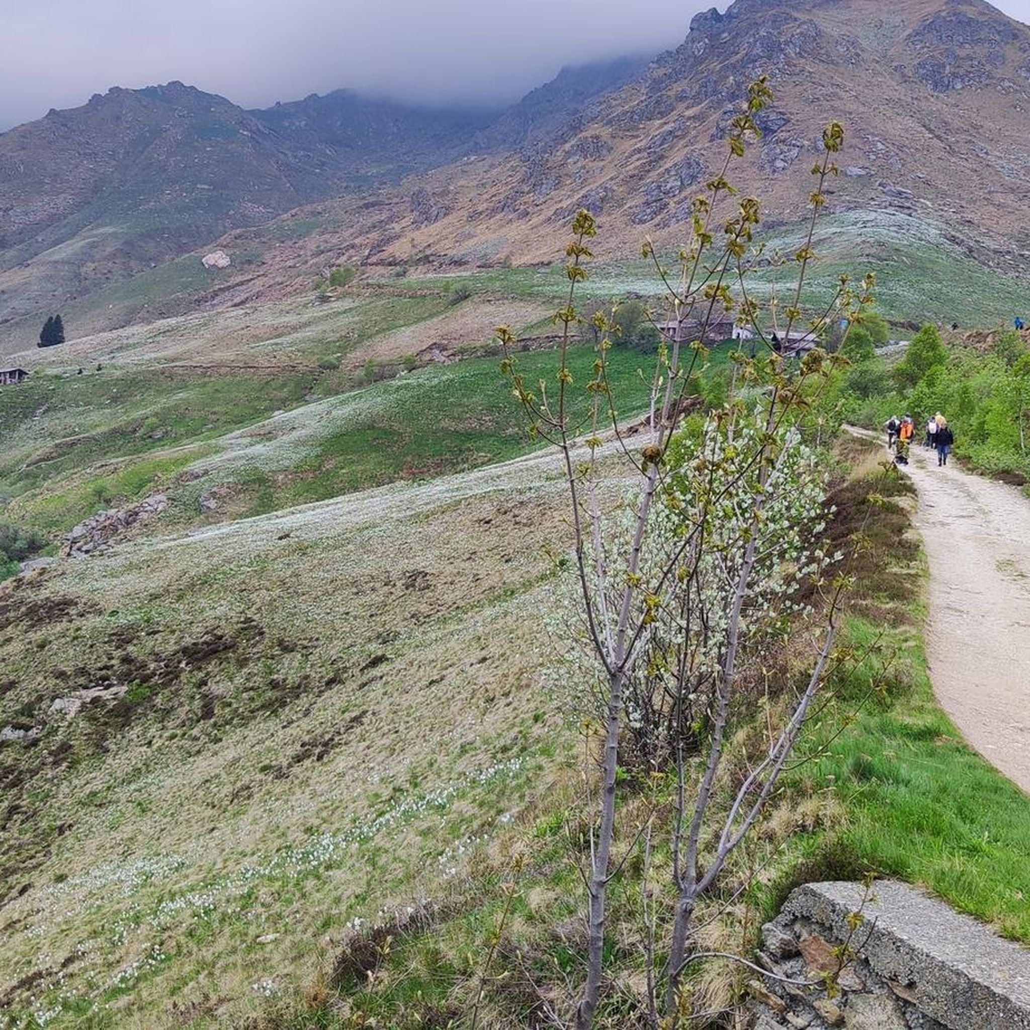
I did a nice tour around there today. From Punta Quinzeina then along the ridge to Punta di Verzel. Descent via the refuge. The location is very beautiful and scenic. Too bad about the clouds today. A nice thick layer at the height of the peaks. So fog for the whole route. I will have to repeat the tour to see the panorama which, I read, must be beautiful.
0
0

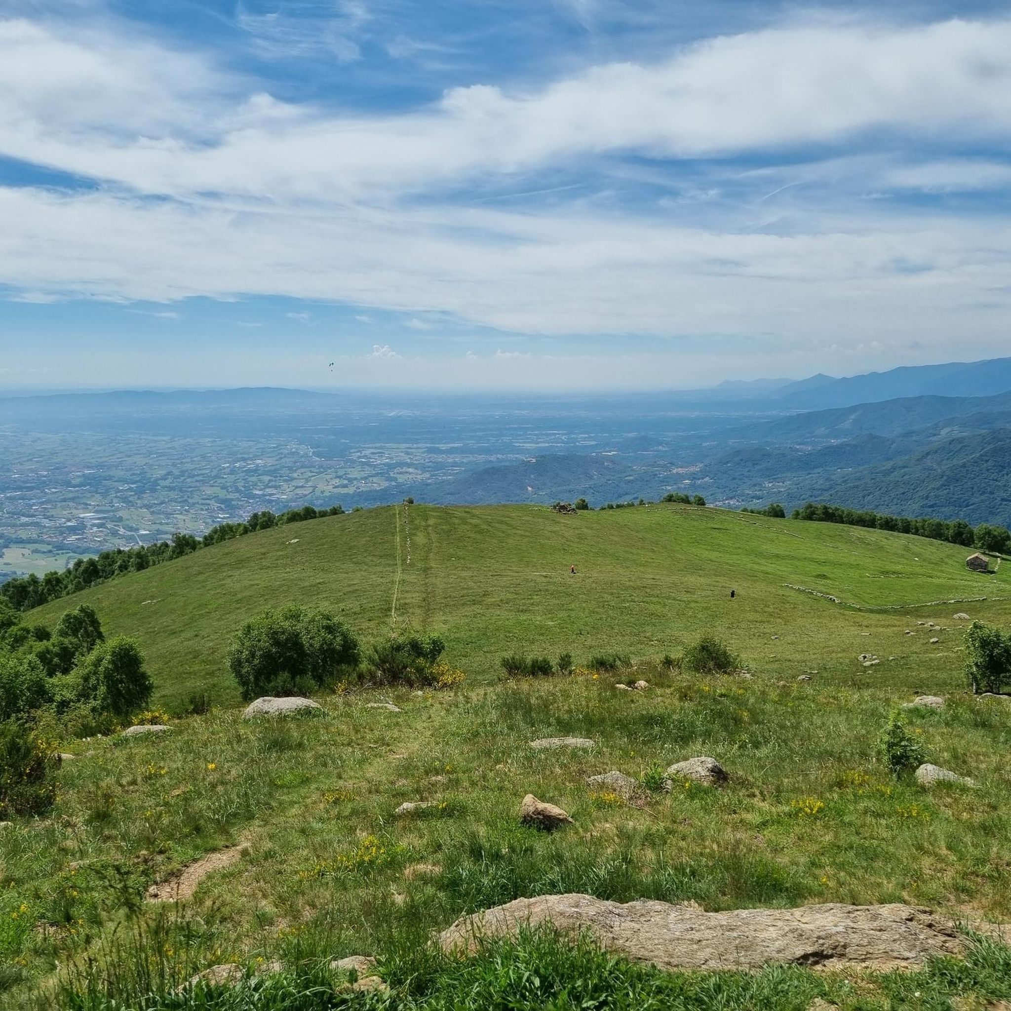
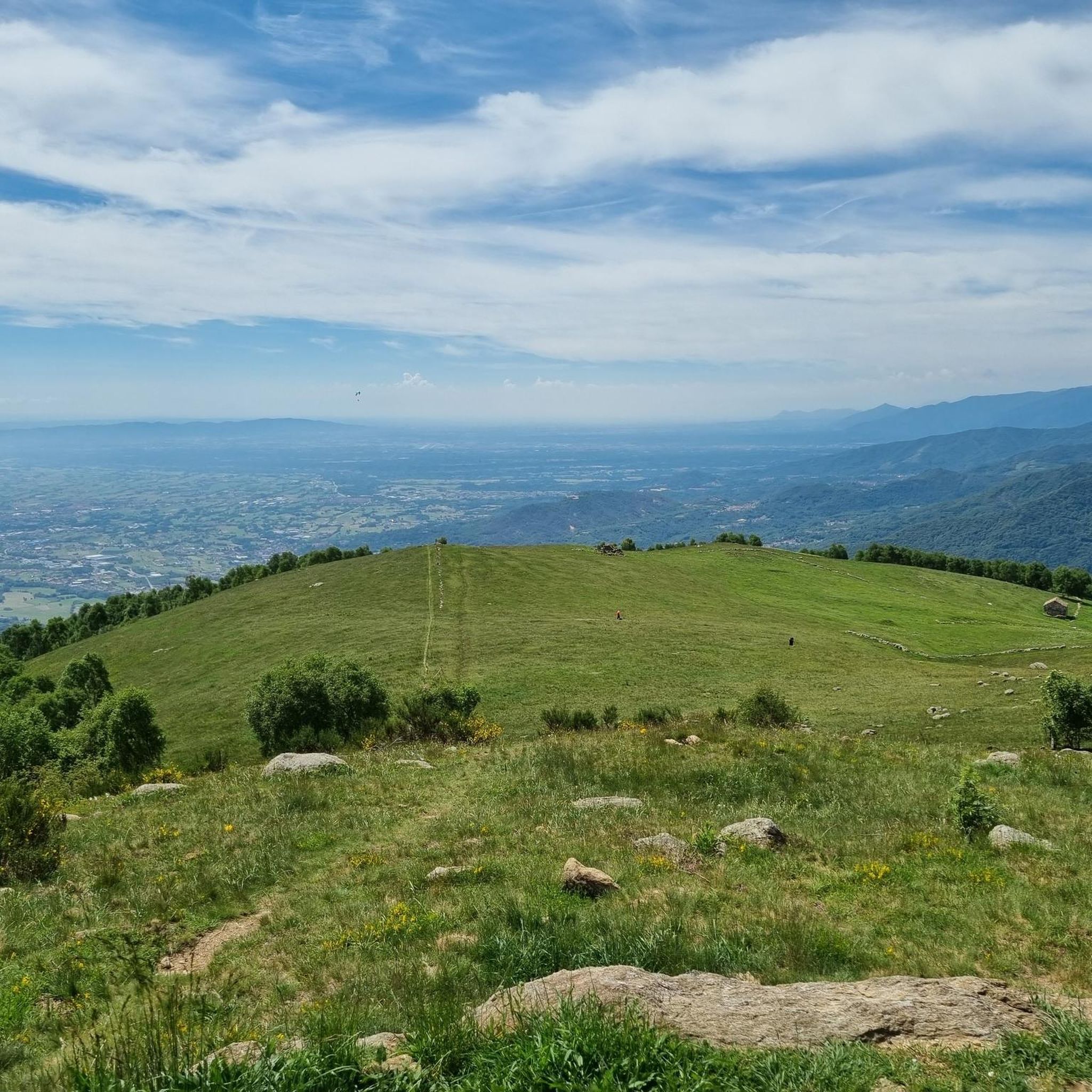
Scenic spot to park to start the hike to Punta Quinzeina
1
0
Croce Quinzeina, built and brought by the people of Frassineto August 1963
1
0

Beautiful Panorama! Steep climbs in the last section from Frassinetto
0
0

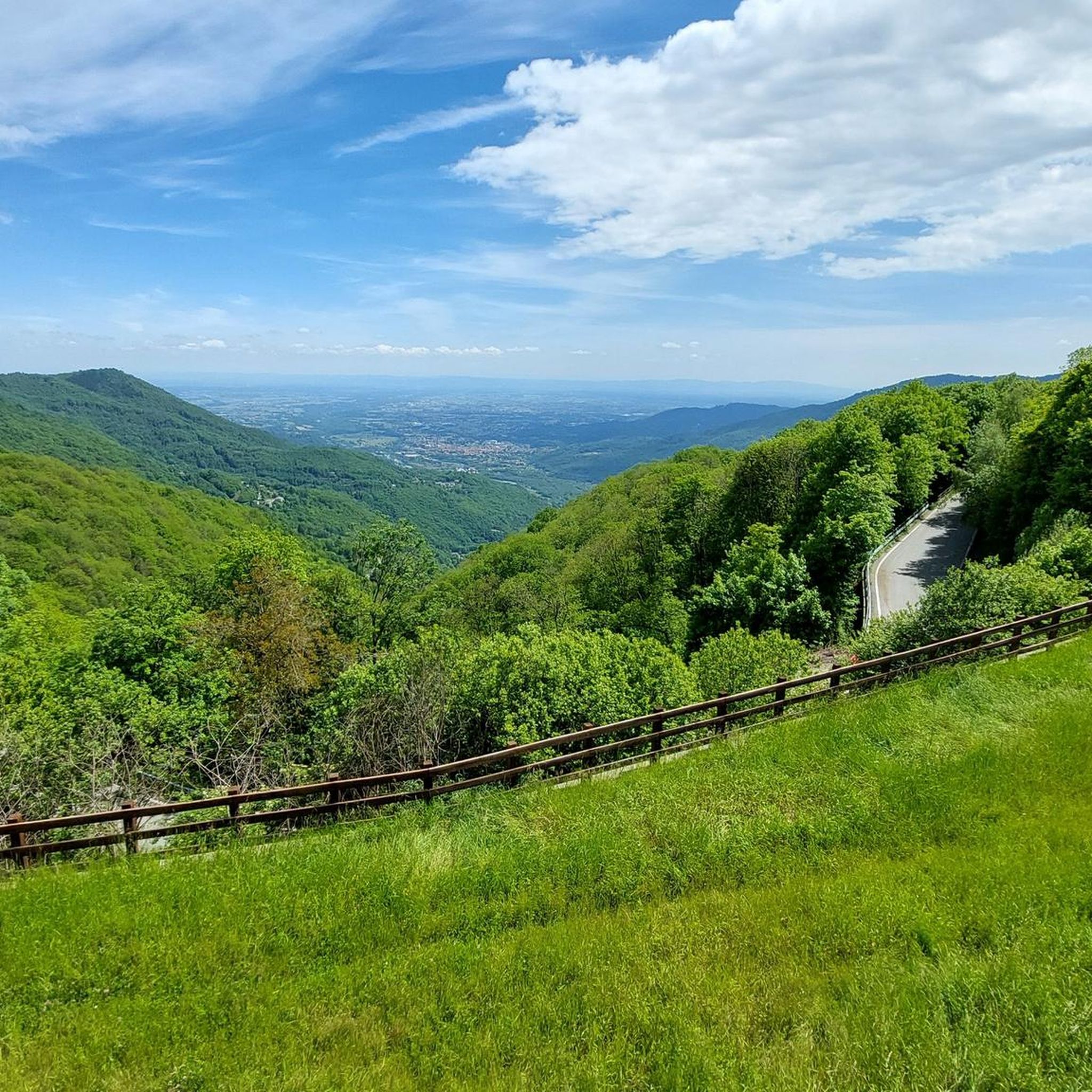
In reality, this place is not so "flat" because, from when the slopes become less steep to when the descent begins, there will not even be a hundred meters ... but the environment is superb, high mountain, and makes up for the road that, especially towards Frassinetto, is not in such good condition. There is nothing, not a bar, not a fountain ... but it is worth stopping and admiring the splendid panorama. Going up from Frassinetto the slope, after the village, becomes discontinuous and challenging, more gradual if you go up from Colleretto Castelnuovo, where the road alternates beautiful hairpin bends in the woods ... however, it is not a gift from this side either!
1
0

Pian del Lupo ideal starting point to reach both Quinseina peaks.
0
0

To reach the 2,231 meters of altitude of Punta Quinseina Sud, also known as Punta Quinseina di Santa Elisabetta, you follow a beautiful path which, although not particularly difficult, has quite steep sections, sometimes on stony ground, and starts from Pian del Lupo. If the mists allow it, the panorama from this point is extraordinary, ranging from the Canavese plain to the Alps. However, even more fascinating is the somewhat exposed path along the ridge that leads to the northern tip. Running along the ridge is an amazing experience!
1
0

It is commonly reached from Pian delle Nere passing from Rifugio Fornetto, with very steep sections of climb (especially at the end), but in the absence of snow and ice and to be considered difficulty E. The sessions from up there are beautiful, from the mountains of the Val d 'Aosta to that of the Cuneo area where Monviso stands out, and then the Canavese plain with the Superga basilica and the Turin hill. I also mention the nearby Quinzeina peaks (north and south) and Punta Rama with its bivouac at the top, clearly visible on clear days
0
0
Frequently Asked Questions
How many hiking trails are available around Borgiallo?
Borgiallo and its surrounding area offer a wide variety of hiking opportunities, with over 230 routes recorded on komoot. These trails traverse mountainous terrain, forested slopes, and scenic valleys, catering to different preferences and skill levels.
Are there easy hiking trails suitable for beginners or families in Borgiallo?
Yes, Borgiallo has a good selection of easy trails. There are 47 easy routes, perfect for a relaxed outing. An example is the Old San Giacomo Road Trail, which is about 4.9 km long and takes around 1 hour 29 minutes, offering gentle ascents through pleasant scenery.
What kind of challenging hikes can I find in Borgiallo?
For experienced hikers seeking a challenge, Borgiallo offers 52 difficult routes. These often involve sustained climbing and significant elevation changes, leading to prominent ridges and panoramic viewpoints. Expect trails that test your endurance and offer rewarding views of the Piedmont region.
Are there any circular hiking routes in the Borgiallo area?
Yes, many of the trails around Borgiallo are designed as circular routes, allowing you to start and end at the same point without retracing your steps. The Santuario di Piova to Bric Filia Loop is a popular moderate option, covering 6.8 km through rolling hills and past a sanctuary.
What are the best viewpoints or scenic spots to discover while hiking?
The mountainous landscape around Borgiallo offers numerous scenic viewpoints. Hikers can ascend to various peaks for expansive vistas. Notable viewpoints include Pian delle Nere, which provides excellent panoramic views, and the Punta Quinseina Sud Summit Cross, offering a rewarding perspective after a challenging climb.
Can I bring my dog on the hiking trails in Borgiallo?
Generally, dogs are welcome on most hiking trails in the Borgiallo area. However, it's always advisable to keep them on a leash, especially in areas with livestock or wildlife, and to check for any specific local regulations or protected areas that might have restrictions. Always carry water for your dog and clean up after them.
Are there any huts or refuges along the trails for a break or overnight stay?
Yes, the Borgiallo region features several huts and refuges that can serve as excellent resting points or even overnight accommodations. You can find places like Rifugio Cima Bossola and Bivacco Alpe Bellono, which offer opportunities for a break and to experience the mountain environment.
What do other hikers say about the trails in Borgiallo?
The komoot community highly rates the hiking experience in Borgiallo, with an average score of 4.3 stars from over 1,100 reviews. Hikers often praise the diverse terrain, the well-maintained paths, and the stunning views from the higher elevations, making it a popular destination for outdoor enthusiasts.
Are there any historical or cultural landmarks to see while hiking in Borgiallo?
Yes, the region blends natural beauty with historical elements. Trails often pass by ancient churches, small chapels, or remnants of traditional alpine life. The Santuario di Piova to Bric Filia Loop, for instance, leads past a sanctuary, offering a glimpse into the local heritage.
What is the typical duration of hikes in Borgiallo?
Hikes in Borgiallo vary significantly in length and duration. You can find shorter, easy walks like the Old San Giacomo Road Trail, which takes under 1.5 hours, to longer, more demanding routes such as the Ridge hike to Punta Quinseina Sud, which can take over 6 hours to complete.
Is there public transport access to trailheads in Borgiallo?
While Borgiallo is a smaller town in a mountainous region, some local bus services might connect to nearby villages or starting points. However, for maximum flexibility and access to a wider range of trailheads, traveling by car is generally recommended. Always check local transport schedules in advance.
Where can I park my car when hiking in Borgiallo?
Many trailheads in and around Borgiallo offer designated parking areas, especially near popular starting points or villages. It's advisable to check specific route descriptions or local signage for the most convenient parking options. In smaller, more remote areas, roadside parking might be available where permitted and safe.
Most popular routes around Borgiallo
Most popular attractions around Borgiallo

Get inspired with the komoot mobile app


Explore more
Browse the best Hikes in other regions.
