The best running trails around Castelnuovo Nigra
4.7
(83)
3,249
runners
253
runs
Jogging around Castelnuovo Nigra offers diverse landscapes in the Italian Alps, situated at 828 meters above sea level. The region features a variety of terrains, from the foothills of mountains like Verzel and Giavino to the scenic Valle Sacra, which traverses woods and small hamlets. Runners can explore routes through beech and chestnut forests, with many trails providing panoramic views across the Canavese plain and the Orco Valley. The area is characterized by its varied elevation, offering both gentle paths…
Last updated: October 9, 2026
68
runners
16.7km
02:38
860m
860m
Hard run. Very good fitness required. Sure-footedness, sturdy shoes and alpine experience required.
31
runners
7.75km
00:59
170m
170m
Moderate run. Good fitness required. Mostly paved surfaces. Suitable for all skill levels.

12
runners
21.4km
02:25
160m
160m
Hard run. Very good fitness required. Mostly paved surfaces. Suitable for all skill levels.
4.0
(1)
7
runners
8.64km
01:01
250m
250m
Moderate run. Good fitness required. Mostly paved surfaces. Suitable for all skill levels.
9
runners
7.33km
00:56
250m
250m
Moderate run. Good fitness required. Mostly paved surfaces. Suitable for all skill levels.
Get access to more routes and recommendations from other explorers.
Already have an account?
Our route recommendations are based on thousands of hikes, rides, and runs completed by other people on komoot.
Start today with a free account
Your next adventure awaits.

Tips from the Community

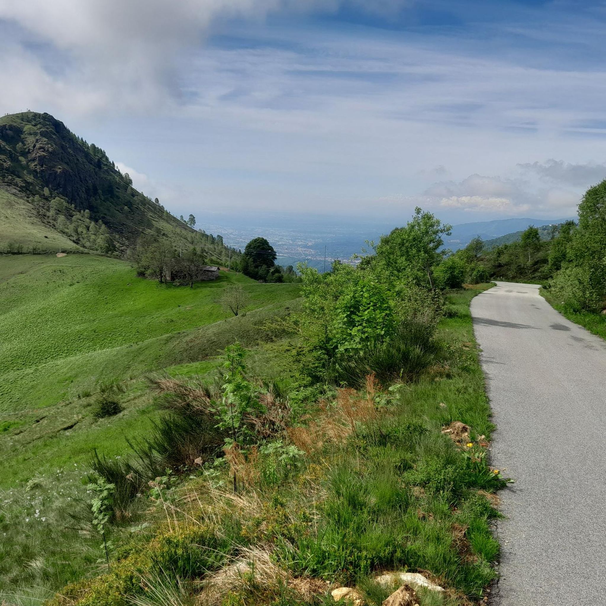
L'Alpe Frera is reachable by dirt road and we can stock up on water at the fountain.
0
0

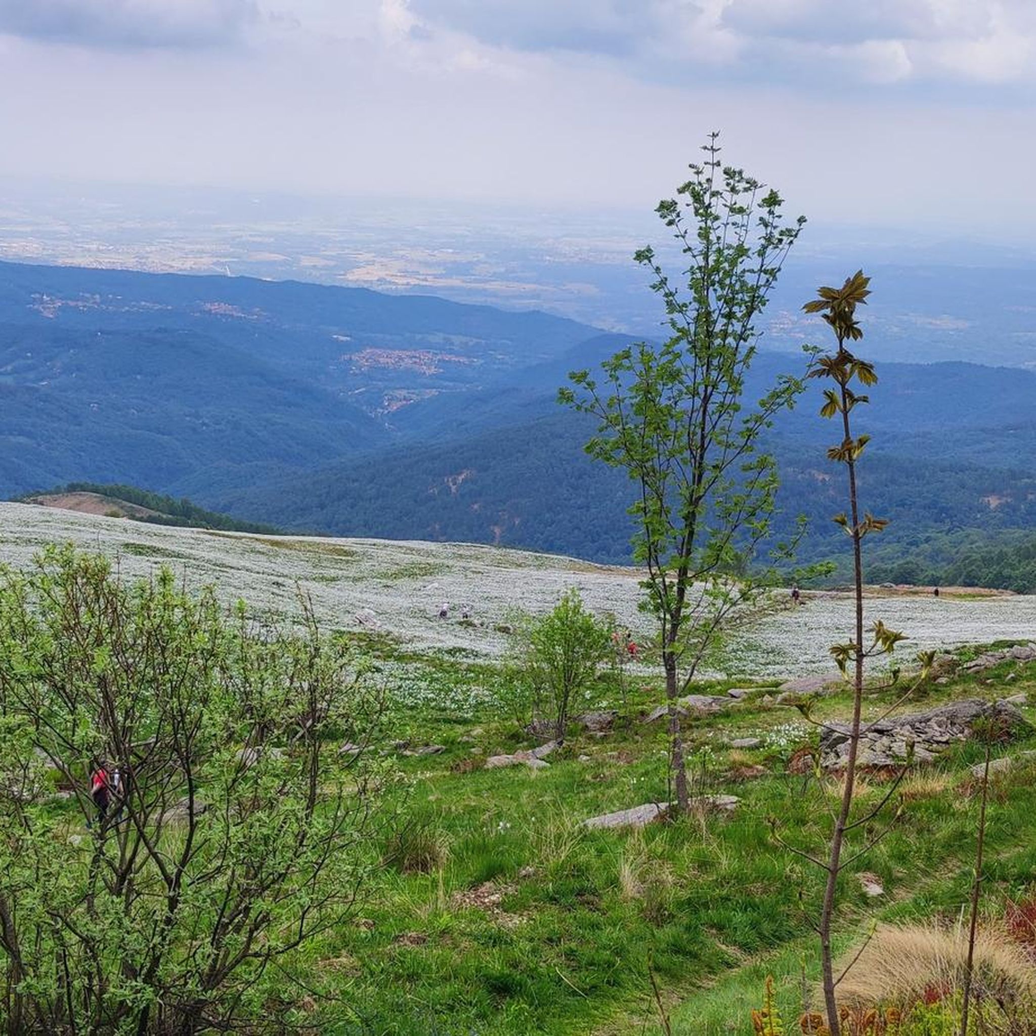
the blooming of Narcissus and Monte Val o in the background
2
0


Accessible by car via a somewhat narrow but recently restored paved road, it is in excellent condition. Ample parking is available. It has a barbecue and picnic area. It's also an excellent starting point for reaching the surrounding peaks.
2
0

A natural spectacle to enjoy in the month of May
2
0
Easily accessible on a paved road (unfortunately). Breathtaking view of the plain. In May, the spectacle of the daffodils blooming is unmissable.
2
0

if you pass by here you can't miss stopping by the Madonna
0
0

late autumn weather
0
1
Frequently Asked Questions
How many running routes are available in Castelnuovo Nigra?
Castelnuovo Nigra offers a wide selection of running routes, with over 200 trails available. These range from easy paths to more challenging mountain runs, catering to various fitness levels.
What kind of terrain can I expect on running trails around Castelnuovo Nigra?
You can expect diverse terrain, from the foothills of mountains like Verzel and Giavino to the scenic Valle Sacra. Trails often traverse beech and chestnut woods, open fields, and offer panoramic views across the Canavese plain and the Orco Valley. The area is known for its varied elevation, providing both gentle paths and significant ascents.
Are there running routes suitable for beginners in Castelnuovo Nigra?
Yes, there are several easier running options. The region features 9 routes classified as easy, perfect for those new to trail running or looking for a more relaxed jog. Many moderate routes also offer less elevation gain, such as the Christmas Tree – Nativity scene loop from Castelnuovo Nigra.
Are there challenging running routes for experienced runners in Castelnuovo Nigra?
Absolutely. For experienced runners seeking a challenge, Castelnuovo Nigra offers 75 difficult routes. These often feature significant elevation changes and longer distances. An example is the Waterfall on the Trail – Rhododendron Trail loop from Castelnuovo Nigra, which covers 16.7 km with substantial elevation gain.
Can I find circular running routes in Castelnuovo Nigra?
Yes, many running routes in Castelnuovo Nigra are designed as loops, allowing you to start and finish in the same location. Examples include the Field of Daffodils – Alpe Frera loop from Pian delle Nere and the Wooden Animal Carving loop from Campo Canavese.
Are there any historical landmarks or attractions I can see while running?
The region is rich in history. While running, you might pass by the remains of the ancient Castle of the Counts of San Martino or the Villa of Ambassador Costantino Nigra. The village itself is an ancient rural Alpine settlement with traditional stone and wood houses. For specific viewpoints, consider routes near Pian del Lupo Viewpoint.
What do other runners enjoy most about jogging in Castelnuovo Nigra?
The running trails in Castelnuovo Nigra are highly rated by the komoot community, with an average score of 4.4 stars from over 40 reviews. Runners often praise the diverse landscapes, the rewarding panoramic views, and the variety of terrain that caters to different abilities. Over 2100 runners have used komoot to explore the area's trails.
What are the best seasons for running in Castelnuovo Nigra?
Spring and autumn are particularly beautiful for running. In spring, the landscapes are adorned with abundant narcissus flowers, creating a stunning visual experience. Autumn offers vibrant foliage. Summer can be pleasant in the higher elevations, while winter running is possible but may require checking local conditions for snow and ice, especially on higher trails.
Are the running trails in Castelnuovo Nigra dog-friendly?
Many trails in the Castelnuovo Nigra area are suitable for running with dogs, especially those through forested areas and less crowded paths. However, it's always advisable to keep dogs on a leash, particularly in areas with wildlife or near livestock, and to check specific trail regulations before heading out.
Where can I park when accessing running trails in Castelnuovo Nigra?
Parking is generally available in and around Castelnuovo Nigra village, as well as at common starting points for trails like Pian delle Nere. Specific parking information for individual routes can often be found on the komoot tour pages, but village centers and popular trailheads usually offer designated spots.
Is Castelnuovo Nigra accessible by public transport for runners?
While Castelnuovo Nigra is a mountain village, public transport options exist to reach the area, though they might be limited. It's recommended to check local bus schedules from larger towns in the Canavese region, such as Ivrea, which may offer connections to the Valle Sacra. Planning ahead is key if relying on public transport.
Are there any places to refuel or get refreshments after a run?
Castelnuovo Nigra, as an ancient rural Alpine village, offers some local establishments where you can find refreshments. You might discover small cafes or trattorias within the village itself, providing a chance to relax and refuel after your run. Pian delle Nere also features a picnic area with fantastic views.
Most popular routes around Castelnuovo Nigra
Most popular attractions around Castelnuovo Nigra

Get inspired with the komoot mobile app


Explore more
Browse the best Running Trails & Routes in other regions.
