The best walks and hikes around Villar Focchiardo
4.5
(492)
2,622
hikers
32
hikes
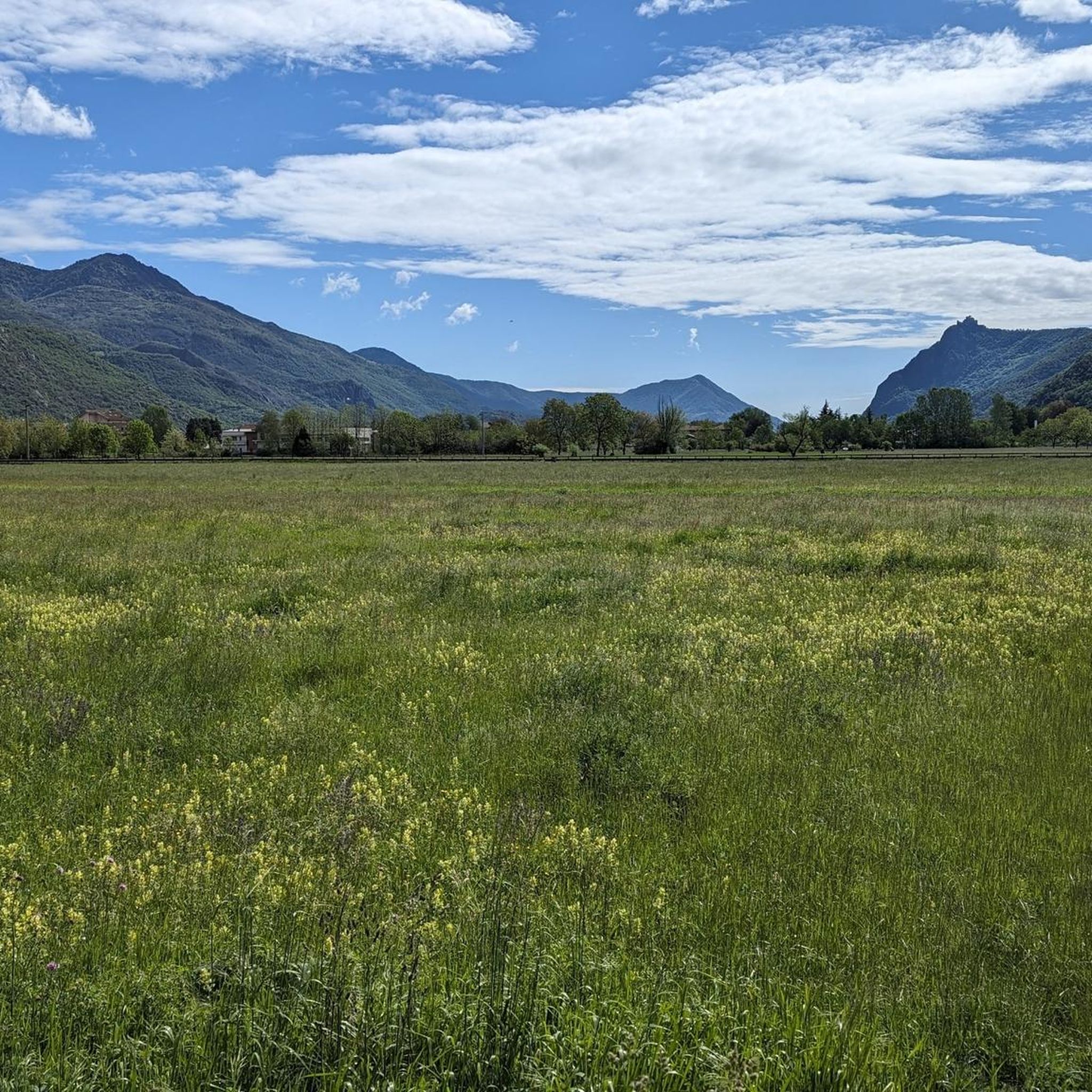
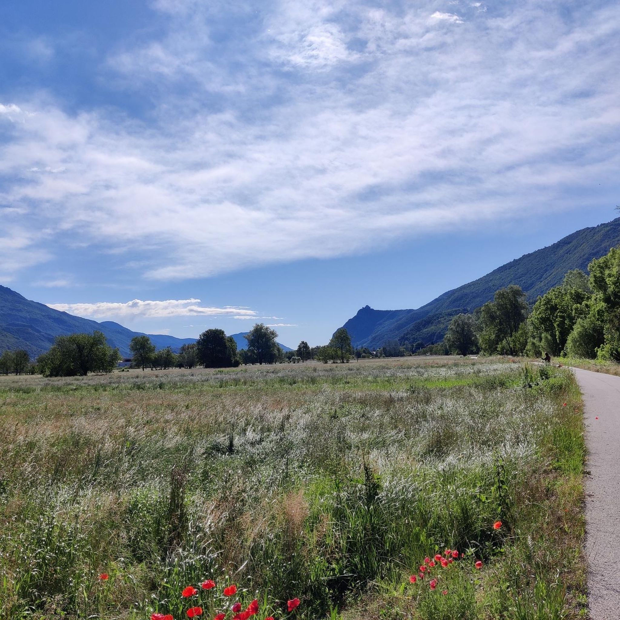
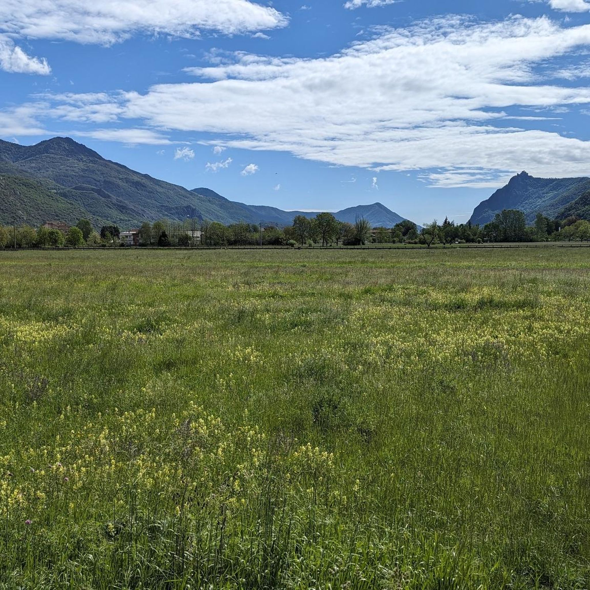
Hiking around Villar Focchiardo offers diverse landscapes within Italy's Susa Valley and the Orsiera-Rocciavrè Natural Park. The region features mountain scenery, meadows, and dense forests, with elevations ranging from 338 meters to 2,632 meters above sea level. Situated at the entrance of the Gravio Valley, the area provides varied terrain for outdoor activities. Hikers can explore alpine meadows, scree, and glacial landscapes, particularly at higher elevations.
Best hiking trails around Villar Focchiardo
- The most popular hiking route is Coazze to Colle del Vento (via Trail 420), a 7.9 miles (12.7 km) trail that takes 6 hours 16 minutes to complete. This difficult route ascends through mountainous terrain, offering expansive views.
- Another top favourite among local hikers is Trail 512 to Alpe Mustione from Villar Focchiardo, a difficult 10.9 miles (17.5 km) path. This trail involves significant elevation gain, leading through forests and open alpine areas.
- Local hikers also love the Via Francigena for all: Villar Focchiardo to Avigliana, a 12.6 miles (20.3 km) trail leading through the Susa Valley, often completed in about 5 hours 20 minutes. This route follows a historic pilgrimage path with moderate elevation changes.
- Hiking around Villar Focchiardo is defined by impressive mountain scenery, lush meadows, and dense forests. The network offers options for various ability levels, from challenging ascents to more accessible valley paths.
- The routes in Villar Focchiardo are highly rated by the komoot community with an average score of 4.5 stars from over 500 reviews. More than 2,600 hikers have used komoot to explore Villar Focchiardo's varied terrain.
Last updated: May 10, 2026
4.2
(6)
42
hikers
12.7km
06:16
1,050m
1,060m
Prepare for a challenging hike on Trail 420, leading you from Coazze to Colle del Vento. This difficult route covers 7.9 miles (12.7 km) and demands a significant effort, with an elevation gain of 3460 feet (1055 metres). You should plan for about 6 hours and 16 minutes to complete it. As you ascend, you'll pass through dense forests and open alpine meadows, offering a real sense of wilderness. The path eventually opens up to reveal expansive views from Colle del Vento, looking out towards the Cristalliera mountains.
To begin your hike, head to Borgata Tonda in Coazze, where you will find convenient parking close to the trailhead. Given the duration and difficulty of this route, it is wise to start early in the morning to allow ample daylight for your journey. Always check weather conditions before you go, especially for mountain trails like this one. Make sure you carry enough water and provisions for the entire day, as services along the trail are limited.
This trail takes you through the Orsiera-Rocciavrè Nature Park, a region rich in natural and historical elements. You will encounter remnants of abandoned villages, like Borgata Dogheria, which offer a glimpse into the area's past. Keep an eye out for the Rocca del Gias, a large gneiss boulder with local legends attached to it. The route also features the refreshing Fontana Sisi spring, a welcome stop on your ascent.
5.0
(1)
6
hikers
17.5km
07:37
1,210m
1,210m
Mountain trail through Piedmont's heritage, passing ancient chapels, waterfalls, and alpine meadows to Alpe Mustione.

Sign up for free
1
hikers
6.92km
02:08
240m
240m
Embark on the Path of the Franks, a moderate hike that takes you through diverse forest paths and old mule tracks. You will cover 4.3 miles (6.9 km) and gain 781 feet (238 metres) in elevation, typically completing the route in about 2 hours and 7 minutes. Along the way, you can enjoy panoramic views of the Gravio Valley and its distant peaks, with the beautiful Gravio Waterfall as a highlight, plunging into an emerald green pool.
When planning your visit, be aware that the trail includes some steeper sections on cobbled mule tracks, especially at the start. While generally accessible, winter conditions can make the route challenging, potentially requiring snowshoes or crampons. Always check local conditions before you head out to ensure a safe and enjoyable experience.
This route, also known as the Val Gravio Trail to Cascata del Gravio via Route 522, is nestled within the Aree Protette delle Alpi Cozie. It offers a rich experience of the natural environment, from chestnut and beech woods to larch forests. The trail culminates near the welcoming Val Gravio Hut, providing a perfect spot to rest after exploring the area's unique features.
20.3km
05:20
160m
200m
Hard hike. Very good fitness required. Easily-accessible paths. Suitable for all skill levels.
4.8
(49)
122
hikers
Moderate hike. Good fitness required. Mostly accessible paths. Sure-footedness required.
Get access to more routes and recommendations from other explorers.
Sign up for free
Already have an account?
Our route recommendations are based on thousands of hikes, rides, and runs completed by other people on komoot.
Start today with a free account
Your next adventure awaits.
Login or Signup
Popular around Villar Focchiardo


Other adventures around Villar Focchiardo

Tips from the Community

One of the various water sources in the area. It is also place number 10 of the treasure hunt "Caccia al Toponimo" organized by the Coazze Tourist Office
1
0
Signs advise against passing on the path that goes through the hamlet due to dilapidated huts. With due caution, it is however perfectly passable.
0
0
The building is not in optimal condition. It is possible to enter the first part to shelter from the wind. After that, there is a locked door.
0
0

Bellissimo pianoro di origine glaciale situato nel vallone di Sangonetto. Raggiungibile da diversi sentieri dalle borgate dell’Indiritto, è una facile meta e punto di passaggio per percorsi più impegnativi verso la testata del vallone
0
0

crampons are necessary in winter
0
0
crampons are necessary in winter
0
0

Hill of the wind in name and in fact, I recommend taking good shelter
0
0

The Valgravio refuge, near the Gravio stream, was built in 1928, then destroyed during the Second World War, rebuilt and expanded after the war. Today it is an essential destination for those who walk in the Orsiera-Rocciavré park. The manager, Mario Sorbino, keeps the dining room and the rooms in the best possible condition.
1
0
Frequently Asked Questions
How many hiking trails are available around Villar Focchiardo?
There are over 30 hiking routes in the Villar Focchiardo area, offering a wide range of options for different skill levels. These trails explore the diverse landscapes of the Susa Valley and the Orsiera-Rocciavrè Natural Park.
Are there any easy or beginner-friendly hiking routes in Villar Focchiardo?
Yes, while many trails involve significant elevation, there are options suitable for beginners. For example, the path to Val Gravio Hut – Val Gravio Hut loop from Certosa di Montebenedetto is a moderate route that offers a pleasant experience without extreme difficulty. The region also features accessible valley paths.
What are some notable landmarks or attractions I can see while hiking in Villar Focchiardo?
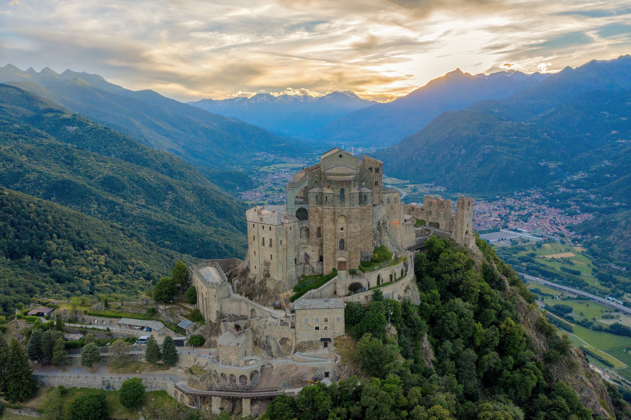
The region is rich in historical and natural sights. You can hike to the iconic Sacra di San Michele, a historic abbey perched on Mount Pirchiriano, offering splendid valley views. Other attractions include the Chapel of the Madonna of Rocca Sella, Borgata Tampe with its ancient stone huts, and the panoramic plateau of Pian dell'Orso within the Orsiera-Rocciavrè Natural Park. You might also encounter unique geological features like the Pera Furà Millstone Cave or the Foresto Gorge.
Are there any family-friendly hiking options in the area?
Yes, the Amprimo Mountain Hut is an easily accessible destination with large lawns, making it ideal for families with small children to play and picnic. Shorter, less strenuous sections of trails, particularly those leading through larch forests to places like Pian dell'Orso, can also be suitable for families.
Can I bring my dog on the hiking trails in Villar Focchiardo?
Many trails in the Orsiera-Rocciavrè Natural Park and surrounding areas are dog-friendly, but it's always advisable to keep dogs on a leash, especially in protected areas where wildlife like chamois, deer, ibex, and marmots are present. Always check specific trail regulations for any restrictions.
What is the best time of year to go hiking in Villar Focchiardo?
Villar Focchiardo offers beautiful hiking experiences year-round. Spring and summer bring vibrant green meadows and clear skies, while autumn transforms the landscape with stunning colors, often complemented by snow-capped peaks. Higher elevation trails are best enjoyed from late spring to early autumn, while lower valley paths can be accessed for longer periods.
Are there any circular hiking routes around Villar Focchiardo?
Yes, there are several loop trails available. An example is the Val Gravio Hut – Val Gravio Hut loop from Certosa di Montebenedetto, which allows you to start and end at the same point, offering a convenient hiking experience.
What kind of wildlife might I encounter in the Orsiera-Rocciavrè Natural Park?
Within the Orsiera-Rocciavrè Natural Park, hikers have a good chance of spotting diverse wildlife. Common sightings include chamois, deer, ibex, foxes, and marmots. Majestic eagles can also be seen soaring overhead, particularly in higher alpine areas.
What do other hikers say about the trails in Villar Focchiardo?
The hiking routes in Villar Focchiardo are highly regarded by the komoot community, with an average rating of 4.5 stars from over 500 reviews. Hikers frequently praise the impressive mountain scenery, lush meadows, and dense forests, as well as the variety of trails suitable for different ability levels.
Is public transport available to reach hiking trailheads in Villar Focchiardo?
While specific public transport options directly to every trailhead may be limited, Villar Focchiardo is part of the Susa Valley, which has regional bus services. It's recommended to check local bus schedules for connections to villages near popular trail starting points. Parking is generally available in or near the main villages for those traveling by car.
Are there any long-distance or historic trails in the area?
Yes, Villar Focchiardo is part of the historic Via Francigena route through the Susa Valley. You can experience a section of this ancient pilgrimage path, such as the Via Francigena for all: Villar Focchiardo to Avigliana, which leads through medieval villages and historical sites.
What is the elevation range for hiking in Villar Focchiardo?
The elevation in the Villar Focchiardo region varies significantly, ranging from 338 meters in the valley floor up to 2,632 meters above sea level in the higher mountain areas. This wide range contributes to the diverse terrain and ecosystems you'll encounter on the trails.
Most popular routes around Villar Focchiardo
Most popular attractions around Villar Focchiardo

Get inspired with the komoot mobile app


Explore more
Browse the best Hikes in other regions.
