The best walks and hikes in the Selkirk Mountains
4.6
(707)
6,240
hikers
198
hikes
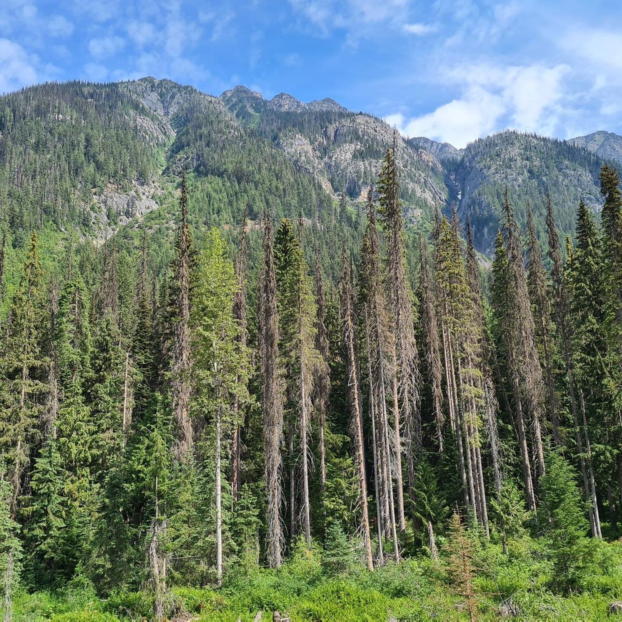
Hiking in the Selkirk Mountains offers diverse and rugged natural beauty, characterized by imposing granite peaks and pristine alpine lakes. The range features a dramatic landscape, including the renowned Selkirk Crest with its granite slabs and domes. Subalpine forests and unique inland temperate rainforests contribute to a varied environment. This region provides a wide array of hiking experiences across its varied terrain.
Best hiking trails in the Selkirk Mountains
- The most popular hiking route is Deep Creek Loop, a 7.2 miles (11.5 km) moderate trail that takes 3 hours 18 minutes to complete, offering canyon overlooks.
- Another top favourite among local hikers is Carlson Hill Loop, an easy 3.3 miles (5.3 km) path. This route provides views of the river and forest.
- Local hikers also love the Canfield Gulch Loop, a 3.5 miles (5.5 km) trail leading through forested hills, often completed in about 1 hour 43 minutes.
- Hiking in the Selkirk Mountains is defined by granite peaks, pristine alpine lakes, and lush inland temperate rainforests. The network offers options for different ability levels, from easy paths to challenging, off-trail adventures.
- The routes in Selkirk Mountains are highly rated by the komoot community with an average score of 4.5 stars from over 500 reviews. More than 4000 hikers have used komoot to explore Selkirk Mountains's varied terrain.
Last updated: October 13, 2026
5.0
(4)
13
hikers
5.36km
01:37
180m
180m
The Carlson Hill Loop offers a delightful mix of terrain, starting on wider paths before narrowing into singletrack that winds through open forests. You'll encounter switchbacks on the ascent, leading to rewarding vistas from Pine Bluff where you can gaze across rolling hills and even spot Spokane's skyline. The trail then descends through scree fields and "rock gardens," offering a varied and engaging experience for its 3.3 miles (5.4 km) distance.
This easy hiking route, with 588 feet (179 metres) of elevation gain, typically takes about 1 hour and 37 minutes to complete. Parking is generally available at the trailhead off Carlson Road, making it an accessible option. Benches are strategically placed at viewpoints and near the Spokane River, providing ideal spots for a break.
Situated within the Saltese Uplands Conservation Area, the Carlson Hill Loop showcases a unique blend of natural beauty and urban proximity. It's a great choice for those seeking a quick, rewarding hike near Spokane, offering diverse ecosystems and geological formations. The trail also connects to other routes, like the Centennial Trail, for longer adventures.
11
hikers
11.5km
03:18
200m
370m
Embark on the Deep Creek Loop, a moderate hiking route that winds through the varied landscape of Riverside State Park. You will cover 7.2 miles (11.5 km) and gain 667 feet (203 metres) in elevation, typically taking about 3 hours and 17 minutes to complete. The trail offers scenic viewpoints, including the Deep Creek Canyon Overlook, where you can enjoy expansive views of the area. You will also cross the distinctive Deep Creek Bridge, adding a unique feature to your journey through the park's natural terrain.
The trailhead for the Deep Creek Loop is easily accessible, with convenient parking available right at the starting point. To make the most of your hike, plan your visit during favorable weather conditions. It is always a good idea to check local park information for any updates or specific advisories before you head out. This ensures you are prepared for the moderate challenge and can fully enjoy the scenic beauty of the route.
This loop is a rewarding outdoor experience within Riverside State Park, showcasing its diverse natural beauty. The route's varied landscape and distinct landmarks like the Deep Creek Canyon Overlook make it a notable option for hikers exploring the region. It provides a good opportunity to immerse yourself in the park's environment and enjoy its unique features.

14
hikers
5.57km
01:43
190m
190m
If you're seeking a diverse and engaging hike close to Spokane County, the Canfield Gulch Loop delivers a rewarding experience. This route takes you through dense forests of pine and fir, offering a mix of old logging roads and newer singletrack. You'll enjoy panoramic views of the Spokane Valley and distant mountains, with the chance to spot wildlife around LeLand Pond. The trail's varied terrain, including some steep sections, makes it a great choice for a moderately strenuous outing.
To plan your trip, know that the Canfield Gulch Loop is accessible throughout the year, making it versatile for different activities. While popular for hiking in warmer months, it also welcomes snowshoers and skiers in winter. The trailhead is easy to find within the Antoine Peak Conservation Area, and parking is generally available. Arriving earlier in the day is always a good idea, especially on weekends, to secure a spot.
This 3.5-mile (5.6 km) loop, with 636 feet (194 metres) of elevation gain, is rated easy and typically takes about 1 hour and 42 minutes to complete. It's nestled within a diverse ecosystem known for critical wildlife habitat, offering a sense of solitude despite its proximity to urban areas. The trail system has seen improvements, with new singletrack sections enhancing the experience beyond the older logging roads.
5
hikers
4.05km
01:09
80m
110m
Hiking the Upper Falls Loop in Post Falls Community Forest offers a 2.5-mile easy route with river views and wooded paths.
5
hikers
9.45km
02:25
30m
40m
The Creekside Trail offers a delightful escape into nature, following the meandering path of a creek or river. You'll find yourself immersed in a serene environment, with opportunities to observe local flora and fauna along the way. The trail's character can vary, from smooth, hard-surfaced sections to more natural, unpaved paths, all while keeping you close to the water's edge. It’s a great option for those seeking a tranquil experience without significant physical challenge.
Planning your visit to the Creekside Trail is generally straightforward, though specific trailhead and parking information should be confirmed locally. This trail is particularly enjoyable during the spring and fall months when the weather is mild, making for comfortable hiking conditions. While the trail is considered moderate, its minimal elevation gain means it's more about covering distance than tackling steep climbs, making it accessible for many.
Many Creekside Trail locations are known for their family-friendly atmosphere, providing a safe and enjoyable outing for all ages. The consistent presence of water makes it a refreshing hike, and depending on the specific location, you might even encounter unique geological formations or historical landmarks. This particular Creekside Trail covers 5.9 miles (9.5 km) with a gentle 110 feet (33 metres) of elevation gain, typically taking around 2 hours and 25 minutes to complete.
4
hikers
4.93km
01:30
170m
170m
The Misty Mountain Trail offers an easy hiking experience through varied terrain within the MacKenzie Natural Area. You will cover 3.1 miles (4.9 km) with a gentle ascent of 568 feet (173 metres), which most hikers complete in about 1 hour and 29 minutes. As you make your way up, you can enjoy glimpses of Liberty Lake, especially from the higher sections of the route. The path is well-maintained, often reported to have cut-back tall grass and dry conditions, making for a pleasant and straightforward walk. This trail provides a great opportunity to immerse yourself in the local natural surroundings.
When planning your visit, remember that this is a four-season trail, but it is best to avoid hiking when the ground is soft and muddy to help preserve the path. The route is two-way, so you will share it with mountain bikers and horseback riders; however, hikers always have the right of way. Dogs are welcome on the trail, making it a good choice for a family outing.
This family-friendly route is a great way to experience the local nature of the MacKenzie Natural Area. It provides a consistent, gradual climb through its varied landscape, offering a pleasant outdoor adventure. The trail's accessibility and well-kept conditions make it a notable option for those looking for an enjoyable and uncomplicated hike in the region.
3
hikers
5.59km
01:36
160m
90m
The Crooked Tree, Meadow, and Butterfly Loop offers a delightful escape into nature, weaving through varied landscapes that include serene alpine meadows and lush forests. This easy 3.5-mile (5.6 km) hike, with a modest 526 feet (160 metres) of elevation gain, provides stunning vistas of the Cabinet Mountains and Lake Pend Oreille. Keep an eye out for the Crooked Tree segment, which boasts a fantastic viewpoint overlooking the Pend Oreille River and Mt. Baldy, and the Butterfly section, known for its scenic beauty and seasonal wildflowers.
Planning your visit is straightforward, as this publicly accessible trail in Pine Street Woods requires no permits or entrance fees. The estimated duration for this hike is around 1 hour and 35 minutes, making it a great option for a shorter outing. Dogs are permitted, but remember to keep them on a leash to ensure the safety of local wildlife. Parking is generally available at the trailhead, and the trail is enjoyable across multiple seasons.
This loop is notable for integrating sections of several named trails, including Butterfly, Meadow Loop, Crooked Tree, Momentum, and Homestead trails, creating a diverse experience within a single route. Its easy difficulty and moderate length make it an excellent choice for families or anyone seeking a rewarding hike without an intense physical challenge. The trail's blend of forest, meadow, and panoramic views makes it one of the best hikes for experiencing the natural beauty of the Sandpoint, Idaho area.
3
hikers
6.46km
02:12
410m
220m
Hike the moderate 4.0-mile Pyramid and Ball Lakes Trail in Idaho's Panhandle National Forest, featuring two beautiful alpine lakes and sceni
2
hikers
21.7km
06:35
620m
1,030m
Embark on the Mount Kit Carson Loop Road, Trail 140 and Trail 110 Loop, a challenging hike spanning 13.5 miles (21.7 km) with a significant elevation gain of 2049 feet (624 metres). You can expect to spend around 6 hours and 35 minutes navigating this difficult route, which winds through varied terrain. As you ascend, you will pass through dense forests of Douglas fir and western red cedar, eventually reaching rocky alpine meadows. From the summit of Mount Kit Carson, you are rewarded with expansive 360-degree views, including Mount Spokane and the Selkirk Range. This trail offers a rewarding experience for those seeking a demanding outdoor adventure.
This route is accessible year-round, offering distinct experiences with each changing season. During the colder months, the area transforms into a popular destination for snowshoeing and snowmobiling, with a warming hut available at Smith Gap. Be aware that the trails are multi-use, so you will share the path with mountain bikers and equestrians, and in winter, with snowshoers and snowmobilers. Plan your visit accordingly, considering the seasonal conditions and potential for shared use.
Located within Mount Spokane State Park, this loop provides a deep dive into the region's natural beauty. The trail is notable for its diverse ecosystems, from lush forests to high-altitude meadows, showcasing vibrant wildflowers in spring and summer. Keep an eye out for spectacular bear grass, especially in August, adding to the scenic appeal. The panoramic vistas from the top of Mount Kit Carson highlight the unique geological features and vastness of the surrounding landscape, making it a standout experience in the area.
1
hikers
6.98km
02:21
590m
0m
Embark on the Mount Spokane Trail 110 and 140 Loop for a moderate hike that offers a rewarding challenge. This 4.3-mile (7.0 km) route takes you through a varied landscape, beginning in dense forests filled with Douglas fir and western red cedar. As you ascend, the trail transitions into an alpine environment, where you will find vibrant bear grass and wildflowers, particularly in summer. The climb involves gaining 1930 feet (588 metres) of elevation, typically taking around 2 hours and 20 minutes to complete. Reaching the summit of Mount Kit Carson, you are treated to expansive 360-degree views of Mount Spokane and the distant Selkirk Range, providing a memorable vista.
When planning your visit to Mount Spokane State Park, be aware that Trail 140 is also a primary downhill mountain bike route. You should stay alert and listen for approaching cyclists to ensure a safe experience for everyone. Parking is generally available at the trailhead, making access straightforward. While the route is suitable for snowshoeing in winter, always check current conditions before heading out to prepare for potential closures or hazards.
This loop offers a unique opportunity to experience the diverse ecosystems of Mount Spokane, from its lower forest slopes to its higher alpine zones. The trail's transition from dense woods to open, flower-filled areas highlights the natural beauty of the region. It provides a solid workout while immersing you in the natural environment, making it a notable choice for hikers seeking both exercise and scenic rewards within the state park.
Get access to more routes and recommendations from other explorers.
Already have an account?
Our route recommendations are based on thousands of hikes, rides, and runs completed by other people on komoot.
Start today with a free account
Your next adventure awaits.
Popular around Selkirk Mountains


Other adventures in the Selkirk Mountains

Tips from the Community

This overlook is well work the extra work to get here from the Centennial Trail. Just be aware that not everyone will be comfortable walking the dirt trail to the overlook from the main paved path. It is quite narrow.
0
0

Deep Creek Bridge is a small pedestrian bridge over Deep Creek along the Spokane River Centennial Trail. From here you get nice views over the water and might see birds and other animals.
0
0
The Saltese Uplands Conservation Area is a sprawling, scenic 522-acre sanctuary in Spokane County, Washington. Nestled on the western slope of the Holiday Hills, just east of Saltese Flats, this conservation area is a great place for locals and visitors alike to explore. There are 7 miles of trails that are all open to the public during the daylight hours.
0
0

Great paths, but sometimes quite sporty without hiking poles.
0
0
If you look left and right you can discover many interesting things.
1
0
Sufficient food is provided on the way up.
1
0
Just the right place for a break after the climb.
2
0
It's better not to touch them, as this can cause serious inflammation.
2
0
Frequently Asked Questions
How many hiking trails are available in the Selkirk Mountains?
The Selkirk Mountains offer a wide variety of hiking experiences, with over 190 routes available. These range from easy strolls through forests to challenging multi-day adventures across rugged terrain.
What kind of terrain can I expect on hikes in the Selkirk Mountains?
Hikers in the Selkirk Mountains will encounter diverse terrain, from dramatic granite peaks and slabs, particularly in the Selkirk Crest, to lush subalpine forests and pristine alpine meadows. Some areas even feature unique inland temperate rainforests. Trails can vary from well-trodden paths to rocky ridgelines and boulder-hopping sections near lakes.
Are there family-friendly hiking options in the Selkirk Mountains?
Yes, the Selkirk Mountains offer numerous easy trails suitable for families. For instance, the Canfield Gulch Loop is an easy 3.5-mile trail through forested hills, and the Misty Mountain Trail is another easy option, just under 5 miles, offering gentle slopes.
Can I bring my dog on trails in the Selkirk Mountains?
While many trails in the Selkirk Mountains are dog-friendly, it's always best to check specific regulations for the area you plan to visit, especially if you are entering national parks or designated wilderness areas. Always keep your dog leashed and practice Leave No Trace principles.
Are there loop hikes available in the Selkirk Mountains?
Yes, the Selkirk Mountains feature several excellent loop hikes. The Deep Creek Loop is a moderate 7.2-mile trail offering canyon overlooks, while the Carlson Hill Loop provides an easier 3.3-mile option with river and forest views. For a longer challenge, consider the Mount Kit Carson Loop Road, Trail 140 and Trail 110 Loop.
What natural attractions can I see along the hiking trails?
The Selkirk Mountains are rich in natural beauty. You can find numerous pristine alpine lakes such as Harrison Lake, Beehive Lake, and Pyramid Lake, often nestled beneath towering granite formations. Waterfalls like American Falls (Upper Priest River Falls) and Bear Creek Falls also add to the scenic allure. Many trails lead to panoramic viewpoints across the Spokane Valley or the Kootenai River Valley.
Are there any interesting landmarks or points of interest in the Selkirk Mountains?
Beyond the stunning natural landscapes, the Selkirk Mountains offer several notable points of interest. You can explore areas like Mount Spokane, which offers expansive views, or visit the Valhalla Provincial Park. The Giant Cedars Boardwalk provides a unique experience through an inland temperate rainforest.
What is the best time of year to hike in the Selkirk Mountains?
The best time for hiking in the Selkirk Mountains is generally from late spring through early fall (May to October). During this period, trails are typically clear of snow, and the weather is more favorable. Alpine meadows are vibrant with wildflowers in summer, and fall brings spectacular foliage. Winter offers opportunities for snowshoeing and cross-country skiing, but many hiking trails become inaccessible.
Are there opportunities for multi-day or backpacking trips?
Yes, the Selkirk Mountains are an excellent destination for multi-day and backpacking trips. Trails leading to alpine lakes like Harrison Lake, Beehive Lake, or Fault Lake are popular for overnight stays. The Pacific Northwest Trail also traverses parts of the Selkirks, offering challenging, long-distance adventures for experienced hikers seeking solitude.
What kind of wildlife might I encounter while hiking?
The Selkirk Mountains are home to diverse wildlife. Hikers might spot deer, elk, and various bird species. More elusive animals like wolverines, lynx, and gray wolves also inhabit the range. Always be aware of your surroundings and carry bear spray, as both black and grizzly bears are present in the region.
Are there any easy trails for beginners in the Selkirk Mountains?
Absolutely. The Selkirk Mountains have over 100 easy trails perfect for beginners or those looking for a relaxed walk. The Upper Falls Loop is a short, easy 2.5-mile path, and the Knothead Trail is another easy option, just over 3.5 miles, offering pleasant river and forest views.
What do other hikers enjoy most about hiking in the Selkirk Mountains?
The Selkirk Mountains are highly rated by the komoot community, with an average score of 4.5 stars from over 500 reviews. Reviewers often praise the breathtaking and varied landscapes, the pristine alpine lakes, and the sense of solitude found on many trails. The diverse range of options, from easy walks to challenging climbs, is also frequently highlighted.
Most popular routes in the Selkirk Mountains
Most popular attractions in the Selkirk Mountains

Get inspired with the komoot mobile app


Explore more
Browse the best Hikes in other regions.
