The best road cycling routes around Ortacesus
5.0
(1)
71
riders
19
rides
Road cycling routes around Ortacesus offer varied terrain suitable for different skill levels. The region features a mix of agricultural plains and rolling hills, with significant elevation gains on longer routes. Road cyclists can expect to encounter landscapes ranging from open countryside to areas near natural water features like Lake Leni. The area provides opportunities for both challenging climbs and more moderate rides.
Best road cycling routes around Ortacesus
- The most popular road cycling route is Donori Level Crossing –…
Last updated: August 1, 2026
14
riders
82.6km
04:32
1,620m
1,620m
Hard road ride. Very good fitness required. Some segments of this route may be unpaved and difficult to ride.
11
riders
128km
06:13
1,770m
1,770m
Hard road ride. Very good fitness required. Some segments of this route may be unpaved and difficult to ride.

Sign up for free
9
riders
106km
06:00
2,310m
2,310m
Hard road ride. Very good fitness required. Some segments of this route may be unpaved and difficult to ride.
3
riders
100km
05:18
1,920m
1,920m
Hard road ride. Very good fitness required. Mostly well-paved surfaces and easy to ride.
6
riders
98.1km
04:40
1,040m
1,040m
Hard road ride. Very good fitness required. Some segments of this route may be unpaved and difficult to ride.
Get access to more routes and recommendations from other explorers.
Sign up for free
Already have an account?
Our route recommendations are based on thousands of hikes, rides, and runs completed by other people on komoot.
Start today with a free account
Your next adventure awaits.
Login or Signup
Popular around Ortacesus


Tips from the Community

Viewpoint on the Mulargia dam and lake, with a wide view of the turquoise waters nestled between hills and woods of the Sardinian hinterland. Ideal photo stop and relaxation point along a cycle touring route, especially in the central hours of the day when the light enhances the colors of the lake and the surrounding landscape.
0
0
Scenic waterfall at the gates of Villacidro, Sa Spendula is the last stretch of the Coxinas river, which makes three leaps between high granite walls for a drop of about 60 meters. Easily reachable from the town, it is particularly striking between autumn and spring, when the water flow is greater, and is often combined with excursions to the nearby waterfalls of Piscina Irgas and Muru Mannu.
0
0

Also known as Lake Montimannu, the lake is located in the Villacidro area, in the heart of the Linas massif. It is an artificial lake created by damming the Leni River between 1976 and 1987, with a 55-meter-high earthen dam. Perfectly integrated into the landscape of Mediterranean scrub and holm oak forests, the lake is part of the Monte Linas – Marganai SCI and hosts various sporting events every year.
0
0
With approximately 14,000 inhabitants, Villacidro is one of the main towns in the Medio Campidano region and is located at the foot of the Monte Linas massif, in a green valley surrounded by hills and streams. The town is known for its olive oil, citrus fruits, and cherries, as well as for its strong artisanal and gastronomic traditions. In the historic center, you'll find shops, bars, restaurants, and various accommodation options. Nearby, the Sa Spendula waterfall, one of the town's symbols, and the Canale Serci mine, where tin was mined as far back as the Nuragic era, are worth a visit.
1
0

Looks like it's good drinking water because locals load their cars with it
0
0

Great place to fill your water bottle
0
0

Small municipality in Trexenta, it hosts one of the stops of the little green train.
0
0

A very large and striking radio telescope!
1
0
Frequently Asked Questions
What kind of terrain can I expect on road cycling routes around Ortacesus?
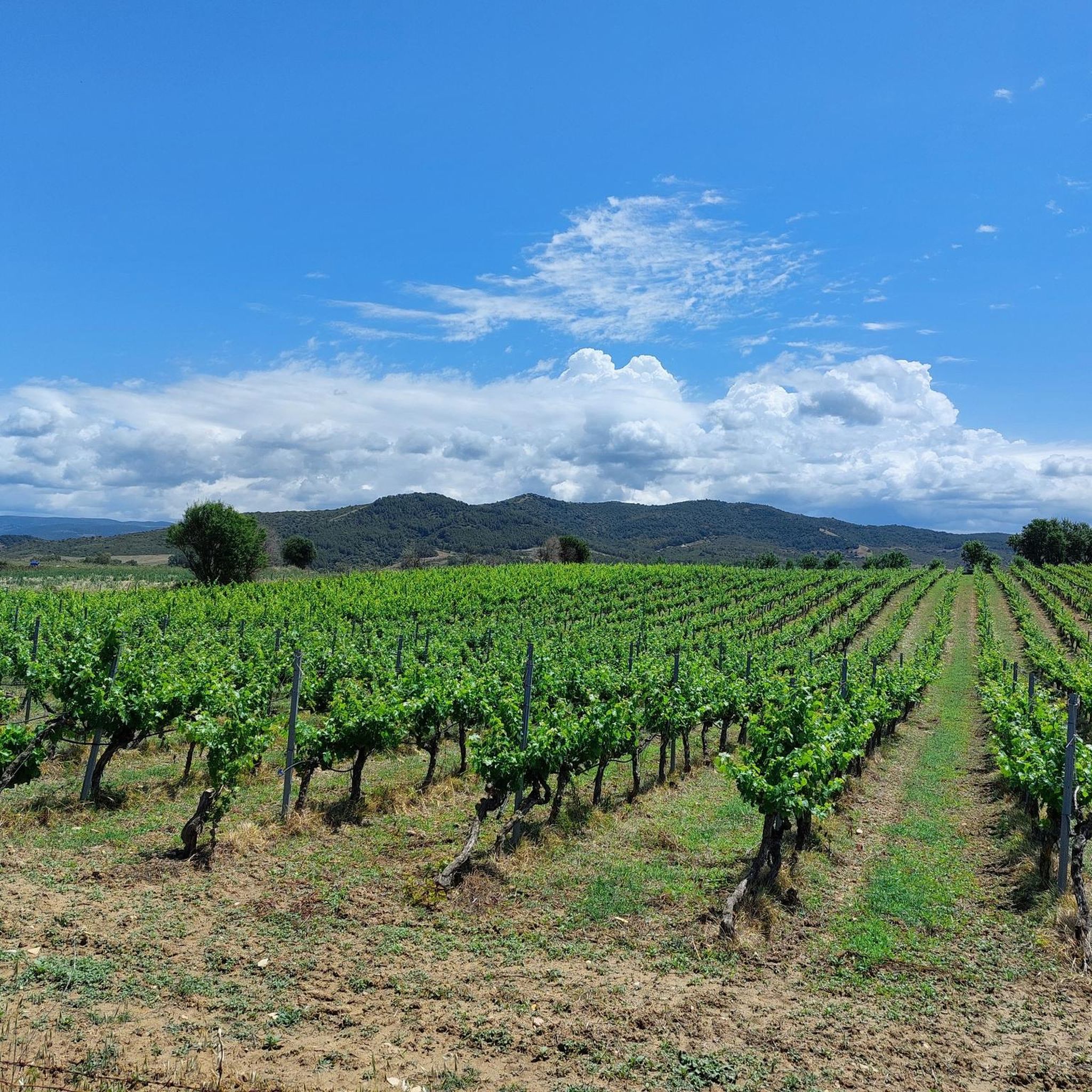
The Ortacesus area offers a diverse range of terrain for road cyclists. You'll find gentle, green rolling hills, quiet roads winding past vineyards and olive groves, and fertile plains. While Ortacesus itself is inland, its location provides proximity to Sardinia's limestone mountains, offering opportunities for more challenging climbs and significant elevation gains for experienced cyclists.
Are there road cycling routes suitable for beginners in Ortacesus?
Yes, there are routes suitable for beginners. For an easier ride, consider the Necropoli di Samassi loop from Serrenti. This route is 28.8 km long with a modest elevation gain of 151 meters, making it a good option for those new to road cycling or looking for a more relaxed experience.
What are some challenging road cycling routes in the Ortacesus area?
For experienced road cyclists seeking a challenge, Ortacesus offers several difficult routes with substantial elevation changes. Popular options include the Donori Level Crossing – Mitza de su Tiriaxiu Spring loop from Donorì, which is 82.5 km with over 1400 meters of ascent, and the even longer Church of Senorbì – Donori Level Crossing loop from Donorì, covering 105.9 km with over 1700 meters of climbing.
What historical or cultural landmarks can I see along road cycling routes near Ortacesus?
The region around Ortacesus is rich in history. You can incorporate visits to ancient sites like the UNESCO World Heritage site of Su Nuraxi di Barumini into your cycling itineraries. Closer to the routes, you might encounter the Roman Baths and Romanesque Church of San Basilio, the Church of Senorbì, or the Church of Santa Maria Assunta, Guasila. Cycling through the area also offers glimpses into traditional farming landscapes and medieval villages.
Are there any circular road cycling routes available?
Yes, many of the road cycling routes around Ortacesus are designed as loops, allowing you to start and end in the same location. Examples include the Necropoli di Samassi loop from Serrenti and the Lake Leni – Monti Mannu Reservoir loop from Serrenti, providing convenient options for your ride.
What natural features will I encounter on road cycling routes in this area?
Road cycling routes around Ortacesus will take you through varied natural landscapes. You'll cycle past green, rolling hills, fertile plains with vineyards and olive groves, and areas near natural water features like Lake Leni. The broader Marmilla region, where Ortacesus is located, is also home to the unique Giara plateau, known for its wild horses, which can be part of longer cycling explorations.
What is the best time of year for road cycling around Ortacesus?
Sardinia generally offers pleasant cycling conditions for much of the year. Spring (April-May) and Autumn (September-October) are often considered ideal, with milder temperatures and less tourist traffic. Summers can be hot, especially inland, so early morning rides are recommended if cycling during July and August.
How many road cycling routes are available in the Ortacesus region?
There are 10 road cycling routes available in the Ortacesus region, catering to various skill levels. This includes 2 easy routes, 2 moderate routes, and 6 difficult routes, ensuring options for both casual riders and those seeking a significant challenge.
What do other road cyclists say about the routes in Ortacesus?
Over 59 road cyclists have used komoot to explore the varied terrain around Ortacesus. While specific ratings are not available, the community frequently praises the mix of flat sections, rolling hills, and challenging ascents, as well as the quiet roads and picturesque scenery that define the region's cycling experience.
Are there any routes that pass by lakes or reservoirs?
Yes, some routes incorporate natural water features. For example, the Lake Leni – Monti Mannu Reservoir loop from Serrenti is a difficult 99.1 km route that takes you past both Lake Leni and the Monti Mannu Reservoir, offering scenic views along the way.
Can I find routes that offer significant elevation gain for training?
Absolutely. The Ortacesus area is excellent for training with significant elevation gain. Routes like the Donori Level Crossing – Mandas Town Entrance Marker loop from Donorì, at 97 km with over 1500 meters of ascent, provide ample climbing opportunities to challenge your endurance.
Most popular routes around Ortacesus
Most popular attractions around Ortacesus

Get inspired with the komoot mobile app


Explore more
Browse the best Road cycling routes in other regions.
