The best walks and hikes around San Cipriano Picentino
4.4
(450)
2,469
hikers
95
hikes
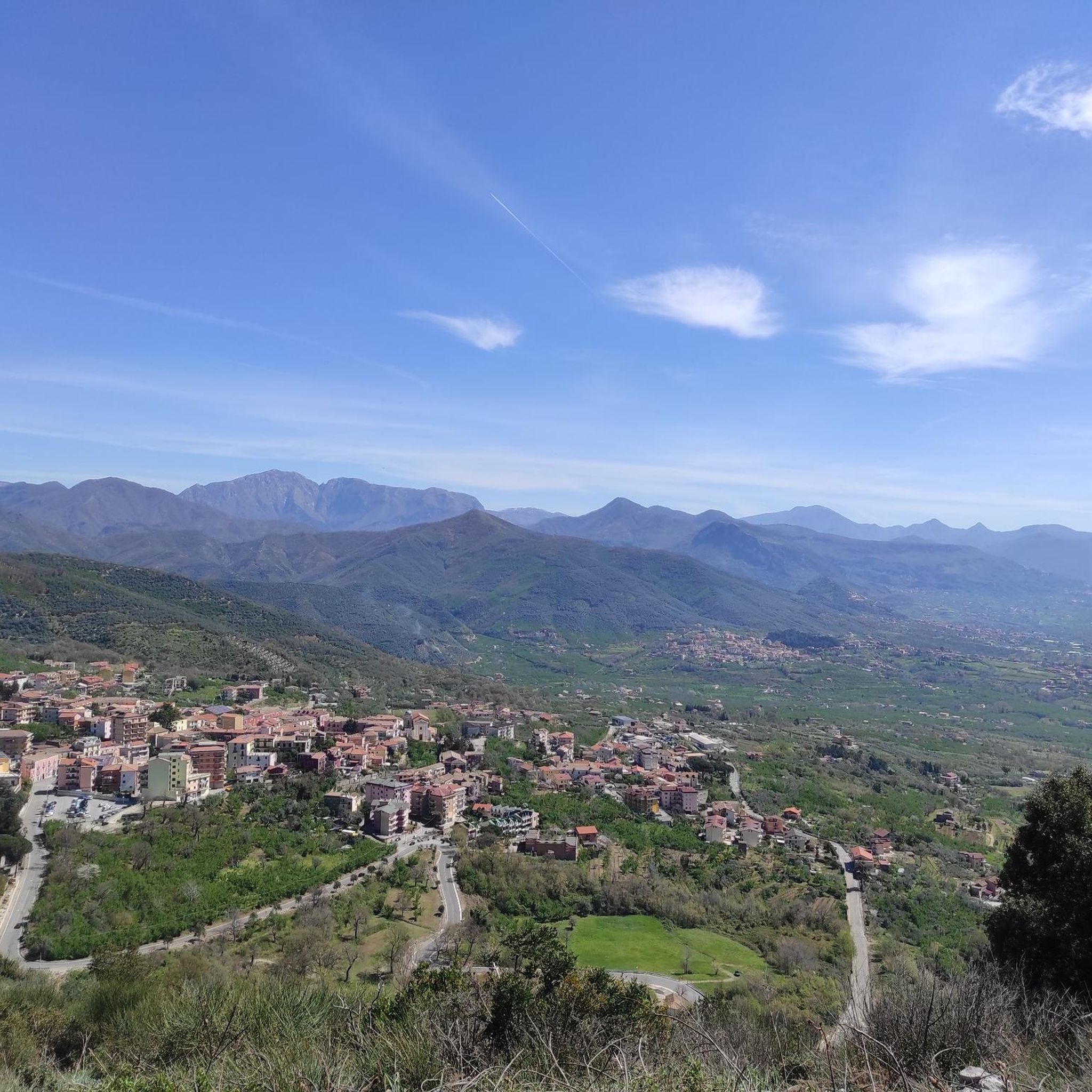
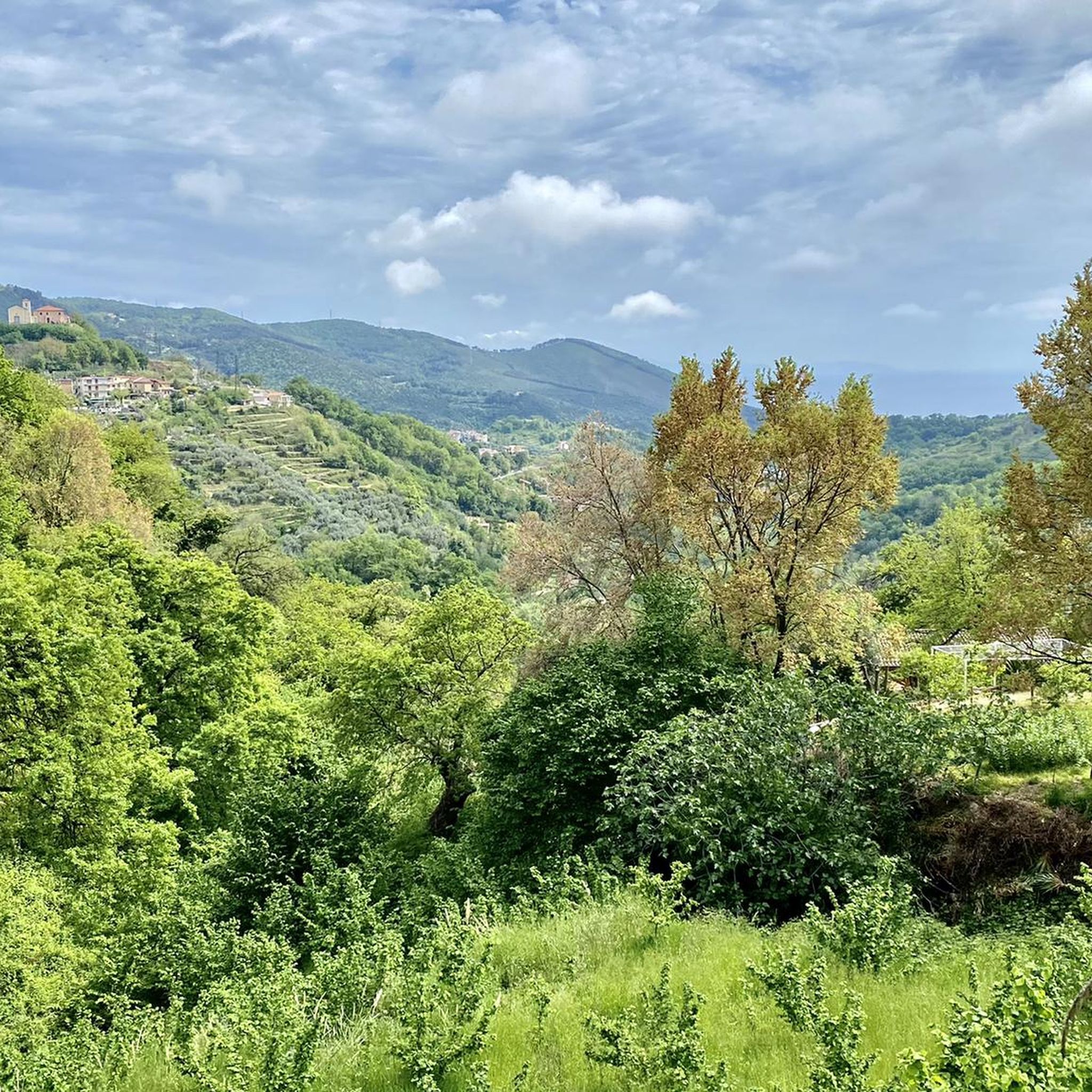
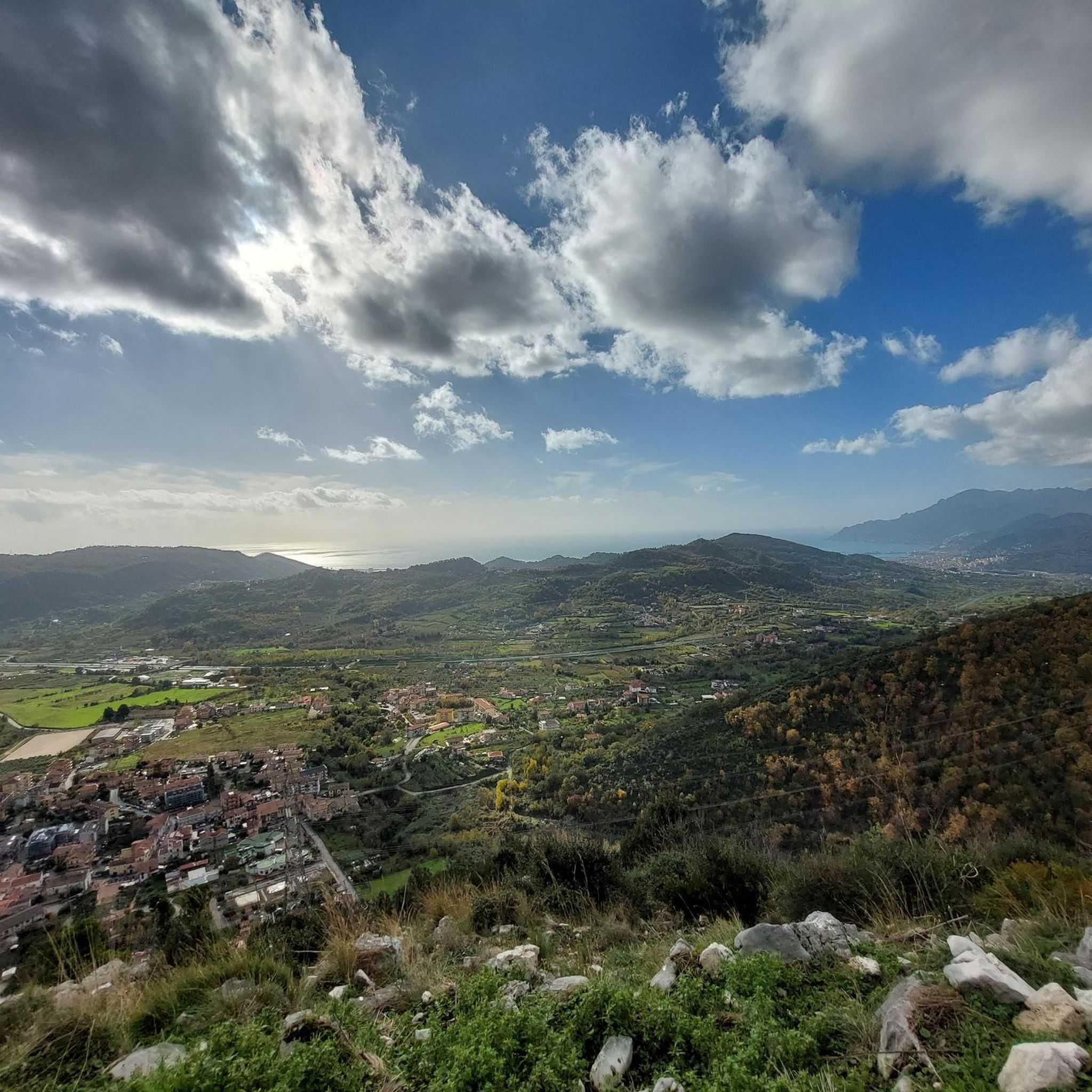
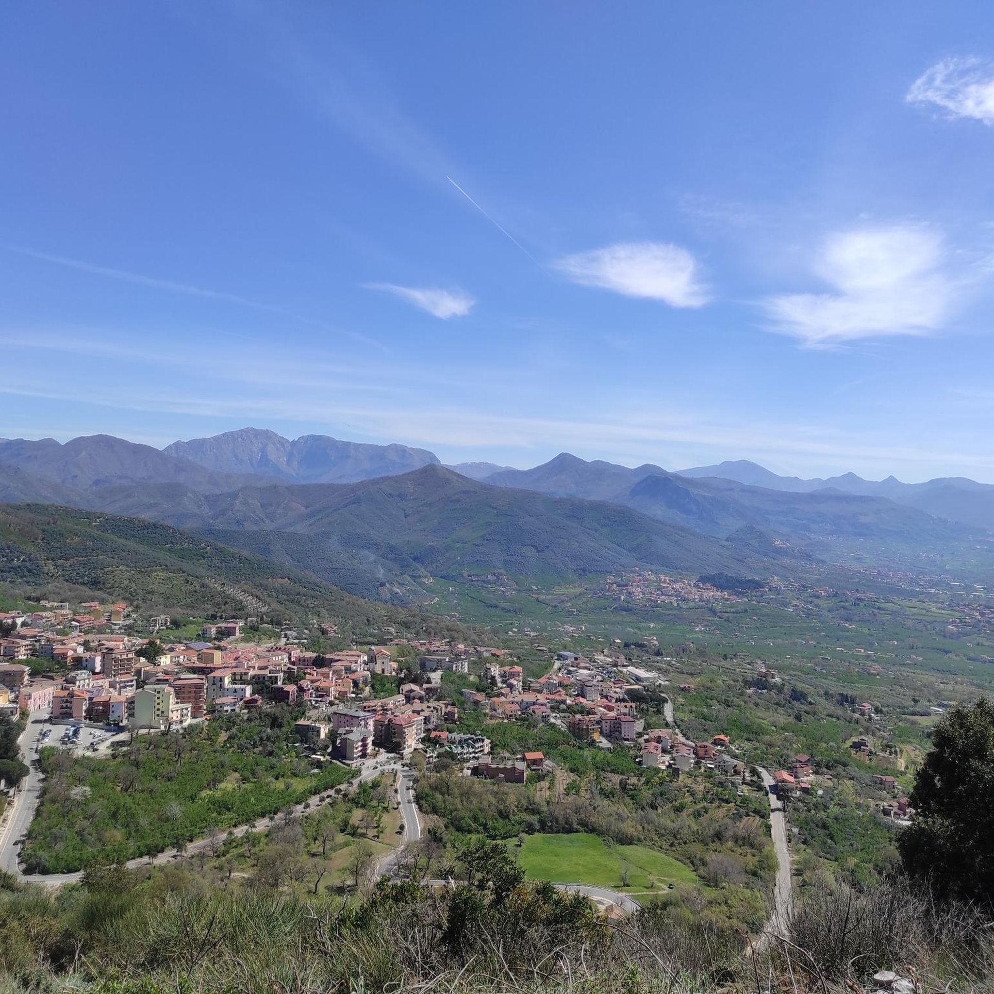
Hiking around San Cipriano Picentino offers diverse trails within the Picentini Mountains National Park, a region characterized by its mountainous terrain and panoramic vistas. The area features significant peaks like Pizzo San Michele and Monte Mai, both reaching over 1,600 meters, providing extensive views of Campania, including the Gulf of Salerno and Mount Vesuvius. The landscape includes varied natural trails, from easy loops through forests and streams to more challenging routes for experienced trekkers. This combination of mountain peaks, national park access, and varied natural features makes it a notable destination for outdoor activities.
Best hiking trails around San Cipriano Picentino
- The most popular hiking route is Monte Tubenna e Monte Visciglieta – loop tour in the Parco dei Monti Piacentini, a 2.3 miles (3.8 km) trail that takes 1 hour 15 minutes to complete. This easy loop explores the natural environment of the Picentini Mountains National Park.
- Another top favourite among local hikers is F1, F2, and F3 Trails Loop, an easy 3.7 miles (6.0 km) path. This route connects multiple trails, offering varied scenery within the local area.
- Local hikers also love the Salerno pedestrian zone – Salerno War Memorial loop from Arbostella, an 8.2 miles (13.3 km) trail leading through urban and coastal areas, often completed in about 3 hours 25 minutes.
- Hiking around San Cipriano Picentino is defined by mountain peaks, panoramic views, and diverse natural trails. The network offers options for different ability levels, from gentle forest walks to more demanding ascents.
- The routes in San Cipriano Picentino are highly rated by the komoot community with an average score of 4.3 stars from over 390 reviews. More than 2200 hikers have used komoot to explore San Cipriano Picentino's varied terrain.
Last updated: May 12, 2026
4.2
(18)
43
hikers
Easy hike. Great for any fitness level. Easily-accessible paths. Suitable for all skill levels.
4.0
(1)
10
hikers
5.98km
01:54
250m
250m
Easy hike. Great for any fitness level. Easily-accessible paths. Suitable for all skill levels.

Sign up for free
4.5
(11)
34
hikers
Moderate hike. Good fitness required. Easily-accessible paths. Suitable for all skill levels.
3.7
(3)
29
hikers
2.78km
00:54
120m
120m
Easy hike. Great for any fitness level. Easily-accessible paths. Suitable for all skill levels.
4.4
(7)
16
hikers
Easy hike. Great for any fitness level. Easily-accessible paths. Suitable for all skill levels.
Get access to more routes and recommendations from other explorers.
Sign up for free
Already have an account?
Our route recommendations are based on thousands of hikes, rides, and runs completed by other people on komoot.
Start today with a free account
Your next adventure awaits.
Login or Signup
Tips from the Community

Once you reach it, you're halfway up the climb!
0
0
easy ascent path to Montestella
0
0
picnic area adjacent to the church
0
0
Protected place surrounded by nature, suitable for everyone. Great place to spend Sunday at the picnic area, and to walk on the educational trails!
0
0

On the top of the mountain, resting on a rock spur, there is a small church dedicated to the Madonna Queen of Monte Stella.
0
0

Parking (Frassineto Naturalistic Oasis)
2
0
The naturalistic area of Frassineto is a forest of approximately 82 hectares, mainly composed of tall trees, such as ash trees (from which it takes its name) but you will also find beech and chestnut trees. The area extends between the territories of Calvanico and Fisciano, in the province of Salerno, which is only 15 km away. We are within the protected area of the Monti Picentini Regional Park, about 700 meters above sea level. https://napoli.viaggiapiccoli.com/oasi-naturalistica-frassineto-con-i-bambini/
2
0
Here begins the path consisting of a series of small bends that lead to the hermitage and its cross. Trekking clothing, sturdy shoes and good physical preparation are recommended.
3
0
Frequently Asked Questions
How many hiking trails are available around San Cipriano Picentino?
There are over 90 hiking trails in the San Cipriano Picentino area, offering a wide range of options from easy walks to more challenging ascents within the Picentini Mountains National Park.
What types of trails can I expect in San Cipriano Picentino?
The region offers a diverse network of trails, including easy loops through forests and streams, such as the Monte Tubenna e Monte Visciglieta loop, and more demanding routes that lead to panoramic mountain summits. You'll find a mix of easy, moderate, and difficult paths suitable for various experience levels.
Are there any family-friendly hiking options in the area?
Yes, San Cipriano Picentino has numerous easy trails suitable for families. The Frassineto Nature Oasis, mentioned in the region research, offers gentle loops through forests and streams. An example of an easy route is the Frassineto Nature Area – Frassineto Chapel loop from Calvanico, which is just over 3 km long.
Can I bring my dog on the hiking trails in the Picentini Mountains National Park?
Regulations regarding dogs in the Picentini Mountains National Park can vary. Generally, dogs are permitted on trails but should be kept on a leash to protect wildlife and ensure the safety of other hikers. It's always advisable to check specific park guidelines or local signage before heading out.
What are the best trails for panoramic views?
For breathtaking panoramic views, consider trails leading to the major peaks. Both Pizzo San Michele and Monte Mai, at 1,607 meters, offer spectacular vistas overlooking Campania, including the Gulf of Salerno, the Lattari mountains, the Gulf of Naples, and even Mount Vesuvius on clear days. While specific komoot routes to these exact summits aren't listed here, many challenging trails in the park will offer similar rewards.
Are there any circular hiking routes available?
Yes, there are several circular routes. For instance, the Monte Tubenna e Monte Visciglieta loop tour is an easy circular path within the Parco dei Monti Picentini. Another option is the F1, F2, and F3 Trails Loop, which connects multiple trails for a varied circular experience.
What interesting landmarks or attractions can I see near the hiking trails?
Beyond the natural beauty, you can explore historical sites and viewpoints. For example, you might find trails leading to or near the Castello di Arechi, which offers a magnificent view of Salerno and its Gulf. There are also various huts and shelters, like the Calvanico Mill, that can be points of interest along your hike.
What do other hikers enjoy most about San Cipriano Picentino?
The area is highly rated by the komoot community, with an average score of 4.3 stars from nearly 400 reviews. Hikers often praise the diverse terrain, from gentle forest walks to challenging mountain ascents, and the rewarding panoramic views of the Campania region, including the coast and Mount Vesuvius.
Are there any challenging or advanced hiking routes?
Yes, for experienced trekkers, the region offers challenging routes, particularly those ascending the higher peaks of the Picentini Mountains. The Monte Stella Cross – "Spaccacuore" equipped area loop is a moderate route with significant elevation gain, providing a good challenge and rewarding views.
Is public transport available to reach the hiking trails?
While San Cipriano Picentino is a hill town, public transport options to directly access trailheads within the Picentini Mountains National Park might be limited. It's generally recommended to check local bus schedules or consider driving to reach more remote starting points. Some routes, like the Salerno pedestrian zone – Salerno War Memorial loop, are more accessible from urban centers like Salerno.
What is the best season for hiking in San Cipriano Picentino?
The best seasons for hiking are typically spring and autumn when the weather is mild and the landscapes are vibrant. Spring brings blooming flora, while autumn offers pleasant temperatures and colorful foliage. Summer can be hot, especially at lower elevations, but higher mountain trails might offer cooler conditions. Winter hiking is possible but requires appropriate gear due to potential snow and ice at higher altitudes.
Are there any trails that offer a mix of mountain and coastal views?
Absolutely. Due to San Cipriano Picentino's strategic location, many higher elevation trails provide unique opportunities to combine mountain trekking with stunning coastal and volcanic scenery. From peaks like Monte Mai, you can marvel at sweeping views that include the Gulf of Salerno, the Lattari mountains, the Gulf of Naples, and even Mount Vesuvius.
Most popular routes around San Cipriano Picentino
Most popular attractions around San Cipriano Picentino

Get inspired with the komoot mobile app


Explore more
Browse the best Hikes in other regions.
