Top 20 Mountain Passes around Posina
Best mountain passes around Posina are situated in the Prealps of Vicenza, offering access to the Pasubio massif. This region features a network of passes known for their historical significance and diverse routes. The area connects various valleys and mountain ranges, providing a range of experiences for outdoor activities.
Best mountain passes around Posina
- The most popular mountain passes is General Achille Papa Refuge, a hut located at 1928 meters at the Porte del Pasubio. It was built after…
Last updated: August 6, 2026
General Achille Papa Refuge
Highlight • Mountain Hut
Translated by Google •
Tip by

The Scarubbi Road
Highlight (Segment) • Trail
La strada degli Scarubbi è una strada carrabile del massiccio del Pasubio, nelle Prealpi vicentine, costruita durante la Prima guerra mondiale. Lunga 10,5 chilometri, parte dal Passo …
Tip by

Sign up now to discover places like this
Get recommendations on the best single tracks, peaks, & plenty of other exciting outdoor places.
Sign up for free
Heroes' Road
Highlight (Segment) • Trail
Translated by Google •
Tip by
Xomo Pass
Highlight • Mountain Pass
Translated by Google •
Tip by
Pian delle Fugazze
Highlight • Mountain Pass
Translated by Google •
Tip by

Sign up for free to discover even more mountain passes around Posina.
Sign up for free
Already have an account?
Start today with a free account
Your next adventure awaits.
Login or Signup

Tips from the Community

starting and finishing point of many routes
0
0

Starting point for the tour Rifugio Papa
0
0

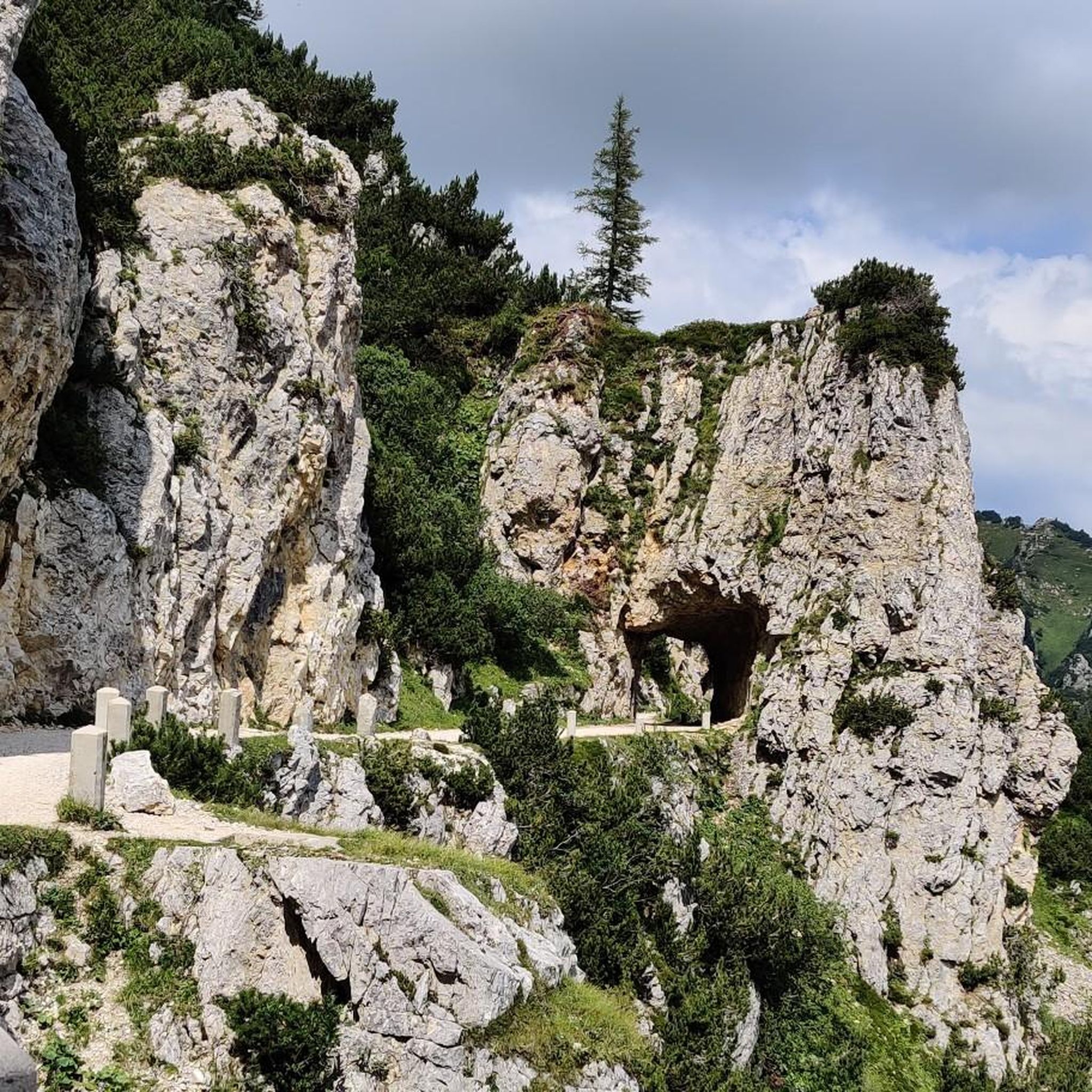
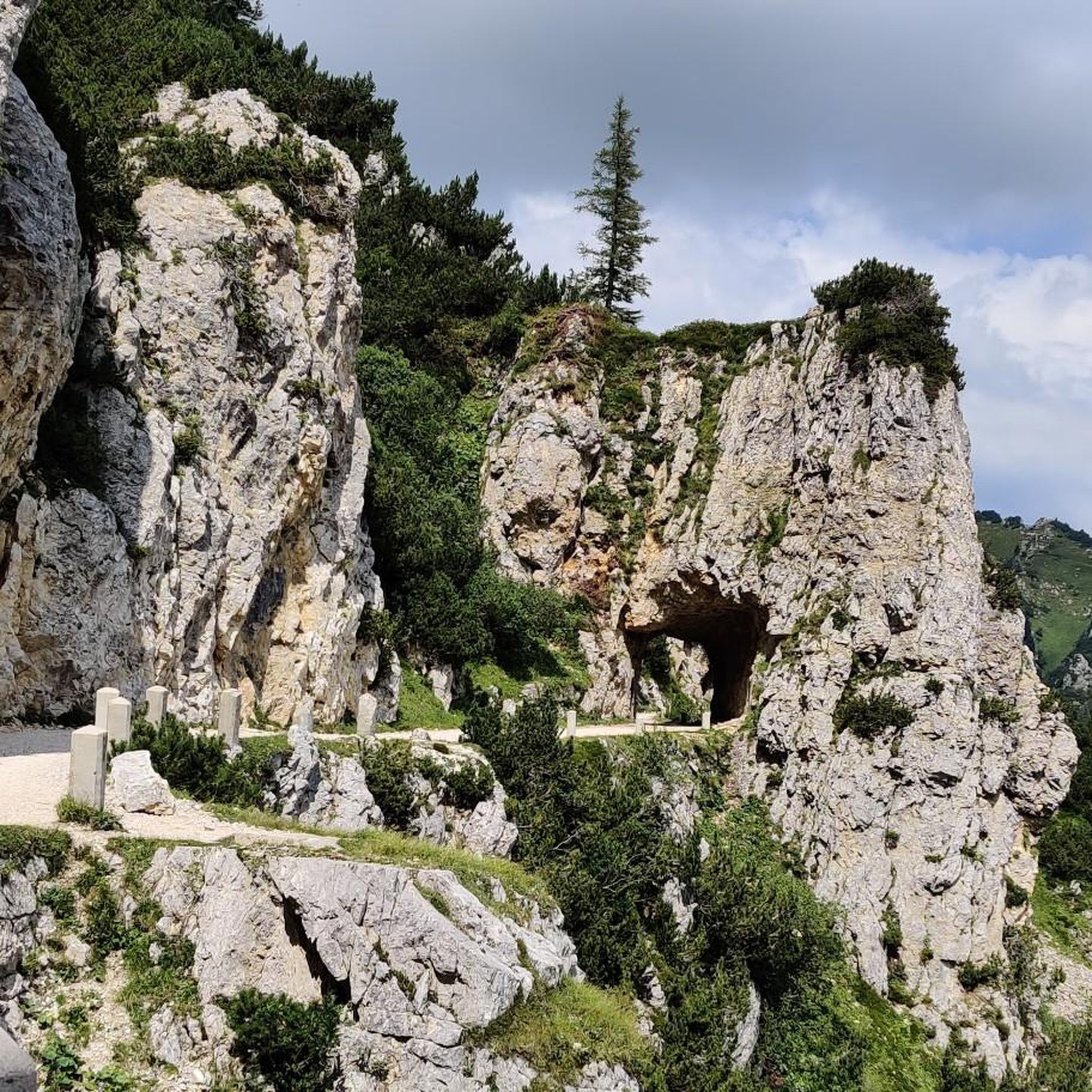
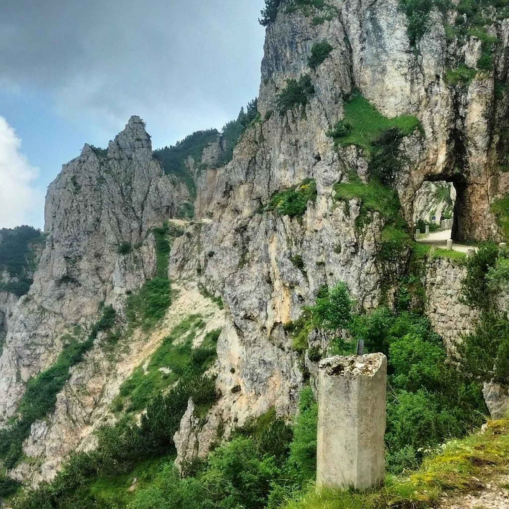
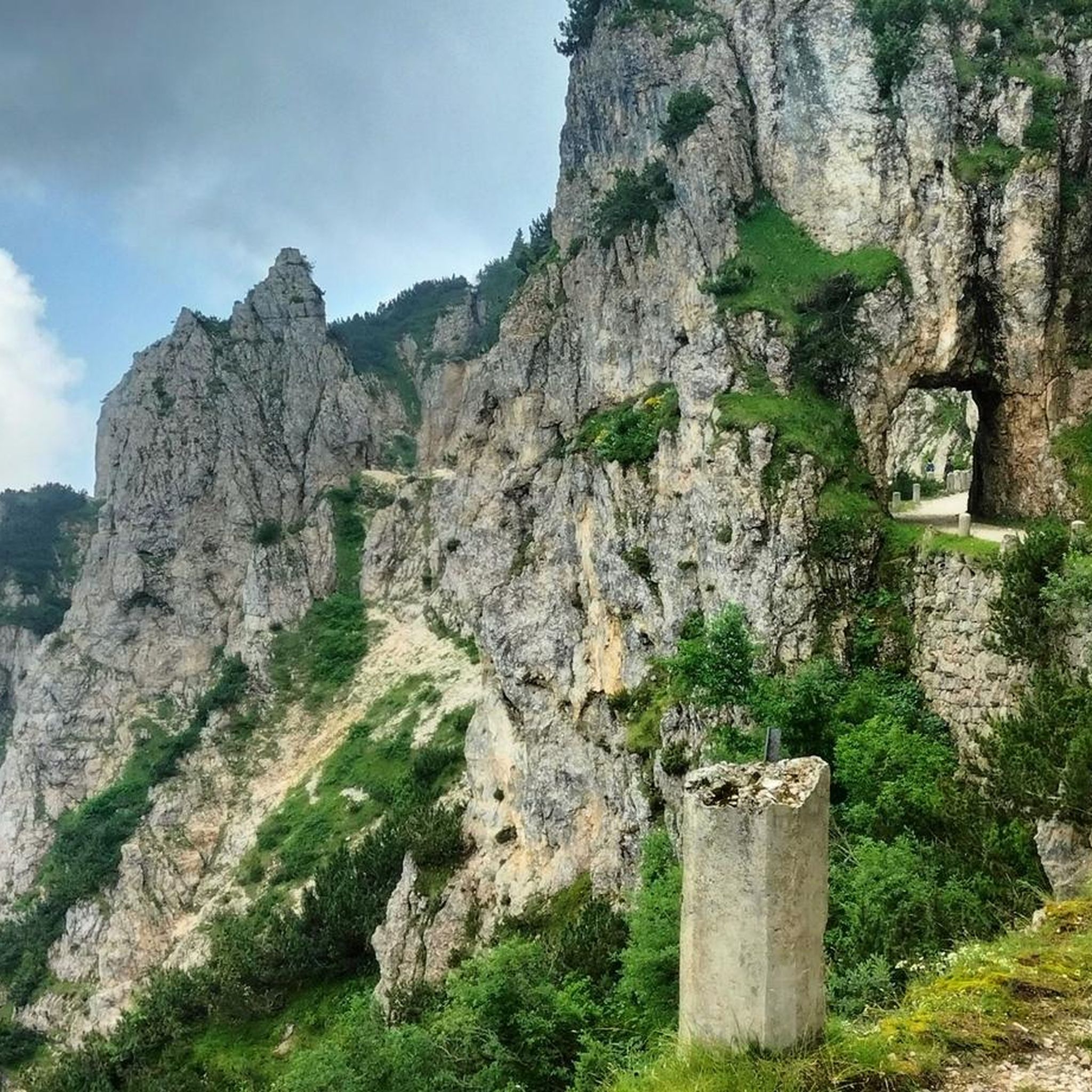
Road to the Rifugio Achille Papa. This is where you walk down if you're doing a circular hike with the 52 tunnels.
6
1
The first plans for the construction of a refuge on Pasubio date back to 1907. However, they were not realized until after the First World War, when the Schio section of the CAI began to build a refuge in memory of the soldiers who had fallen on Pasubio. Source: https://de.m.wikipedia.org/wiki/Rifugio_Achille_Papa
7
0

Great hub for road, gravel or MTB rides.
0
0
Excellent joint for various road, gravel or MTB rides.
0
0

Simple route in terms of terrain type, with a spectacular view.
2
0

Named after General Achille Papa, Gold Medal for military valor who died during the First World War in 1917, the refuge is located at the saddle of the Porte del Pasubio, at 1,928 meters above sea level, on the massif of the same name. Today the Papa refuge is owned by the CAI of Schio and boasts around sixty beds.
2
1
Frequently Asked Questions
What makes the mountain passes around Posina unique?
The mountain passes around Posina, nestled in the Prealps of Vicenza, are unique for their blend of historical significance, challenging routes, and stunning natural beauty. They serve as gateways to the larger Pasubio massif and offer diverse experiences for hikers, cyclists, and history enthusiasts, with many trails revealing vestiges of World War I.
What historical significance do the mountain passes near Posina hold?
Many passes in the region, such as The Scarubbi Road, were built during World War I by the Italian Army for strategic access to the front lines. Passo della Borcola also served as a political border for centuries and features numerous trails with trenches, tunnels, and artillery positions from the war. These areas are rich with stories and remnants of a significant past.
What outdoor activities can I do near these mountain passes?
The mountain passes around Posina offer a variety of outdoor activities. You can find numerous routes for mountain hiking, cycling, and gravel biking. Many trails lead to historical sites, viewpoints, and refuges like the General Achille Papa Refuge.
What can I expect when visiting Passo Xomo?
Passo Xomo is a crucial alpine pass connecting Val Leogra and Val di Posina. It's primarily known as a strategic starting point for excursions into the Pasubio area, particularly for accessing the renowned Strada degli Scarubbi and the Strada delle 52 Gallerie. The pass is accessible by car and features a refuge, making it a convenient base for exploring the surrounding mountains.
What is special about Passo della Borcola?
Passo della Borcola marks the natural eastern boundary of the Pasubio massif and is rich in history, having been a political border for centuries. Today, it's a 'place of welcome and remembrance' with trails revealing World War I vestiges. Visitors can also enjoy traditional Trentino cuisine at Malga Borcola and visit a small Alpine church. The ascent from Posina is a steep and winding route, popular with motorcyclists for its picturesque landscapes. You can learn more about its history here.
What are the main features of Pian delle Fugazze?
Pian delle Fugazze is an alpine pass situated on the border between the provinces of Vicenza and Trento. It separates the Sengio Alto chain from the Pasubio massif, connecting the Leogra and Vallarsa valleys. It's a popular starting point for excursions into the Pasubio, including routes like the Strada degli Eroi, and is part of the wider European E5 path and the Sentiero della Pace (Peace Path), offering extensive trekking opportunities.
Is the Strada degli Scarubbi a mountain pass, and what is its significance?
The Strada degli Scarubbi is not a mountain pass itself, but a historic 10.5-kilometer carriage road connecting Passo Xomo to Porte del Pasubio. Built during World War I, it offers breathtaking views and a challenging route. While generally closed to private vehicles, it's highly popular among mountain bikers and serves as a common descent route for hikers. Its historical context and scenic terrain make it a significant attraction.
Are there family-friendly options among the mountain passes?
Yes, some areas around the mountain passes offer family-friendly options. For instance, the General Achille Papa Refuge is categorized as family-friendly, providing accommodation and a place to rest after exploring. While many routes can be challenging, starting points like Passo Xomo offer facilities that can make a visit more comfortable for families.
What kind of terrain can I expect at Camonda Pass?
Camonda Pass features an initial asphalt climb, with paths diverging into various routes that lead towards towns like Manfron di Sopra, Torrebelvicino, and Schio. This pass is a highlight for those who enjoy mixed-terrain cycling and hiking, offering a blend of paved and unpaved sections.
What are the parking facilities like at the mountain passes?
Parking facilities are available at key mountain passes. For example, Passo Xomo offers parking and is not locked for car traffic, making it an ideal starting point. Pian delle Fugazze also has facilities, though it's a popular motorcycle route, so parking might be busier during peak times.
Is public transport available to reach the mountain passes?
While specific public transport routes directly to all mountain passes might be limited, major passes like Passo Xomo, Passo della Borcola, and Pian delle Fugazze are generally accessible by road. It's advisable to check local bus schedules or consider driving to reach these starting points, as public transport options can vary and might require transfers.
What is the best time to visit the mountain passes around Posina?
The best time to visit the mountain passes around Posina is generally from late spring to early autumn (May to October). During these months, the weather is more favorable for hiking and cycling, and trails are typically free of snow. However, after heavy spring rains, routes like the Strada degli Scarubbi can be prone to landslides, so checking local conditions is always recommended.
Are there any refuges or places to eat near the mountain passes?
Yes, there are several refuges and places to eat. The General Achille Papa Refuge at Porte del Pasubio offers accommodation and meals. At Passo della Borcola, you can stop at Malga Borcola for traditional Trentino cuisine. Passo Xomo also has places to eat, known for local specialties like Sopressa sandwiches. Pian delle Fugazze also features cafes and restaurants.
Most popular routes around Posina
Most popular attractions around Posina

Get inspired with the komoot mobile app


Explore more
See even more epic mountain passes by checking out these guides around Posina:
