The best MTB trails around Lozio
4.5
(591)
3,909
riders
162
rides
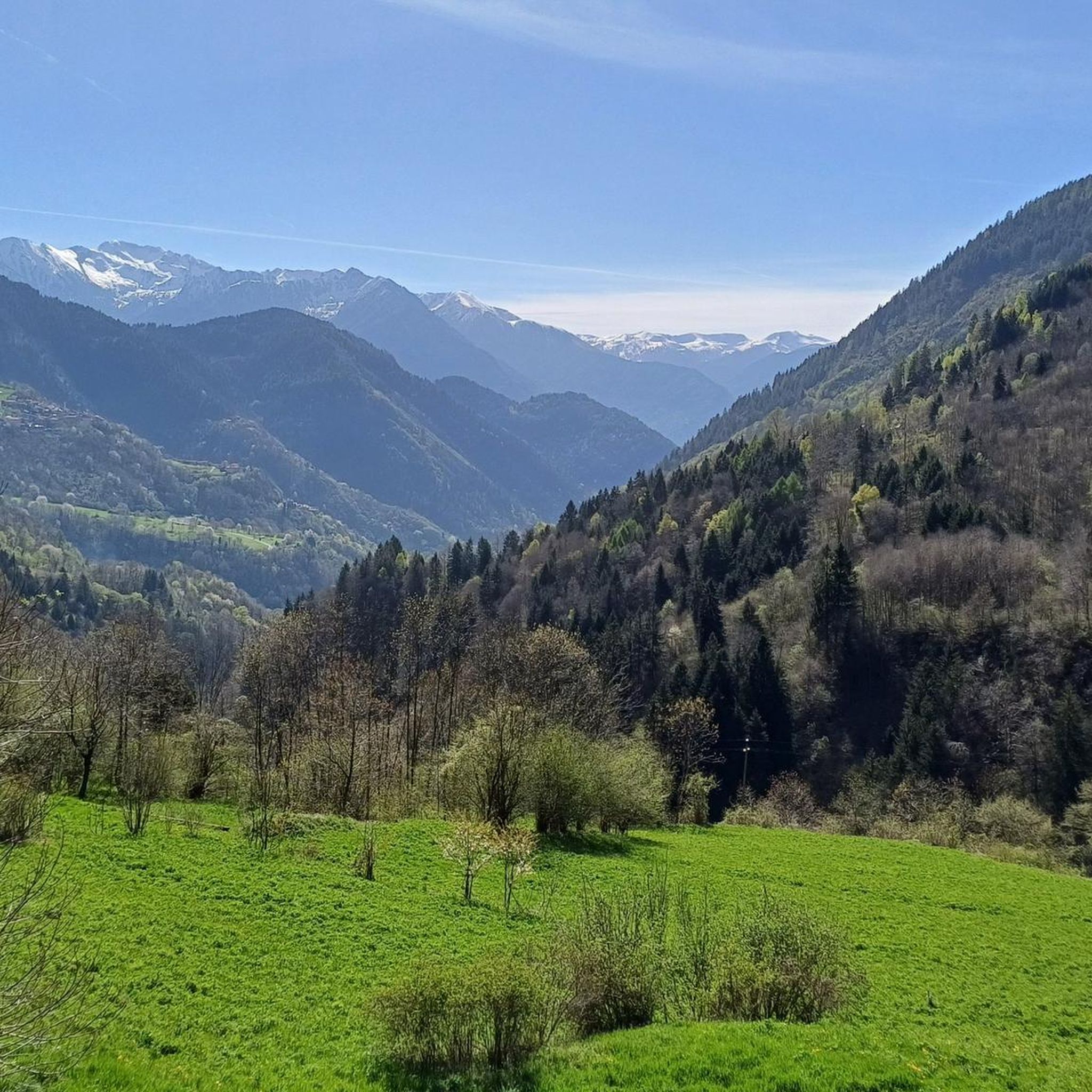
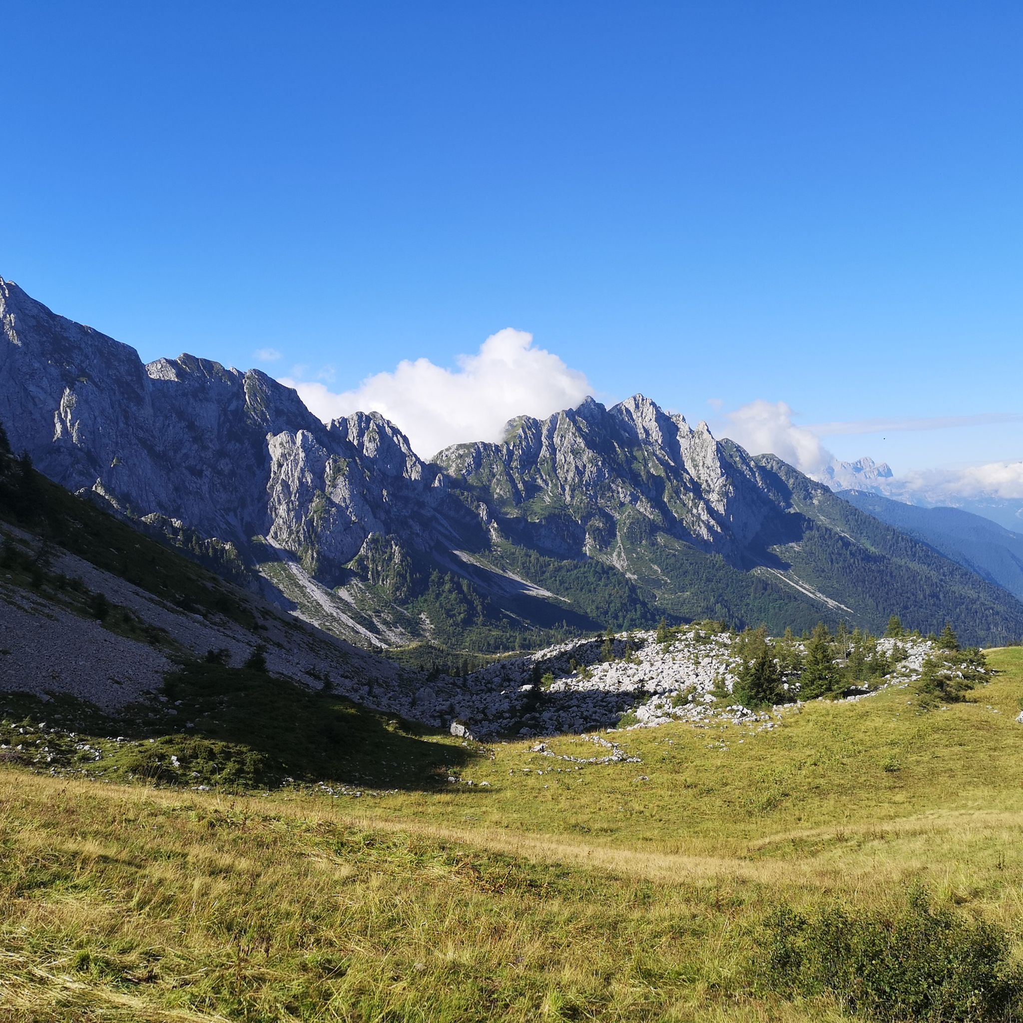
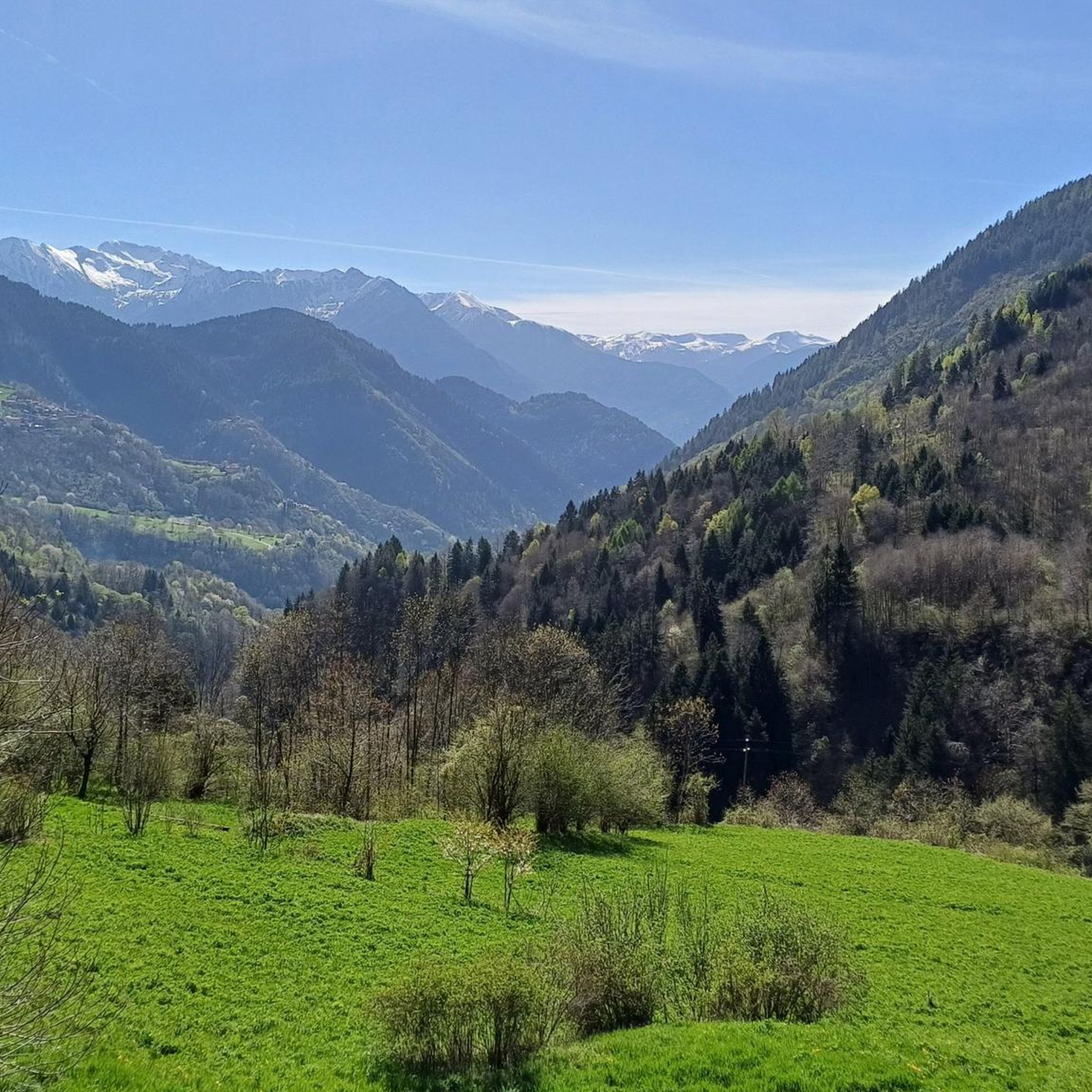
Mountain biking around Lozio features a landscape characterized by deep valleys, mountain passes, and extensive gravel roads, providing varied terrain for cyclists. The region includes significant elevation changes, with routes traversing areas like Mount Mignone and offering views of Lake Lova. Riders can expect a mix of challenging climbs and scenic descents through forested areas and open mountain environments. This area provides a robust network of mountain bike trails suitable for different skill levels.
Best mountain bike trails around Lozio
…Last updated: August 2, 2026
4.2
(32)
196
riders
54.9km
03:11
320m
320m
Moderate mountain bike ride. Good fitness required. Suitable for all skill levels.
154
riders
34.8km
03:45
1,250m
1,250m
Hard mountain bike ride. Very good fitness required. Advanced riding skills necessary.

Sign up for free
4.4
(16)
55
riders
41.9km
04:16
1,710m
1,710m
Hard mountain bike ride. Very good fitness required. Suitable for all skill levels.
4.9
(7)
38
riders
41.1km
03:44
1,200m
1,200m
Hard mountain bike ride. Very good fitness required. Advanced riding skills necessary. Some portions of the route may require you to push your bike.
4.8
(5)
39
riders
43.6km
04:02
1,230m
1,230m
Hard mountain bike ride. Very good fitness required. Advanced riding skills necessary.
Get access to more routes and recommendations from other explorers.
Sign up for free
Already have an account?
Our route recommendations are based on thousands of hikes, rides, and runs completed by other people on komoot.
Start today with a free account
Your next adventure awaits.
Login or Signup


Tips from the Community

The Ciclovia dell'Oglio is an excellent cycle touring route of 282 kilometers that entirely follows the course of the Oglio river, connecting the mountains of Lombardy to the Po Valley. Considered the "most beautiful cycle path in Italy" (title received at the Italian Green Road Award 2019), it has a total negative elevation difference of almost 1,862 meters, starting from 1,883 meters at the Passo del Tonale to reach 21 meters of the Po at San Matteo delle Chiaviche. The route is 80% asphalt and 20% compact dirt road and is ideal for gravel, trekking, or e-bikes.
0
0

The Malga di Val Sorda is not a "classic" alpine pasture hut with grazing activities, but a hiking landmark located in the large meadow of Val Sorda, along the paths that lead from Croce di Salven towards Pratolungo, Malga Guccione, and finally Monte Altissimo. Online information describes it as part of the valley's pasture and pool system, crossed by CAI trails 186 and 187. 📍 Location The hut is located in the central pasture of Val Sorda, reached after about 1h10 of walking from Croce di Salven along trail 186. It is a junction point between: trail 186 (towards Pratolungo and Altissimo) trail 187 (steeper, climbs towards the Val Sorda refuge/structure)
0
0
The Church of San Fiorino is one of Borno's small historical wonders, and thanks to the sources I consulted, I can give you an accurate, complete, and up-to-date overview. 🕍 Identity and location It is a subsidiary church dedicated to San Fiorino / San Floriano, the Roman legionary invoked against fires and floods. It stands northwest of Borno, along the road leading to Lake Lova, in a very quiet grassy and wooded area. 📜 Origins and history The sources agree on a long and layered history: 11th–13th century: first documented construction phases. 1410: appears in the list of ancient Camun churches subject to contribution to the Bishop of Brescia. 1456: a papal bull establishes the curatial benefit of S. Florini. 1532: cited in the Queriniano Catalogue of ecclesiastical benefices. 1567–1573: recorded in pastoral visits as a country church. Archaeological findings During restorations and excavations, artifacts have emerged that suggest the presence of an ancient Roman place of worship: a fragment of an altar dedicated to Mercury, with a Latin inscription; a Roman burial with the mark "LLAESEC"; stone elements with grooves typical of ancient thresholds. These findings strengthen the hypothesis that the church was built on a previous pagan temple. 🏛️ Architecture The church is simple and harmonious, typical of Camun rural chapels: Single nave with two bays. Rectangular presbytery with a barrel vault. Mixed masonry bell tower. Sober facade, with an off-center stone portal and traces of frescoes. Inside, you can find: 16th-century frescoes (partially mutilated), a 15th-century fresco with San Fiorino in the guise of a legionary, architectural elements from different eras. 🔧 Restorations The church, deteriorated by time, was restored in 1978 thanks to Don Costantino Ravelli.
0
0
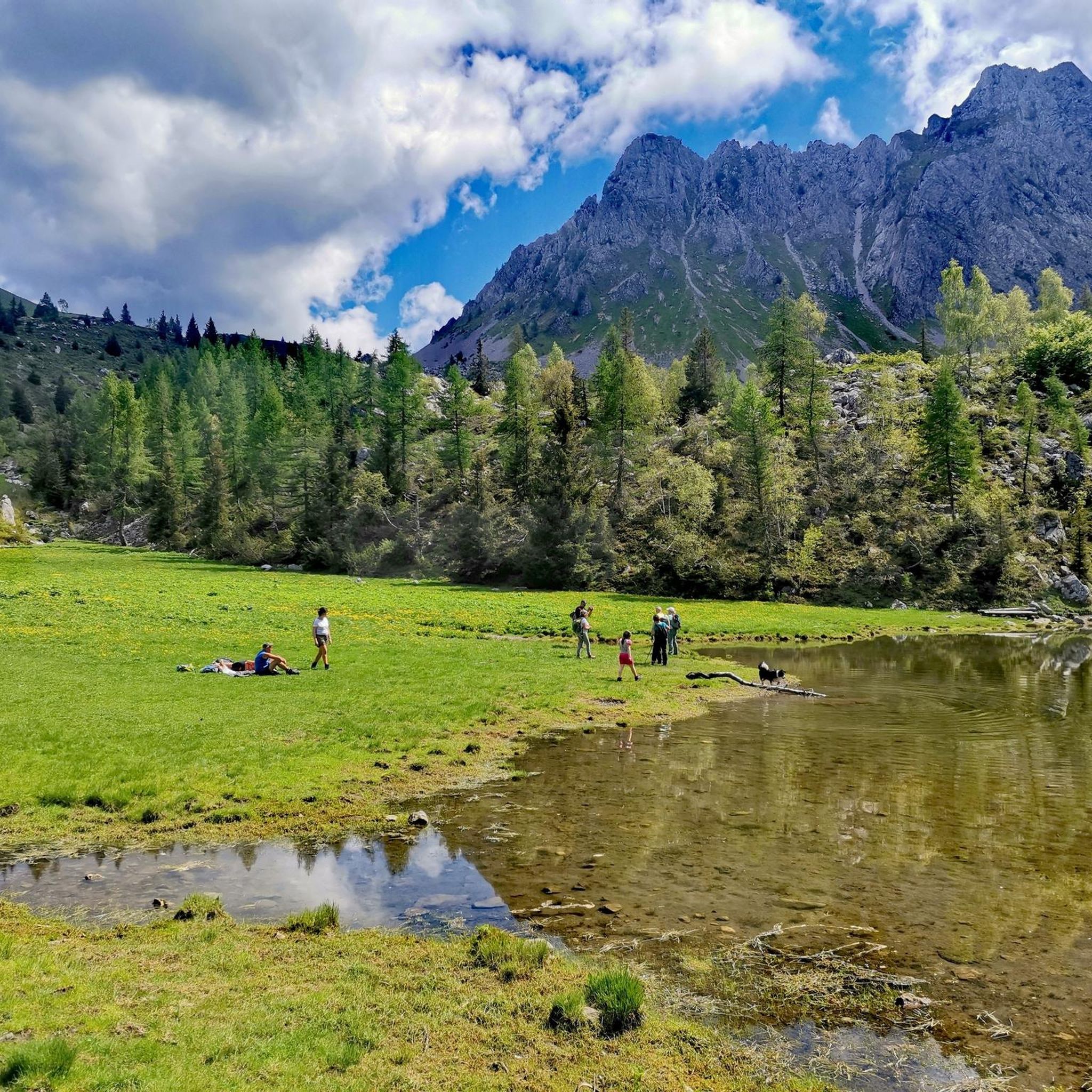
🏞️ Lago di Lova — Borno (Valle Camonica) 📌 Identity and characteristics Lago di Lova is a small alpine lake located at about 1300 m altitude, in a glacial basin between: Pizzo Camino (2491 m) Monte Mignone (1742 m) It is fed by two small streams and flows downstream, forming the San Fiorino stream. The environment is typical of the Lombard Prealps: red fir woods on the south side, wide pasture on the north side, luminous and very tranquil atmosphere. 🚶♂️ How to get there From Borno – Navertino (the most classic) Elevation gain: about 400 m Time: 1 h – 1 h 15’ Path initially asphalted up to the Trattoria Navertino, then dirt and steep in some sections. Mixed terrain: cobblestones, dirt, dense forest. From Ossimo Superiore Steep mule track up to Baleggie, then a flat traverse towards the lake. From Villa (Lozio) Ascent to Colle del Mignone (1526 m) and descent towards the lake. All itineraries are for pedestrians or MTB only: motorized vehicles are prohibited. 🏡 Services and atmosphere At the lake, you'll find Chalet Lova, highly appreciated for its sandwiches and typical dishes, with outdoor tables and a picnic area. The place is ideal for: families, hikers, photographers, scenic breaks before heading up towards Mignone or Varicla. 🔗 Hiking connections Lago di Lova is a central hub for several CAI itineraries: Colle Mignone → Monte Mignone → loops towards Agol, Averta, Varicla Rifugio Laeng (via 110/182) Malga Mignone (steep but direct ascent) Rifugio San Fermo (upper part of CAI 82) ⭐ Why it's special It is one of the most iconic and accessible places on the plateau. It offers a perfect mix of forest, water, and pastures. It is a starting point for more challenging itineraries but also an ideal destination for a short trip. It has a serene and bright atmosphere, much loved by families and photographers.
1
0
🐄 Malga Mignone — Borno (Valle Camonica) 📍 Location Malga Mignone is located above Lago di Lova, along the ridge that climbs towards: Colle Mignone, Monte Mignone, the junction for Rifugio Laeng, the panoramic trail towards Rifugio San Fermo. It is an important hub between trails 103, 104, 109, 110, 182 and the upper section of CAI 82. 🏞️ Environment The mountain hut is located in an area: grassy and open, with a view of Lago di Lova and the peaks of the Camino group, surrounded by huts and summer pastures. It is a perfect place for an intermediate break before climbing towards Varicla or towards the San Fermo ridge. 🚶♂️ How to get there From Borno – Navertino → Lago di Lova The most common route: Departure from Navertino. Climb through the woods to Lago di Lova (trail 109). Skirt the lake. Take the trail that climbs towards the hut: steep, suitable for hikers accustomed to elevation gain. From Lago di Lova → Colle Mignone → Malga Mignone Climb on steep grassy slopes, but with an intuitive direction. Possible loop with return on dirt roads. 🔗 Main connections From Malga Mignone, trails depart or pass towards: Rifugio Laeng (via trails 110 and 182) Rifugio San Fermo (continuing left, section not always marked) Monte Mignone (1743 m) Colle Mignone (1535 m), a crossroads of various itineraries ⭐ Why it's an important point It is the crossroads of almost all itineraries in the Lova–Varicla area. It offers wide views and a very bright environment. It is an excellent point for medium-difficulty hiking loops. It allows you to modulate the trip: more challenging climbs (Mignone, Arano, Laeng) or gentler ones (return to Lova).
0
0
The Church of San Fiorino is one of the small historical and spiritual pearls of the Borno plateau (Valle Camonica): a simple, intimate building, but layered with history, ancient cults, and surprising discoveries. 🕍 Identity and location The small church stands north of the inhabited area of Borno, along the road leading to Lova, in a grassy and silent area, slightly set back from the village. It is a subsidiary church dedicated to San Fiorino / San Floriano, a figure venerated as a protector against fires and floods. 📜 Origins and history The first attestations date back to the 15th century, but tradition and archaeological findings suggest an even older origin. Key points of its history: 1456: A bull of Callixtus III mentions the chapel of Sancti Florinj among the Camunican churches subject to contribution. 1532: It appears in the Queriniano Catalogue of ecclesiastical benefices. 16th century: It is registered in pastoral visits as a country church. Around 1650: Extensions and renovations that give it its current appearance. 1978–1980: Modern restorations that bring to light frescoes and Roman artifacts. 🏛️ Architecture The church is simple and harmonious, typical of Camunican rural chapels: Single nave with two bays. Rectangular presbytery with a barrel vault. Mixed masonry bell gable. Sober facade, with a decentered stone portal and traces of ancient frescoes. Inside, you can find: 16th-century frescoes, partly mutilated; a 15th-century fresco depicting San Fiorino as a Roman legionary; architectural elements from different eras. 🏺 Archaeological finds During the 1980 restorations, artifacts emerged that suggest the presence, in Roman times, of a small temple dedicated to Mercury: a fragment of a Roman altar with a dedication to Mercury; a Roman burial with the inscription “LLAESEC”; stone elements with grooves typical of ancient thresholds. These findings make the site particularly fascinating: a place where Christian worship seems to have overlapped with a previous pagan sacred site.
0
0
It is not Lake San Fiorino but Lake Lova
0
0
Frequently Asked Questions
How many mountain bike trails are available around Lozio?
There are over 150 mountain bike trails around Lozio, offering a wide range of options for different skill levels. This includes 13 easy routes, 67 moderate routes, and 79 difficult routes.
Are there any easy or beginner-friendly mountain bike trails in Lozio?
Yes, Lozio offers 13 easy mountain bike trails suitable for beginners or those looking for a more relaxed ride. A good option is the Valle Camonica Cycle Route – Oglio Cycle Path loop from Breno, which is a moderate route following a cycle path through the valley, offering a gentle introduction to the region's cycling.
What kind of terrain can I expect on mountain bike trails in Lozio?
The terrain around Lozio is characterized by deep valleys, mountain passes, and extensive gravel roads. You'll encounter significant elevation changes, with routes traversing areas like Mount Mignone, offering a mix of challenging climbs and scenic descents through forested areas and open mountain environments.
Are there any challenging mountain bike routes for experienced riders?
Absolutely. Lozio has 79 difficult mountain bike trails. For experienced riders seeking a challenge, consider the Mount Mignone – Lake Lova loop from Valle Lovareno, which features significant elevation gain and stunning views of Lake Lova. Another demanding option is the View of Val Camonica – Croce Domini Pass loop from Breno, known for its substantial climbs.
What are the best times of year for mountain biking in Lozio?
Given Lozio's mountainous terrain, the best time for mountain biking is typically from late spring through early autumn (May to October). During these months, the weather is generally more stable, and trails are free from snow, offering optimal conditions for riding.
Are there mountain bike trails that form a loop in Lozio?
Yes, many of the mountain bike trails in Lozio are designed as loops. For example, the Beautiful gravel road – Malga Valsorda loop from Castello di Lozio is a popular circular route that takes you through gravel roads and mountain terrain. Another loop option is the Beautiful gravel road – Croce di Salven Pass loop from Schilpario.
What do other mountain bikers say about the trails in Lozio?
The mountain bike trails in Lozio are highly rated by the komoot community, with an average score of 4.5 stars from over 600 reviews. Riders often praise the varied terrain, the scenic beauty of the valleys and mountain passes, and the well-maintained gravel roads.
Are there any scenic viewpoints or natural attractions along the mountain bike routes?
Yes, the routes often provide stunning views, such as those of Lake Lova from the Mount Mignone – Lake Lova loop. The region is also home to several notable mountain passes like Campelli Pass and Vivione Pass, which offer panoramic vistas. You can also find various huts and cabins, such as Campione Hut, which can serve as scenic stops.
Are there any places to eat or drink near the mountain bike trails in Lozio?
While specific cafes or pubs directly on every trail are not listed, the region has several huts and cabins, such as San Fermo Hut and Nani Tagliaferri Hut, which often offer refreshments or meals. Towns like Breno and Castello di Lozio, which serve as starting points for many routes, will also have dining options.
What are the typical trail conditions like in Lozio?
The trails in Lozio consist of a mix of cycle paths, extensive gravel roads, and mountain paths. Conditions can vary with weather, but generally, the gravel roads are well-maintained. Mountain sections can be more rugged, especially after rain. It's always advisable to check local weather forecasts before heading out.
Is Lozio suitable for family mountain biking?
While many routes involve significant elevation, the region does offer easier trails that could be suitable for families with some biking experience. The cycle path sections, like those found on the Valle Camonica Cycle Route – Oglio Cycle Path loop, are generally flatter and safer for family outings. Always check the difficulty and distance of a route to ensure it matches your family's ability.
Most popular attractions around Lozio

Get inspired with the komoot mobile app


Explore more
Browse the best MTB trails in other regions.
