The best walks and hikes around Ortona
4.6
(58)
900
hikers
16
hikes
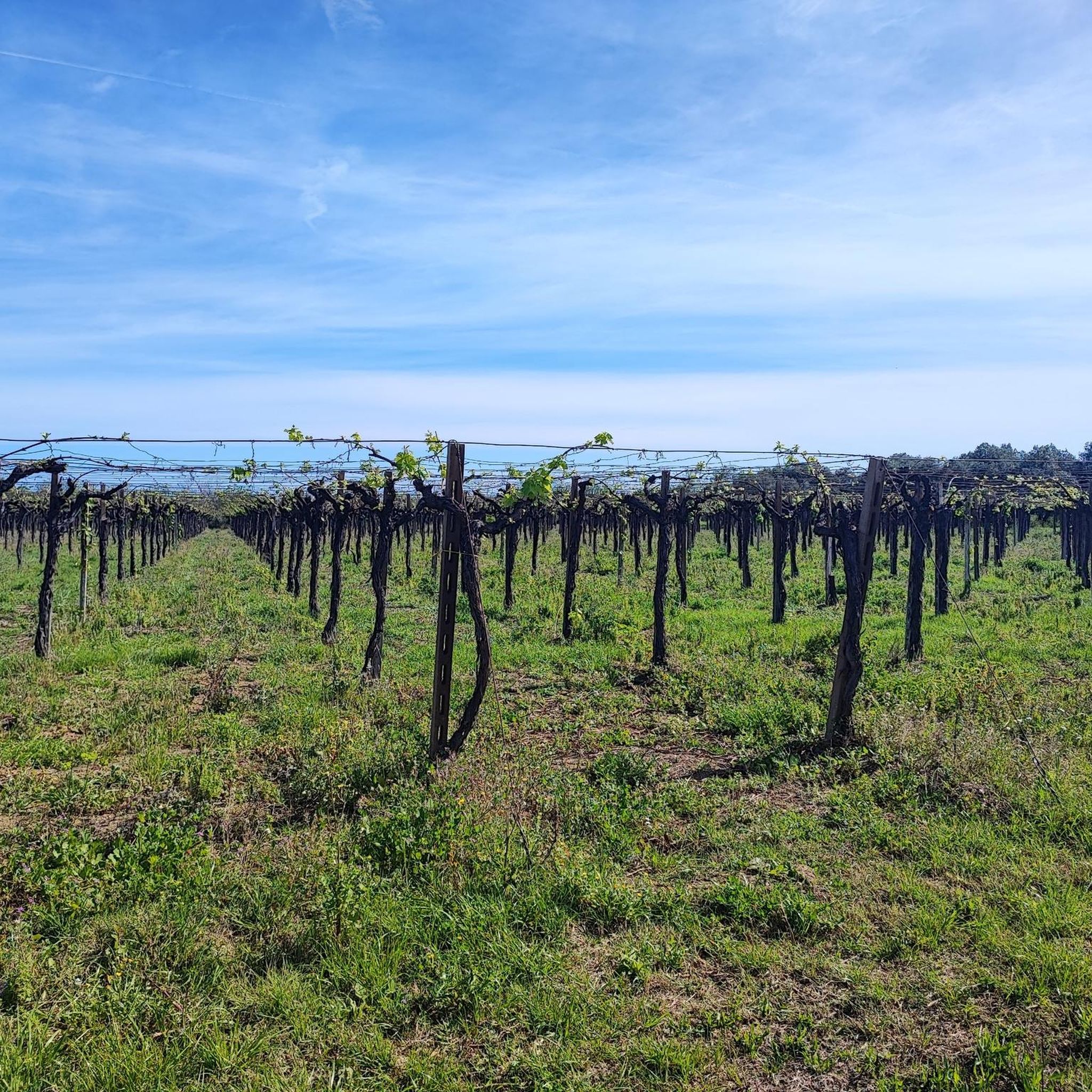
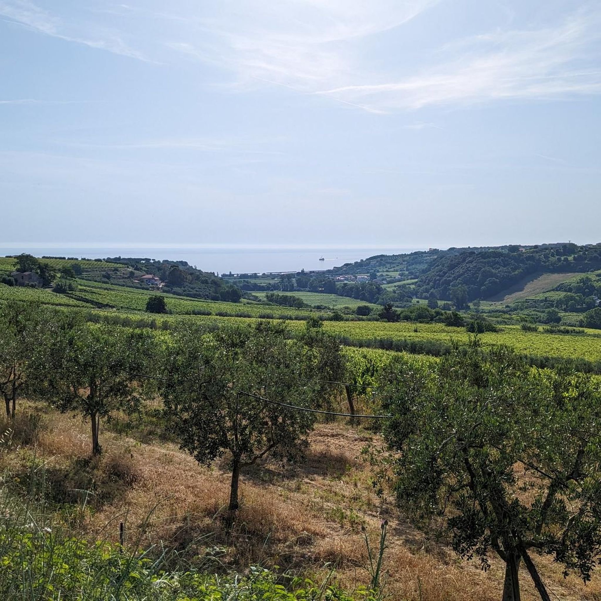
Hiking around Ortona offers diverse landscapes, blending coastal features with rolling hills. The town is situated on the Adriatic Sea, forming part of the Costa dei Trabocchi, known for its unique *trabocchi* fishing structures. The area features a mix of sandy beaches and rugged bays, transitioning inland to hills that lead towards the Majella National Park. This varied terrain provides a range of hiking opportunities.
Best hiking trails around Ortona
- The most popular hiking route is Via Verde dei Trabocchi – Pedestrian and Cycle Path loop from Ortona, a 6.8 miles (11.0 km) trail that takes 2 hours 50 minutes to complete, offering panoramic sea views along the historic coastal path.
- Another top favourite among local hikers is Francavilla al Mare Seafront – Palazzo Sirena loop from Contrada Postilli, an easy 4.0 miles (6.5 km) path. This route provides a leisurely stroll along the seafront, showcasing coastal scenery.
- Local hikers also love the Trabocco on the Adriatic Coast – Isolated tip overflow loop from Ortona, a 15.8 miles (25.5 km) trail leading through the unique coastal landscape of the Trabocchi, often completed in about 6 hours 39 minutes.
- Hiking around Ortona is defined by coastal paths, the unique *trabocchi* structures, and rolling hills with Adriatic Sea views. The network offers options for different ability levels, from easy coastal walks to more challenging routes.
- The routes in Ortona are highly rated by the komoot community with an average score of 4.6 stars from over 70 reviews. More than 900 hikers have used komoot to explore Ortona's varied terrain.
Last updated: July 18, 2026
4.9
(10)
101
hikers
10.9km
02:48
50m
50m
Moderate hike. Good fitness required. Easily-accessible paths. Suitable for all skill levels.
5.0
(1)
44
hikers
Easy hike. Great for any fitness level. Easily-accessible paths. Suitable for all skill levels.

Sign up for free
4.8
(6)
35
hikers
26.5km
06:55
180m
180m
Hard hike. Very good fitness required. Easily-accessible paths. Suitable for all skill levels.
20
hikers
Easy hike. Great for any fitness level. Easily-accessible paths. Suitable for all skill levels.
14
hikers
4.18km
01:05
30m
30m
Easy hike. Great for any fitness level. Easily-accessible paths. Suitable for all skill levels.
Get access to more routes and recommendations from other explorers.
Sign up for free
Already have an account?
Our route recommendations are based on thousands of hikes, rides, and runs completed by other people on komoot.
Start today with a free account
Your next adventure awaits.
Login or Signup



Tips from the Community

Riserva Naturale Punta dell'Acquabella: a wild coastal paradise 🌿🌊 One of the absolute ecological pearls along this route is the Riserva Naturale Punta dell'Acquabella. While many coastal towns are busy and touristy, here you'll discover a hidden oasis where rugged cliffs, fragrant pine forests, and an azure sea come together perfectly. Why you should definitely stop here: 💧 Crystal clear water The name Acquabella – “beautiful water” – says it all. The sheltered bay boasts remarkably clear seawater that invites a refreshing dip. 🎨 Art along the route The reserve lies right next to the Galleria Aurelia. Just before you dive into the tunnel, you'll cycle past impressive murals by street artist Millo, a tribute to the local war resistance. 🏚️ An abandoned fishing village in the green Hidden behind the pebble beach lie the ruins of Borgo dell’Acquabella. This small fishing hamlet was abandoned in the '70s and has since been slowly reclaimed by nature. 🚴 A place made for cyclists By car, this hidden bay is barely accessible due to the narrow and steep access roads. By bike, you reach the reserve via the Via Verde and roll almost effortlessly to this unique coastal spot. A short stop that feels like a discovery: wild nature, sea views, and a piece of hidden history in one place.
2
0
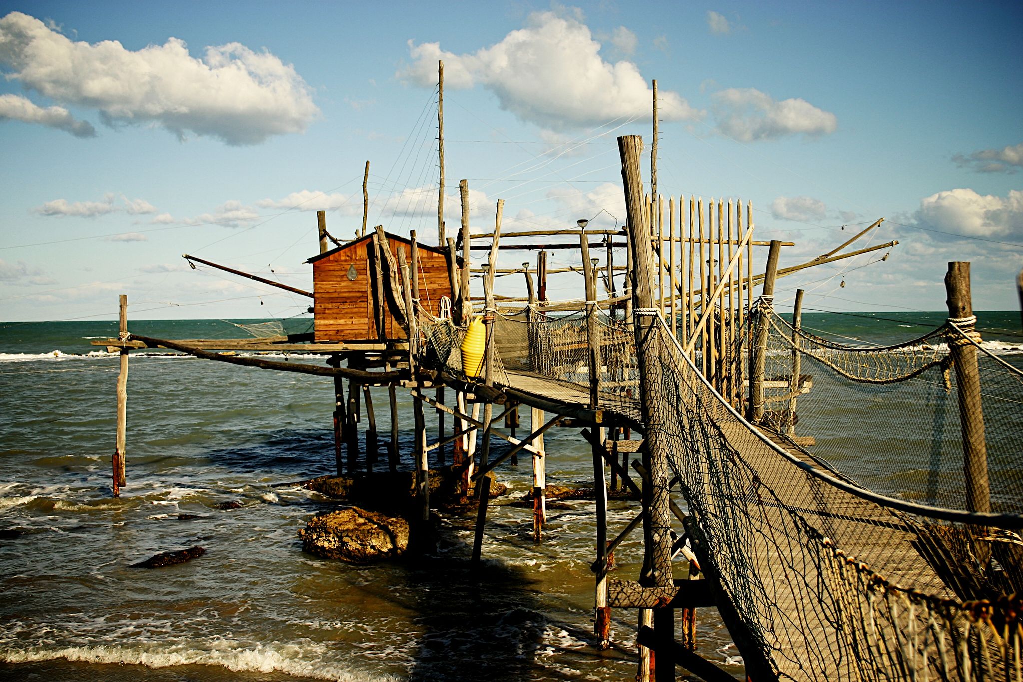
The Trabucchi cycle path (officially known as the Via Verde dei Trabocchi) is a beautiful, largely flat cycle path over 50 kilometers long that runs along the Adriatic coast of the Italian region of Abruzzo on a former railway line. The path owes its name to the trabocchi (singular: trabocco): unique, monumental wooden fishing platforms on stilts that rise above the water like giant spiders.
2
0
Trabocco Mucchiola – Picnic with sea view Trabocco Mucchiola is a lovely place to take a break during your tour along the Via Verde dei Trabocchi. Next to the cycle path, there is a shady picnic area with tables, ideal for resting, eating something, or simply enjoying the view of the Adriatic Sea. The charming wooden trabocco stands on the rocky Punta Mucchiola and is one of the first fishing platforms you will encounter south of Ortona. Thanks to its splendid location, this is also a beautiful stop along the route to capture a beautiful memory.
2
0
Flat and car-free: The route is laid out on a former railway line directly on the Adriatic Sea. It is fully asphalted, flat, and 100% car-free, making it perfect for any type of cyclist (from road cyclists to families).Unique setting: You cycle right past the iconic trabocchi: wooden, spider-like fishing platforms that hover over the waves. At many of these platforms, you can stop nowadays for a unique lunch or dinner with fresh fish.
2
0
The stretch around San Vito Chietino and Marina di San Vito is considered the absolute highlight of the route. Here, spectacular views, historic railway tunnels, and the largest concentration of trabocchi alternate. An unforgettable coastal tour not to be missed.
2
0
Good to know where you can forget your urgent business. During your business, you can charge your batteries in the meantime.
2
0
Imagine: the Adriatic Sea shimmering beside you, a fresh sea breeze on your face, and an endless cycle path winding along the coast. The Via Verde dei Trabocchi is one of those routes where you don't actually want the ride to end. This cycle path, over 50 kilometers long and largely flat, follows a former railway line and takes you along one of the most beautiful coastal stretches of Abruzzo. Along the way, you'll pass the iconic trabocchi: impressive wooden fishing platforms that seem to float above the sea on stilts. With their long arms and nets, they stand out against the horizon like gigantic wooden works of art.
3
0
Spiaggia di Punta dell'Acquabella – Hidden nature gem Near the cycle tunnel in Ortona lies Spiaggia di Punta dell'Acquabella, one of the most beautiful and pristine beaches on the Costa dei Trabocchi. This protected nature reserve is surrounded by high cliffs and a fragrant pine forest and is known for its crystal-clear, turquoise water – ideal for a refreshing dip during a hot bike ride. Behind the beach lie the silent ruins of the former fishing village Borgo dell'Acquabella, which has been abandoned since the 1970s. The turn-off to the beach is also located near the impressive murals by Millo, making both highlights perfectly combinable. Please note that this is a natural pebble beach without any facilities. Bring plenty of drinking water, and water shoes are definitely recommended if you want to enter the clear water.
3
0
Frequently Asked Questions
What kind of terrain can I expect on hiking trails around Ortona?
Hiking around Ortona offers a diverse mix of coastal paths, rolling hills, and unique landscapes. You'll find trails along the Adriatic Sea, often featuring the iconic *trabocchi* fishing structures, as well as routes that venture inland through the 'Teatina hill' region. The terrain ranges from flat, accessible coastal paths to more challenging hilly sections.
Are there easy hiking trails suitable for beginners in Ortona?
Yes, Ortona has several easy trails perfect for beginners. For a leisurely stroll with coastal views, consider the Francavilla al Mare Seafront – Palazzo Sirena loop from Contrada Postilli, which is an easy 6.5 km path. Another accessible option is the Trabocco Punta della Mucchiola – Pedestrian and Cycle Path loop from Riserva Naturale Controllata di Punta dell'Acquabella, covering about 4.7 km.
What are the best trails for families with children?
The Via Verde dei Trabocchi – Pedestrian and Cycle Path loop from Ortona is an excellent choice for families. This 11 km trail is predominantly flat, built along a former railway line, and offers panoramic sea views, making it suitable for various fitness levels and enjoyable for children. It's a great way to experience the unique Costa dei Trabocchi.
Can I find circular hiking routes in Ortona?
Yes, many of Ortona's trails are designed as loops, allowing you to start and end in the same location. Popular circular routes include the Via Verde dei Trabocchi – Pedestrian and Cycle Path loop from Ortona and the more challenging Trabocco on the Adriatic Coast – Isolated tip overflow loop from Ortona, which offers a longer coastal experience.
What interesting landmarks or natural features can I see along the trails?
Ortona's trails are rich with sights. You'll encounter the iconic *trabocchi* fishing structures, particularly along the Via Verde dei Trabocchi. Specific examples include Trabocco Punta Torre and Trabocco Spezzacatene. The Punta dell'Acquabella Nature Reserve also offers beautiful natural scenery and clear waters.
What is the best time of year to go hiking in Ortona?
The best time for hiking in Ortona is generally spring (April-June) and early autumn (September-October). During these periods, the weather is pleasant, temperatures are mild, and the landscapes are vibrant. Summer can be hot, especially for longer coastal walks, while winter offers a different, often quieter, experience, though some services might be reduced.
Are there any dog-friendly hiking trails in Ortona?
Many of the coastal paths and the Via Verde dei Trabocchi are suitable for walking with dogs, provided they are kept on a leash. It's always recommended to check local regulations for specific nature reserves or beaches, but generally, the open coastal trails offer great opportunities for you and your canine companion to enjoy the scenery.
How many hiking trails are available around Ortona?
There are around 14 hiking trails available in the Ortona area, offering a variety of experiences. This includes 11 easy routes, 2 moderate, and 1 difficult trail, ensuring options for different skill levels and preferences.
What do other hikers say about the trails in Ortona?
The hiking trails in Ortona are highly regarded by the komoot community, with an average rating of 4.6 stars from over 70 reviews. Hikers frequently praise the stunning sea views, the unique experience of walking past the *trabocchi*, and the well-maintained paths, especially along the Via Verde.
Are there any longer, more challenging hikes available?
For those seeking a more challenging experience, the Trabocco on the Adriatic Coast – Isolated tip overflow loop from Ortona is a difficult 25.5 km trail. This route typically takes over 6 hours to complete and offers an extensive exploration of the unique coastal landscape of the Trabocchi, with more significant elevation changes compared to the easier coastal strolls.
Is there public transport access to the hiking trailheads?
While Ortona itself has public transport, direct access to all trailheads by public transport can be limited, especially for routes outside the immediate town center. The Via Verde dei Trabocchi is easily accessible from Ortona. For other trails, particularly those further afield or in more rural areas, a car might be more convenient for reaching the starting points.
Where can I find parking for hiking near Ortona?
Parking is generally available in Ortona town center and at various points along the coast, especially near popular beaches and access points to the Via Verde dei Trabocchi. Specific parking areas can often be found near the start of well-known trails, though it's advisable to check local signage for any restrictions or fees.
Most popular attractions around Ortona

Get inspired with the komoot mobile app


Explore more
Browse the best Hikes in other regions.
