The best mountain hikes around Besenello
4.8
(25)
166
hikers
6
hikes
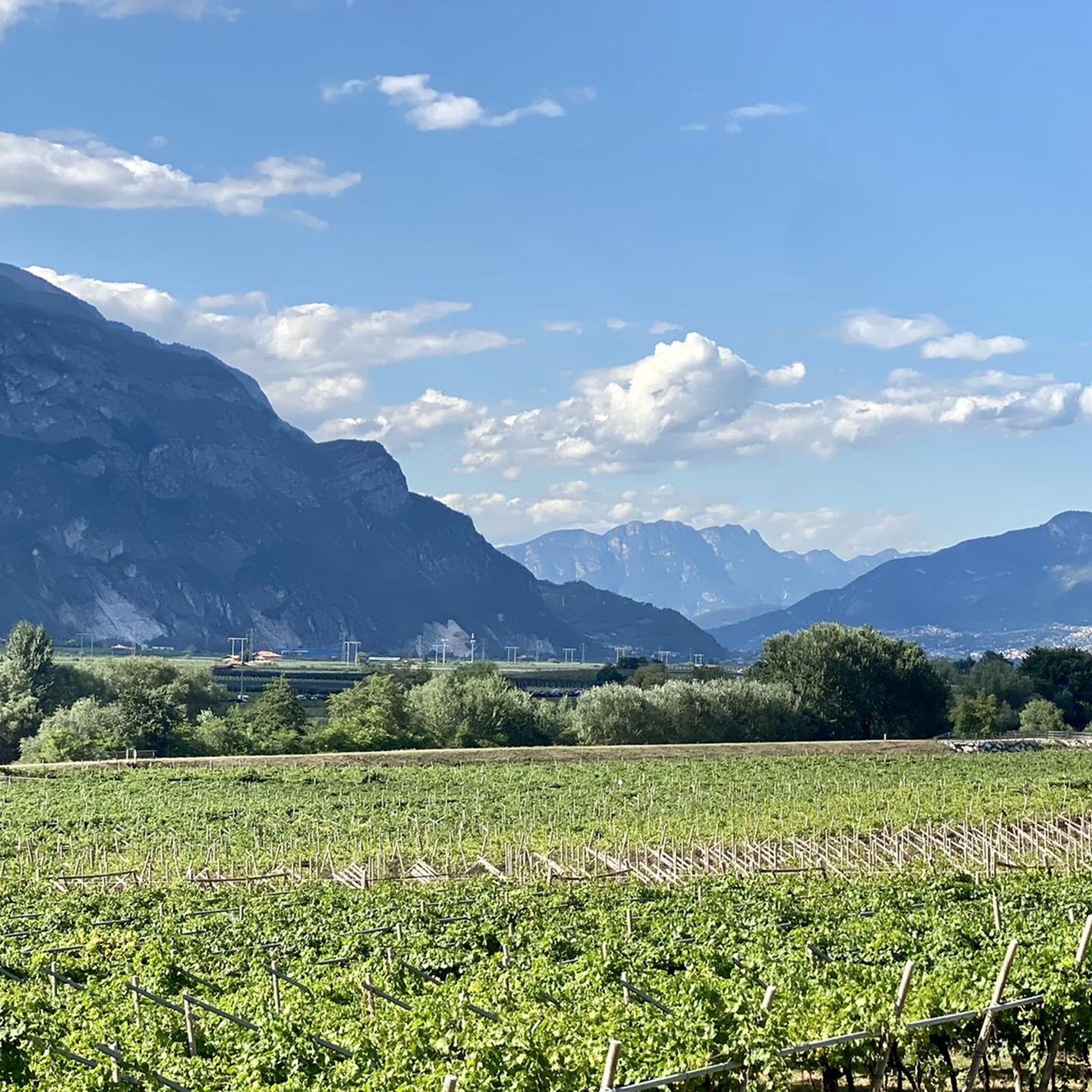
Mountaineering around Besenello offers a diverse landscape characterized by rugged ridges, deep gorges, and forested slopes within the Trentino region. The area features prominent peaks and challenging ascents, providing varied terrain for experienced mountaineers. Limestone formations and natural viewpoints are common, making it a destination for those seeking elevation and panoramic vistas.
Best mountaineering routes around Besenello
- The most popular mountaineering route is Costa del Cavai – Monte Cavo Ridge loop from Biotopo Toribera delle Viote, a 6.3 miles (10.1 km) trail that takes 4 hours 38 minutes to complete. This difficult route features a prominent ridge walk with significant elevation gain.
- Another top favourite among local mountaineers is Valimpach Via Ferrata – Cliffside View loop from Centa San Nicolò, a moderate 4.2 miles (6.7 km) path. This route includes a via ferrata section, offering cliffside views and a unique mountaineering experience.
- Local mountaineers also love the Mountaineering loop from Sentiero della Pace, a 7.4 miles (11.9 km) trail leading through varied mountain terrain, often completed in about 5 hours 58 minutes.
- Mountaineering around Besenello is defined by challenging ridge walks, via ferrata sections, and forested mountain paths. The network offers options for moderate to difficult ability levels, with 4 moderate and 4 difficult routes available.
- The routes in Besenello are highly rated by the komoot community with an average score of 4.9 stars from 27 reviews. More than 100 mountaineers have used komoot to explore Besenello's varied terrain.
Last updated: July 19, 2026
4.9
(10)
72
hikers
Hard mountaineering route. Good fitness required. Sure-footedness, sturdy shoes and alpine experience required.
4.3
(6)
29
hikers
6.70km
02:34
440m
440m
Moderate mountaineering route. Good fitness required. Easily-accessible paths. Suitable for all skill levels.

Sign up for free
5.0
(3)
20
hikers
Moderate mountaineering route. Good fitness required. Mostly accessible paths. Sure-footedness required.
5.0
(3)
14
hikers
11.3km
05:58
910m
910m
Hard mountaineering route. Very good fitness required. Sure-footedness, sturdy shoes and alpine experience required.
6
hikers
12.6km
04:39
660m
660m
Moderate mountaineering route. Good fitness required. Mostly accessible paths. Sure-footedness required.
Our route recommendations are based on thousands of hikes, rides, and runs completed by other people on komoot.
Start today with a free account
Your next adventure awaits.
Login or Signup

Tips from the Community

rideable up to halfway but then the lower part is completely unrideable. also pushing is rather dangerous. Should really only be ridden by full pros.
0
0

The suggestive and old connecting road to the village of Valle. Recommended for descent
0
0
The satisfying plateau where you forget the effort of the Kaiserjegerstrasse climb
0
0

From the Virti command post to the 1000-meter altitude line, nicely rideable from here into the gorge, Vall Centa and to the mill at least S5, continuously unrideable. Difficult to walk even without a bike!
1
0
Cozy refuge for a stop to regain energy. Located in a beautifully sized alpine meadow. Starting point for hikes and e-bike tours.
0
0

Monte Cornetto, along with Cima Verde and Dos d'Abramo, is one of the peaks that make up the famous "Tre Cime del Bondone"; it's probably the one with the best panoramic views. From here, the view opens up to a 360° panorama of the Brenta Dolomites, Adamello, Paganella, the Lessinia Mountains, the Garda Prealps, Carega, and the Lagorai mountain range. The climb to the summit cross features easy rock sections, but requires hands.
1
0

One of the many artificial dams in the Centa valley
0
1

Always worth a trip because of the view.
1
0
Frequently Asked Questions
What types of mountaineering routes can I expect around Besenello?
Mountaineering around Besenello is characterized by challenging ridge walks, via ferrata sections, and forested mountain paths. The terrain includes rugged ridges, deep gorges, and forested slopes, offering diverse experiences for those seeking elevation and panoramic vistas.
Are there any beginner-friendly mountaineering routes in Besenello?
While there are no routes classified as 'easy', Besenello offers 4 moderate mountaineering routes. These can be a good starting point for those with some experience looking to progress. An example is the Trail in the Gorge loop from Piazza, which covers 8.1 km with a moderate difficulty.
What is the typical distance and elevation gain for mountaineering routes in this area?
The mountaineering routes around Besenello vary in length and elevation. You'll find routes ranging from approximately 6.7 km to 12.6 km. Elevation gains typically range from around 440 meters up to over 900 meters, depending on the specific tour.
Are there any circular mountaineering routes available?
Yes, many of the mountaineering routes around Besenello are designed as loops. For instance, you can explore the Case di Pietra – Rifugio Vincenzo Lancia loop from Pozza, a moderate 12.6 km route, or the more challenging Mountaineering loop from Sentiero della Pace.
What are some of the most challenging mountaineering routes in Besenello?
For experienced mountaineers, Besenello offers several difficult routes. The Costa del Cavai – Monte Cavo Ridge loop from Biotopo Toribera delle Viote is a prominent ridge walk with significant elevation gain, covering 10.1 km. Another challenging option is the Mountaineering loop from Sentiero della Pace, which is 11.9 km long and features varied mountain terrain.
What kind of natural attractions or landmarks can I see along the mountaineering routes?
The region around Besenello is rich in natural beauty. You might encounter deep gorges like the Vallarsa Valley or the Rio Torto Riverbed. Some routes also feature via ferrata sections, such as the Via Ferrata della Valscura, offering unique cliffside views.
Are there any via ferrata sections on the mountaineering routes?
Yes, some routes incorporate via ferrata sections, providing a unique mountaineering experience with cliffside views. A notable example is the Valimpach Via Ferrata – Cliffside View loop from Centa San Nicolò, a moderate route that includes such a section.
What do other mountaineers say about the routes in Besenello?
The mountaineering routes in Besenello are highly regarded by the komoot community, with an average rating of 4.9 stars from 27 reviews. Users often praise the varied terrain, challenging ridge walks, and the unique experience of the via ferrata sections.
What is the best time of year for mountaineering in Besenello?
Given the challenging nature of the routes, including ridge walks and via ferrata sections, the best time for mountaineering in Besenello is typically from late spring through early autumn (May to October) when the weather is more stable and trails are free of snow and ice. Always check local conditions before heading out.
Are there any facilities or huts along the mountaineering routes?
While specific facilities vary by route, some tours, like the Case di Pietra – Rifugio Vincenzo Lancia loop from Pozza, may pass by mountain huts or refuges. It's always advisable to check the specific route details for available facilities before your trip.
How many mountaineering routes are available in the Besenello area?
There are 8 mountaineering routes available around Besenello, offering a mix of moderate and difficult options to suit different skill levels.
Most popular routes around Besenello
Most popular attractions around Besenello

Get inspired with the komoot mobile app


Explore more
Browse the best Mountain Hikes & Routes in other regions.
