The best walks and hikes around Finale Emilia
4.2
(92)
480
hikers
16
hikes
Hiking around Finale Emilia primarily involves exploring the flat plains of the Po Valley, characterized by agricultural landscapes and river systems. While the immediate vicinity offers local paths, the town serves as a gateway to the more diverse terrain of the wider Emilia-Romagna region. This includes the foothills of the Apennine Mountains, which feature varied elevations, forests, and unique geological formations like the Sassi di Roccamalatina. The area provides a range of trails from easy strolls along waterways to more…
Last updated: May 20, 2026
2.7
(3)
5
hikers
17.6km
04:27
20m
20m
Moderate hike. Good fitness required. Mostly accessible paths. Sure-footedness required.
5.0
(1)
9
hikers
7.53km
01:54
10m
10m
Easy hike. Great for any fitness level. Easily-accessible paths. Suitable for all skill levels.

Sign up for free
2.3
(3)
7
hikers
Easy hike. Great for any fitness level. Easily-accessible paths. Suitable for all skill levels.
7
hikers
6.80km
01:43
10m
10m
Easy hike. Great for any fitness level. Easily-accessible paths. Suitable for all skill levels.
1.5
(2)
7
hikers
10.5km
02:37
10m
10m
Moderate hike. Good fitness required. Easily-accessible paths. Suitable for all skill levels.
Get access to more routes and recommendations from other explorers.
Sign up for free
Already have an account?
Our route recommendations are based on thousands of hikes, rides, and runs completed by other people on komoot.
Start today with a free account
Your next adventure awaits.
Login or Signup
Tips from the Community

Beautiful cycle path
0
0

This town is on the border between the provinces of Modena and Ferrara and until 1863 it was called Finale di Modena, then with the unification of Italy it changed its name. It was among the towns most damaged by the 2012 earthquake and there is still the rubble of the fortress and the clock tower now in the process of reconstruction together with the many buildings in the centre.
3
0

The Castello delle Rocche was built in 1402 and is also known as Rocca Estense because towards the end of the 15th century the castle became the residence of the Este family. Unfortunately it was heavily damaged by the 2012 earthquake.
1
0

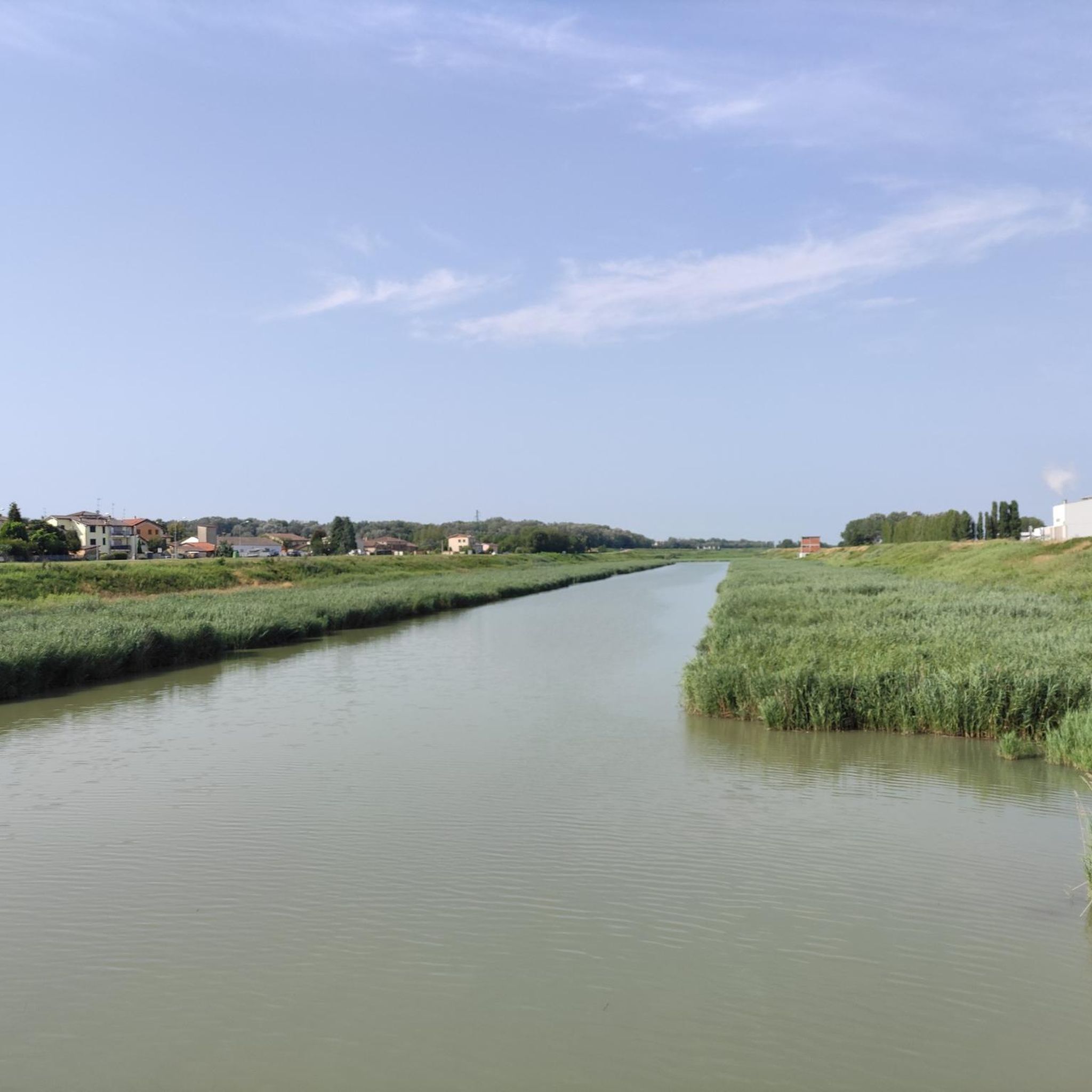
The Panaro is the last tributary of the Po and rises on the Tuscan-Emilian Apennines.
0
0
Frequently Asked Questions
What kind of hiking terrain can I expect around Finale Emilia?
Hiking around Finale Emilia primarily involves exploring the flat agricultural plains of the Po Valley, characterized by river systems and open landscapes. However, the town also serves as a gateway to the more diverse terrain of the wider Emilia-Romagna region, including the foothills of the Apennine Mountains. Here, you can find varied elevations, forests, and unique geological formations like the Sassi di Roccamalatina, offering a range of experiences from easy strolls to more challenging routes.
How many hiking trails are available in the Finale Emilia area?
There are over 60 hiking routes available around Finale Emilia, catering to various skill levels. These include 40 easy trails perfect for a relaxed outing, 25 moderate routes for a bit more challenge, and even 1 difficult trail for experienced hikers seeking a strenuous adventure.
Are there any easy or beginner-friendly hikes near Finale Emilia?
Yes, Finale Emilia offers many easy and beginner-friendly options. For example, the Castello delle Rocche loop from Finale Emilia is an easy 3.7-mile trail that takes about 1 hour 30 minutes. Another accessible option is the Madonnina Shrine loop from Renazzo, which is 2.9 miles long and can be completed in about 1 hour 10 minutes.
What are some notable natural features or landmarks I can see while hiking in the region?
While Finale Emilia itself is in the flat Po Valley, the wider Emilia-Romagna region offers stunning natural features. The Apennine Mountains feature high-altitude moorlands and conifer forests. You can explore unique sandstone rock formations up to 70 meters high in the Sassi di Roccamalatina Regional Park, or visit the Dardagna Waterfalls in the Corno alle Scale Regional Park. The Vena del Gesso Romagnola also offers spectacular chalky gypsum hills and fossil beds.
Are there any historical sites or castles to explore near the hiking trails?
Yes, the region around Finale Emilia is rich in history. You can find several castles and historical sites. For instance, the Castello delle Rocche is a local landmark, and the Estense Fortress of San Felice sul Panaro is another significant historical structure. The Via Romea Nonantolana, a historic route, also passes through the area, offering a blend of natural beauty and cultural heritage.
What is the best time of year to go hiking around Finale Emilia and the wider Emilia-Romagna region?
The best time to hike largely depends on your preferred terrain. For the flat plains around Finale Emilia, spring and autumn offer pleasant temperatures. For the Apennine Mountains, late spring through early autumn (May to October) is ideal, as the weather is generally milder and trails are clear of snow. Summer can be hot in the plains but offers cooler temperatures at higher elevations in the Apennines.
Are there any circular hiking routes available?
Yes, many routes in the area are designed as loops. A popular option is the On the Via Romea Nonantolana – ring tour from Finale Emilia, a moderate 11-mile trail. Another local favorite is the Hiking loop from Finale Emilia, which is 6.5 miles long and offers a moderate experience.
What do other hikers say about the trails in Finale Emilia?
The trails in Finale Emilia are highly rated by the komoot community, with an average score of 4.3 stars from over 70 reviews. Hikers often praise the peaceful agricultural landscapes, the well-maintained paths, and the accessibility of routes for various fitness levels. Many appreciate the opportunity to explore local history and nature on these trails.
Can I find trails suitable for families with children?
Yes, the numerous easy trails around Finale Emilia are well-suited for families. The flat terrain and shorter distances make them enjoyable for children. Consider routes like the Castello delle Rocche loop from Finale Emilia, which is relatively short and offers interesting local scenery without significant elevation changes.
Are there any dog-friendly hiking trails in the area?
Most trails in the Finale Emilia area and the wider Emilia-Romagna region are generally dog-friendly, especially those outside of strictly protected wildlife zones. It's always recommended to keep dogs on a leash, especially in agricultural areas or near livestock, and to check specific park regulations if venturing into regional or national parks. The flat, open paths around Finale Emilia are typically good for walks with dogs.
Is public transport available to reach hiking trailheads near Finale Emilia?
While Finale Emilia itself has some local public transport, reaching specific trailheads, especially those further into the Apennines, might require a combination of public transport and a short walk or taxi. For local trails directly accessible from Finale Emilia, public transport within the town might be an option. For exploring the wider Emilia-Romagna region, a car often provides more flexibility to access diverse trailheads.
Are there any waterfalls or significant water features to see on hikes?
While the immediate vicinity of Finale Emilia is characterized by river systems in the Po Valley, for more dramatic water features like waterfalls, you would need to venture into the Apennine Mountains. The Dardagna Waterfalls, for example, are a popular natural attraction within the Corno alle Scale Regional Park, accessible via a scenic loop trail.
Where can I find more information about hiking in the Emilia-Romagna region?
For broader information about hiking and paths across the entire Emilia-Romagna region, you can visit the official tourism website: visitemilia.com. This resource provides details on various trails and outdoor activities throughout the region.
Most popular routes around Finale Emilia
Most popular attractions around Finale Emilia

Get inspired with the komoot mobile app


Explore more
Browse the best Hikes in other regions.
