The best MTB trails around Fontanelice
4.6
(74)
785
riders
16
rides
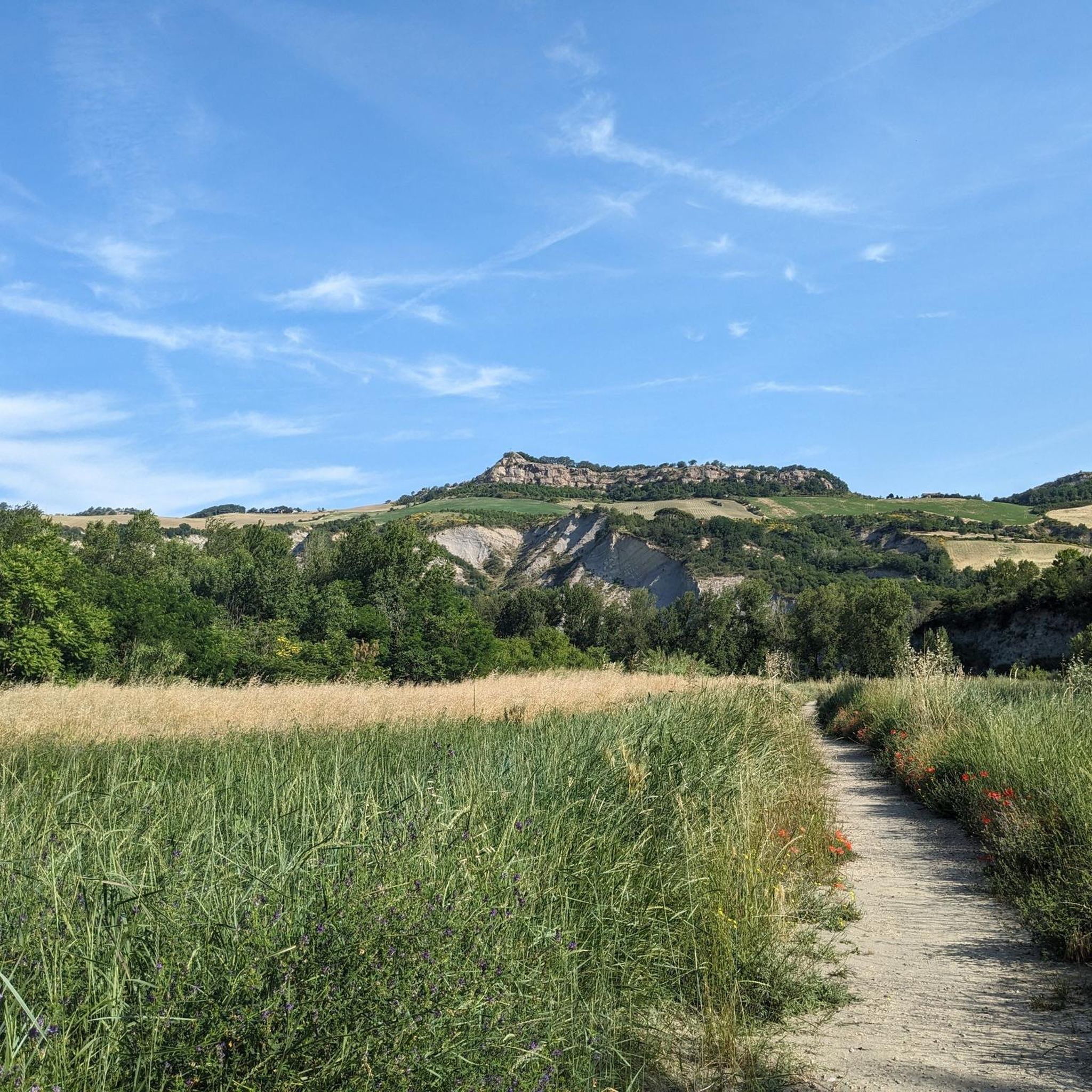
Mountain bike trails around Fontanelice are situated in the Santerno Valley, characterized by its river, surrounding hills, and dense forests. The landscape features notable geological formations like Riva dei Cavalli, a prominent rocky cliff. This area provides diverse terrain for mountain biking, ranging from riverbanks to elevated forested paths. The region's topography offers varied routes suitable for different skill levels.
Best mountain bike trails around Fontanelice
- The most popular mountain bike trail is Pollo Trail – Church of Valmaggiore loop…
Last updated: November 1, 2026
4.9
(7)
108
riders
40.0km
03:31
990m
990m
Hard mountain bike ride. Very good fitness required. Advanced riding skills necessary. Some portions of the route may require you to push your bike.
5.0
(1)
34
riders
48.2km
05:05
1,750m
1,750m
Hard mountain bike ride. Very good fitness required. Advanced riding skills necessary. Some portions of the route may require you to push your bike.

5.0
(4)
32
riders
Moderate mountain bike ride. Good fitness required. Advanced riding skills necessary.
5.0
(1)
37
riders
34.4km
03:30
1,130m
1,130m
Hard mountain bike ride. Very good fitness required. Advanced riding skills necessary. Some portions of the route may require you to push your bike.
4.5
(2)
26
riders
Moderate mountain bike ride. Good fitness required. Advanced riding skills necessary.
Get access to more routes and recommendations from other explorers.
Already have an account?
Our route recommendations are based on thousands of hikes, rides, and runs completed by other people on komoot.
Start today with a free account
Your next adventure awaits.

Other adventures around Fontanelice

Tips from the Community

...it dominates the entire Senio valley.....
0
0

Dirt climb with gradients of 11% but worth it
0
0

Eyes that here film you when you do it!
0
0

From Monte Battagliola almost everything is passable, in the last stretch before arriving at the refuge some sections are very, very steep.
0
0
After the stretch in the woods, the path is barely visible. The last stretch before reaching the house must be done on foot for long stretches due to a landslide. Be careful because the presence of sheepdogs is reported.
0
0
You go up from Via Siepi di San Giovanni and you arrive near the La Taverna farmhouse. You can also go through Rio Maggiore, in my opinion it is more beautiful
0
0

The "no transit for tanks" sign is nice!
0
0

The toponym Valmaggiore seems to derive from a Roman signal tower of the late empire (Valle Major). The same name remained until the Middle Ages when a small castle and then a municipality arose on the hill, mentioned for the first time in 1265. The small town and the church are also known for a unique event for this area which dates back to 19 October 1506, when Pope Julius II, traveling from Palazzuolo sul Senio towards Bologna, to drive out the Bentivoglios, passed through Valmaggiore on horseback a sumptuously adorned white mule, followed by an escort of cardinals and armed men. Today a plaque commemorating that event adorns the façade of the church. I'll leave you the link.... https://www.imolafaenza.it/cosa-fare/chiesa-di-valmaggiore/
0
0
Frequently Asked Questions
How many mountain bike trails are there around Fontanelice?
There are 17 mountain bike trails around Fontanelice. These routes offer a variety of experiences, with 1 easy, 6 moderate, and 10 difficult options to choose from.
What are the difficulty levels of mountain bike trails in Fontanelice?
The mountain bike trails in Fontanelice cater to various skill levels. You'll find 1 easy route, 6 moderate trails, and 10 difficult options, ensuring there's a challenge for every rider.
Are there any family-friendly mountain bike trails in Fontanelice?
While most trails around Fontanelice are moderate to difficult, there is 1 easy mountain bike route available. For families, consider exploring the less challenging sections of the Pollo Trail – Church of Valmaggiore loop from Fontanelice, which is rated moderate but offers scenic, verdant hills.
Can I find circular mountain bike routes in Fontanelice?
Yes, many mountain bike trails around Fontanelice are circular. For example, you can ride the Pollo Trail – Church of Valmaggiore loop from Fontanelice, the View of Sella di Ca' Budrio – Abandoned House of Le Banzole loop from Fontanelice, or the Monte Codronco Antennas loop from Fontanelice, all designed as loops.
What kind of landscapes will I encounter on the mountain bike trails?
The trails in Fontanelice traverse diverse landscapes within the Santerno Valley. You'll ride along the river, through surrounding hills, and dense forests. Notable features include the impressive rocky formation of Riva dei Cavalli and elevated forested paths, offering varied terrain and scenic views.
Are there any waterfalls accessible by mountain bike in Fontanelice?
Yes, you can find waterfalls near Fontanelice. The Monte Codronco Antennas – Moraduccio Waterfall loop from Fontanelice is a difficult route that includes the Moraduccio Waterfall. Additionally, the region research mentions the 'Cascata dei due salti' along the Rio della Caspa trail in the Santerno Valley, which can be a pleasant walk or a point of interest during your ride.
What are some notable landmarks or viewpoints along the mountain bike trails?
The trails offer several points of interest. You can experience the Scenic Section of the Santerno River, or explore the Imolese Badlands and Trail to the Church of Sant'Andrea. The View of Sella di Ca' Budrio – Abandoned House of Le Banzole loop from Fontanelice offers views of the Santerno Valley. You might also encounter mountain passes like Prugno Pass or Zattaglia Pass.
What do other mountain bikers enjoy most about Fontanelice?
The area is highly rated by the komoot community, with an average score of 4.6 stars from 59 reviews. Over 800 mountain bikers have explored Fontanelice's varied terrain, often praising the diverse landscapes, from riverbanks to elevated forested paths, and the challenging yet rewarding routes.
Is Fontanelice suitable for mountain biking year-round?
Fontanelice, with its diverse terrain and location in the Santerno Valley, is generally appealing for outdoor activities. While specific winter conditions are not detailed, the region's hills and forests suggest that spring and autumn offer ideal conditions with pleasant temperatures and vibrant scenery. Summer can be warm, and winter might bring colder, potentially wetter conditions, especially on higher elevation trails.
Are there any cafes or places to eat near the mountain bike trails?
Fontanelice is known for its river oasis, which includes amenities like BBQ stations and a risto-bar, providing convenient spots for refreshments. The town itself also offers local establishments where you can refuel after your ride.
What is the longest mountain bike trail in Fontanelice?
The longest mountain bike trail listed is the Monte Codronco Antennas – Moraduccio Waterfall loop from Fontanelice, which spans 55.3 km (34.4 miles) and typically takes around 4 hours 24 minutes to complete.
What is the average elevation gain on mountain bike trails in Fontanelice?
The elevation gain varies significantly across trails. For instance, the Pollo Trail – Church of Valmaggiore loop from Fontanelice has an elevation gain of approximately 786 meters, while the Monte Codronco Antennas loop from Fontanelice involves over 1080 meters of ascent.
Most popular attractions around Fontanelice

Get inspired with the komoot mobile app


Explore more
Browse the best MTB trails in other regions.
