The best walks and hikes around Barisciano
4.4
(3426)
20,167
hikers
233
hikes
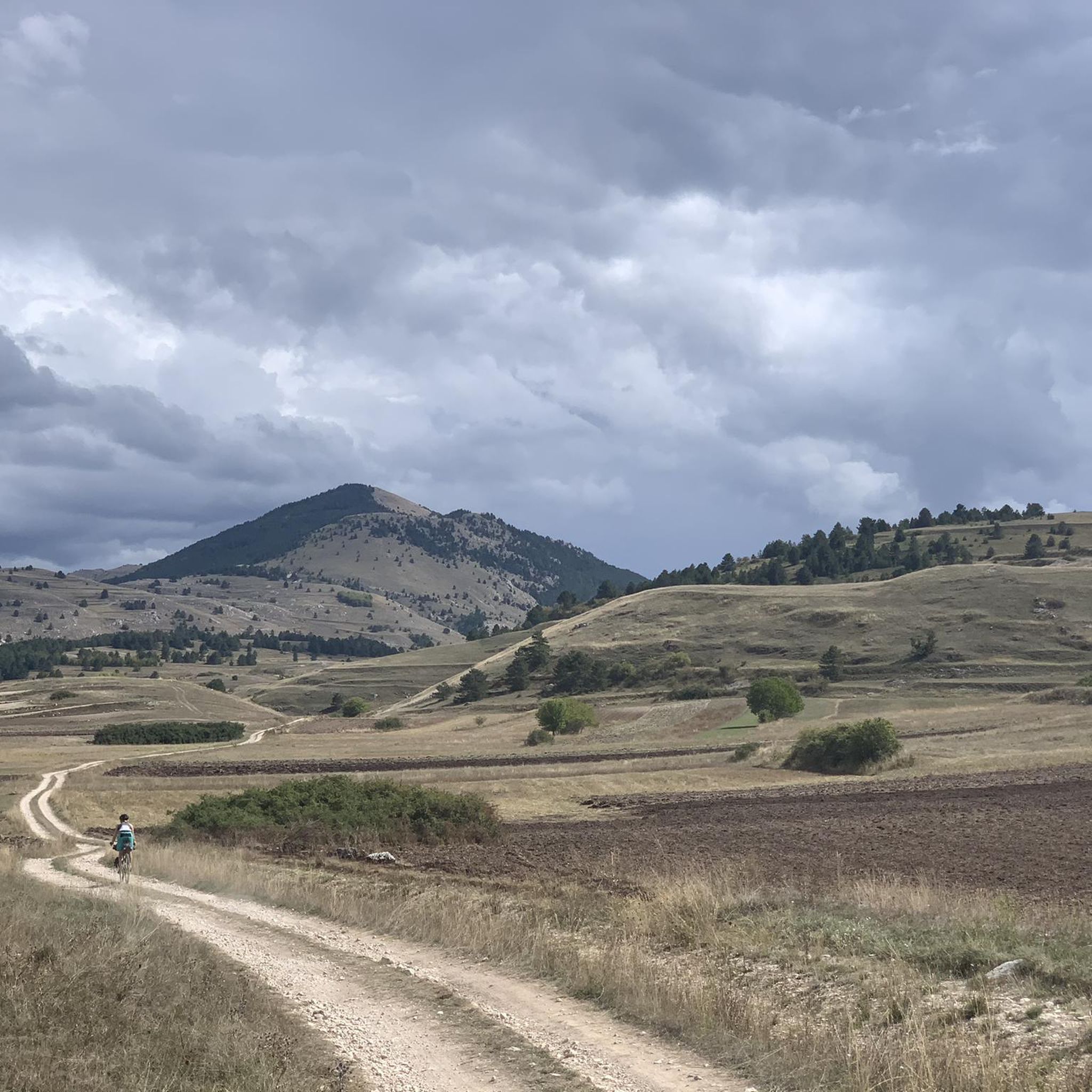
Hiking around Barisciano offers diverse terrain within Italy's Abruzzo region, situated at 940 meters above sea level. The area is characterized by its location within the Gran Sasso e Monti della Laga National Park, featuring rolling hills, high mountain peaks, and geological formations carved into limestone mountains. Landscapes include the vast alpine meadow of Campo Imperatore Plateau and the well-preserved Ancient Friars' Forest. This region provides a variety of trails for different skill levels.
Best hiking trails around Barisciano
- The…
Last updated: November 5, 2026
4.4
(5)
28
hikers
9.80km
03:02
350m
350m
Moderate hike. Good fitness required. Easily walkable paths.
4.8
(12)
45
hikers
13.5km
04:27
590m
590m
Moderate hike. Good fitness required. Mostly walkable paths. Sure-footedness required.

4.8
(12)
48
hikers
14.9km
04:55
660m
660m
Moderate hike. Good fitness required. Mostly walkable paths. Sure-footedness required.
5.0
(1)
9
hikers
13.0km
04:12
590m
590m
Moderate hike. Good fitness required. Easily walkable paths.
7
hikers
13.6km
03:53
290m
290m
Hard hike. Good fitness required. Sure-footedness, sturdy shoes and alpine experience required.
Get access to more routes and recommendations from other explorers.
Already have an account?
Our route recommendations are based on thousands of hikes, rides, and runs completed by other people on komoot.
Start today with a free account
Your next adventure awaits.
Tips from the Community

A beautiful way to see the Aquilano and Teramano sides of Gran Sasso without too much effort
0
0

Don't just ride or cycle past the Laghetto di Pietranzoni. This small mountain lake, located at an altitude of 1,660 meters in the middle of Campo Imperatore, is one of the most photogenic spots in the Abruzzo region. The natural lake, formed by glaciers, constantly changes size due to meltwater and rain, making every visit different. Why stop here? On a windless day, the imposing Corno Grande, the highest peak in the Apennines, is beautifully reflected in the clear water. The endless high plain, aptly nicknamed 'Little Tibet', offers a unique landscape full of peace and space. Moreover, it requires hardly any effort: from the parking lot, you can walk to the shore in just a few minutes. In spring, thousands of blooming crocuses provide a colorful spectacle, while the lake is a perfect spot year-round to take a break, take photos, and fully enjoy the impressive landscape.
5
0
The Campo Imperatore plateau is so special because it is one of Europe's most alien and untouched landscapes. The plateau is over 15 kilometers long and lies at an average altitude of 1,800 to 2,000 meters. This creates a unique combination of extreme vastness, raw nature, and cultural history. The main reasons why this area is unique: Europe's 'Little Tibet': Due to the vast treeless plains, the grazing herds of horses and sheep, and the immense mountain ranges surrounding it, you absolutely do not feel like you are in Italy here. The horizon is nowhere interrupted by modern buildings, which gives a rare sense of ultimate emptiness and space. The setting for iconic films: The alien landscape has been used as a film set by countless Hollywood directors. Major classics and westerns such as Once Upon a Time in the West and The Name of the Rose were filmed here.
6
0
It is a water supply for animals. These large, elongated basins are called abbeveratoi and are specifically built for the livestock (such as cows, horses, and sheep) that roam freely on the Campo Imperatore during the summer months. Why it is not a foot bath? Herder culture: the plateau has an age-old tradition of transumanza (seasonal cattle migration). These types of basins are essential to supply the large herds with drinking water in an otherwise very dry karst landscape. Hygiene: The water is not chlorinated or filtered for human use. Animals drink directly from it, so the water may contain bacteria. Ecological function: The basins often also form a small, local ecosystem for amphibians (such as alpine newts) and insects in this dry mountain area. Washing or bathing your feet in these basins is therefore strongly discouraged to keep the water supply for livestock and local nature clean.
4
0
Laghetto di Pietranzoni is a natural lake. It is a small high-mountain lake of glacial origin (formed by glacier activity), located at an altitude of 1,660 meters on the Campo Imperatore plateau in the Italian region of Abruzzo. The lake is located in the Parco Nazionale del Gran Sasso e Monti della Laga. The size of the water varies greatly by season; it grows with meltwater and rain in the spring and can shrink considerably in hot summers. Definitely worth a stop. Why? Laghetto di Pietranzoni is undoubtedly one of the most beautiful photo locations in Abruzzo. On a windless day, the imposing Corno Grande, the highest peak in the Apennines, is perfectly reflected in the clear water. The lake lies in the middle of the vast Campo Imperatore plateau, also known as 'Little Tibet', where the endless vistas create a special sense of peace and space. Moreover, this spot is surprisingly easy to reach: from the parking lot, you can walk to the shore in a few minutes. In the spring, thousands of wild crocuses color the surroundings purple, and the lake forms an ideal starting point for beautiful hikes through the Gran Sasso massif. A short stop you won't soon forget.
5
0

The trail is very beautiful, but you have to be especially careful of DOGS: not all of them are harmless (one chased us and barked for a long time)...
0
0

incredibly beautiful place to visit
0
0

beautiful lakes path in a path all in the green
0
0
Frequently Asked Questions
How many hiking trails are available around Barisciano?
Barisciano offers a wide variety of hiking opportunities, with over 215 trails available. These routes cater to all skill levels, from easy walks to challenging mountain treks, all set within the stunning Gran Sasso e Monti della Laga National Park.
What kind of terrain and landscapes can I expect when hiking in Barisciano?
The region around Barisciano features incredibly diverse landscapes. You'll find everything from rolling hills to majestic high mountain peaks within the Gran Sasso e Monti della Laga National Park. Notable features include the vast alpine meadow of the Campo Imperatore Plateau, dramatic geological formations carved into limestone mountains, and the serene Ancient Friars' Forest, a well-preserved oak forest.
Are there easy hikes suitable for families or beginners in Barisciano?
Yes, Barisciano has many easy trails perfect for families and beginners. Out of over 215 routes, 54 are classified as easy. These paths allow you to enjoy the natural beauty without requiring advanced fitness. For example, the Cima di Faiete – Lake Passaneta loop from Valico di Monte Cristo is a moderate 9.8 km hike that is easily accessible and suitable for most skill levels, leading past mountain peaks and small lakes.
Can I find challenging mountain treks in the Barisciano area?
Absolutely. For experienced hikers seeking a challenge, Barisciano offers 65 difficult routes. These trails often involve significant elevation changes and require good fitness and sure-footedness. A demanding option is the Campo Imperatore Summit – Campo Imperatore loop from Ruderi di Sant'Egidio, an 18.6 km hard hike that requires very good fitness and alpine experience.
Are there any circular hiking routes around Barisciano?
Yes, many of the trails in Barisciano are circular, allowing you to start and end at the same point. Popular circular options include the Monte Scindarella – Monte Paganica loop from Valico di Monte Cristo, a moderate 13.5 km path traversing mountain peaks, and the Rifugio Cenerale – Croce del Poggio loop from Poggio Picenze, a moderate 12.8 km hike.
What natural features or landmarks can I see along the hiking trails?
Hiking in Barisciano offers access to numerous natural wonders and historical sites. You can explore the vast Campo Imperatore Plateau, often called the 'Little Tibet' of Italy, or discover the tranquil Lakes of Fossetta, Passaneto, and Racollo. The area also features impressive mountain passes like Capo la Serra Pass and Maccione Pass, offering stunning panoramic views.
Are there any waterfalls to visit near Barisciano?
Yes, the region around Barisciano is home to several beautiful waterfalls. You can visit the impressive Stiffe Waterfall, the scenic Rio Arno Waterfalls, or the picturesque Ruzzo Waterfalls. These natural attractions provide refreshing stops and stunning photo opportunities during your hikes.
What historical sites can be incorporated into a hiking itinerary?
Barisciano itself offers historical attractions that can complement your outdoor adventures. You can explore the remains of an 11th-century Medieval Castle Ruins, which stand atop a hill and provide panoramic views of the Piana di Navelli. Additionally, the historic Monastery of San Colombo, now a floriculture research center with a botanical garden, is surrounded by the Ancient Friars' Forest, offering a serene environment for exploration.
When is the best time of year to hike in Barisciano?
Barisciano is an ideal hiking destination, particularly during the warmer months. The cool mountain air in summer makes it very pleasant for outdoor activities. While some routes transform into cross-country skiing trails in winter, the spring and autumn offer vibrant colors and comfortable temperatures for exploring the diverse landscapes of the Gran Sasso e Monti della Laga National Park.
How do other hikers rate the trails in Barisciano?
The hiking trails around Barisciano are highly regarded by the komoot community. They have an impressive average rating of 4.5 stars from over 3,100 reviews. More than 18,900 hikers have used komoot to explore the varied terrain, often praising the stunning panoramic views, diverse landscapes, and the range of options for different ability levels.
Are there options for parking near trailheads in Barisciano?
Many trailheads in the Barisciano area, especially those leading to popular routes or within the Gran Sasso e Monti della Laga National Park, typically offer designated parking areas. For specific routes, it's advisable to check the individual tour details on komoot for precise starting points and parking information.
Is it possible to reach hiking trailheads using public transport?
While Barisciano is a small town, public transport options to reach specific remote trailheads within the national park might be limited. It's generally recommended to have personal transportation for maximum flexibility. However, local bus services might connect Barisciano to larger towns, from where you could potentially arrange further transport to certain starting points. Always check local public transport schedules in advance.
Is Barisciano suitable for hiking with dogs?
The Gran Sasso e Monti della Laga National Park, where Barisciano is located, generally welcomes dogs on trails, provided they are kept on a leash to protect wildlife and ensure the safety of other hikers. It's always best to check specific park regulations or individual trail rules before heading out, especially concerning protected areas or sensitive habitats.
Most popular routes around Barisciano
Most popular attractions around Barisciano

Get inspired with the komoot mobile app


Explore more
Browse the best Hikes in other regions.
