The best walks and hikes around Crecchio
4.4
(63)
1,020
hikers
55
hikes
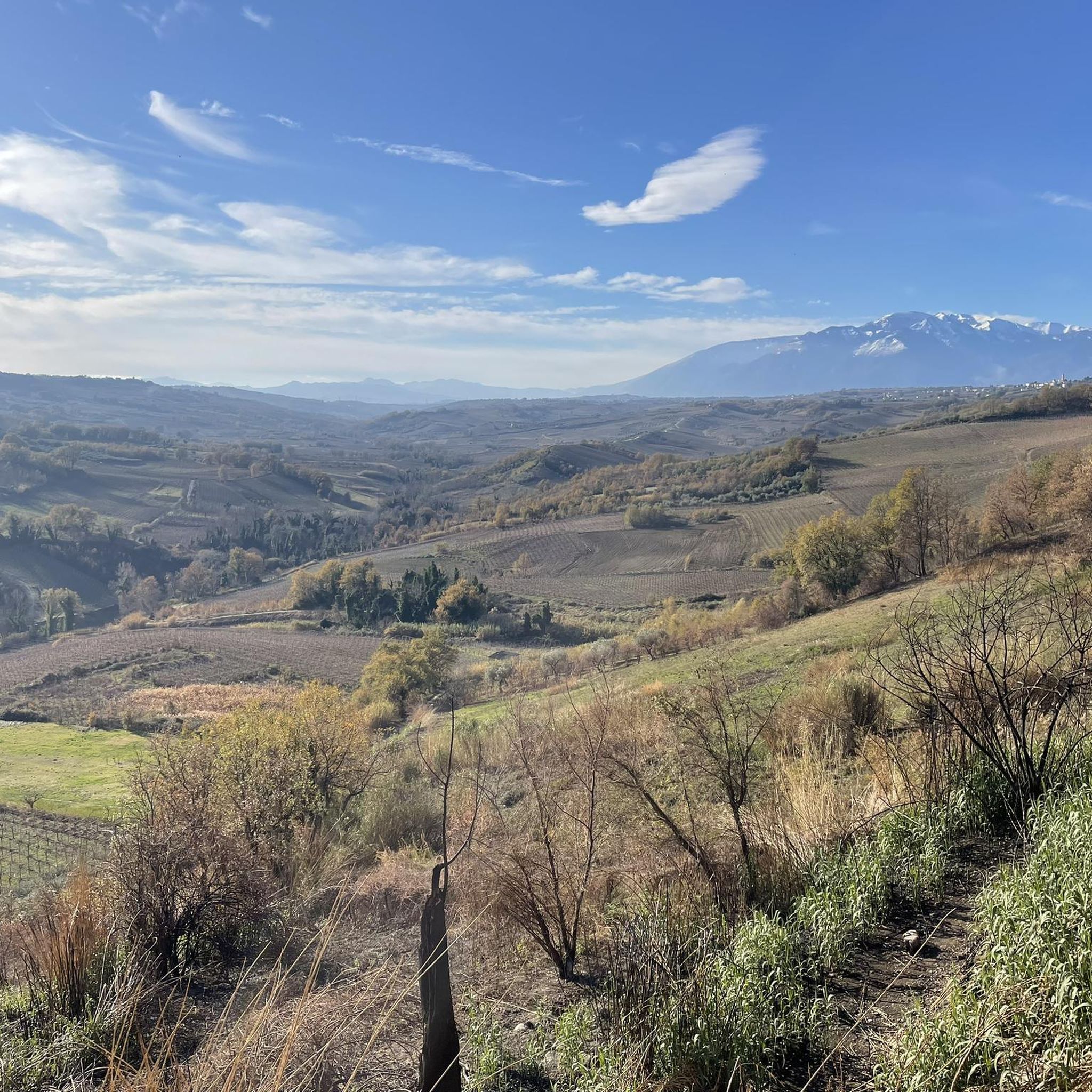
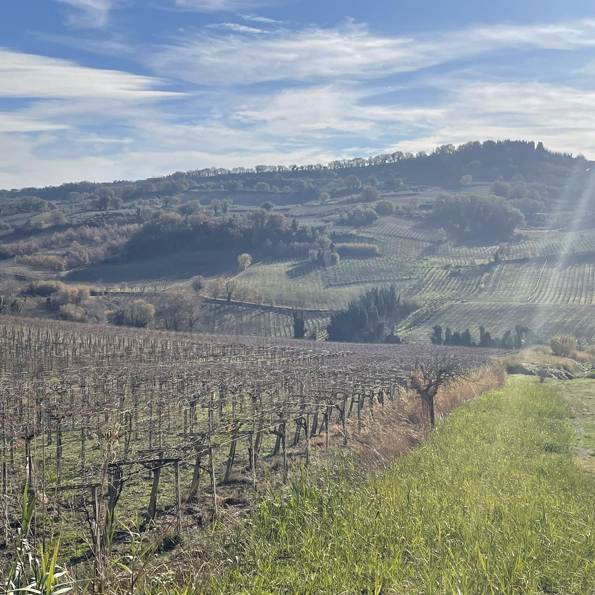
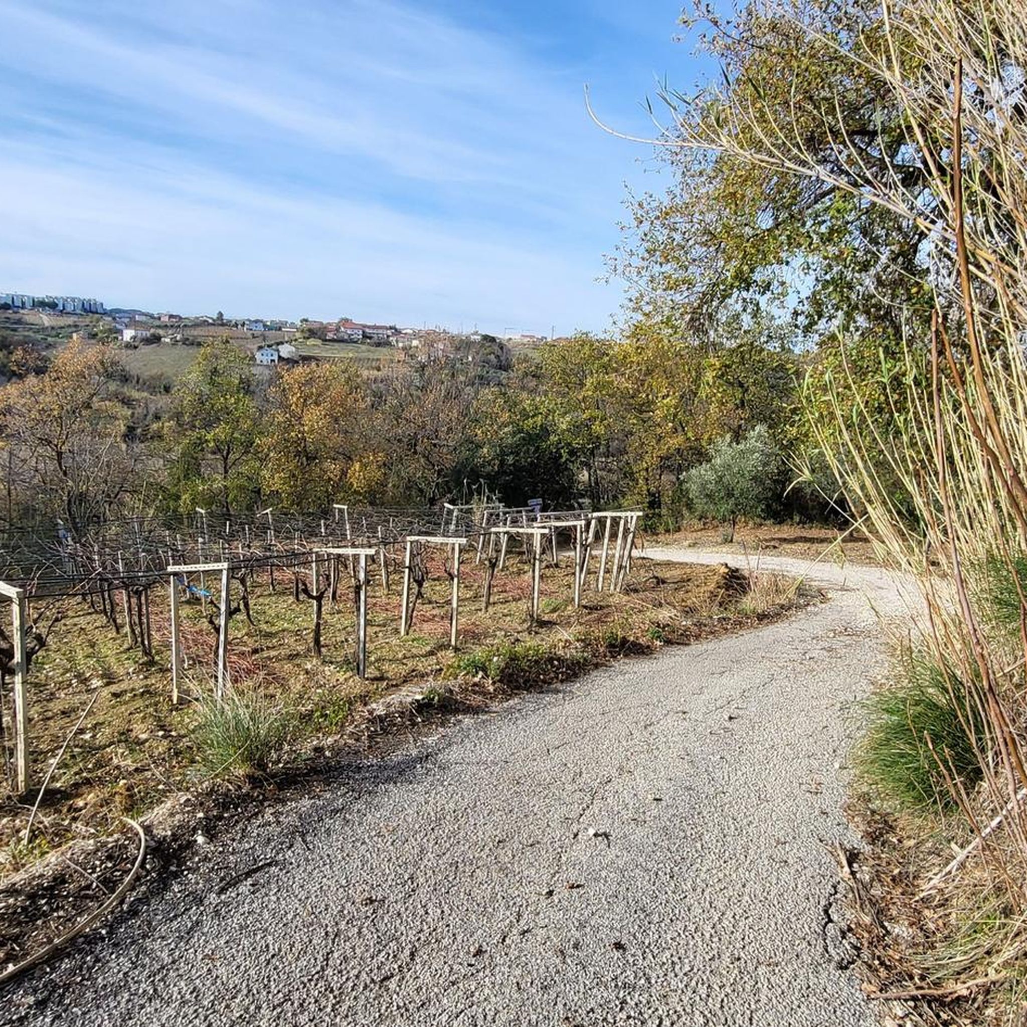
Hiking around Crecchio offers diverse landscapes, characterized by hilly terrain and valleys carved by streams like the Arielli and Rifago. The region features a blend of agricultural areas with vineyards and olive groves, providing scenic routes. Situated between the Adriatic coast and the foothills of the Maiella Mountain Massif, Crecchio provides access to varied elevation changes and natural features. The area's topography includes both predominant hills and flatter expanses.
Best hiking trails around Crecchio
- The most popular hiking route is…
Last updated: July 19, 2026
4.9
(10)
101
hikers
10.9km
02:48
50m
50m
Moderate hike. Good fitness required. Easily-accessible paths. Suitable for all skill levels.
4.8
(6)
35
hikers
26.5km
06:55
180m
180m
Hard hike. Very good fitness required. Easily-accessible paths. Suitable for all skill levels.

Sign up for free
16
hikers
9.44km
02:33
130m
130m
Moderate hike. Good fitness required. Easily-accessible paths. Suitable for all skill levels.
14
hikers
4.18km
01:05
30m
30m
Easy hike. Great for any fitness level. Easily-accessible paths. Suitable for all skill levels.
14
hikers
8.06km
02:10
100m
100m
Moderate hike. Good fitness required. Easily-accessible paths. Suitable for all skill levels.
Get access to more routes and recommendations from other explorers.
Sign up for free
Already have an account?
Our route recommendations are based on thousands of hikes, rides, and runs completed by other people on komoot.
Start today with a free account
Your next adventure awaits.
Login or Signup

Tips from the Community

Riserva Naturale Punta dell'Acquabella: a wild coastal paradise 🌿🌊 One of the absolute ecological pearls along this route is the Riserva Naturale Punta dell'Acquabella. While many coastal towns are busy and touristy, here you'll discover a hidden oasis where rugged cliffs, fragrant pine forests, and an azure sea come together perfectly. Why you should definitely stop here: 💧 Crystal clear water The name Acquabella – “beautiful water” – says it all. The sheltered bay boasts remarkably clear seawater that invites a refreshing dip. 🎨 Art along the route The reserve lies right next to the Galleria Aurelia. Just before you dive into the tunnel, you'll cycle past impressive murals by street artist Millo, a tribute to the local war resistance. 🏚️ An abandoned fishing village in the green Hidden behind the pebble beach lie the ruins of Borgo dell’Acquabella. This small fishing hamlet was abandoned in the '70s and has since been slowly reclaimed by nature. 🚴 A place made for cyclists By car, this hidden bay is barely accessible due to the narrow and steep access roads. By bike, you reach the reserve via the Via Verde and roll almost effortlessly to this unique coastal spot. A short stop that feels like a discovery: wild nature, sea views, and a piece of hidden history in one place.
3
0
The Trabucchi cycle path (officially known as the Via Verde dei Trabocchi) is a beautiful, largely flat cycle path over 50 kilometers long that runs along the Adriatic coast of the Italian region of Abruzzo on a former railway line. The path owes its name to the trabocchi (singular: trabocco): unique, monumental wooden fishing platforms on stilts that rise above the water like giant spiders.
3
0
Trabocco Mucchiola – Picnic with sea view Trabocco Mucchiola is a lovely place to take a break during your tour along the Via Verde dei Trabocchi. Next to the cycle path, there is a shady picnic area with tables, ideal for resting, eating something, or simply enjoying the view of the Adriatic Sea. The charming wooden trabocco stands on the rocky Punta Mucchiola and is one of the first fishing platforms you will encounter south of Ortona. Thanks to its splendid location, this is also a beautiful stop along the route to capture a beautiful memory.
2
0
Flat and car-free: The route is laid out on a former railway line directly on the Adriatic Sea. It is fully asphalted, flat, and 100% car-free, making it perfect for any type of cyclist (from road cyclists to families).Unique setting: You cycle right past the iconic trabocchi: wooden, spider-like fishing platforms that hover over the waves. At many of these platforms, you can stop nowadays for a unique lunch or dinner with fresh fish.
2
0
Spiaggia di Punta dell'Acquabella – Hidden nature gem Near the cycle tunnel in Ortona lies Spiaggia di Punta dell'Acquabella, one of the most beautiful and pristine beaches on the Costa dei Trabocchi. This protected nature reserve is surrounded by high cliffs and a fragrant pine forest and is known for its crystal-clear, turquoise water – ideal for a refreshing dip during a hot bike ride. Behind the beach lie the silent ruins of the former fishing village Borgo dell'Acquabella, which has been abandoned since the 1970s. The turn-off to the beach is also located near the impressive murals by Millo, making both highlights perfectly combinable. Please note that this is a natural pebble beach without any facilities. Bring plenty of drinking water, and water shoes are definitely recommended if you want to enter the clear water.
3
0
Alessandro Fantini Mural: A Tribute to a Cycling Legend 🚴♂️🎨Near the beach of Spiaggia Ripari Bardella, you will find this impressive mural. The artwork was created in April 2023 by street artists Nicola Di Totto (Dueneko) and Lorenzo Nicoletti (Skugio). This was done especially for the Grand Départ of the Giro d'Italia 2023 on the Costa dei Trabocchi.Who was Alessandro Fantini?The sprint king of Abruzzo: "Sandrino" Fantini was born in 1932 in nearby Fossacesia.Great successes: As an explosive sprinter, he won no fewer than seven stages in the Giro d'Italia and two stages in the Tour de France during his professional career (1955–1961).Tragic end: In 1961, during a mass sprint in the Tour of Germany, he crashed heavily, passing away at the young age of 29.What else do you see here?Right next to Fantini's portrait, you will find the colourful, multi-metre-long artwork "Dal primo all'ultimo" (From the first to the last). This mural depicts a compact cycling peloton stretching for a good 60 metres along the wall.
3
0
Street Art by Millo: Tribute to the Resistance 🎨🚴♀️Just before the cycle tunnel at the Punta dell'Acquabella nature reserve, you'll cycle past the impressive diptych "Dalle Radici al Fiore" by the famous Italian street artist Millo. This gigantic black-and-white artwork with bright red poppies tells a special historical story.Why you should stop here:Beautiful Street Art: Admire Millo's unique, recognizable style, directly on the retaining wall along the cycle path.Historical Story: The diptych honors the resistance during the Battle of Ortona (1943) in World War II.Heroic Women: The mural specifically draws attention to the 'staffette': brave local women who used bicycles to deliver coded messages between the lines.Symbolism: The red poppies (papaveri) symbolize the Italian partisans and regained freedom.Practical cycling tip:Location: You can't miss this artwork. It's located directly on the Via Verde (heading south from Ortona), just before entering the illuminated cycle tunnel. Pull over for a unique photo!
3
0
Imagine: the Adriatic Sea shimmering beside you, a fresh sea breeze on your face, and an endless cycle path winding along the coast. The Via Verde dei Trabocchi is one of those routes where you don't really want the ride to end. This cycle path, over 50 kilometers long and largely flat, follows a former railway line and takes you along one of the most beautiful coastal stretches of Abruzzo. Along the way, you'll pass the iconic trabocchi: impressive wooden fishing platforms that seem to float on the sea on stilts. With their long arms and nets, they stand out against the horizon like gigantic wooden works of art. Thanks to the flat course, this route is suitable for almost everyone, from recreational cyclists to avid mileage eaters. Along the way, charming beaches, atmospheric villages, and countless spots beckon where you can stop for an espresso, an ice cream, or a fresh fish lunch with a sea view. The Via Verde dei Trabocchi is not just a cycle path, but an experience that effortlessly combines nature, culture, and relaxation. A route you must cycle at least once.
3
0
Frequently Asked Questions
How many hiking trails are available around Crecchio?
Crecchio offers a wide variety of hiking experiences, with over 50 trails available for exploration. These routes cater to different preferences, ranging from easy strolls through vineyards to more challenging paths with varied elevation.
What kind of terrain can I expect when hiking near Crecchio?
The terrain around Crecchio is quite diverse, characterized by rolling hills and valleys carved by streams like the Arielli and Rifago. You'll hike through extensive vineyards and olive groves, which are prominent features of the agricultural landscape. The region's position between the Adriatic coast and the foothills of the Maiella Mountain Massif also means you can expect varied elevation changes and scenic views.
Are there easy hiking options suitable for beginners in Crecchio?
Yes, Crecchio has plenty of easy hiking options perfect for beginners or those looking for a relaxed walk. More than half of the trails, specifically 26 out of 51, are rated as easy. An example is the Lanciano loop from Lanciano, which is 4.4 miles (7.1 km) with gentle gradients through the countryside.
Are there any challenging hikes around Crecchio?
While many trails are easy to moderate, there are a few more challenging options for experienced hikers. The region's proximity to the Maiella Mountain Massif hints at potential for more strenuous excursions, though specific challenging routes within the immediate Crecchio area are fewer. There are 2 routes rated as difficult among the 51 available.
What natural features can I discover on hikes around Crecchio?
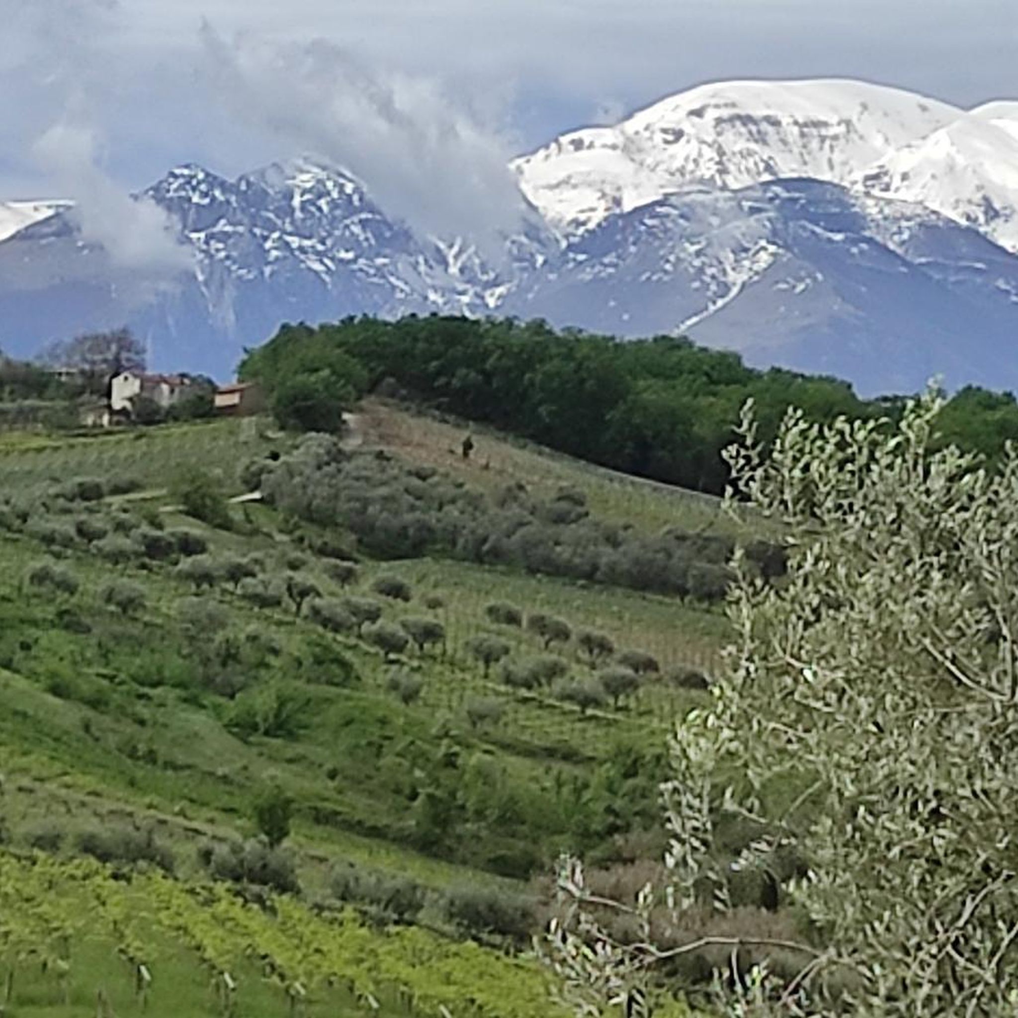
Hiking around Crecchio allows you to explore lush river valleys formed by streams like the Arielli, Rifago, and Moro. You'll also encounter vast agricultural landscapes dominated by vineyards and olive groves. The area offers glimpses of the Adriatic coast and, on clearer days, views towards the impressive Maiella Mountain Massif.
Are there any historical landmarks or attractions to see while hiking near Crecchio?
Yes, hiking in Crecchio often combines natural beauty with rich history. The medieval village center itself is dominated by its Ducal Castle. Nearby, you can explore attractions such as the Aragonese Castle of Ortona. Some trails also lead near the Via Verde dei Trabocchi, a scenic coastal path, and you might spot unique murals like the Alessandro Fantini Mural or the Dalle Radici al Fiore Murals by Millo.
Can I find viewpoints with panoramic scenery on the trails?
Absolutely. Crecchio is situated on a hill with steep flanks, and its varied hilly terrain naturally offers numerous viewpoints. Many routes provide scenic vistas over the surrounding valleys, agricultural landscapes, and towards the Adriatic Sea. On clear days, you can also catch impressive views of the distant Maiella Mountain Massif.
Are there family-friendly hiking trails in Crecchio?
Yes, with 26 easy routes available, Crecchio is well-suited for family outings. These trails typically feature gentle gradients and pass through pleasant landscapes like vineyards and olive groves, making them enjoyable for all ages. The Fonte del Borgo loop from Quartiere Trento e Trieste is an easy 4.5 miles (7.3 km) option that families might enjoy.
Are there circular hiking routes available in Crecchio?
Many of the hiking routes around Crecchio are designed as loops, offering convenient circular walks. For instance, the Fonte del Borgo – Torri Montanare loop from Lanciano is a moderate 7.1 miles (11.5 km) circular trail, and the Torri Montanare – Lanciano loop from Lanciano is an easy 4.4 miles (7.0 km) loop.
What do other hikers say about the trails in Crecchio?
The hiking trails in Crecchio are highly regarded by the komoot community, holding an impressive average rating of 4.3 stars from over 60 reviews. Hikers often praise the diverse landscapes, which include charming vineyards, olive groves, and scenic river valleys. The blend of natural beauty with historical elements, such as the medieval village, is also frequently highlighted as a unique aspect of the Crecchio hiking experience.
Is there public transport available to reach hiking trailheads in Crecchio?
Crecchio is a small village, and while local bus services connect it to larger towns like Lanciano, direct public transport to specific trailheads might be limited. It's advisable to check local bus schedules in advance or consider driving to the starting points of your chosen hikes, where parking is generally available.
What is the best time of year to go hiking in Crecchio?
The spring and autumn months are generally considered the best times for hiking in Crecchio. During these seasons, the weather is typically mild and pleasant, making for comfortable walking conditions. Spring brings blooming wildflowers and lush greenery, while autumn offers beautiful foliage and cooler temperatures, ideal for longer excursions.
Most popular attractions around Crecchio

Get inspired with the komoot mobile app


Explore more
Browse the best Hikes in other regions.
