The best walks and hikes around Pennapiedimonte
4.6
(1611)
7,272
hikers
24
hikes
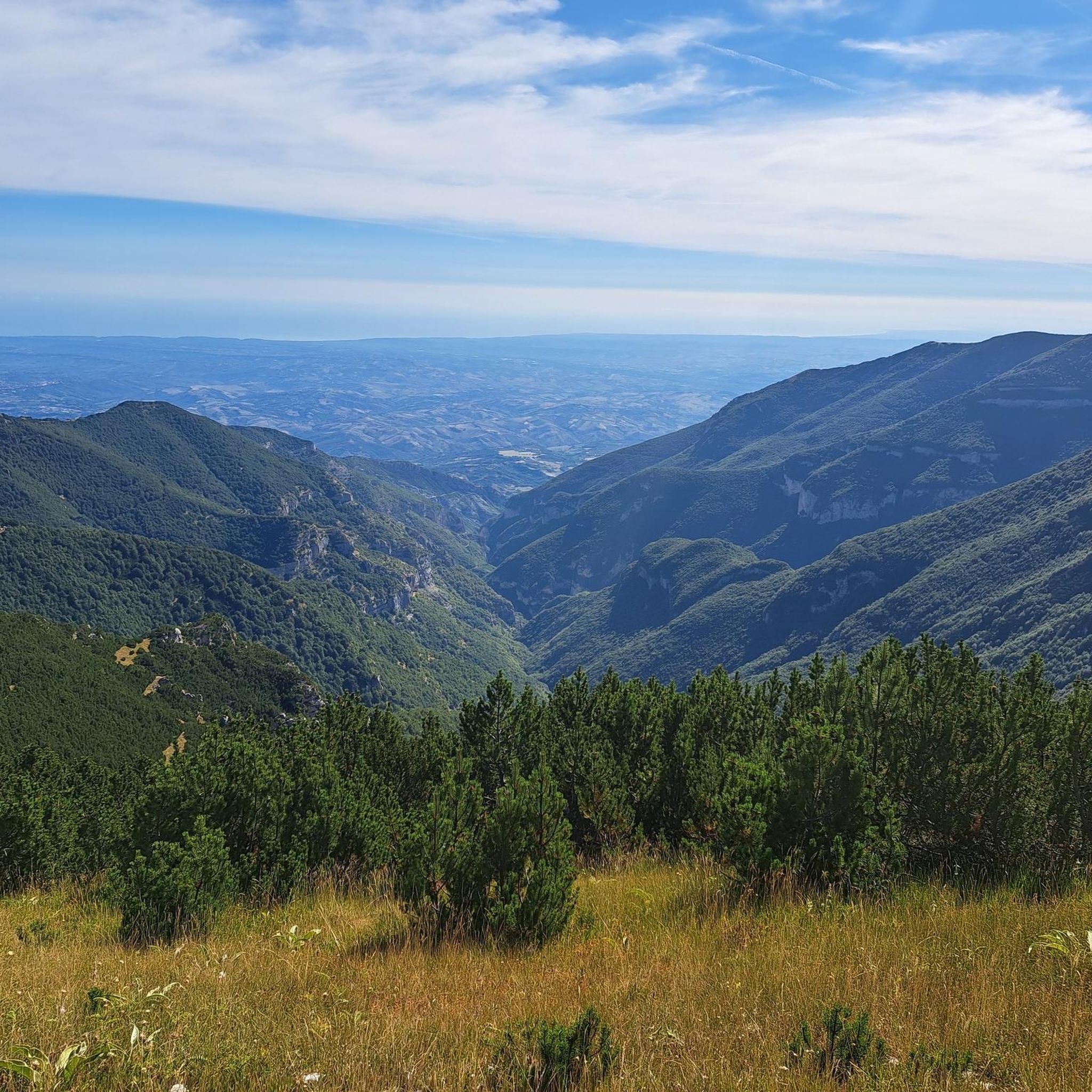
Hiking around Pennapiedimonte offers access to the rugged terrain and diverse ecosystems of Majella National Park. The region is characterized by dramatic landscapes, including deep canyons, river valleys, and unique rock formations. Hikers will find significant altitude differences, ranging from lower valleys to mountain peaks, providing varied challenges and panoramic views. This area is known for its natural features, such as waterfalls and ancient pastoral caves.
Best hiking trails around Pennapiedimonte
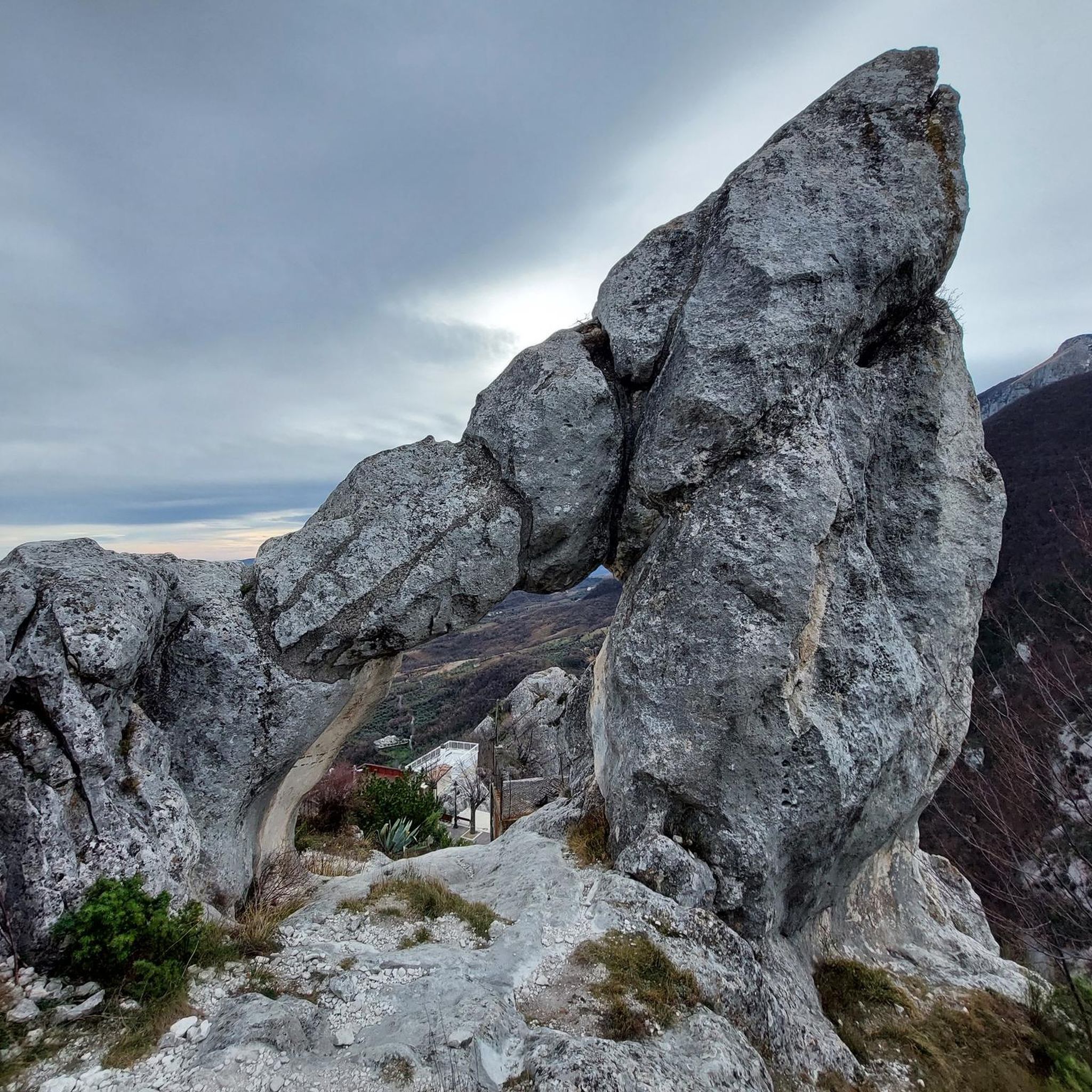
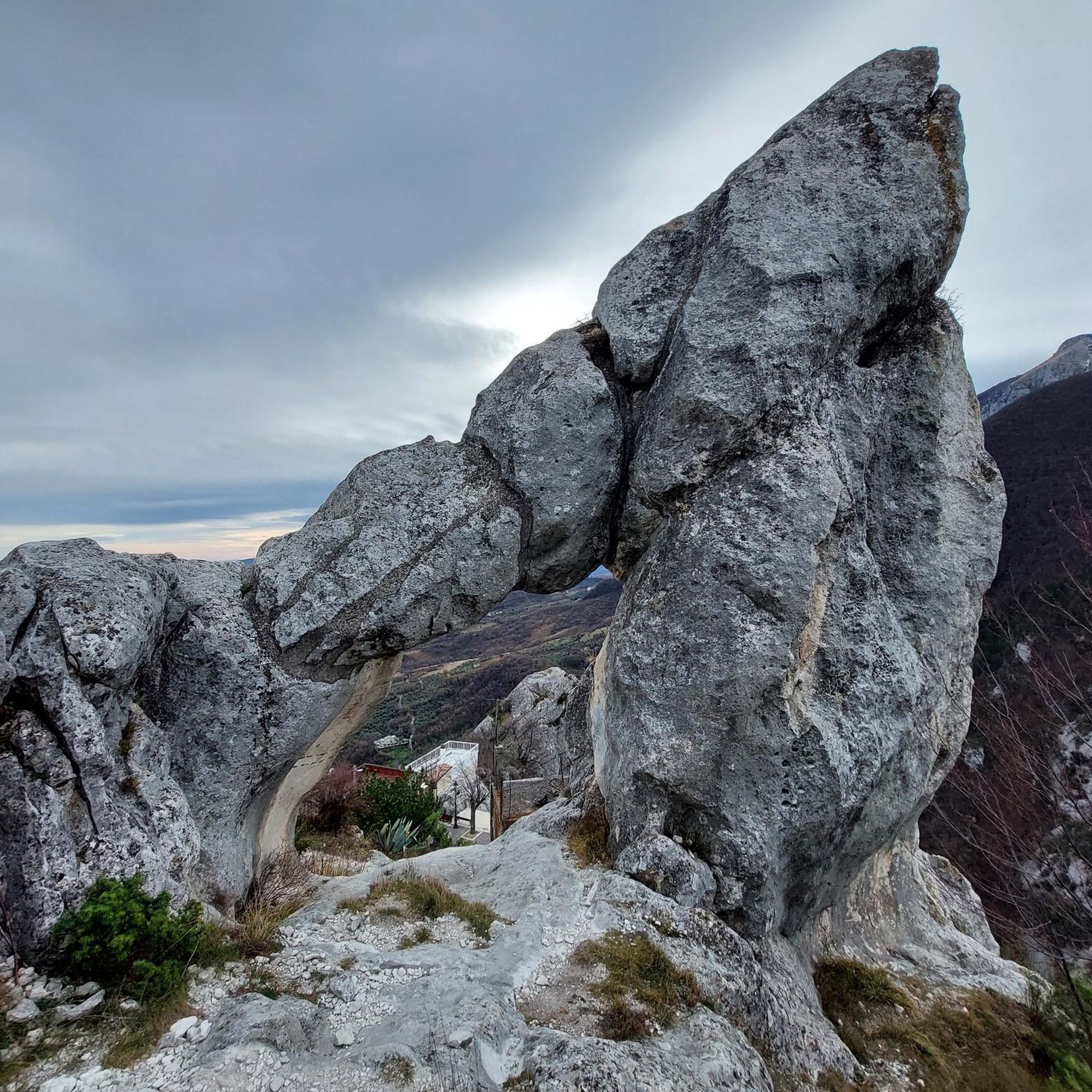
- The most popular hiking route is Dea Maja Rock Arch (Cimirocco) – Majelletta Picnic Area loop from Pennapiedimonte, a 6.5 miles (10.5 km) trail that takes 3 hours 24 minutes to complete. This moderate route explores unique geological features and offers views towards the Majelletta area.
- Another top favourite among local hikers is View of Majella Mountain – Majelletta Picnic Area loop from Pennapiedimonte, a difficult 10.9 miles (17.5 km) path. This challenging trail provides extensive views of the Majella mountain range and surrounding landscapes.
- Local hikers also love the Saddle of Monte Acquaviva – Carlo Fusco Shelter loop from Rifugio Bruno Pomilio, an 8.5 miles (13.7 km) trail leading through high mountain terrain, often completed in about 5 hours 53 minutes.
- Hiking around Pennapiedimonte is defined by rugged mountain terrain, deep river valleys, and unique rock formations within Majella National Park. The network offers options for both moderate and difficult routes, catering to various experience levels.
- The routes in Pennapiedimonte are highly rated by the komoot community with an average score of 4.6 stars from over 1,300 reviews. More than 6,300 hikers have used komoot to explore Pennapiedimonte's varied terrain.
Last updated: September 28, 2026
4.7
(33)
261
hikers
21.1km
10:33
1,390m
1,390m
Hard hike. Very good fitness required. Sure-footedness, sturdy shoes and alpine experience required.
4.7
(62)
271
hikers
Moderate hike. Good fitness required. Mostly accessible paths. Sure-footedness required.

4.4
(40)
184
hikers
17.5km
07:02
1,160m
1,160m
Hard hike. Very good fitness required. Mostly accessible paths. Sure-footedness required.
4.8
(28)
218
hikers
Moderate hike. Great for any fitness level. Mostly accessible paths. Sure-footedness required.
4.6
(20)
136
hikers
6.83km
02:24
270m
270m
Moderate hike. Good fitness required. Mostly accessible paths. Sure-footedness required.
Get access to more routes and recommendations from other explorers.
Already have an account?
Our route recommendations are based on thousands of hikes, rides, and runs completed by other people on komoot.
Start today with a free account
Your next adventure awaits.
Tips from the Community

The small sacred monument encountered on Monte AMARO is – in addition to the view on offer – perhaps also a fitting place for a brief moment of reflection. Christiane Völkel commented a few years ago on the wonderfully fitting sentence by the Italian poet Francesco Petrarca (who lived in the 14th century), "One always has the sky above oneself," as follows: "What's the use of praying? The question moves me (...) I have found the answer and the certainty for myself that when I pray I am with the Lord, or rather, that He is often noticeably closer to me when I pray than usual. This leaves me the opportunity to pour out my heart to Him (...) This familiarity with Him makes me believe in Him."
0
0


Here the path leads along the entrance of the grotto and goes steeply uphill opposite.
0
0

If you go beyond the end of the paved road, after the telecommunications facilities of the blockhouse, you'll find a paved road that ends on another stretch of gravel road, leading to a sort of small terrace, where you can admire a 360° panorama. A short distance away, you can see a small chapel dedicated to Our Lady of the Snows... from there, you'll find trails for hiking or, for a while, for a gravel bike ride.
0
0

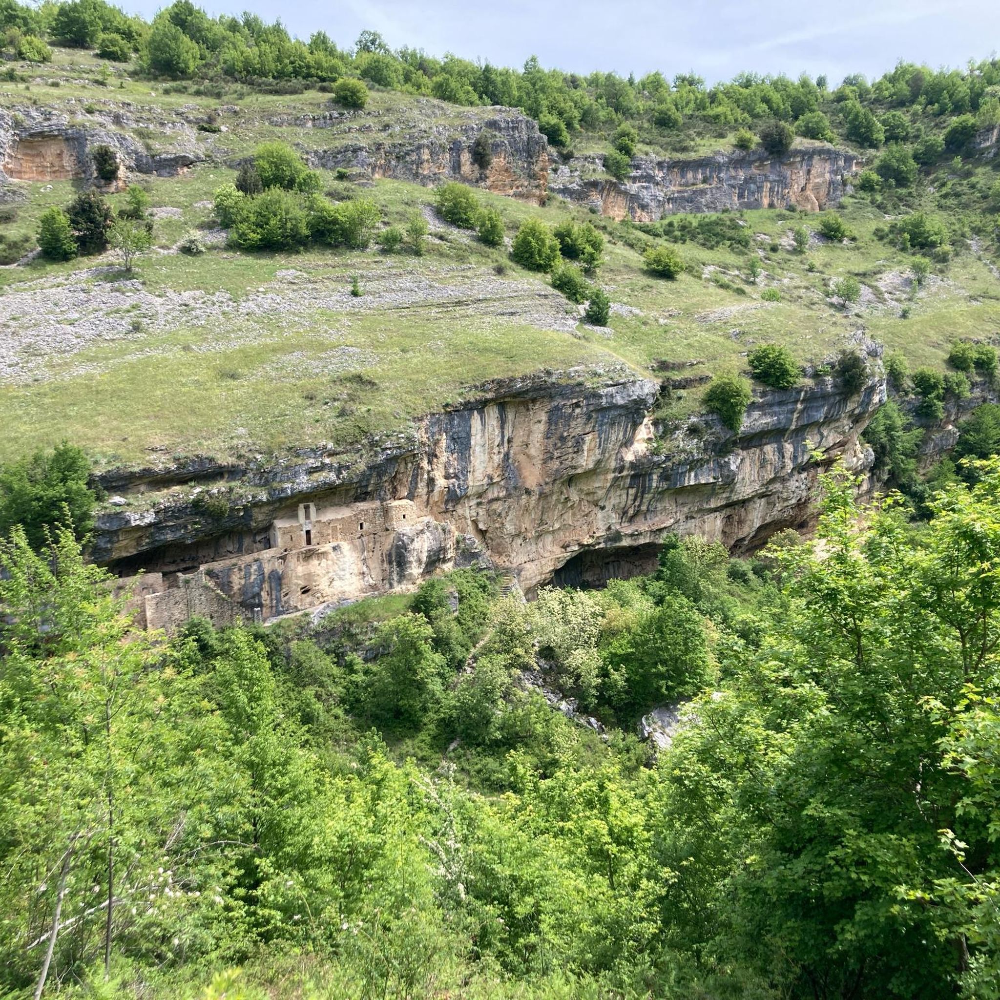
The Pischioli is a refuge located under a rock spur with a fountain and a rest area equipped with tables adjacent to the refuge. It is located in a suggestive panoramic point with the Avello and Tre Grotte valleys and the Majella with a view of Cima Murelle looking up. Starting from Balzolo you pass the famous Pinna, which symbolizes the goddess Maja, also called Cimirocco. Skirting the aqueduct fence you climb steeply along a stony path, a couple of sections are slightly exposed but nothing transcendental. After the initial section the climb becomes a little less steep and passes through vegetation composed of juniper bushes, it is a slightly slippery climb especially in the case of rain. After a good hour of walking a clearing suddenly appears with the rock spur that guards the Pischioli refuge. A short distance from the refuge there are several pastoral caves of great beauty and the Madonna delle Sorgenti. To continue towards Pomilio, take the path uphill that will first lead to Rapina and then arrive among meadows and mountain pines at Pomilio. To descend from Pischioli it is possible, recommended in case of unstable or wet weather, to take the path that from the Pischioli equipped area enters the woods and descends towards Bocca di Valle, not taking the fork for Bocca di Valle the path will take us under Balzolo in the area reserved for parking cars. It is a longer but simple path that passes through a beautiful wood where there are several remains of walls of pastoral huts. There are several routes, more or less difficult, to reach it.
1
0

Outpost of the neo-Italian army. The Blockhaus (rock house) was the term used to name the military forts built in the southern provinces of Italy to counter the actions of post-unification brigandage. Built between 1865 and 1864, it was used until 1866 by a group of 18 soldiers with horses following them.
0
0

This trail stays lower than the summit, but offers several breathtaking views.
0
0
Frequently Asked Questions
How many hiking trails are available around Pennapiedimonte?
There are over 20 hiking trails around Pennapiedimonte, offering a range of experiences within the Majella National Park. These routes are highly rated by the komoot community, with an average score of 4.6 stars.
What kind of terrain can I expect when hiking in Pennapiedimonte?
Hiking in Pennapiedimonte involves rugged mountain terrain, deep river valleys, and unique rock formations. The area is characterized by significant altitude differences, from lower valleys to mountain peaks, providing diverse challenges and panoramic views.
Are there any waterfalls to discover on hikes near Pennapiedimonte?
Yes, the region features several picturesque waterfalls. You can find the Linaro waterfall in the Valle dell'Avello, and the Cascata del Macarone della Pila (also known as the 'Three Caves Waterfall') accessible from Balzolo. Additionally, the San Giovanni Waterfall is another notable natural monument in the area.
Can I find any circular hiking routes in the area?
Yes, many routes around Pennapiedimonte are designed as loops. For example, the Dea Maja Rock Arch (Cimirocco) – Majelletta Picnic Area loop from Pennapiedimonte is a moderate 6.5-mile trail exploring unique geological features. Another option is the challenging View of Majella Mountain – Majelletta Picnic Area loop from Pennapiedimonte, offering extensive views.
What are some interesting landmarks or natural features to see along the trails?
Hikers can explore a variety of natural features. The Gorges of Fara San Martino offer impressive canyons, while the Orfento Valley provides beautiful trails through its gorges. You can also discover unique geological formations like the Dea Maja Rock Arch (Cimirocco) and historic pastoral caves.
Are there any challenging hikes for experienced trekkers?
Absolutely. Pennapiedimonte offers several difficult routes for experienced hikers. A challenging option is the Saddle of Monte Acquaviva – Carlo Fusco Shelter loop from Rifugio Bruno Pomilio, an 8.5-mile trail through high mountain terrain. Another demanding route is the Blockhaus Trail – Saddle of Monte Acquaviva loop from Rifugio Bruno Pomilio, covering nearly 12 miles with significant elevation gain.
What is the best time of year to go hiking in Pennapiedimonte?
The Majella National Park, where Pennapiedimonte is located, offers diverse experiences throughout the year. Spring and autumn generally provide pleasant temperatures and vibrant scenery, ideal for hiking. Summer can be warm, especially at lower altitudes, but higher trails offer cooler conditions. Winter hiking is possible but may require specific gear and experience due to snow and ice.
What do other hikers enjoy most about the trails in Pennapiedimonte?
The trails in Pennapiedimonte are highly rated by the komoot community, with an average score of 4.6 stars from over 1,300 reviews. Hikers often praise the dramatic landscapes, the sense of wild nature, and the breathtaking panoramic views, especially from spots like the Balzolo Viewpoint.
Are there any easy or moderate hikes suitable for those with good training?
Yes, while the region is known for its ruggedness, there are moderate options. The Dea Maja Rock Arch (Cimirocco) – Majelletta Picnic Area loop from Pennapiedimonte is a moderate 6.5-mile trail. Another moderate choice is the Blockhaus (2,096 m) – Chapel of Our Lady of the Snow loop from Rifugio Bruno Pomilio, a shorter 2.8-mile route with less elevation.
Is there parking available near the trailheads in Pennapiedimonte?
Yes, parking is generally available at key starting points for many routes, such as the Balzolo Viewpoint in Pennapiedimonte or near Rifugio Bruno Pomilio for higher mountain trails. It's advisable to check specific trailhead information for detailed parking facilities.
What are the highest points accessible by hiking trails in the region?
The Majella National Park features significant altitude differences, with peaks like Monte Focalone reaching 2,676 meters. Trails in the area can lead to high mountain terrain, such as the Saddle of Monte Acquaviva, offering access to some of the highest points in the Apennines.
Most popular attractions around Pennapiedimonte

Get inspired with the komoot mobile app


Explore more
Browse the best Hikes in other regions.
