The best walks and hikes around Ovindoli
4.5
(488)
2,294
hikers
71
hikes
Hiking around Ovindoli, nestled in Italy's Apennine Mountains, offers diverse terrain within the Sirente-Velino Regional Natural Park. The landscape features high mountain peaks like Monte Magnola, expansive glacial plateaus such as Piani di Pezza, and deep gorges like Gole di Celano. The region is characterized by a mix of forested slopes, open valleys, and rocky ascents, providing varied hiking experiences.
Best hiking trails around Ovindoli
- The most popular hiking route is La Val D'Arano – loop from Ovindoli, a…
Last updated: October 10, 2026
4.4
(29)
119
hikers
12.2km
03:19
160m
160m
Moderate hike. Good fitness required. Easily-accessible paths. Suitable for all skill levels.
4.6
(21)
114
hikers
Hard hike. Very good fitness required. Easily-accessible paths. Suitable for all skill levels.

4.8
(17)
35
hikers
11.0km
03:56
460m
460m
Moderate hike. Good fitness required. Mostly accessible paths. Sure-footedness required.
4.4
(5)
28
hikers
27.6km
08:59
1,160m
1,160m
Hard hike. Very good fitness required. Mostly accessible paths. Sure-footedness required.
4.2
(47)
211
hikers
8.13km
02:09
80m
80m
Moderate hike. Good fitness required. Easily-accessible paths. Suitable for all skill levels.
Get access to more routes and recommendations from other explorers.
Already have an account?
Our route recommendations are based on thousands of hikes, rides, and runs completed by other people on komoot.
Start today with a free account
Your next adventure awaits.

Tips from the Community

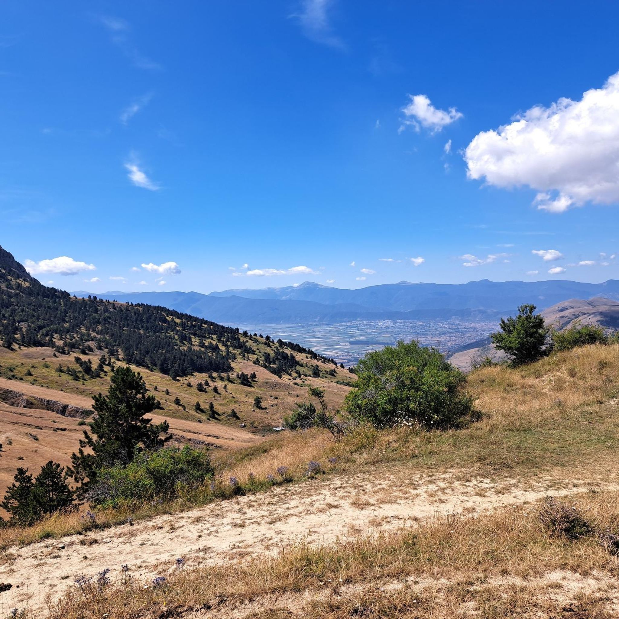
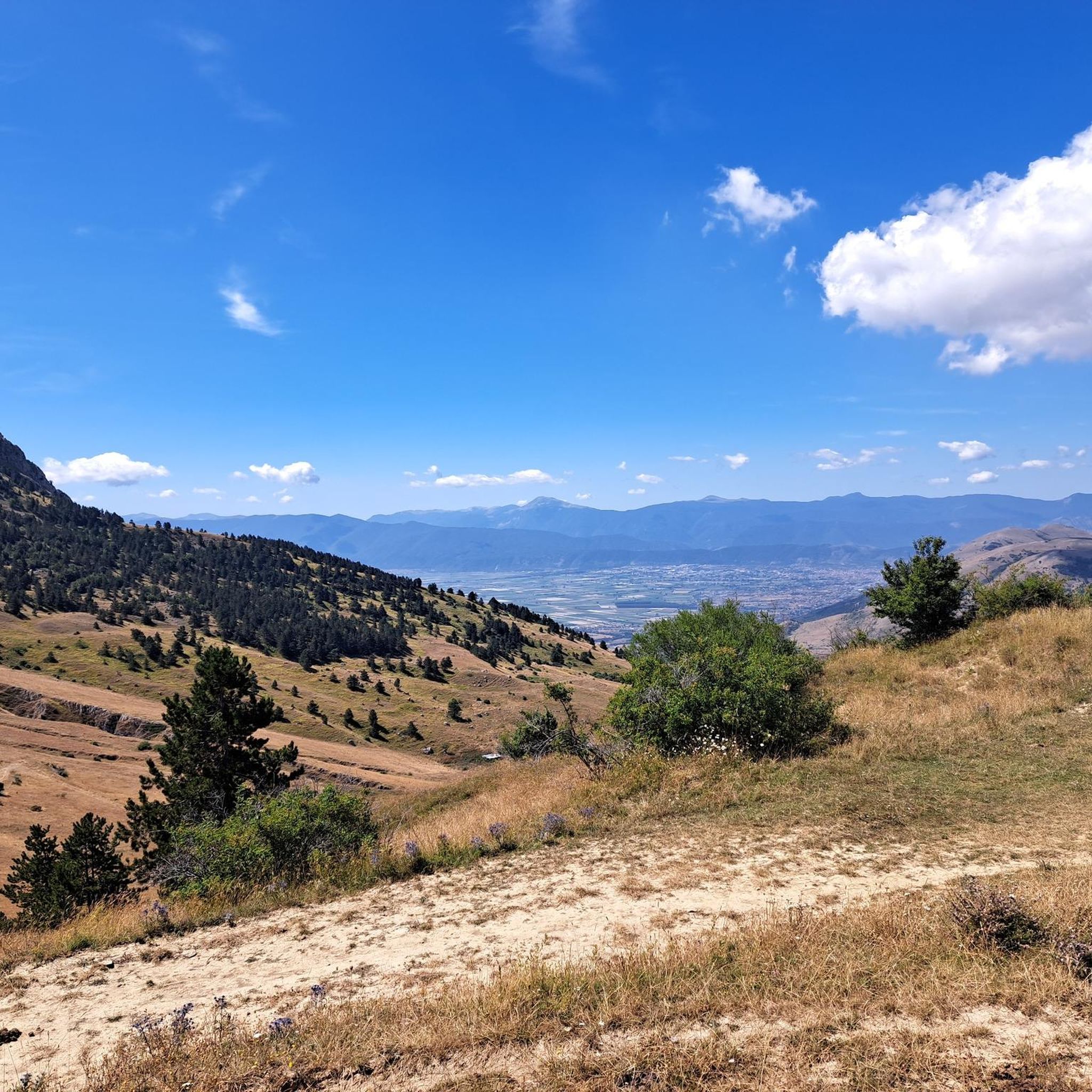
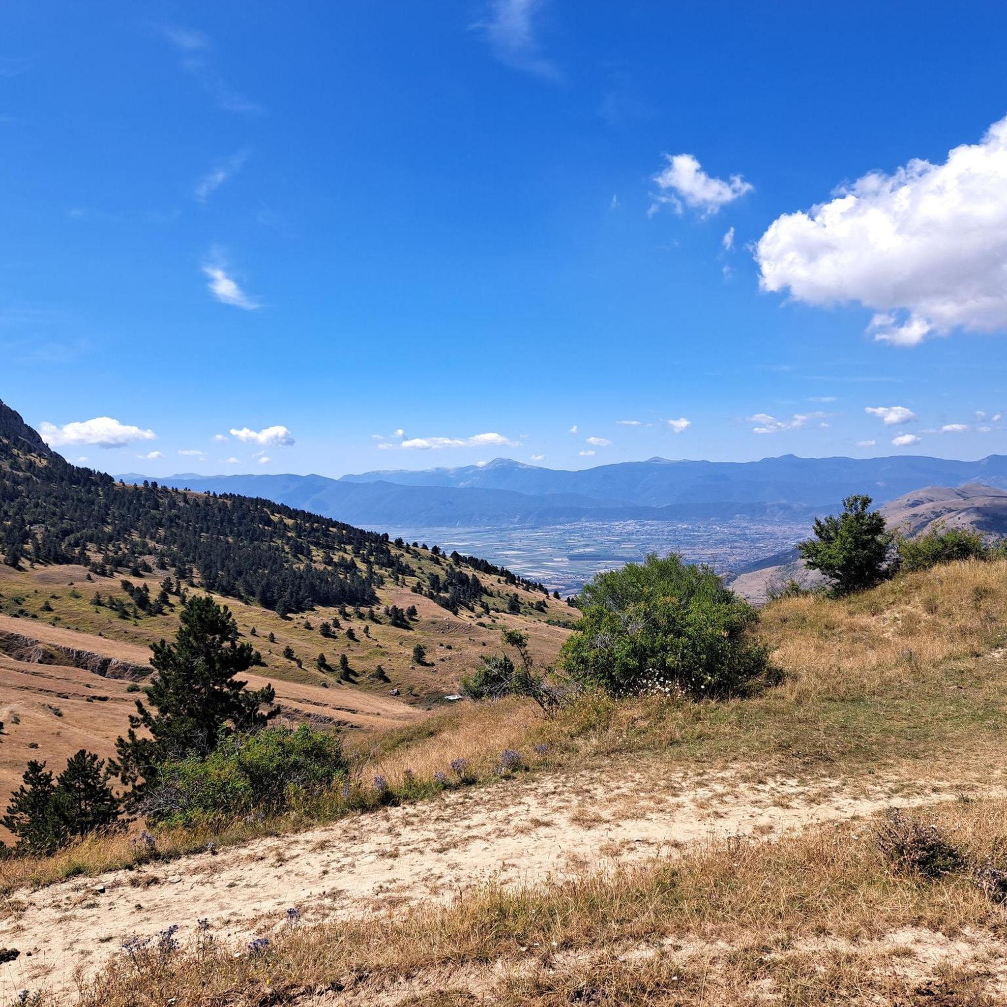
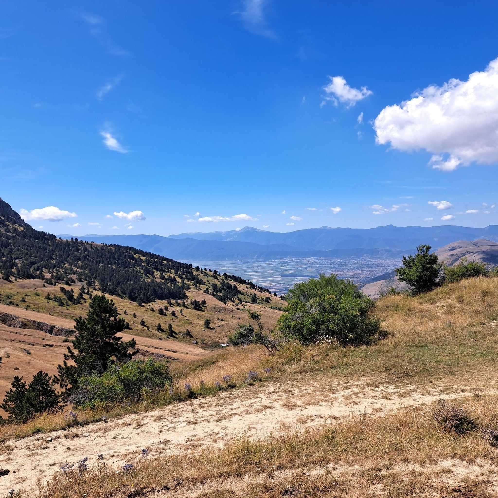
View over all the main Abruzzo peaks
1
0

Is it also possible with gravel? Can October be considered as a period to do it?
0
0

excellent landscape overlooking the Gran Sasso and the Maiella mountains. Possibility of meeting chamois too
1
0


Done many times, as well as with cross-country skis, also with Mtb. Enchanting scenery both in summer and in winter as someone has already commented. Did it again just yesterday in Mtb, and we'll do it again, and again 🚴🏻♀️😎✌🏾
1
1

Monte Sirente is a mountain in the Abruzzo Apennines, 2349 meters high, which is part of the Sirente-Velino Park. It is a destination for hikers and nature lovers, from the top you have a wonderful view of the surrounding landscape.
1
0
The village of Ovindoli stands at 1375 m asl in the presence of Mount Magnola. It is located within the Sirente-Velino Regional Natural Park, in the so-called "Altopiano delle Rocche". In addition to the naturalistic beauties, it is also worth mentioning its ancient castle-enclosure dating back to an era between the 12th and 14th centuries.
0
0
Monte Etra is a mountain in the Sirente-Velino group, inside the Regional Park. It is located between the Gole di Aielli-Celano and the Piani di Pezza, and is a rocky and sharp peak. You can go up from Ovindoli or from Aielli, following the marked paths.
1
0
Frequently Asked Questions
How many hiking trails are available around Ovindoli?
Ovindoli offers a wide variety of hiking experiences, with over 60 trails recorded on komoot. These range from easy walks to challenging high-altitude treks within the Sirente-Velino Regional Natural Park.
Are there easy hiking trails suitable for beginners in Ovindoli?
Yes, Ovindoli has several easy trails perfect for beginners or those looking for a relaxed walk. There are 20 easy routes available, such as the Valle d'Arano Loop from Ovindoli, which is about 7 km long and offers gentle terrain.
Can families with children find suitable hiking routes in Ovindoli?
Absolutely. Many trails in Ovindoli are suitable for families. The La Val D'Arano – loop from Ovindoli is a moderate 12.2 km trail that explores the scenic Valle d'Arano, offering an accessible and enjoyable experience for most families. The Fonte Canale Trail is also noted as accessible to everyone.
Are there any trails that feature waterfalls or gorges in Ovindoli?
Yes, the region boasts impressive natural features. The Gorges of Celano offer a mesmerizing hike, especially in summer, with narrow passages and glittering waterfalls like the Fonte degli Innamorati Waterfall. These are among the best hikes around Ovindoli.
Where can I find trails with panoramic viewpoints in Ovindoli?
For breathtaking views, consider hiking to the Monte Velino Summit Cross or Pizzo di Ovindoli for epic vistas. A less strenuous option is the Monumento dell'Alpino, located a short walk above Ovindoli, which provides incredible 360-degree panoramic views of the surrounding mountains and valleys.
What natural landmarks can I explore while hiking in Ovindoli?
Beyond the Gorges of Celano, you can explore the vast Piani di Pezza, a beautiful glacial plateau surrounded by mountains. Other notable natural monuments include Pozzo Caldaio and various mountain passes like Valico Fonte Capo La Maina, offering diverse landscapes.
Are there circular hiking routes available in Ovindoli?
Yes, Ovindoli offers several excellent circular routes. Popular options include the La Val D'Arano – loop from Ovindoli, the challenging Monte Savina and Monte Etra – loop tour, and the Monte di Selva Canuta and Monte delle Canelle Loop, all providing varied terrain and scenic beauty.
What is the best time of year to go hiking in Ovindoli?
Ovindoli is a year-round destination. For hiking, the warmer months from late spring to early autumn (May to October) are ideal, offering pleasant temperatures and clear trails. In winter, the area transforms into a ski resort, but snowshoeing and winter walks are also popular.
Are dogs allowed on the hiking trails in Ovindoli?
Many trails in the Sirente-Velino Regional Natural Park are dog-friendly, but it's always best to keep dogs on a leash, especially given the presence of wildlife such as the Marsican wolf and peregrine falcon. Always check specific trail regulations before heading out.
What do other hikers appreciate most about the trails in Ovindoli?
The trails in Ovindoli are highly rated by the komoot community, with an average score of 4.5 stars from over 300 reviews. Hikers often praise the stunning natural landscapes, diverse terrain ranging from high peaks to expansive plateaus, and the well-marked paths that cater to all skill levels.
Are there any challenging high-altitude treks in Ovindoli?
Yes, for experienced hikers seeking a challenge, Ovindoli offers several difficult high-altitude treks. The Monte Sirente Loop from Ovindoli is a demanding 27.6 km route with significant elevation gain, providing an intense workout and rewarding panoramic views.
What is the typical duration for hikes in Ovindoli?
Hike durations vary greatly depending on the trail's difficulty and length. Easy walks like the Valle d'Arano Loop can take around 2 hours, while moderate trails such as the La Val D'Arano – loop from Ovindoli typically take about 3 hours 20 minutes. More difficult routes, like the Monte Savina and Monte Etra loop, can extend to 5-6 hours or more.
Most popular attractions around Ovindoli

Get inspired with the komoot mobile app


Explore more
Browse the best Hikes in other regions.
