The best road cycling routes around Roccascalegna
4.2
(42)
1,356
riders
94
rides
Road cycling around Roccascalegna is characterized by its hilly and mountainous terrain, situated between the Abruzzo coast and the Maiella massif, cradled by the Sangro river. The region features varied landscapes, including rolling hills, dense forests, and historic medieval villages. Cyclists can expect challenging ascents and scenic descents through unspoilt natural surroundings. This area offers a network of routes that traverse diverse environments, providing a range of experiences for road cyclists.
Best road cycling routes around Roccascalegna
- The most popular…
Last updated: October 9, 2026
34.6km
02:35
1,140m
1,140m
Hard road ride. Very good fitness required. Some segments of this route may be unpaved and difficult to ride.
5.0
(1)
37
riders
100km
05:15
1,750m
1,750m
Hard road ride. Very good fitness required. Mostly well-paved surfaces and easy to ride.

26
riders
132km
07:31
3,000m
3,000m
Hard road ride. Very good fitness required. Mostly well-paved surfaces and easy to ride.
5.0
(2)
49
riders
84.6km
05:06
2,160m
2,160m
Hard road ride. Very good fitness required. Mostly well-paved surfaces and easy to ride.
4.0
(1)
27
riders
118km
06:22
2,310m
2,310m
Hard road ride. Very good fitness required. Mostly well-paved surfaces and easy to ride.
Get access to more routes and recommendations from other explorers.
Already have an account?
Our route recommendations are based on thousands of hikes, rides, and runs completed by other people on komoot.
Start today with a free account
Your next adventure awaits.

Tips from the Community

The inhabitants of Abruzzo and the neighboring region of Lazio have their own local observation related to this Passo Lanciano. When the sun sets in the spring behind the mighty Majella massif, it quickly gets dark on the Abruzzo side (i.e., where Passo Lanciano is located) and dusk falls, while on the other side of the mountains, in Lazio, it is still bright daylight. Locals joke that at the same moment, one half of Italy goes to sleep, and the other goes for an aperitivo.
0
0

spectacular places, lots of wind.
0
0

Passo Forchetta, connecting Roccaraso to Campo di Giove, offers a journey through a fresh and lush forest. The road, although the asphalt is not in perfect condition and subject to small landslides, offers a picturesque and fascinating driving experience.
1
0

Beautiful tourist village near Roccaraso
0
0

You can get here by train with your bike and go for a ride.
8
0

Passo Lanciano connects the two Abruzzo villages of Pretoro and Lettomanoppello. It is a place much loved by the locals, both in the summer and in the winter months: in fact, various hiking trails start from here and there are ski slopes. There is no shortage of restaurants where you can eat the typical arrosticini.
0
0

Picturesque Italian old town with quaint buildings and fountains in the square.
1
0
Frequently Asked Questions
How many road cycling routes are available around Roccascalegna?
There are over 75 road cycling routes around Roccascalegna, offering a wide range of options for cyclists. Most routes are classified as difficult, with a few moderate and easy options available.
What kind of terrain can I expect when road cycling in Roccascalegna?
Roccascalegna is situated in a hilly and mountainous region between the Abruzzo coast and the Maiella massif. Cyclists can expect varied terrain, including challenging ascents and scenic descents, often with significant elevation gains. Some routes may even include unpaved sections for an added adventure.
Are there any circular road cycling routes starting from Roccascalegna?
Yes, there are circular routes available. For example, you can explore the area with the challenging route Around the lake of Casoli from Roccascalegna - Ring tour, which covers about 34.5 km with over 1100 meters of elevation gain.
What are the best times of year for road cycling in Roccascalegna?
The Abruzzo region, including Roccascalegna, generally offers good cycling conditions from spring through autumn. Summer can be warm, especially in the valleys, but the higher elevations provide cooler temperatures. Spring and early autumn often provide pleasant weather and beautiful scenery.
What historical landmarks can I see along road cycling routes in the area?
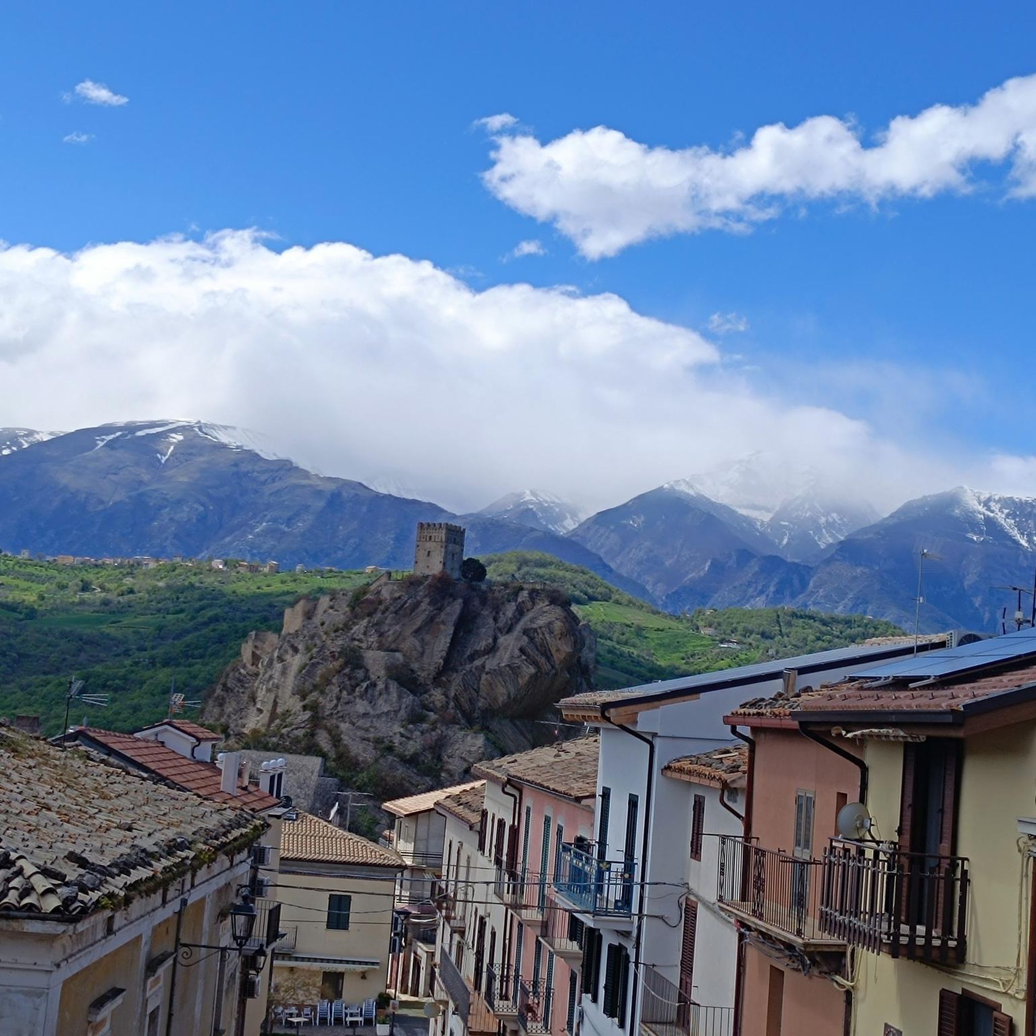
The most iconic landmark is the dramatic Castello di Roccascalegna, often called the 'castle in the sky,' offering breathtaking panoramic views. Other historical sites include the Baronial Palace. Further afield, routes like Ortona's Aragonese Castle – Rolling Hills Route loop from Archi can take you past other significant historical structures.
Are there any natural attractions or viewpoints along the cycling routes?
Absolutely. The region is rich in natural beauty. You can find stunning viewpoints like the View from Roccascalegna Castle. Natural monuments nearby include the Gorges of Fara San Martino, the Vallone di Santo Spirito, and the Sources of the Verde River. You might even encounter a Waterfall in Gola di Pennadomo.
What do other road cyclists say about the routes in Roccascalegna?
The road cycling routes around Roccascalegna are highly rated by the komoot community, with an average score of 4.3 stars from 38 reviews. Cyclists often praise the challenging climbs, the stunning panoramic views, and the unspoiled natural surroundings.
Are there any routes that offer significant climbing challenges?
Yes, Roccascalegna is known for its challenging climbs. For instance, the route Pretoro – Climb to Passo Lanciano loop from Piane d'Archi features a substantial 2461 meters of elevation gain over its 96 km distance, making it a demanding ride for experienced cyclists.
Can I find routes that connect to coastal areas or other regions?
While Roccascalegna is inland, the broader Abruzzo region is well-connected. Routes like Trabocco Punta Torre – Mouth of the Sangro River loop from Casoli can take you towards the coast, allowing you to experience diverse landscapes from mountains to the Adriatic Sea. The region also boasts the 'Bike To Coast' cycle path, which connects various medieval villages along the Adriatic coast.
Is parking available for cyclists in Roccascalegna?
While specific designated cycling parking areas are not detailed, Roccascalegna is a small village. Parking is generally available within the village, especially near its main attractions, from where you can typically start your cycling tours.
Are there any long-distance road cycling routes in the vicinity?
Yes, many routes extend for significant distances, offering long-distance challenges. For example, the View of Palena – Quarto Grande Plateau loop from Casoli covers nearly 94 km with over 1600 meters of climbing, providing a full day's ride through varied landscapes.
Most popular attractions around Roccascalegna

Get inspired with the komoot mobile app


Explore more
Browse the best Road cycling routes in other regions.
