The best cycling routes around Raguhn-Jeßnitz
4.6
(675)
1,117
riders
90
rides
Touring cycling routes around Raguhn-Jeßnitz traverse a diverse landscape within Saxony-Anhalt, Germany. The region is situated at the edge of the Fläming and the Dübener Heide, encompassing parts of the Middle Elbe Biosphere Reserve and the Düben Heath Nature Park. Cyclists encounter mixed forests, sunlit farmlands, and quiet floodplains of the Elbe and Mulde rivers, alongside lakes such as the Great Goitzsche Lake. The terrain features varied elevations suitable for touring cyclists.
Best touring cycling routes around Raguhn-Jeßnitz
- The most…
Last updated: October 2, 2026
4.9
(82)
176
riders
Hard bike ride. Good fitness required. You may need to push your bike for some segments of this route.
4.4
(8)
43
riders
Hard bike ride. Good fitness required. You may need to push your bike for some segments of this route.

4.7
(35)
72
riders
Hard bike ride. Good fitness required. You may need to push your bike for some segments of this route.
4.6
(12)
34
riders
92.3km
05:29
210m
210m
Hard bike ride. Very good fitness required. Mostly paved surfaces. Suitable for all skill levels.
4.1
(22)
86
riders
61.4km
03:47
150m
150m
Moderate bike ride. Good fitness required. Mostly paved surfaces. Suitable for all skill levels.
Get access to more routes and recommendations from other explorers.
Already have an account?
Our route recommendations are based on thousands of hikes, rides, and runs completed by other people on komoot.
Start today with a free account
Your next adventure awaits.
Other adventures around Raguhn-Jeßnitz

Tips from the Community

You can ride your MTB nicely around the Muldestausee. Via Pouch, Friedersdorf —alte Poststrasse —Schlaitz
1
0

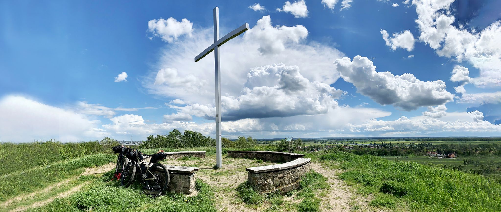
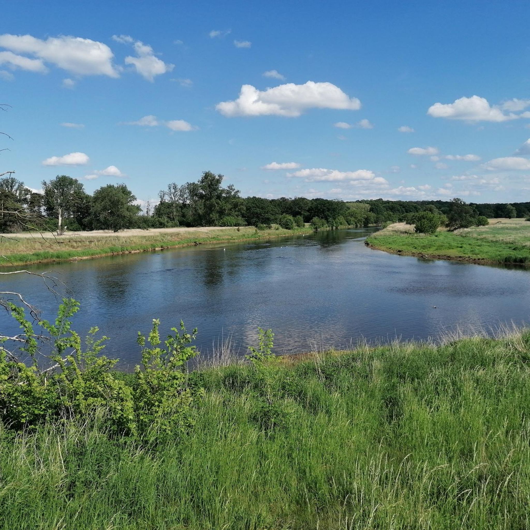
This view is from the Kornhaus. The Kornhaus is an excursion restaurant on the Elbe in the Dessau-Roßlau district of Ziebigk. It belongs to the Bauhaus buildings in Dessau.
3
0

The barrier structure near Friedersdorf is a 19 m high and 303 m long gravity dam with a construction volume of 40,000 m³. On February 17, 2023, a hydropower plant was commissioned, which is expected to generate 13.6 GWh of electrical energy per year. The construction cost 25 million euros and began in October 2016.[1] Source https://de.wikipedia.org/wiki/Muldestausee
2
0
The normal water level is around 79 m above sea level with a storage volume of approx. 115 million m³. The role of the Muldestausee as a flood retention basin is insignificant. However, the basin can temporarily retain 3 million m³ during floods (difference between total storage and usable storage). In fact, it is not a reservoir in the true sense, but rather a river dam. Since the flow velocity of the Mulde slows down considerably upon entering the lake, the Muldestausee acts as a sedimentation trap, into which approx. 400,000 t of solids (gravel, sand, silt) are deposited annually. These solids are missing from the river upon exiting the outlet structure, leading to a greater deepening of the riverbed of the lower Mulde and having ecological consequences. Source https://de.wikipedia.org/wiki/Muldestausee
2
0
After the excavation of coal from the Muldenstein open-cast mine (1954–1975), the relocation of the Mulde river over a distance of approximately eleven kilometers was necessary to expand the Goitzsche open-cast mine (today's Großer Goitzschesee). Part of the new river course was laid through the excavated Muldenstein open-cast mine. Flooding took place from April 30, 1975, to March 1, 1976. The Muldestausee lake has an inlet and an outlet structure. Source https://de.wikipedia.org/wiki/Muldestausee
2
0
The Muldestausee is an flooded open-cast mine in the district of Anhalt-Bitterfeld/Sachsen-Anhalt. Its bordering towns are Friedersdorf, Schlaitz, Pouch and Mühlbeck. With a surface area of 6.3 km², it is the third largest body of water in the state of Saxony-Anhalt. Its length is approx. 9 km, its widest point is 2 km, and its greatest depth is 35 m Source https://de.wikipedia.org/wiki/Muldestausee
2
0

Great path along the Elbe, very relaxed.
0
0
Frequently Asked Questions
How many touring cycling routes are available in Raguhn-Jeßnitz?
Raguhn-Jeßnitz offers a wide selection of touring cycling routes, with over 90 options available. These routes traverse diverse landscapes, including the Dübener Heide Nature Park and the Mulde River.
What is the best time of year for touring cycling in Raguhn-Jeßnitz?
The most pleasant times for touring cycling in Raguhn-Jeßnitz are spring and summer, when temperatures are mild and nature is in full bloom. Autumn also provides a beautiful experience as the forests display vibrant colors.
What kind of terrain can I expect on touring cycling routes in Raguhn-Jeßnitz?
The region offers varied terrain, from predominantly paved paths suitable for easy rides to more challenging routes that may include loose surfaces. You'll encounter rolling hills, dense forests, and picturesque riverine environments along the Mulde and Elbe floodplains.
Are there touring cycling routes suitable for beginners or those looking for an easy ride?
Yes, Raguhn-Jeßnitz has plenty of options for less experienced cyclists or those seeking a relaxed ride. Over 50 easy touring cycling routes are available, allowing you to enjoy the scenery without significant challenges.
Are there more challenging touring cycling routes in the area?
For experienced touring cyclists looking for a challenge, Raguhn-Jeßnitz offers over 20 difficult routes. One such route is the Elbe Floodplains Near Dessau – Hunting Bridge over the Mulde loop from Marke, which covers 33.0 miles (53.0 km) and features varied terrain.
What natural features can I explore along the touring cycling routes?
You can explore the scenic Mulde River, the expansive Dübener Heide Nature Park, and several beautiful lakes. The Great Goitzsche Lake (also known as the Bitterfeld Sea) and the Jeßnitz quarry pond are notable spots for strengthening breaks and idyllic views. The quiet floodplains of the Elbe and Mulde rivers also offer picturesque cycling.
Are there any historical or cultural landmarks to see while cycling?
Yes, the region is rich in historical and cultural sites. You can visit the Sieglitzer Park Gate, the impressive Hunting Bridge over the Mulde, or the Bitterfeld City Harbor. The Altjeßnitz Estate and Park, featuring Germany's largest and oldest baroque labyrinth, and the medieval Rabenstein Castle, offering panoramic views, are also worth exploring.
Are there any circular touring cycling routes in Raguhn-Jeßnitz?
Many touring cycling routes in Raguhn-Jeßnitz are designed as loops, allowing you to start and end at the same point. An example is the moderate Salegaster Forst Forest Path – Cycle Bridge over the Mulde loop from Marke, which takes you through Salegaster Forst and along the Mulde River.
What do other touring cyclists enjoy the most about touring cycling in Raguhn-Jeßnitz?
The area is highly rated by the komoot community, with an average score of 4.7 stars from over 525 reviews. Reviewers often praise the diverse landscapes, the extensive network of routes, and the opportunity to explore both natural beauty and historical sites.
Are there any routes that offer views of the local lakes?
Absolutely. The View of Gröberner Lake – Lake Gröbern loop from Raguhn is a popular moderate route that provides scenic views of Gröberner Lake, also known as the Bitterfeld Sea.
Can I find places to eat or rest along the touring cycling routes?
Yes, there are several spots where you can take a break and refuel. The Forsthaus Leiner-Berg Beer Garden and the Pannenkoek Shaft Lodge are examples of places offering refreshments. Additionally, the Bitterfeld City Harbor has restaurants and cafes where you can relax.
Are there any long-distance touring cycling routes that pass through Raguhn-Jeßnitz?
The Mulde Cycle Path, a significant long-distance route, traverses the area. This path provides well-maintained sections for exploring the natural beauty along the Mulde River and connecting to various sights.
What is the longest touring cycling route available in the region?
One of the longer routes is the difficult Bergwitz Lake – Kapenschlösschen loop from Raguhn, which spans approximately 57.2 miles (92.0 km) and offers an extensive cycling experience.
Most popular routes around Raguhn-Jeßnitz
Most popular attractions around Raguhn-Jeßnitz

Get inspired with the komoot mobile app


Explore more
Browse the best Cycling routes in other regions.
