The 6 Most Amazing Peaks around San Polo Matese
Best mountain peaks around San Polo Matese are found within the Matese Apennine chain, situated in the Molise region of Italy. This area serves as a gateway to the Matese massif, which spans both Molise and Campania. The peaks closest to San Polo Matese offer diverse features and natural landscapes. This mountainous territory provides opportunities for outdoor activities and exploration.
Best mountain peaks around San Polo Matese
- The most popular mountain peaks is Monte Miletto Summit, a summit that…
Last updated: July 14, 2026
Monte Miletto Summit
Highlight • Summit
Translated by Google •
Tip by

La Gallinola Summit
Highlight • Summit
Translated by Google •
Tip by

Sign up now to discover places like this
Get recommendations on the best single tracks, peaks, & plenty of other exciting outdoor places.
Sign up for free
Mount Mutria
Highlight • Summit
Translated by Google •
Tip by

Punta Giulia (Anticima della Gallinola)
Highlight • Summit
Translated by Google •
Tip by
Pianellone Karst Plateau
Highlight • Natural Monument
Translated by Google •
Tip by
Sign up for free to discover even more peaks around San Polo Matese.
Sign up for free
Already have an account?
Start today with a free account
Your next adventure awaits.
Login or Signup

Tips from the Community

Gallinola (1,923 m above sea level) is the second highest peak in the Matese range and is located in Molise. It can be reached from Campitello Matese via a 5.5 km hike and an elevation gain of just under 500 meters. The view from the summit is spectacular, stretching from the Maiella to the Tyrrhenian Sea, clearly visible in good weather.
1
0

A short hike with no particular difficulties. The trailhead from Campitello Matese is unmarked and difficult to identify. The trail itself is poorly marked. For those like me who'd never done it, it's essential to follow the trail on an app or similar. The descent was made by descending from the chairlift side (which doesn't operate and doesn't appear to be in operation anymore), then descending along the ski slope, which halfway through features a barbed wire barrier (!) that I had to cross.
0
0

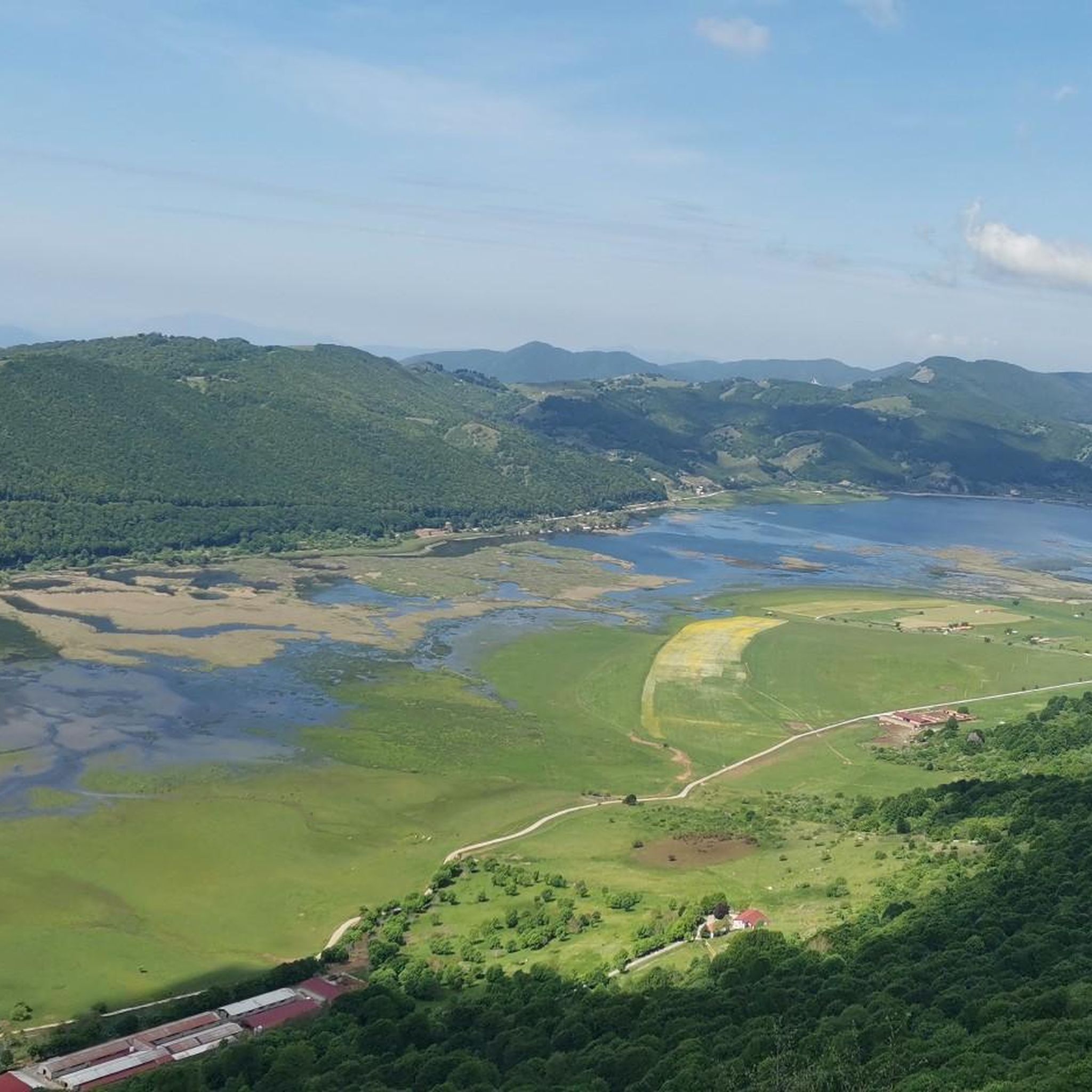
Challenging route with a difference in altitude of about 600m, starting from the Ecocamous refuge located in the Santa Maria valley. During the route you will encounter woods, valleys and a beautiful view of Lake Matese. The route leads to the highest peak in Campania, La Gallinola (1923m)
0
0

Getting there from the Santa Maria refuge was a slog but when you admire the view you understand that it's worth it
3
0

Mount Miletto (2,050 meters above sea level) straddles Campania and Molise and offers a 360° view of the Apennines, Lake Matese and the Mediterranean Sea in the distance.
0
0

From the summit 2050 MT. you can sense the curvature of blue ozone 🌍
0
0

Monte Mutria is the highest peak of the Guardiaregia-Campochiaro Regional Reserve, with its 1823 meters of altitude. Near the top is the chapel of Sant'Antonio, built in the 1990s and a destination for summer pilgrimages. The panorama extends over the great mountains of the Apennines, and on the clearest days you can even see the sea.
2
0

Gallinola is part of the Matese massif, and with its 1923 meters it is the highest point in Campania. From here the breathtaking panorama is guaranteed.
4
0
Frequently Asked Questions
Which mountain peaks are most popular for hiking around San Polo Matese?
The Matese massif offers several popular peaks. Monte Miletto Summit, the highest point in the Matese, is highly favored for its extensive panoramic views. Another popular choice is La Gallinola Summit, known for being the highest point in Campania and offering breathtaking vistas of both the Tyrrhenian and Adriatic Seas. Mount Mutria is also appreciated for its diverse flora and fauna, including dense beech forests.
What kind of natural features and viewpoints can I expect to see on these peaks?
The peaks around San Polo Matese are rich in natural beauty. You can expect to see vast karst landscapes with sinkholes and dolines, especially around Monte Miletto Summit. Peaks like Mount Mutria feature dense beech forests and wide, wind-swept meadows. From the summits, panoramic viewpoints often extend to the Gulf of Naples, Mount Vesuvius, the islands of Capri and Ischia, and both the Tyrrhenian and Adriatic Seas on clear days.
Are there hiking trails suitable for families or beginners in the Matese mountains?
Yes, while some peaks offer challenging routes, there are also more accessible options. For example, an accessible trail of approximately 2 kilometers from Piano della Corte makes La Gallinola Summit reachable for hikers in about 90 minutes. The area around Mount Mutria also features trails through wooded sections and open paths that can be suitable for various skill levels, offering a different landscape with ancient beech trees.
What are the more challenging hiking options for experienced trekkers?
Experienced trekkers will find challenging routes to peaks like Monte Miletto Summit, the highest peak in the Matese massif. Trails leading to its summit can start from Lake Matese or Campitello Matese. Similarly, the route to La Gallinola Summit from the Santa Maria refuge is described as challenging, involving a significant altitude difference of about 600m through woods and valleys.
Can I bring my dog on the mountain trails around San Polo Matese?
The Matese mountains, including areas within the Guardiaregia-Campochiaro Regional Reserve, are generally welcoming to dogs. However, it's always recommended to keep dogs on a leash, especially due to the presence of diverse wildlife such as the Apennine wolf, wildcat, and various raptor species. Specific regulations might apply in certain protected areas, so checking local signage is advisable.
What is the best season to hike the mountain peaks around San Polo Matese?
The best season for hiking is typically spring through early autumn (May to October), when the weather is milder and trails are clear of snow. During these months, you can fully enjoy the diverse flora and fauna. Summer offers longer daylight hours, while spring and autumn provide pleasant temperatures and vibrant landscapes.
Is winter hiking possible in the Matese mountains?
Yes, winter hiking is possible and offers a unique experience, especially with activities like snowshoeing and skiing. The area around Monte Miletto Summit is home to the ski resorts of Campitello Matese, making it a popular destination for winter sports enthusiasts. However, winter conditions require appropriate gear, experience, and awareness of weather changes.
Where can I find parking for trailheads in the Matese mountains?
Parking is generally available at key starting points for trails. For instance, trails to La Gallinola Summit can be accessed from areas like Piano della Corte. For Monte Miletto Summit, trailheads are accessible from locations such as Lake Matese and Campitello Matese. Specific parking information for individual routes can often be found on detailed trail maps or local tourism resources.
Are there any permits required for hiking in the Matese Regional Park?
Generally, permits are not required for day hiking on established trails within the Matese Regional Park. However, it's always good practice to check with local visitor centers or park authorities for any specific regulations, especially if you plan to engage in activities like camping or accessing restricted areas. The park aims to preserve its natural environment, so adhering to Leave No Trace principles is essential.
What outdoor activities can I do near these mountain peaks besides hiking?
Beyond hiking, the Matese mountains offer a variety of outdoor activities. You can explore numerous cycling routes, including mountain biking trails and road cycling routes. For instance, there are cycling tours around San Polo Matese, MTB trails, and road cycling routes that take you through scenic landscapes and past natural monuments. In winter, the area around Monte Miletto Summit is popular for skiing and snowboarding.
What do visitors enjoy most about the mountain peaks around San Polo Matese?
Visitors frequently highlight the extraordinary panoramic views from the summits, which can encompass both the Tyrrhenian and Adriatic Seas, and even distant landmarks like Mount Vesuvius and the Gulf of Naples on clear days. The diverse natural environments, from rugged karst landscapes to dense beech forests, and the rich biodiversity, including wild horses and various raptor species, are also highly appreciated. The sense of accomplishment after a challenging climb and the tranquility of nature are often mentioned.
Are there any unique natural monuments or geological formations to see?
Yes, the Matese massif is known for its distinctive karst geology. The upper reaches of peaks like Monte Miletto Summit feature sinkholes, dolines, and caves. The Pianellone Karst Plateau, located at 1390 meters, is one of the largest karst basins in the Matese area, offering a unique geological sight.
Most popular routes around San Polo Matese
Most popular attractions around San Polo Matese

Get inspired with the komoot mobile app


Explore more
See even more amazing summits around San Polo Matese with these guides:
