The best walks and hikes around Letino
4.2
(250)
1,015
hikers
88
hikes
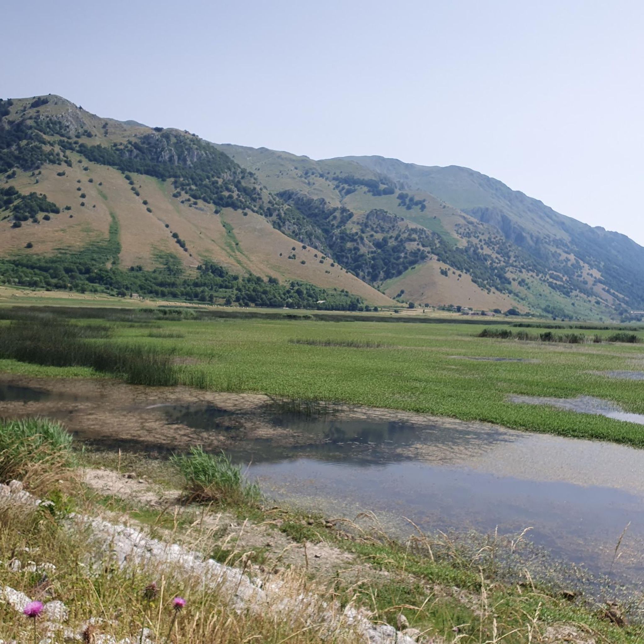
Hiking around Letino offers access to the diverse landscapes of the Matese Regional Park, characterized by its mountainous terrain, dense woodlands, and the prominent Lago di Letino. The region features significant elevation changes, including peaks like Monte Favaracchi, providing varied challenges for hikers. Trails often traverse forested slopes and open areas, with routes frequently circling the lake or connecting to other natural features within the park.
Best hiking trails around Letino
- The most popular hiking route is Gallo Matese – Regional Park of Matese, an 8.8 miles (14.1 km) moderate trail that takes 4 hours 20 minutes to complete. This route explores the varied terrain of the Matese Regional Park.
- Another top favourite among local hikers is Lake Letino Loop, a difficult 7.6 miles (12.2 km) path. This circular route offers views of Lago di Letino and the surrounding hills.
- Local hikers also love the Letino and Lago di Letino – loop in the Parco Regionale del Matese, a 4.9 miles (7.9 km) trail leading through the Parco Regionale del Matese and past Lago di Letino, often completed in about 2 hours 59 minutes.
- Hiking around Letino is defined by its mountainous landscapes, the serene Lago di Letino, and the extensive Matese Regional Park. The network offers options for easy walks, moderate excursions, and challenging ascents.
- The routes in Letino are highly rated by the komoot community with an average score of 4.4 stars from over 160 reviews. More than 700 hikers have used komoot to explore Letino's varied terrain.
Last updated: August 17, 2026
4.2
(6)
22
hikers
14.1km
04:21
470m
470m
This moderate 8.8-mile (14.1 km) hike in the Gallo Matese area, taking about 4 hours and 20 minutes to complete, guides you through the diverse terrain of the Matese Regional Park. You will gain around 1540 feet (469 metres) in elevation as you explore clear calcareous mountains, lush forests, and serene valleys. Keep an eye out for the crystal-clear waterfalls and pools formed by the Sava River, often found within cypress forests. The route also showcases karst phenomena like sinkholes, adding to the varied landscape.
This route is considered moderate, requiring good fitness, but it follows easily accessible paths. The village of Gallo Matese, situated at 875 meters above sea level, serves as a natural starting point, offering views of the surrounding landscapes. The park offers a range of trails, but this specific route balances challenge with accessibility, making it a solid choice for a rewarding day out.
The Matese Regional Park is a protected area known for its rich biodiversity and remote tranquility, making it an ideal escape from busier regions. You will experience stunning natural landscapes, including pristine lakes and extensive forests. The park is home to diverse flora and fauna, with rare bird species like the golden eagle and peregrine falcon. The nearby village of Gallo Matese adds to the charm with its traditional stone houses and rustic character.
4
hikers
12.2km
04:00
450m
450m
Embark on the Lake Letino Loop, a difficult hike that challenges you with 1471 feet (448 metres) of elevation gain over 7.6 miles (12.2 km). This route takes approximately 3 hours and 59 minutes to complete, guiding you through rugged mountains and deep valleys. You will experience diverse landscapes, from lush forests to open areas offering views of tranquil lakes. Keep an eye out for the picturesque Lake Letino itself, a key landmark on this journey. The trail also provides glimpses of towering limestone peaks and craggy cliffs, showcasing the wild beauty of the Matese Regional Park.
Before you set out, be aware that finding the starting point for this hike can be tricky, as the trailhead is often unmarked. The path itself is also poorly signed in places, so carrying a reliable navigation app is essential to stay on course. You might encounter some unusual sections along the way, including a ski slope that has a barbed wire barrier. Plan your visit carefully and ensure you are prepared for these conditions.
This loop offers a deep dive into the Matese Regional Park, an area known for its dramatic geological features. Beyond the natural beauty, the route also passes by the historic Letino Castle, adding a cultural dimension to your outdoor adventure. The diverse terrain, from deep valleys to towering limestone formations, makes this trail a notable experience for those seeking a challenging hike in this region.

Sign up for free
19.4km
07:26
1,180m
1,180m
Hard hike. Very good fitness required. Sure-footedness, sturdy shoes and alpine experience required.
19.7km
08:08
1,200m
1,200m
This difficult 12.2-mile hiking loop in Matese Regional Park offers challenging terrain, panoramic views, and the spectacular Rava di Prata
7.86km
02:59
420m
420m
Hard hike. Good fitness required. Sure-footedness, sturdy shoes and alpine experience required.
Get access to more routes and recommendations from other explorers.
Sign up for free
Already have an account?
Our route recommendations are based on thousands of hikes, rides, and runs completed by other people on komoot.
Start today with a free account
Your next adventure awaits.
Login or Signup

Tips from the Community

A short hike with no particular difficulties. The trailhead from Campitello Matese is unmarked and difficult to identify. The trail itself is poorly marked. For those like me who'd never done it, it's essential to follow the trail on an app or similar. The descent was made by descending from the chairlift side (which doesn't operate and doesn't appear to be in operation anymore), then descending along the ski slope, which halfway through features a barbed wire barrier (!) that I had to cross.
0
0

The trail is not an official CAI trail and although the route suggested by koomot is intuitive, the deviation it proposes is risky. In fact, the undergrowth has almost reclaimed the trail, making it difficult and unpredictable. Access to the waterfalls is quite intuitive even if they are also not marked. On site you have to make do to find a location and bathing remains difficult. Exploring a bit you find several pools of freezing water. Despite the difficulty, it remains an enchanting place.
1
0

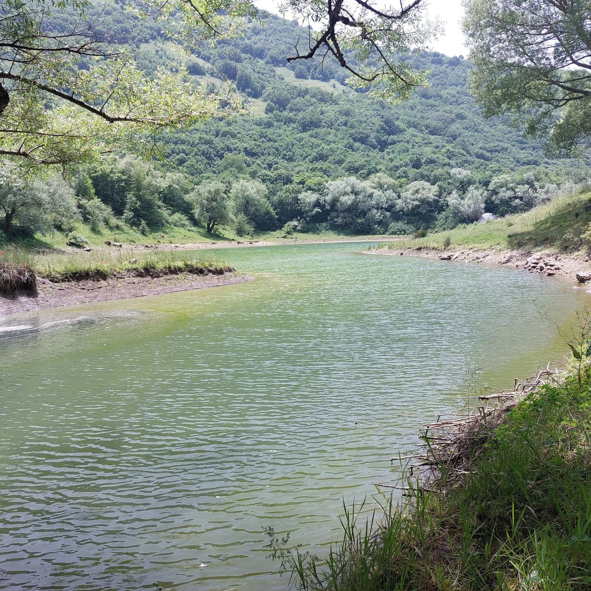
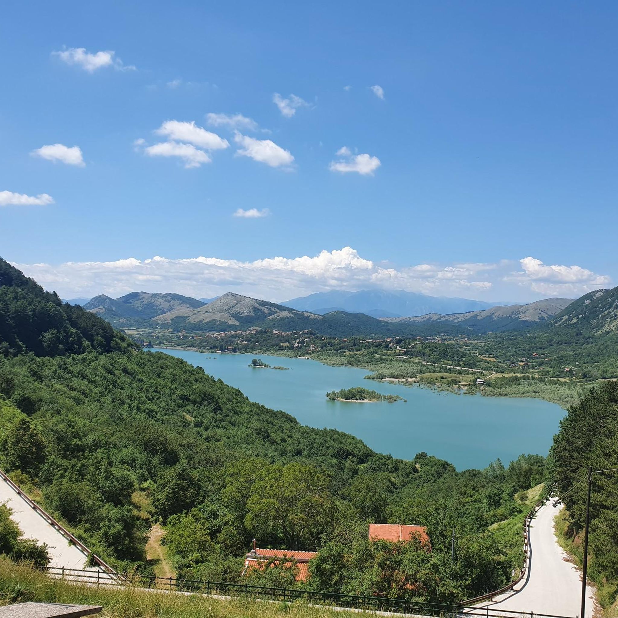
From the north shore of the lake you can enjoy an excellent view and on the east bank you can see the walls of the small dam which was used to power the Enel power plant which has now been decommissioned for many years.
0
0
The Lete stream produces small waterfalls and natural pools where it is possible to swim.
0
0
The castle of Prata Sannita, better known as Castello Pandone, was built in the Lombard era as a military garrison. Since 1984 the Castle has been declared a monument of historical-artistic interest.
0
0
Mount Miletto (2,050 meters above sea level) straddles Campania and Molise and offers a 360° view of the Apennines, Lake Matese and the Mediterranean Sea in the distance.
0
0

From the summit 2050 MT. you can sense the curvature of blue ozone 🌍
0
0

On the border between Campania and Molise you have a breathtaking view of the two regions.
1
0
Frequently Asked Questions
How many hiking trails are available around Letino?
There are over 70 hiking trails in the Letino area, offering a wide range of options from easy strolls to challenging mountain ascents within the Matese Regional Park.
Are there any easy, family-friendly hiking trails near Letino?
Yes, Letino offers 7 easy trails suitable for families. While specific family-friendly routes aren't detailed, the area around Lago di Letino generally provides more accessible terrain for shorter, less strenuous walks.
What is the best time of year for hiking in Letino?
The Matese Regional Park, including Letino, is best enjoyed from spring through autumn. During these seasons, the weather is generally mild, and the landscapes are vibrant. Summer can be warm, especially at lower elevations, while winter hiking is possible but may require specific gear for snow and ice, particularly at higher altitudes like Monte Favaracchi.
Are there any circular hiking routes starting near Letino?
Yes, several circular routes are available. A popular option is the Lake Letino Loop, a challenging 12.2 km path offering continuous views of the lake and surrounding hills. Another is the Letino and Lago di Letino – loop in the Parco Regionale del Matese, which is 7.9 km long.
Are there any challenging hikes in the Letino area?
Letino is known for its challenging terrain, with 40 difficult routes available. For instance, the Prata Sannita to Monte Favaracchi Loop is a demanding 19.7 km hike with significant elevation gain, leading towards Monte Favaracchi. Another challenging option is the Sources of Capo d'Acqua and Monte Miletto – loop in the Matese Regional Park, covering 19.4 km.
Are there hiking trails with waterfalls near Letino?
Yes, the region features natural attractions including waterfalls. You can explore the Lete Waterfalls, which are a notable highlight in the Matese Regional Park and can be incorporated into various hiking routes.
What kind of natural attractions can I see along the hiking trails around Letino?
Hikers can discover diverse natural monuments and peaks. Highlights include the Monte Miletto Summit, the La Gallinola Summit, and the expansive Campitello Matese Plateau. The area also features the serene Lago di Letino and the rugged beauty of Monte Favaracchi.
What do other hikers enjoy most about hiking in Letino?
The area is highly rated by the komoot community, with an average score of 4.4 stars from over 160 reviews. Hikers frequently praise the diverse landscapes of the Matese Regional Park, the serene beauty of Lago di Letino, and the variety of trails catering to different difficulty levels.
Is there public transport access to hiking trails in Letino?
While Letino is a small mountain village, public transport options directly to trailheads can be limited. It's generally recommended to arrive by car for greater flexibility in accessing the various hiking routes within the Matese Regional Park.
Where can I find parking for hiking trails in Letino?
Parking is typically available in or near the village of Letino itself, and at designated starting points for popular trails within the Matese Regional Park. Specific parking details often depend on the individual trailhead, so it's advisable to check route descriptions for precise information.
Are there any hidden gem walks or less-trafficked trails in the Letino area?
The Matese Regional Park is vast, and while some routes are popular, many trails offer a sense of solitude. Exploring the lesser-known paths leading to various peaks or through dense woodlands away from the main lake loops can reveal quieter, equally rewarding experiences. The sheer number of trails (over 70) means there are always new areas to discover.
What should I pack for hiking in Letino?
Given the mountainous terrain and varied trail difficulties, it's essential to pack appropriate gear. This includes sturdy hiking boots, layers of clothing suitable for changing weather conditions, sufficient water, snacks, a map or GPS device (like komoot's app), and sun protection. For more challenging routes or off-season hikes, consider trekking poles and emergency supplies.
Most popular attractions around Letino

Get inspired with the komoot mobile app


Explore more
Browse the best Hikes in other regions.
