The best MTB trails around Trentola-Ducenta
4.3
(65)
529
riders
70
rides
Mountain biking around Trentola-Ducenta offers a diverse landscape for riders. The region features a mix of coastal views, particularly around the Gulf of Pozzuoli, and scenic lake areas such as Lake Avernus. Riders can also find forested sections, like Bosco Contessa, providing varied terrain. The area's elevation changes are moderate, making it suitable for different skill levels.
Best mountain bike trails around Trentola-Ducenta
- The most popular mountain bike trail is View of the Gulf of Pozzuoli – Lake Avernus loop…
Last updated: May 12, 2026
4.6
(8)
28
riders
52.8km
03:06
400m
400m
Moderate mountain bike ride. Good fitness required. Suitable for all skill levels.
5.0
(1)
9
riders
40.0km
02:57
660m
660m
Hard mountain bike ride. Good fitness required. Advanced riding skills necessary. Some portions of the route may require you to push your bike.

Sign up for free
5.0
(1)
11
riders
Moderate mountain bike ride. Good fitness required. Suitable for all skill levels.
12
riders
Hard mountain bike ride. Very good fitness required. Advanced riding skills necessary. Some portions of the route may require you to push your bike.
12
riders
50.3km
03:06
450m
450m
Moderate mountain bike ride. Good fitness required. Suitable for all skill levels.
Get access to more routes and recommendations from other explorers.
Sign up for free
Already have an account?
Our route recommendations are based on thousands of hikes, rides, and runs completed by other people on komoot.
Start today with a free account
Your next adventure awaits.
Login or Signup


Tips from the Community

The castle originally took the name Castrum Gironis: according to some from the name of Hieron of Syracuse (to whom the first settlement dating back to the 5th century BC is attributed), according to others from the "circumference of walls" fortified that surrounded the small island of trachyte rock.
0
0
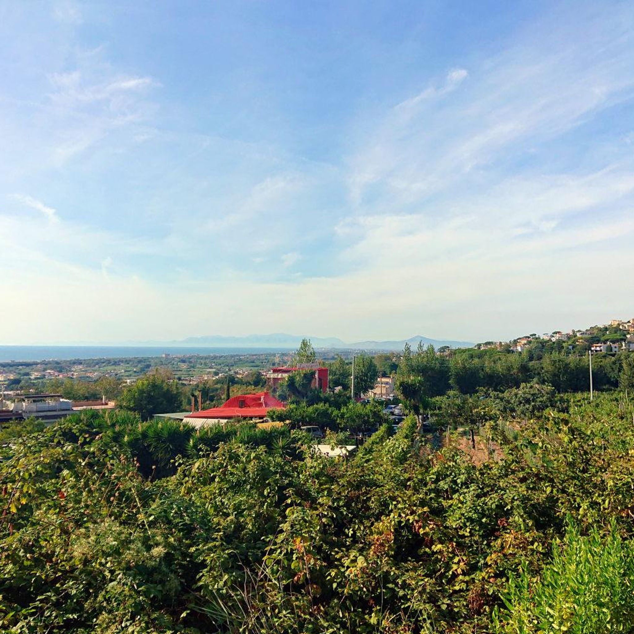
The Gulf of Pozzuoli is a cove located near the city from which it takes its name, Pozzuoli. The gulf is entirely contained within the Gulf of Naples. It winds between Cape Miseno and Cape Posillipo: the distance between the two points is about 6 kilometers. The area concerned is that of the Phlegraean Fields. Geology The main phenomenon affecting the gulf is bradyseism, which in the eighties made it necessary to move the port 50 meters forward from its original location and which is the origin of the archaeological finds from the Roman era of parts of the city now underwater. Monitoring Since 2008, a system for monitoring marine volcanoes called "CUMAS" (Cabled Underwater Module for Acquisition of Seismological data) has been present in the center of the gulf, at a depth of one hundred meters, which is connected in real-time to the monitoring room of the Vesuvius Observatory. Environment Together with the island of Ischia,
0
0
The Anfiteatro di Cuma, located in the Archaeological Park of Campi Flegrei (Bacoli, NA), is one of the oldest examples of stable amphitheaters in Campania, dating back to the end of the 2nd century BC. Built in the Republican era near Monte Grillo, the structure measured approximately (90 x 70) meters and could accommodate up to 7000 spectators, highlighting its ancient origins.
1
0
Lake Averno is a lake of volcanic origin located near Pozzuoli. According to myth, it is the gateway to the underworld, probably due to the sulfurous fumes that rose from it in antiquity. The lake is visited by Aeneas in the Aeneid, guided by the Sibyl, to reach the Kingdom of the Dead. Historically, in the Augustan age, it became the site, along with the nearby Lake Lucrino, of the so-called Portus Julius, a military port of which it constituted the inner basin. Subsequently abandoned due to the easy silting up of the access, it was incorporated into the Ripa Puteolana, the complex of docks of the commercial port of Puteoli. Along its shores stands the so-called "Temple of Apollo", actually a hall of a vast thermal complex, one of the numerous facilities that arose in the Phlegraean Fields to also exploit the natural heat springs.
1
0
Lake Averno is a lake of volcanic origin located near Pozzuoli, according to myth the gateway to the underworld, probably due to the sulfurous fumes that rose from it in antiquity. The lake is visited by AENEAS! in the Aeneid, guided by the Sibyl, to reach the Kingdom of the Dead. Historically, in the Augustan age, it became the site, along with the nearby Lake Lucrino, of the so-called Portus Iulius, a military port of which it constituted the inner basin. Subsequently abandoned due to the easy silting up of the access, it was incorporated into the Ripa Puteolana, the complex of docks of the commercial port of Puteoli. Along its shores stands the so-called "Temple of Apollo", actually a hall of a vast thermal complex, one of the numerous facilities that arose in the Phlegraean Fields to also exploit the natural heat sources.
1
0

I recommend parking the car in the space outside the Monte Nuovo oasis, crossing the oasis and then going down towards Lake Averno, along this lake there are farmhouses and restaurants
1
0

The Aragonese Castle of Baia houses a museum with very interesting finds as well as offering visitors a breathtaking view of the entire area.
1
0

A walk among nature and wild animals, between dirt roads and cobblestone pavements, not to be missed in any season.
1
0
Frequently Asked Questions
How many mountain bike trails are available around Trentola-Ducenta?
There are over 60 mountain bike trails around Trentola-Ducenta, offering a wide range of options for different skill levels and preferences.
Are there mountain bike trails suitable for beginners or families in Trentola-Ducenta?
Yes, Trentola-Ducenta offers a few easy mountain bike trails, with 3 specifically categorized as easy. These routes typically feature moderate elevation changes and less technical terrain, making them suitable for beginners or family outings.
What kind of terrain can I expect on mountain bike trails in Trentola-Ducenta?
The mountain bike trails around Trentola-Ducenta feature a diverse landscape. You can expect a mix of coastal views, particularly around the Gulf of Pozzuoli, scenic lake areas like Lake Avernus, and forested sections such as Bosco Contessa. The elevation changes are generally moderate, but some difficult routes offer more challenging climbs.
Are there challenging mountain bike trails for advanced riders?
Absolutely. For advanced riders seeking a challenge, there are 14 difficult mountain bike trails around Trentola-Ducenta. Routes like the Bosco Contessa Entrance – Jump Ramp loop from Giugliano-Qualiano offer forested sections with technical features, while the Panoramic View of Caserta – San Leucio Bourbon Arch loop from San Marcellino-Frignano provides significant elevation gain over its 76.8 km length.
What are some scenic mountain bike routes in the area?
Many routes offer beautiful scenery. The View of the Gulf of Pozzuoli – Lake Avernus loop from Giugliano-Qualiano is highly recommended for its coastal vistas and lake scenery. Another great option is the Lake Avernus – Lake Avernus loop from Giugliano-Qualiano, which focuses on the picturesque lake environment.
Are there any mountain bike trails that are loop routes?
Yes, many of the mountain bike trails around Trentola-Ducenta are designed as loops, allowing you to start and finish at the same point. Examples include the Canalone Caserta Enduro Trail – San Leucio Bourbon Arch loop from Gricignano-Teverola and the Bosco Contessa Entrance – Jump Ramp loop from Giugliano-Qualiano.
What is the best season for mountain biking in Trentola-Ducenta?
Trentola-Ducenta generally enjoys a Mediterranean climate. Spring (April-May) and Autumn (September-October) are often considered ideal for mountain biking, offering pleasant temperatures and less humidity than the summer months. Winter can also be suitable on drier days, while summer might be hot, especially at midday.
What do other mountain bikers say about the trails in Trentola-Ducenta?
The mountain bike trails in Trentola-Ducenta are highly rated by the komoot community, with an average score of 4.4 stars from over 70 reviews. Riders often praise the diverse terrain, from coastal views to forested sections, and the variety of routes suitable for different skill levels.
Are there any interesting landmarks or attractions near the mountain bike trails?
Yes, there are several notable attractions nearby. You might encounter historical sites like the Royal Palace of Carditello or the Hermitage of Santa Maria Pietraspaccata. Nature lovers can explore the Pirate Dock at Lake Patria. Some routes, like the Canalone Caserta Enduro Trail – San Leucio Bourbon Arch loop from Gricignano-Teverola, pass by historical architecture.
What should I bring for a mountain bike ride in Trentola-Ducenta?
Given the varied terrain and potential for longer rides, it's advisable to bring plenty of water, snacks, a repair kit, and appropriate safety gear including a helmet. Sun protection is also recommended, especially on routes with coastal exposure or less tree cover. Check the weather forecast before you head out.
Are there mountain bike trails with cafes or refreshment stops nearby?
While specific cafes directly on every trail are not guaranteed, many routes pass through or near towns and villages where you can find refreshment stops. Planning your route with komoot allows you to identify points of interest and potential stops along the way.
Most popular attractions around Trentola-Ducenta

Get inspired with the komoot mobile app


Explore more
Browse the best MTB trails in other regions.
