The best walks and hikes around Laterza
4.5
(358)
1,409
hikers
17
hikes
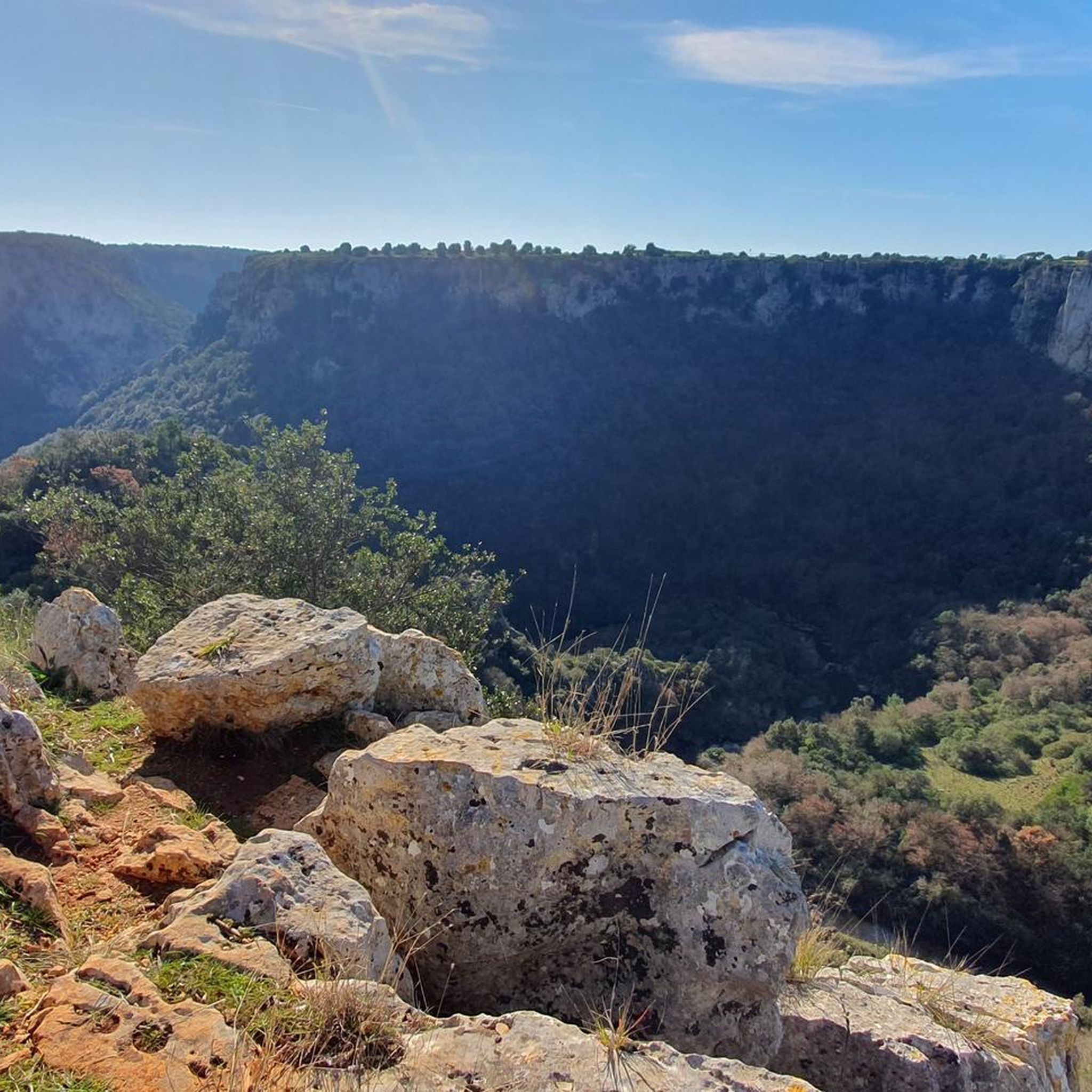
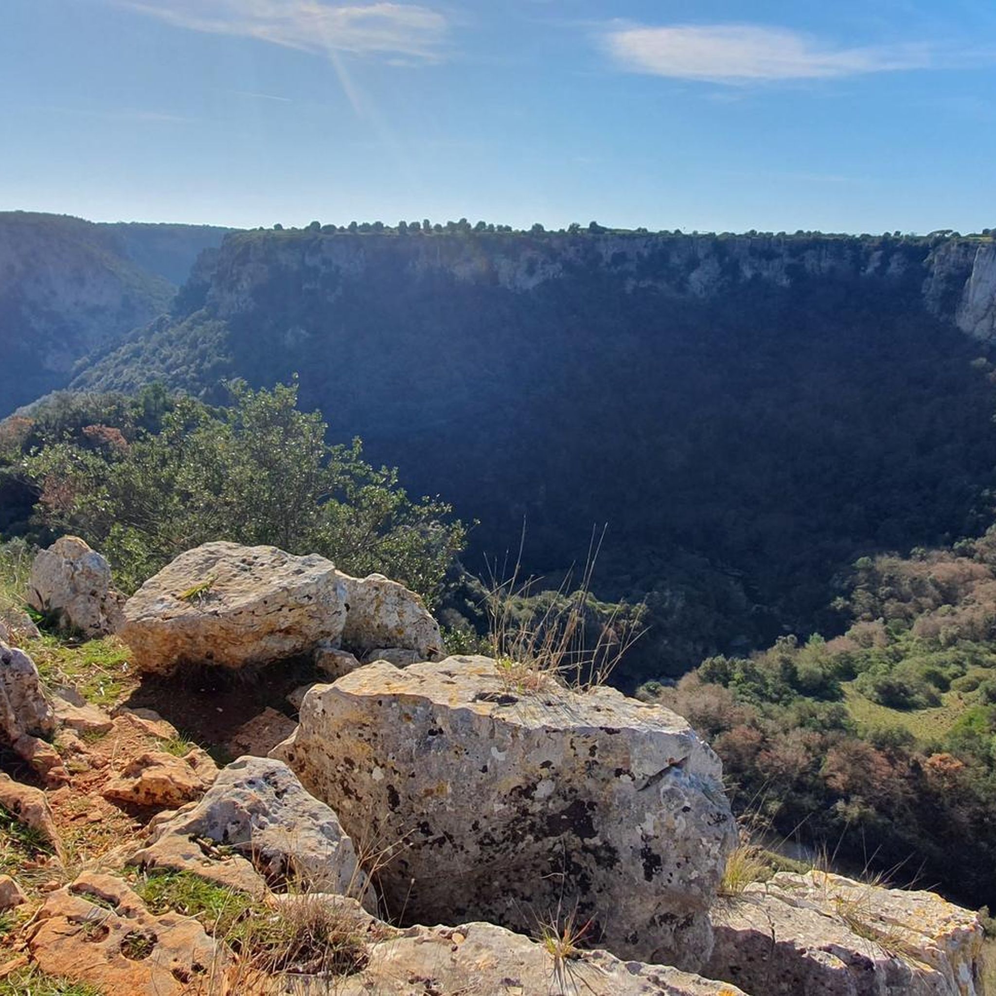
Hiking around Laterza offers access to a landscape dominated by the Gravina di Laterza, a deep natural gorge within Puglia's Murgia region. This area is characterized by extensive networks of trails carved into limestone, featuring vertical walls up to 200 meters deep. The terrain includes karst formations, Mediterranean scrub, and diverse flora, providing varied environments for outdoor exploration.
Best hiking trails around Laterza
- The most popular hiking route is Gravina di Laterza Loop, an 11.3 mile (18.2 km) trail that takes 4 hours 56 minutes to complete. This route explores the extensive canyon landscapes and biodiversity of the region.
- Another top favourite among local hikers is View of Gravina di Laterza – View of the Gravina Canyon loop from Laterza, a moderate 5.5 mile (8.8 km) path. This trail offers panoramic views of the Gravina Canyon from Laterza, with an elevation gain of 720 feet (220 m).
- Local hikers also love the View of the Gravina Canyon – View of the Gravina Canyon loop from Gravina di Laterza, a 2.7 mile (4.3 km) trail leading through the canyon's edge, often completed in about 1 hour 13 minutes.
- Hiking around Laterza is defined by dramatic canyon landscapes, limestone gorges, and Mediterranean scrub. The network of trails offers options for various ability levels, from easy loops to more challenging routes.
- The routes in Laterza are highly rated by the komoot community with an average score of 4.5 stars from around 300 reviews. More than 1200 hikers have used komoot to explore Laterza's varied terrain.
Last updated: October 10, 2026
4.5
(29)
101
hikers
18.2km
04:56
240m
240m
Moderate hike. Good fitness required. Easily-accessible paths. Suitable for all skill levels.
4.6
(31)
157
hikers
7.71km
02:13
190m
190m
Moderate hike. Good fitness required. Easily-accessible paths. Suitable for all skill levels.

4.6
(36)
130
hikers
Easy hike. Great for any fitness level. Easily-accessible paths. Suitable for all skill levels.
4.6
(28)
97
hikers
7.82km
02:11
150m
150m
Moderate hike. Good fitness required. Easily-accessible paths. Suitable for all skill levels.
3.7
(3)
16
hikers
20.7km
05:37
290m
290m
Hard hike. Very good fitness required. Easily-accessible paths. Suitable for all skill levels.
Get access to more routes and recommendations from other explorers.
Already have an account?
Our route recommendations are based on thousands of hikes, rides, and runs completed by other people on komoot.
Start today with a free account
Your next adventure awaits.

Tips from the Community

The house of worship found here is not just dedicated to the Mother of God Mary; often it is additional titles that dedicate it to a church festival such as her Immaculate Conception, Nativity, or Ascension. The patronage addressed at this sanctuary, however, carries a special addition with MADONNA DEL ROSARIO. This refers to a prayer that was very popular in the folk piety of earlier times and is still gladly maintained today in many parishes or private households (at least by the older generation). Especially during foot pilgrimages, for example, the Rosary prayer is very gladly used, as the repetition of the individual mysteries by the leader and the response of the praying people easily creates a meditative atmosphere.
0
0


nice walk with children
0
0

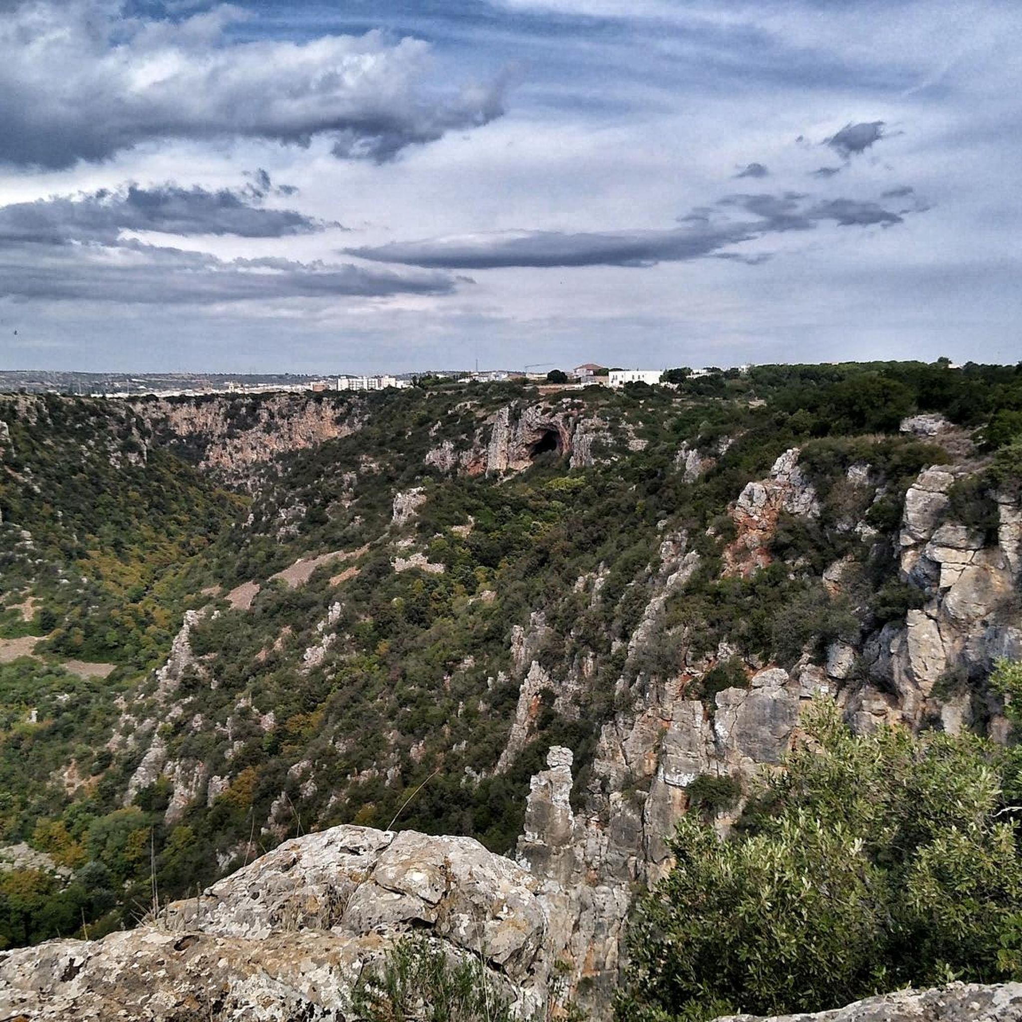
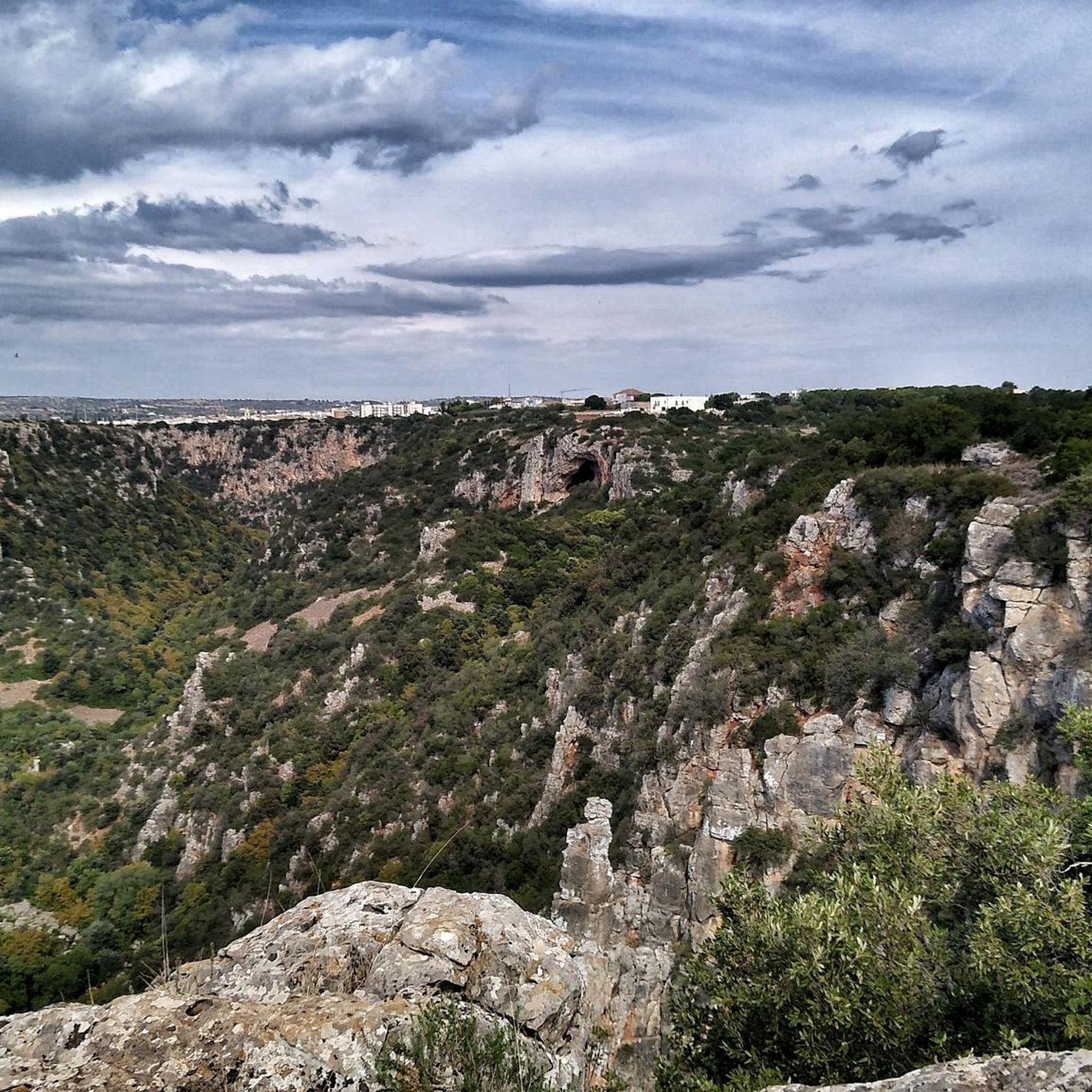
The Grotta Croce (The Cross Grotto) is a natural cavity set in the walls of the canyon. This cave ist home to several birds, including kestrels and swifts and if you are lucky, you can spot the eagle that inhabits the area.
0
0
There are a handful of those water collecting channels alongside the road. Most likely to catch the water running off the road during a downpour
0
0
Along the sides of the ravine as it snakes its way around the town are the ruins of rock-cut settlements so distinctive of Ginosa. These are the settlements of people who cut their houses and churches into the rock. The best place to visit these dwellings is on the eastern side of the town, in the Rione di Rivolta. At the end of the 5th century AD when the Roman Empire came under attack from the Goths and other Germanic tribes attacking Rome, the open plains were no longer safe. And it was then that people sought refuge in the relatively safer ravines. The soft, limestone bedrock made it easy to cut into the sides of the ravines to create places to live that were easier to protect against the Goths to begin with, but also the Saracens later. Over the turbulent centuries of the Middle Ages that followed the fall of the Western Roman Empire fully developed communities emerged in these ravines. These early Medieval troglodytes ‘built’ surprisingly complex villages simply by cutting into the rock at different levels. Besides creating domestic spaces – Casa Grotto (cave house), they also cut churches into the sides of the ravines. They also cut channels and cisterns into the rock to supply water. The rock cut villages in the ravines around Ginosa were still inhabited up until the 20th century. Today the Casa Grottos and rock cut churches with their Byzantine frescoes are a popular tourist attraction, particularly Villagio Rivolta. Here visitors can see the typical structure of the casa grotto, where rooms at the front were communal and where cooking would have taken place, while animals were kept in the room at the rear – for safety. In front of the houses you can see the network of human-made cisterns, basins and channels that caught and stored rain water. What today seems like a random collection of ruined artificial caves is in fact a very elaborate village made up of 66 individual houses, constructed over five levels one on top of the other connected by stairs.
0
0
Below the castle and in amongst the buildings right on the edge of Rione di Casale you can not miss an eye-catching gabled façade and bell tower. These are the noticeable features of 16th century church, Chiesa Matrice. A church that for centuries has had a special place in the religious traditions and history of Ginosa. Do not let the seemingly out of the way location of Chiesa Matrice lead you to think this is an insignificant church. Everything about this sacred space is intimately linked to the changing historical fortunes and allegiances of Ginosa. Construction of the church began towards the end of the 15th century to appease French soldiers. At the time, Ginosa was caught up in the Italian Wars – a series of conflicts that involved most of the major states of western Europe fight for territory and power. Giambattista Doria not only enlisted French architects to build the church, he also had it dedicated to a prominent French Saint, Martin of Tours. Take a closer look at the fading painting on the front façade beneath the rose window. It is thought to represent the legend of Martin’s Cloak. Martin is depicted on horseback cutting his cloak in two, one half of which he gave to the poor, nude beggar he is said to have encountered at the gates of Amiens. Saint Martin’s and the French soldiers’ hold over the church here was not to last long. In one of the five chapels, in an ornate wooden display case, is an 18th century statue of Mary holding Jesus and a rosary. In 1756 the town chose to re-dedicate the church to Mary, Madonna del Rosario. Since its construction in the early 16th century, the church has witnessed a number of changes. In the 17th century, like many churches in Italy it was restored in a Baroque style. All that remains of this period are the painted walls and ceiling at the back of the right-hand aisle. The rest of aisle, the left-hand aisle, the nave and apse is simply white. It does make for a very bright interior. Chiesa Matrice was in fact built on top of an earlier church. The edge of the apse of that earlier church, built in about 1000 AD, can be seen through a glass panel in the floor of the apse.
0
0
Along the sides of the ravine as it snakes its way around the town are the ruins of rock-cut settlements so distinctive of Ginosa. These are the settlements of people who cut their houses and churches into the rock. There are two parts of the rock village: Rione Casale and Rione di Rivolta. Travel Guides by Experienced Archaeologists & Historians Destinations • Europe • Italy Travel Guide • Puglia • Ginosa Historic Landmarks Facebook-f Twitter Pinterest 5 Historical Landmarks that Tell the Stories of Ginosa Discover the stories of a town in southern Italy where the inhabitants were living in rock-cut caves for centuries; from the time of the Romans to the not so distant past. Ginosa – a town off the beaten track, even for Puglia. Thomas Dowson Last Checked and/or Updated 15 December 2021 No Comments Italy Travel Tips & Ideas Like many towns in Puglia, Ginosa owes its fascination to its geographical location as much as its history. Both the physical and historical aspects of the town are immediately visible. In fact the two are intertwined, and have been for centuries. Many, many thousands of years ago a u-shaped bend in a river, as it meanders its way towards the Gulf of Taranto (about 20km away), created a spur of land that has obviously been very attractive to successive inhabitants of Ginosa. Over the centuries people have built on this spur and in the horseshoe-shaped ravine giving Ginosa its distinctive character today. These five historical landmarks are a great way to discover that character. Peucetian Funerary Structure Perhaps not as prominent as some of the other landmarks, but significant nonetheless. On the edge of the square in front of the town hall are the oldest remains of human habitation on view in Ginosa. Just below street level and underneath a row of holm oak trees is a series of Peucetian tombs, left exposed and visible through glass covers. Little is known about the Peucetians. They are one of three Iapygian populations that occupied what is Puglia today; the other two being the Daunians and Messapians. Some archaeologists have suggested that the Iapygians are descendants of the Illyrians, who crossed the Adriatic Sea and settled in southern Italy during the 9th century BC. Whatever their origins, artefacts excavated by archaeologists show they were in close contact with the nearby Greek colonies, such as Metaponto and Taranto. It was the Roman defeat of these Greek colonies in southern Italy in the Phyrric War (280 to 275 BC) that lead to the incorporation of the region into the Roman Republic. During the construction of the square in front of the Ginosa’s town hall, builders came across a Peucetian funerary complex. The necropolis was excavated by archaeologists and left open, but covered with protect glass structures to enable people to see the different types of tombs. One limestone sarcophagus stands above ground on the square; a few others can be seen in their original place within the tombs. Troglodyte Village Along the sides of the ravine as it snakes its way around the town are the ruins of rock-cut settlements so distinctive of Ginosa. These are the settlements of people who cut their houses and churches into the rock. The best place to visit these dwellings is on the eastern side of the town, in the Rione di Rivolta. Towards the end of the 5th century AD when the Roman Empire came under attack from the Goths and other Germanic tribes attacking Rome, the open plains were no longer safe. And it was then that people sought refuge in the relatively safer ravines. The soft, limestone bedrock made it easy to cut into the sides of the ravines to create places to live that were easier to protect against the Goths to begin with, but also the Saracens later. Over the turbulent centuries of the Middle Ages that followed the fall of the Western Roman Empire fully developed communities emerged in these ravines. These early Medieval troglodytes ‘built’ surprisingly complex villages simply by cutting into the rock at different levels. Besides creating domestic spaces – Casa Grotto (cave house), they also cut churches into the sides of the ravines. They also cut channels and cisterns into the rock to supply water.
0
0
Frequently Asked Questions
What kind of terrain can I expect on hiking trails around Laterza?
Hiking around Laterza primarily involves dramatic canyon landscapes, especially within the Gravina di Laterza. The terrain is characterized by limestone gorges, karst formations, and Mediterranean scrub. Trails often follow the canyon's edge, offering varied environments for exploration.
Are there easy hiking trails suitable for beginners or families in Laterza?
Yes, Laterza offers several easy trails. For instance, the View of the Gravina Canyon – View of the Gravina Canyon loop from Gravina di Laterza is an easy 4.3 km (2.7 mile) loop that takes about an hour to complete, perfect for a relaxed walk along the canyon's edge.
What are the best times of year to go hiking in Laterza?
The best times to hike in Laterza are typically spring (March to May) and autumn (September to November). During these seasons, the weather is mild and pleasant, and the natural landscape, including wild orchids and the distinctive Campanula versicolor, is particularly vibrant. Summers can be very hot, while winters are generally mild but can have occasional rain.
Can I spot any wildlife or unique plants while hiking in Laterza?
Laterza is a haven for wildlife and unique flora. The region's microclimate supports rare Mediterranean plants, over 50 species of wild orchids, and the Campanula versicolor. For wildlife, keep an eye out for golden eagles, kestrels, wild boars, and foxes. The area is also renowned for birdwatching, with rare birds of prey like the Egyptian vulture and peregrine falcon nesting in the Gravina di Laterza, especially around the Oasi LIPU Gravina di Laterza.
Are there any circular hiking routes available in Laterza?
Yes, many of the trails around Laterza are circular. A popular moderate option is the Gravina di Laterza Loop, an 18.2 km (11.3 mile) route that explores the extensive canyon landscapes and biodiversity. Another moderate circular path is the View of Gravina di Laterza – View of the Gravina Canyon loop from Laterza, which is 8.8 km (5.5 miles) long and offers panoramic views.
What interesting landmarks or natural features can I see along the trails?
The primary natural feature is the stunning Gravina di Laterza, one of Europe's deepest canyons, with vertical walls up to 200 meters deep. Along the trails, you can also explore the Grotta Croce in Laterza, a karst cave known for its natural beauty and historical significance. Numerous panoramic viewpoints offer sweeping vistas of the gorge. The wider Terra delle Gravine Regional Natural Park also features ancient rock-cut churches and cave houses.
Is there parking available near the hiking trailheads in Laterza?
Yes, parking is generally available near the main access points and trailheads in Laterza, especially for routes that start close to the town or designated viewing areas. Specific parking details can often be found on individual route descriptions on komoot.
What do other hikers enjoy most about the trails in Laterza?
The trails in Laterza are highly rated by the komoot community, with an average score of 4.5 stars from nearly 300 reviews. Hikers frequently praise the dramatic canyon views, the unique geological formations, and the rich biodiversity. Many appreciate the well-marked paths and the variety of routes suitable for different fitness levels.
Are there any challenging hikes for experienced hikers in Laterza?
Yes, Laterza offers challenging routes for experienced hikers. While specific 'difficult' rated routes are fewer, the longer moderate trails, such as the 18.2 km Gravina di Laterza Loop, can be quite demanding due to their length and elevation changes, providing a substantial challenge for those seeking a longer adventure.
Can I bring my dog on the hiking trails in Laterza?
Generally, dogs are welcome on many of the hiking trails in Laterza. However, it's always advisable to check specific regulations for protected areas like the Terra delle Gravine Regional Natural Park or the Oasi LIPU, as some areas might require dogs to be on a leash or have restricted access to protect wildlife. Always ensure your dog is under control and clean up after them.
How long do hikes around Laterza typically take?
Hikes around Laterza vary significantly in length and duration. Easy loops, like the 4.3 km View of the Gravina Canyon – View of the Gravina Canyon loop from Gravina di Laterza, can be completed in just over an hour. Moderate trails, such as the 8.8 km View of Gravina di Laterza – View of the Gravina Canyon loop from Laterza, might take around 2.5 to 3 hours, while longer routes like the 18.2 km Gravina di Laterza Loop can take nearly 5 hours.
Are there any trails that lead to caves or historical sites?
Yes, some trails offer access to historical and natural cave sites. For example, the Grotta Croce in Laterza – View of the Gravina Canyon loop from Laterza is a 11.9 km (7.4 mile) moderate hike that specifically includes the Grotta Croce, a significant karst cave. The wider region also features ancient rock-cut churches and cave houses integrated into the natural environment of the Terra delle Gravine Park.
Most popular attractions around Laterza

Get inspired with the komoot mobile app


Explore more
Browse the best Hikes in other regions.
