The best road cycling routes around Río Adra
4.6
(38)
2,251
riders
73
rides
Road cycling routes around Río Adra traverse a diverse landscape, from the challenging ascents of the Sierra Nevada and Sierra de Gádor mountains to the flatter, scenic coastal roads along the Mediterranean Sea. The region is characterized by significant elevation changes in its mountainous areas and a fertile riverine environment created by the Río Adra. This varied topography offers a range of road cycling experiences, including demanding climbs and routes through agricultural lands and natural vegetation.
Best road cycling routes…
Last updated: October 28, 2026
5.0
(1)
160
riders
110km
06:07
2,440m
2,440m
Hard road ride. Very good fitness required. Mostly well-paved surfaces and easy to ride.
171
riders
143km
07:42
2,840m
2,830m
Hard road ride. Very good fitness required. Mostly well-paved surfaces and easy to ride.

72
riders
103km
05:44
2,270m
2,270m
Hard road ride. Very good fitness required. Mostly well-paved surfaces and easy to ride.
5.0
(1)
58
riders
53.3km
02:20
310m
310m
Moderate road ride. Good fitness required. Mostly well-paved surfaces and easy to ride.
78
riders
122km
05:52
1,430m
1,420m
Hard road ride. Very good fitness required. Some segments of this route may be unpaved and difficult to ride.
24
riders
48.1km
02:37
950m
950m
Hard road ride. Very good fitness required. Some segments of this route may be unpaved and difficult to ride.
22
riders
104km
05:46
2,280m
2,270m
Hard road ride. Very good fitness required. Mostly well-paved surfaces and easy to ride.
19
riders
41.6km
02:08
750m
750m
Moderate road ride. Good fitness required. Mostly well-paved surfaces and easy to ride.
16
riders
33.4km
01:40
520m
520m
Moderate road ride. Good fitness required. Mostly well-paved surfaces and easy to ride.
5.0
(1)
15
riders
45.8km
02:19
770m
770m
Moderate road ride. Good fitness required. Mostly well-paved surfaces and easy to ride.
Get access to more routes and recommendations from other explorers.
Already have an account?
Our route recommendations are based on thousands of hikes, rides, and runs completed by other people on komoot.
Start today with a free account
Your next adventure awaits.
Tips from the Community


Darrícal is a small hamlet of Alcolea, located in the Alpujarra of Almería, next to the Grande de Adra River. Although today only a few families live here, in summer the town comes alive and retains its charm with its cubic houses with thatched roofs and its 16th-century church, restored by the residents themselves. Its August festivals are lively, with processions through steep streets and fireworks from the river, a draw for those seeking authentic traditions. For hikers, the riverside setting and the views of the Sierra Nevada offer an ideal setting for short, leisurely hikes.
1
0

In the tourist information office there is a beautifully done exhibition about the history of the region (unfortunately I didn't understand the language). Check it out!
0
0

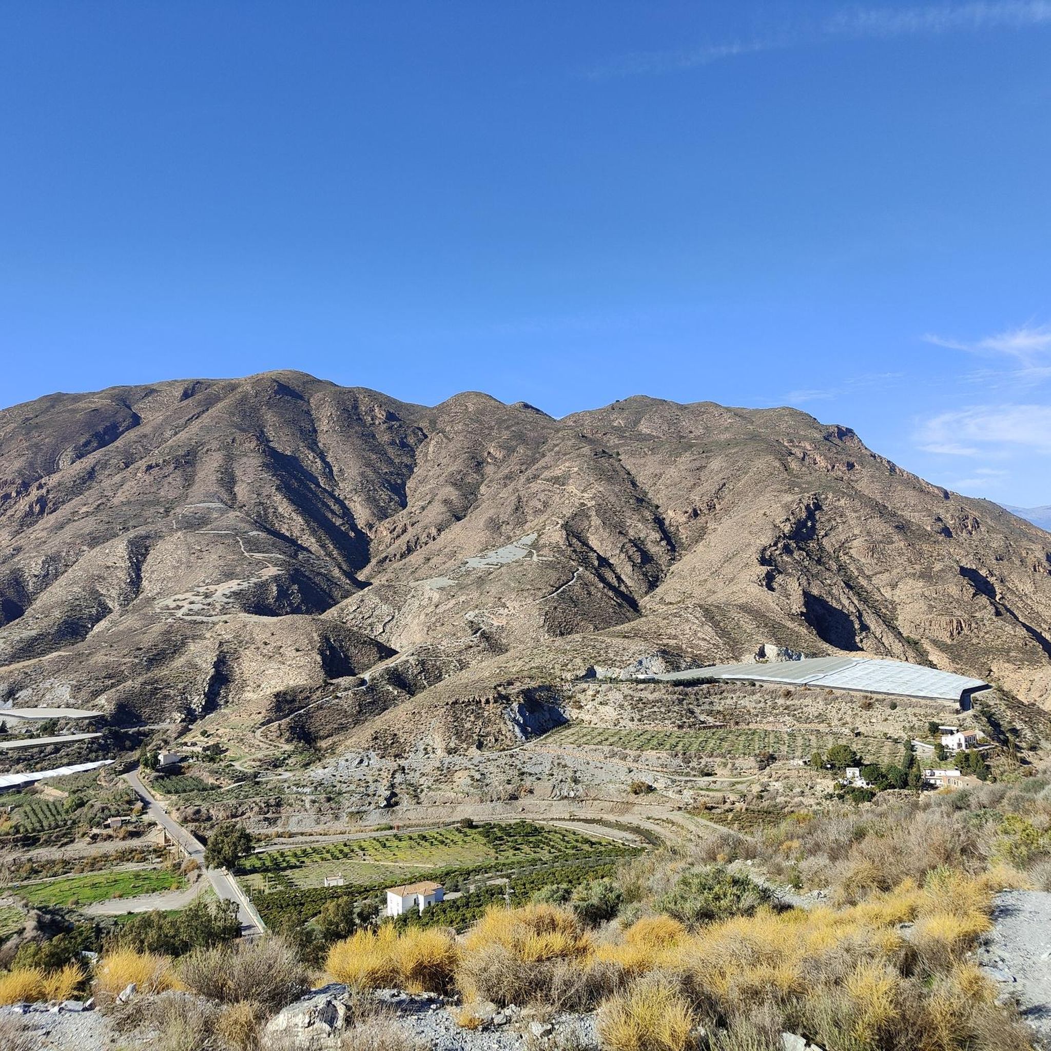
The Puerto de la Ragua marks the border between the provinces of Granada and Almería. The Sierra Nevada stretches on both sides, with the 3000m peaks on the Granada side. The highest mountain in the province of Almería, El Chullo, is, however, easily accessible from the Puerto de la Ragua. The Puerto de la Ragua is just over 2000m.
0
0

A great place to relax. You can take homemade wine and a piece of cake. You can also go higher!
0
0
Frequently Asked Questions
How many road cycling routes are available around Río Adra?
There are over 50 road cycling routes around Río Adra, offering a diverse range of experiences. These routes are highly rated by the komoot community, with an average score of 4.6 stars from over 30 reviews.
What kind of terrain can I expect on road cycling routes in Río Adra?
The Río Adra region offers a varied topography for road cycling. You'll find challenging ascents and descents in the mountainous areas like the Sierra Nevada and Sierra de Gádor, as well as flatter, scenic coastal roads along the Mediterranean Sea. The riverine valleys also provide routes through agricultural lands and natural vegetation, creating a dynamic cycling experience.
Are there challenging road cycling routes in the Río Adra area?
Yes, Río Adra is known for its challenging road cycling routes, particularly those venturing into the Sierra Nevada and Sierra de Gádor. Many routes feature significant elevation gains, requiring good to very good fitness. For example, the Ugíjar – Road to Benínar Reservoir loop from Berja is a difficult 142.6 km path with extensive climbs and descents.
Can I find easier or flatter road cycling routes near Río Adra?
While the region is known for its mountainous challenges, you can find easier options, especially along the coast. The riverine environment also offers routes through valleys that are less demanding than the high mountain passes. Komoot lists 2 easy and 26 moderate routes in the area, providing options for various skill levels.
What are some scenic viewpoints or landmarks to look out for on road cycling routes?
The region boasts breathtaking scenery. You'll encounter panoramic mountain views from routes like the Road to Benínar Reservoir – View of the Mountains loop from Berja. Coastal routes offer sea breezes and Mediterranean vistas. The Torre del Cautor – Playa de Casarones loop from Puente del Río passes by the Torre del Cautor, which offers great views of the Costa Tropical. The Albuferas de Adra Natural Reserve, near the river's mouth, is also a significant ecological site for birdlife.
What is the best time of year for road cycling in Río Adra?
The Río Adra region, being in southern Spain, generally offers favorable conditions for road cycling for much of the year. Spring and autumn typically provide pleasant temperatures, making them ideal for tackling both mountain and coastal routes. Summers can be hot, especially inland, so early morning or late afternoon rides are recommended during those months. Winters are generally mild, allowing for year-round cycling, though mountain passes might experience cooler temperatures.
Are there any circular road cycling routes around Río Adra?
Yes, many of the road cycling routes around Río Adra are designed as loops, allowing you to start and finish in the same location. Examples include the Benínar Reservoir – Berja loop from Berja and the Benínar Reservoir loop from Berja, which are popular choices for local cyclists.
What do other road cyclists enjoy most about road cycling in Río Adra?
The komoot community highly rates road cycling in Río Adra, with an average score of 4.6 stars. Reviewers often praise the dramatic and varied topography, from challenging mountain climbs to picturesque coastal roads, and the unique ecological corridor created by the river. The serene, less-trafficked inland roads are also frequently mentioned for providing an immersive natural experience.
Are there cafes or pubs along the road cycling routes for a break?
Yes, the region has a rich historical and cultural context, with charming villages scattered throughout. Cyclists can often find traditional bars and cafes in these villages, perfect for a coffee stop or a refreshment break during their ride. Adra town center and other local towns will also offer various amenities for cyclists.
Is public transport available to access road cycling routes in Río Adra, and can I bring my bike?
Public transport options in the Río Adra region, particularly for carrying bikes, can be limited, especially for routes further inland. It's advisable to check local bus services for specific routes and their policies regarding bicycles. For most road cycling adventures, driving to a starting point with ample parking and then cycling from there is often the most convenient option.
Where can I find parking for road cycling routes in Río Adra?
Parking is generally available in and around the towns and villages that serve as common starting points for road cycling routes, such as Berja or Adra. For routes that venture into more rural or mountainous areas, look for designated parking areas near trailheads or inquire locally about suitable spots to leave your vehicle. It's always a good idea to plan your starting point with parking in mind.
Are there any specific permits required for road cycling in the Río Adra region?
Generally, no specific permits are required for road cycling on public roads in the Río Adra region. However, if your route takes you through protected natural areas or private land, it's always wise to check for any specific regulations or access restrictions that might apply. For general information about the region, you can refer to resources like Wikipedia's entry on Río Adra.
Most popular routes around Río Adra

Get inspired with the komoot mobile app


Explore more
Browse the best Road cycling routes in other regions.
