The best walks and hikes in Corredor Ecológico Del Río Tinto
4.1
(77)
326
hikers
70
hikes
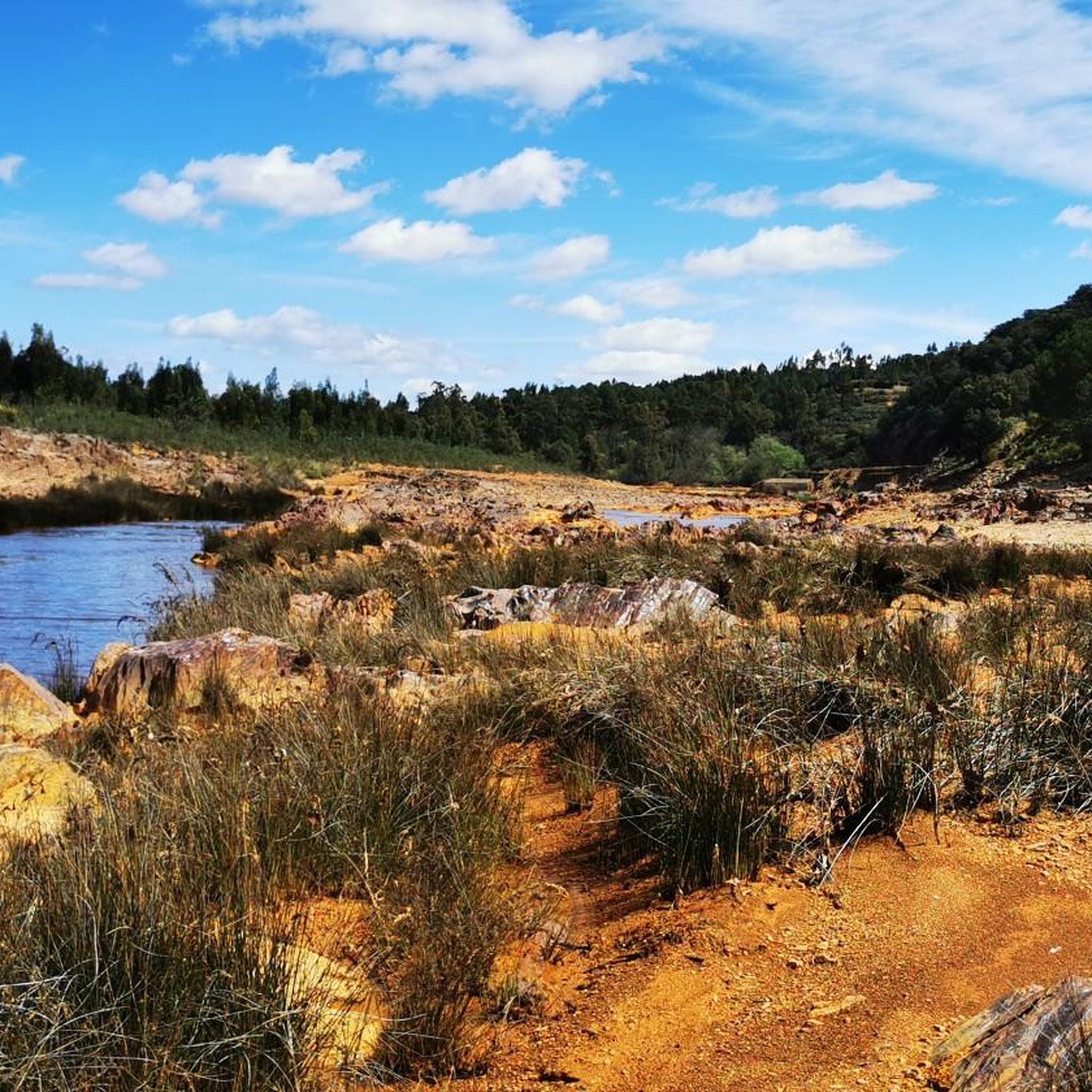
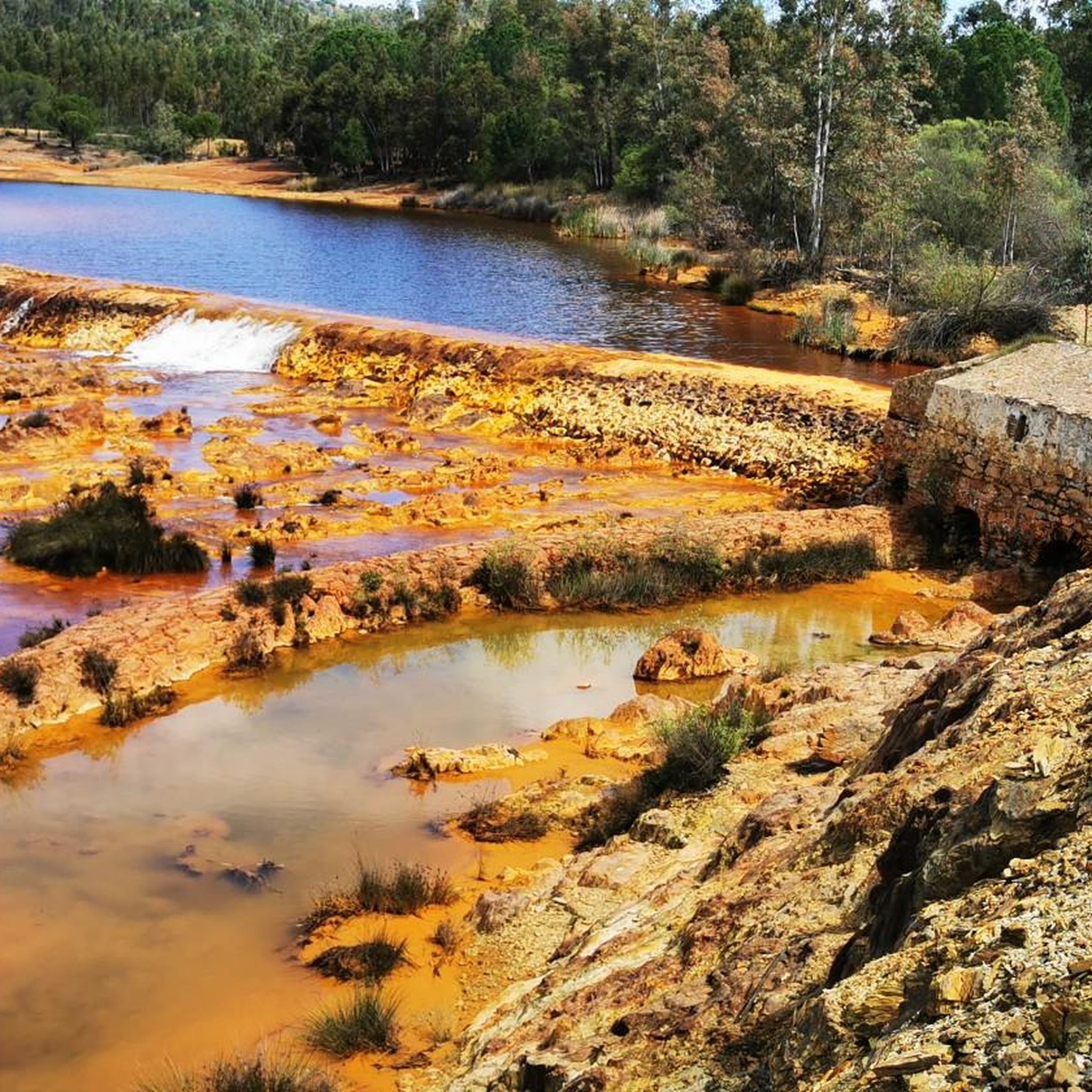
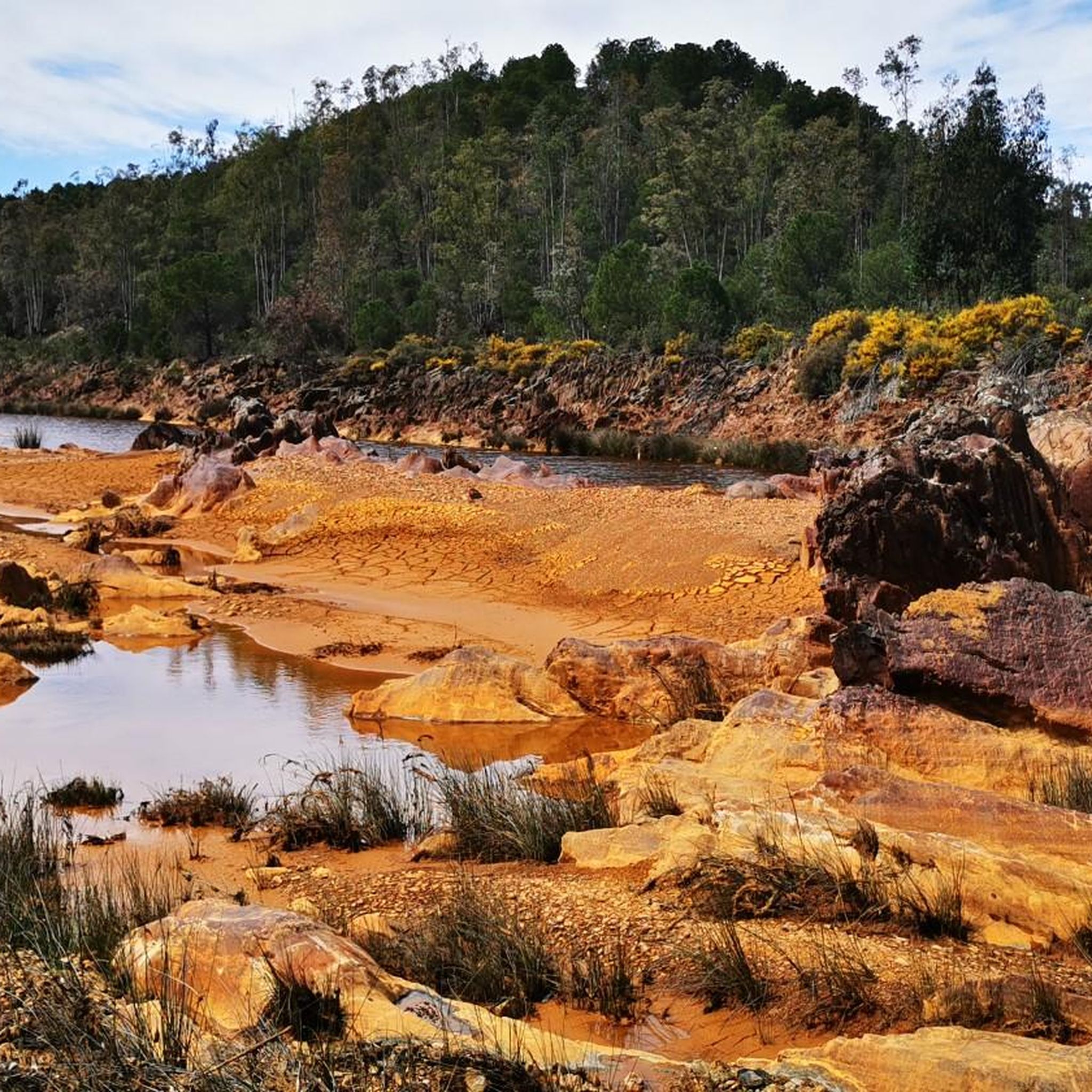
Hiking trails in Corredor Ecológico Del Río Tinto traverse a landscape shaped by its unique reddish-orange river, extensive mining heritage, and diverse ecosystems. The region features vast open-pit mines, slag heaps, and abandoned industrial structures, alongside public forests, gallery forests, and Mediterranean wet meadows. This area serves as an ecological corridor connecting Doñana and Sierra Morena, supporting varied flora and fauna. The terrain includes both natural riverine paths and routes following old railway lines.
Best hiking trails in Corredor Ecológico Del Río Tinto
- The most popular hiking route is Fog - circular tour to the walled city, a 4.3 miles (6.8 km) trail that takes 1 hour 48 minutes to complete. This easy route explores the area around the historic walled city of Niebla.
- Another top favourite among local hikers is Río Tinto Greenway Loop, a moderate 5.1 miles (8.2 km) path. This trail follows sections of the old railway line, offering views of the distinctive Río Tinto.
- Local hikers also love the Dolmens of El Pozuelo Route, a 4.3 miles (6.9 km) trail leading through an area with ancient megalithic structures, often completed in about 1 hour 53 minutes.
- Hiking in Corredor Ecológico Del Río Tinto is defined by its unique reddish-orange river, dramatic mining landscapes, and varied forest and meadow ecosystems. The network offers options for different ability levels, from easy walks to moderate treks.
- The routes in Corredor Ecológico Del Río Tinto are highly rated by the komoot community with an average score of 4.1 stars from over 60 reviews. More than 300 hikers have used komoot to explore Corredor Ecológico Del Río Tinto's varied terrain.
Last updated: May 10, 2026
2.3
(3)
6
hikers
6.84km
01:49
60m
70m
Easy hike. Great for any fitness level. Easily-accessible paths. Suitable for all skill levels.
4.8
(5)
11
hikers
8.25km
02:21
190m
190m
Hike the moderate Río Tinto Greenway Loop, a 5.1-mile trail through a unique, reddish landscape shaped by ancient mining history.

Sign up for free
5.0
(1)
4
hikers
6.88km
01:54
110m
120m
Hike the easy 4.3-mile (6.9 km) circular trail around the Dolmens of El Pozuelo, gaining 375 feet (114 metres) in under two hours.
5.0
(1)
2
hikers
9.00km
02:36
210m
210m
Moderate hike. Good fitness required. Easily-accessible paths. Suitable for all skill levels.
2
hikers
10.1km
02:37
50m
50m
Moderate hike. Good fitness required. Easily-accessible paths. Suitable for all skill levels.
Get access to more routes and recommendations from other explorers.
Sign up for free
Already have an account?
Our route recommendations are based on thousands of hikes, rides, and runs completed by other people on komoot.
Start today with a free account
Your next adventure awaits.
Login or Signup
Tips from the Community

Part of the route runs alongside the river, and due to recent rains, the paths and trails have disappeared. There are sections where it's impossible to know where to walk, and some are even dangerous because of the dense vegetation washed down by the river.
0
0

Top here is an old Roman bridge
1
0

The current appearance of the castillo dates back to the 15th century. Inside is the weapons yard. Steps and stairs lead up to the fortress walls. From here you can enjoy a beautiful panoramic view (apart from the ugly cement factory) of the town, the surrounding area and the Río Tinto.
1
0
Beautiful Roman bridge over the Rio Tinto.
1
0

One of the most populated areas of archaeological sites in Zalamea La Real. This site was excavated in the middle of the 20th century and was dated between 3000 and 2500 BC. c.
2
0
Views of one of the meanders formed by the Rio Tinto as it passes through the municipality of Berrocal.
1
1
Old railway line that was used for just over a century until 1984 to transport the minerals extracted in the Riotinto-Nerva mining basin.
1
1
Religious sanctuary of the town of Berrocal. Said congregation was divided into two buildings that represented two sides, the one above and the one below. That is why we still find the Hermitage of the Brotherhood of the Santa Cruz de Abajo and the one above.
1
1
Frequently Asked Questions
What kind of terrain can I expect on the hiking trails in Corredor Ecológico Del Río Tinto?
The terrain in Corredor Ecológico Del Río Tinto is exceptionally diverse and unique. You'll encounter the striking reddish-orange banks of the Río Tinto, often described as a 'Martian landscape,' alongside vast open-pit mines and industrial archaeology from centuries of mining. The routes also traverse public forests, gallery forests with willows and poplars, Mediterranean wet meadows, and dehesas, offering a mix of natural and historically transformed landscapes.
Are there hiking trails suitable for all difficulty levels?
Yes, the Corredor Ecológico Del Río Tinto offers a range of trails to suit various fitness levels. There are over 70 routes in total, with 28 classified as easy, 36 as moderate, and 6 as difficult. This ensures that both casual walkers and experienced hikers can find suitable options.
What natural features or landmarks can I see while hiking?
Hikers can explore a wealth of natural and historical landmarks. The most prominent is the Río Tinto itself, with its unique coloration. You can also discover impressive mining landscapes like the Corta Peña del Hierro, ancient structures such as the Roman Bridge 🌉 Niebla, and the scenic Cachán Bridge. The area also features megalithic structures along routes like the Dolmens of El Pozuelo Route.
When is the best time of year to hike in Corredor Ecológico Del Río Tinto?
The best time to hike in Corredor Ecológico Del Río Tinto is typically during the spring (March to May) and autumn (September to November) months. During these periods, the weather is milder and more pleasant for outdoor activities, allowing you to comfortably enjoy the unique landscapes and historical sites. Summers can be very hot, and winters can be cooler and wetter.
Are there family-friendly hiking options in the region?
Yes, there are several family-friendly hiking options. Many of the 28 easy trails are suitable for families. For instance, the Fog - circular tour to the walled city is an easy 4.3-mile route that explores the historic area around Niebla. Some sections of trails, like the 'Camino natural del río Tinto,' are also designed to be accessible for people with reduced mobility, making them great for families with strollers.
Can I bring my dog on the hiking trails?
Generally, dogs are welcome on many of the hiking trails in Corredor Ecológico Del Río Tinto. However, it's always recommended to keep your dog on a leash, especially in areas with wildlife or near livestock, and to clean up after them. Always check for specific signage or local regulations at trailheads, as rules can vary.
What do other hikers enjoy most about hiking in Corredor Ecológico Del Río Tinto?
The area is highly rated by the komoot community, with an average score of 4.1 stars from over 60 reviews. Hikers frequently praise the unique 'Martian' scenery of the Río Tinto, the fascinating blend of natural beauty with historical mining landscapes, and the variety of well-maintained trails that cater to different skill levels.
Are there any circular hiking routes available?
Yes, circular routes are a popular option in the region. An example is the Fog - circular tour to the walled city, which allows you to start and end in the same location while exploring the historic town of Niebla. The Río Tinto Greenway Loop is another moderate circular path that follows sections of the old railway line.
Are there places to eat or stay near the hiking trails?
Yes, the towns and villages surrounding the Corredor Ecológico Del Río Tinto, such as Minas de Riotinto, Nerva, and Niebla, offer various amenities. You can find cafes, restaurants, and accommodation options in these areas, providing convenient bases for your hiking adventures and places to refuel after a day on the trails.
What is the historical significance of the Corredor Ecológico Del Río Tinto?
The region boasts a profound historical significance, primarily due to its millennia-long mining heritage. It was home to Europe's largest open-pit mine, and evidence of ancient exploitation, including Roman mines, can still be found. This history is visible in the vast mining landscapes, abandoned industrial structures, and historical sites like the Roman Bridge 🌉 Niebla, all of which add a unique layer to the hiking experience.
Can I explore the mining history beyond just hiking?
Absolutely. In addition to hiking through the historical mining landscapes, you can experience the region's past through attractions like the Tourist Mining Railway (Ferrocarril Turístico de las Minas de Río Tinto), which offers a unique journey in original wooden wagons alongside the river. There's also a Mining Museum that provides comprehensive insights into the heritage, including a recreation of a Roman mine.
Are there any trails that follow old railway lines?
Yes, the region is known for trails that utilize old railway lines, offering relatively flat and scenic paths. The Río Tinto Greenway Loop is a prime example, following sections of the old railway. Another route, On the banks of the Riotinto along the old railway, also provides an opportunity to hike along these historic tracks.
Most popular routes in Corredor Ecológico Del Río Tinto
Most popular attractions in Corredor Ecológico Del Río Tinto

Get inspired with the komoot mobile app


Explore more
Browse the best Hikes in other regions.
