The best running trails in Gándaras De Budiño
4.0
(8)
618
runners
51
runs
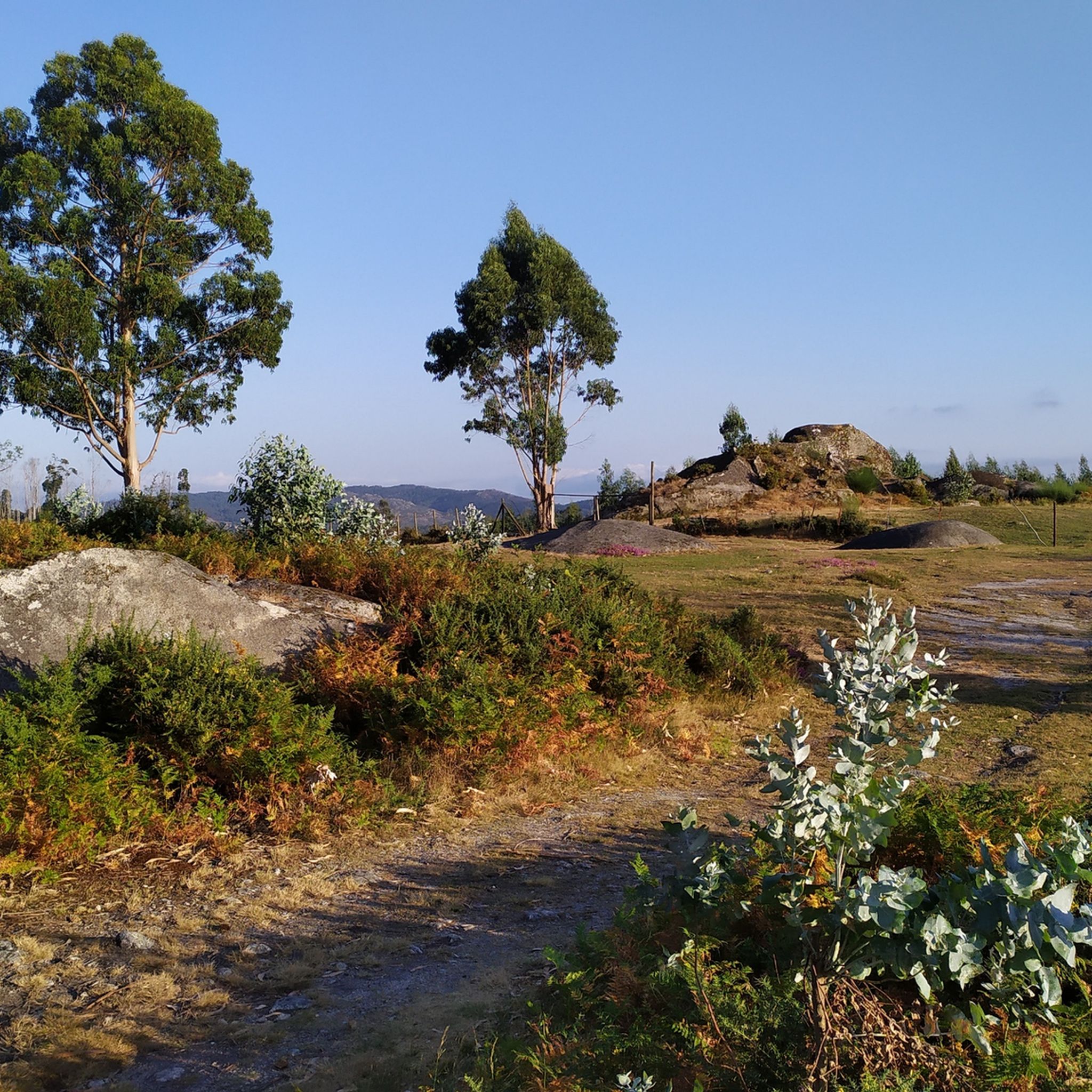
Jogging routes in Gándaras De Budiño traverse a landscape characterized by extensive wetlands, watercourses, and riparian forests, shaped by the Louro River. This area features a complex system of lakes, lagoons, and peat bogs, offering varied terrain for runners. The region is situated between the O Galiñeiro and Cans-Budiño mountain ranges, presenting a wide, flat depression with wet heathland. These natural features provide diverse running environments, from riverside paths to open areas.
Best jogging routes in Gándaras De Budiño
- The…
Last updated: August 8, 2026
3.0
(1)
57
runners
11.7km
01:17
180m
180m
Moderate run. Good fitness required. Mostly paved surfaces. Suitable for all skill levels.
17
runners
40.6km
04:30
410m
410m
Hard run. Very good fitness required. Mostly paved surfaces. Suitable for all skill levels.

Sign up for free
5.0
(3)
24
runners
7.76km
00:51
30m
30m
Moderate run. Good fitness required. Mostly paved surfaces. Suitable for all skill levels.
15
runners
11.1km
01:14
30m
30m
Moderate run. Good fitness required. Mostly paved surfaces. Suitable for all skill levels.
9
runners
28.2km
03:43
880m
880m
Hard run. Very good fitness required. Mostly paved surfaces. Suitable for all skill levels.
Get access to more routes and recommendations from other explorers.
Sign up for free
Already have an account?
Our route recommendations are based on thousands of hikes, rides, and runs completed by other people on komoot.
Start today with a free account
Your next adventure awaits.
Login or Signup

Tips from the Community

For those of us who are older, it reminds us of what it was like to cross from one country to another, when you might randomly have to open the trunk of your car so that both police forces could check what you were carrying, so that younger people could get their documents, and above all so that everyone can see how beautiful and enriching it is to be able to live in peace between neighboring countries.
0
0

Valença Fortress, also known as Praça-forte de Valença do Minho, is an imposing jewel of Portuguese military architecture with over eight centuries of history. Its origins date back to the 13th century, when King Sancho I and later Afonso III fortified it to protect the border with Galicia. During the Restoration War (17th–18th centuries), it was transformed into a Vauban-style fortress under the engineer Miguel de l’École and the architect Manuel Pinto de Vilalobos, being completed in 1713. The fortress withstood attacks during the Restoration, was captured and recaptured several times, and was also defended during the Napoleonic Wars and the Liberal Wars.
4
0

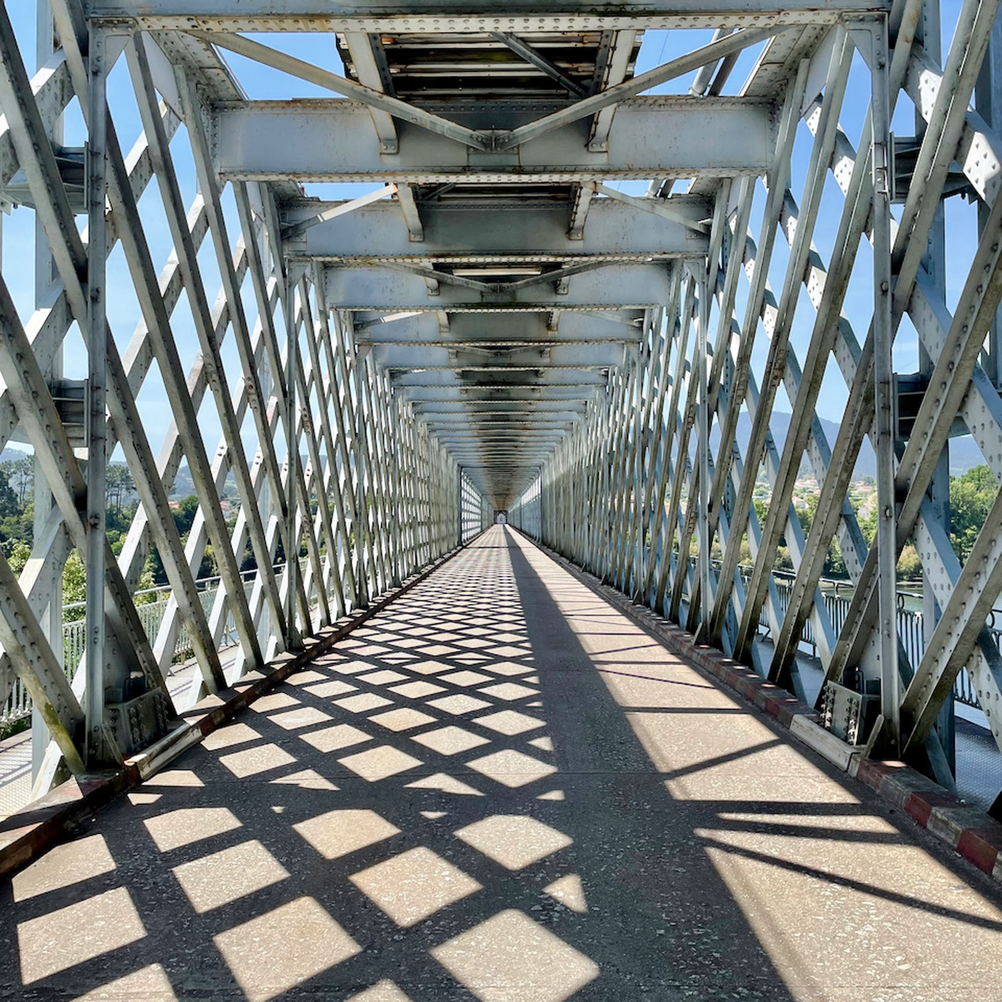
The Tui International Bridge is a landmark on the border between Portugal and Spain, connecting the Galician city of Tui to Valença, Portugal, across the Minho River. This historic metal truss bridge serves as a crossing for cars, trains, and pedestrians. It is also part of the Camino de Santiago route, offering views of the river and both cities.
1
0

The imposing Valença Fortress rises atop a hill, dominating the landscape and leaving an unforgettable impression on those who arrive. More than a symbol, it is the soul of the city, preserving centuries of history within its walls. Built in the 17th century on the ruins of an ancient 13th-century castle, the fortress is a masterful example of military architecture of the period, with its star-shaped walls stretching for an impressive 5.5 kilometers. Upon entering, one immediately senses the strength and grandeur of Valença, one of the oldest towns in Portugal.
2
0

Superbly preserved and well-maintained star-shaped fortress
5
1

The well-preserved star fortress of Valença dominates the Minho valley from an elevated position and offers wide views in all directions.
4
1
The Louro River Trail is a very popular hiking route in Galicia, especially in the municipalities of Porriño and Mos. This trail follows the course of the Louro River and has been equipped with dirt roads, bridges, walkways and rest areas.😎🚶♀️
7
0
Frequently Asked Questions
How many running routes are available in Gándaras De Budiño?
There are over 25 running routes mapped in Gándaras De Budiño, offering a variety of distances and difficulty levels. These routes are highly rated by the komoot community, with an average score of 5.0 stars.
What kind of terrain can I expect on the jogging trails in Gándaras De Budiño?
The running trails in Gándaras De Budiño traverse a diverse landscape. You'll encounter extensive wetlands, watercourses, and riparian forests, particularly along the Louro River. The terrain includes a complex system of lakes, lagoons, peat bogs, and flooded meadows, as well as wet heathland. This offers a mix of surfaces, from riverside paths to more open areas.
Are there any easy or beginner-friendly running routes in Gándaras De Budiño?
Yes, Gándaras De Budiño offers several moderate routes suitable for beginners or those looking for an easier run. For example, the Running loop from Estrada is a relatively flat 3.1-mile (5.1 km) trail that can be completed in about 34 minutes.
What historical landmarks can I see while running in Gándaras De Budiño?
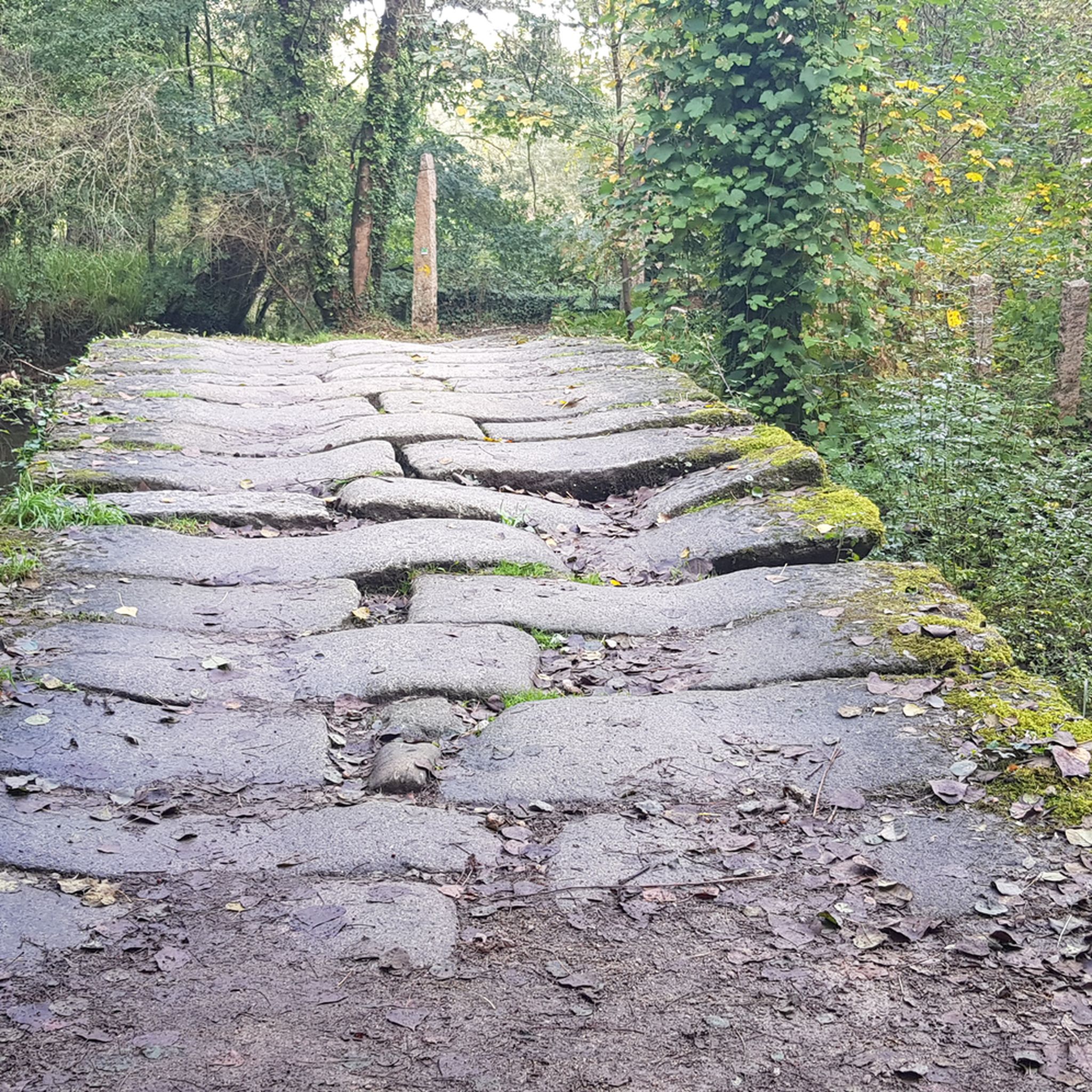
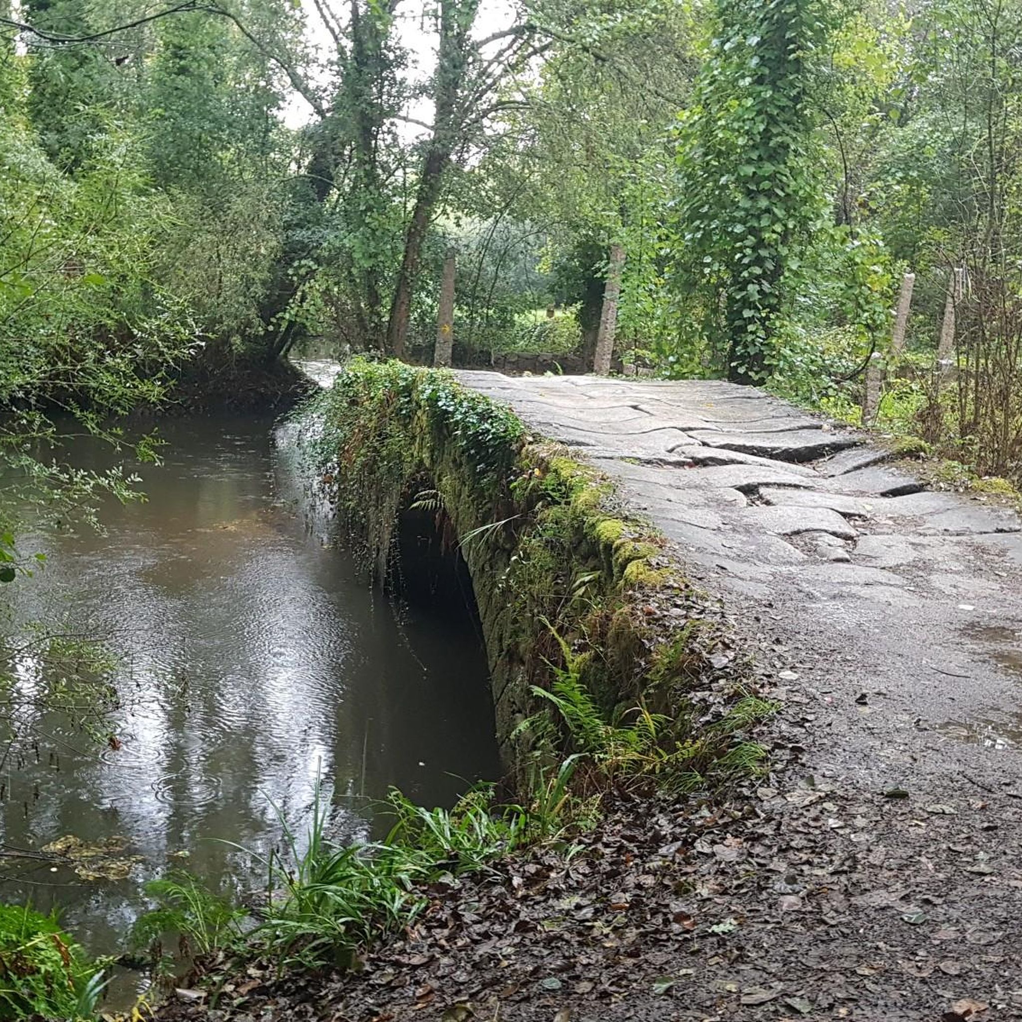
The region is rich in history. You can encounter cultural heritage features like 'poldras' and 'pontellas'. A notable landmark is the ancient medieval Ponte da Veiga, also known as the 'Roman Bridge,' which was part of the Roman Via XIX and is still used by pilgrims on the Portuguese Way to Santiago de Compostela. The Ponte da Veiga – Riverside Walk – Tui loop from Tui is a great route to experience this.
Are there any circular running routes in Gándaras De Budiño?
Yes, many of the running routes in Gándaras De Budiño are circular, allowing you to start and finish at the same point. An example is the Praia Fluvial de Areeiros loop from Baltar, a moderate 4.1-mile (6.6 km) route.
What are the best times of year to go jogging in Gándaras De Budiño?
Gándaras De Budiño is enjoyable for running throughout much of the year. The diverse ecosystems, including wetlands and riparian forests, offer scenic beauty in spring and autumn. Summers are generally pleasant, but it's always advisable to check local weather forecasts, especially during peak heat or heavy rain, to ensure comfortable conditions.
Are the running trails in Gándaras De Budiño suitable for families?
Many of the moderate and flatter routes are suitable for families, offering a chance to enjoy nature together. The varied terrain and opportunities for bird and nature observation can make for an engaging outing. Consider routes like the Running loop from Estrada for a less strenuous option.
What kind of wildlife can I expect to see while running in Gándaras De Budiño?
Gándaras De Budiño is a designated Natura 2000 area, recognized for its significant biodiversity. You might spot over 150 species of vertebrates, including 80 species of nesting waterfowl, as well as various protected plants, amphibians, reptiles, and mammals. Platforms are available for bird and nature observation along many trails.
Are there any challenging running routes with significant elevation gain?
For experienced runners seeking a challenge, there are routes with significant elevation. The Monte Aloia Summit View – San Ciao Viewpoint loop from Tui is a difficult 17.5-mile (28.2 km) trail with substantial elevation gain, leading to panoramic views.
What do other runners enjoy most about jogging in Gándaras De Budiño?
The area is highly rated by the komoot community, with an average score of 5.0 stars. Runners often praise the unique combination of diverse natural landscapes, the serene beauty of the wetlands and riparian forests, and the historical points of interest like the Ponte da Veiga. The variety of terrain and well-maintained paths are also frequently highlighted.
Are there any specific viewpoints or scenic spots along the running trails?
Yes, the region offers several scenic spots. The Monte Aloia Summit View – San Ciao Viewpoint loop from Tui, for instance, leads to panoramic views. Additionally, the extensive wetlands and riparian forests along the Louro River provide picturesque settings, and dedicated platforms are available for bird and nature observation.
Most popular routes in Gándaras De Budiño
Most popular attractions in Gándaras De Budiño

Get inspired with the komoot mobile app


Explore more
Browse the best Running Trails & Routes in other regions.
