The best road cycling routes around Hallingskarvet
55
riders
4
rides
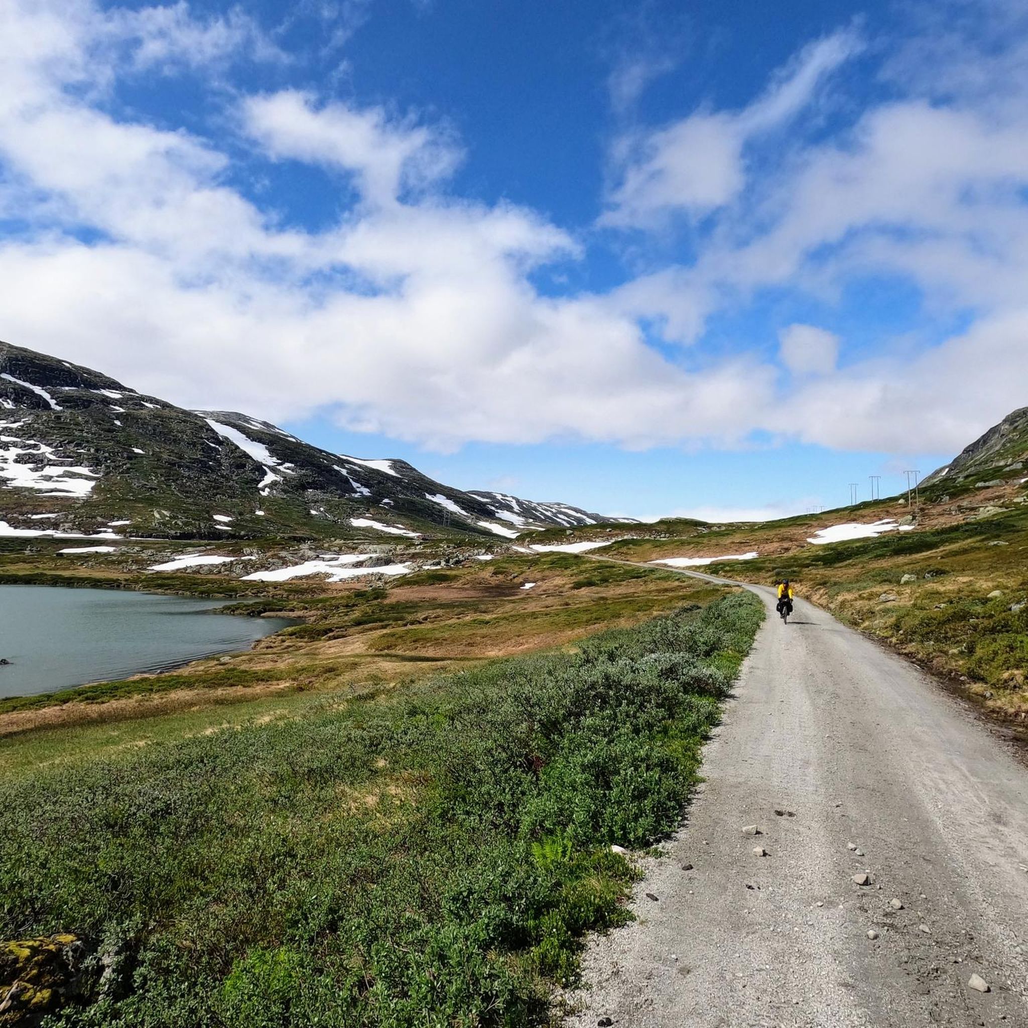
Road cycling around Hallingskarvet offers routes through a dramatic high-mountain landscape characterized by vast plateaus, steep cliffs, and deep valleys. The Hallingskarvet National Park encompasses this rugged, glacially sculpted terrain, providing a unique environment for cyclists. Lower elevations transition into heathlands and alpine meadows, with numerous small lakes and glacial rivers. The region's varied topography presents diverse road cycling experiences.
Best road cycling routes around Hallingskarvet
- The most popular road cycling route is Halne – Dyranut Fjellstova loop from Geilo…
Last updated: October 5, 2026
24
riders
112km
05:10
1,120m
1,120m
Hard road ride. Very good fitness required. Some segments of this route may be unpaved and difficult to ride.
9
riders
123km
06:42
2,480m
2,480m
Hard road ride. Very good fitness required. Mostly well-paved surfaces and easy to ride.

4
riders
34.3km
01:56
570m
570m
Moderate road ride. Good fitness required. Mostly well-paved surfaces and easy to ride.
18
riders
23.8km
01:45
340m
340m
Moderate road ride. Good fitness required. Some segments of this route may be unpaved and difficult to ride.
Our route recommendations are based on thousands of hikes, rides, and runs completed by other people on komoot.
Start today with a free account
Your next adventure awaits.
Tips from the Community

The nearby hotel is hospitable, great for warming up
0
0

At the western end of Ustedalsjorden near Geilo, an unusual wooden bridge crosses the Usta river at the historic starting point of the Nordmannsslepa, the oldest known trade and travel route across the Hardangervidda. The original bridge was built between 1884 and 1885. When it became dilapidated, a faithful replica was erected in 1990 using traditional timber construction methods, retaining the building style of the 18th-century original.
0
0

Put on dry clothes, preferably something windproof if you plan to go downhill. Phenomenal slope. Wonderful view
0
0

Halne Fjellstugu sits at the northern tip of the Halnefjorden and is a superb base for excursions into the northern part of the Hardangervidda. It's also an accommodation option for those completing the epic SignaTUR MASSIV. There are 75 beds in total here and a cafe too for a well-deserved refuel.
0
0
Train station in Geilo. The Bergen / Oslo train runs here. Stops en route: Sandvika, Asker, Drammen, Hokksund, Vikersund, Hønefoss, Nesbyen, Gol, Ål, Ustaoset, Haugastøl, Finse, Hallingskeid, Myrdal (transfer option to the Flåm Railway), Upsete, Mjølfjell and Voss.
0
0


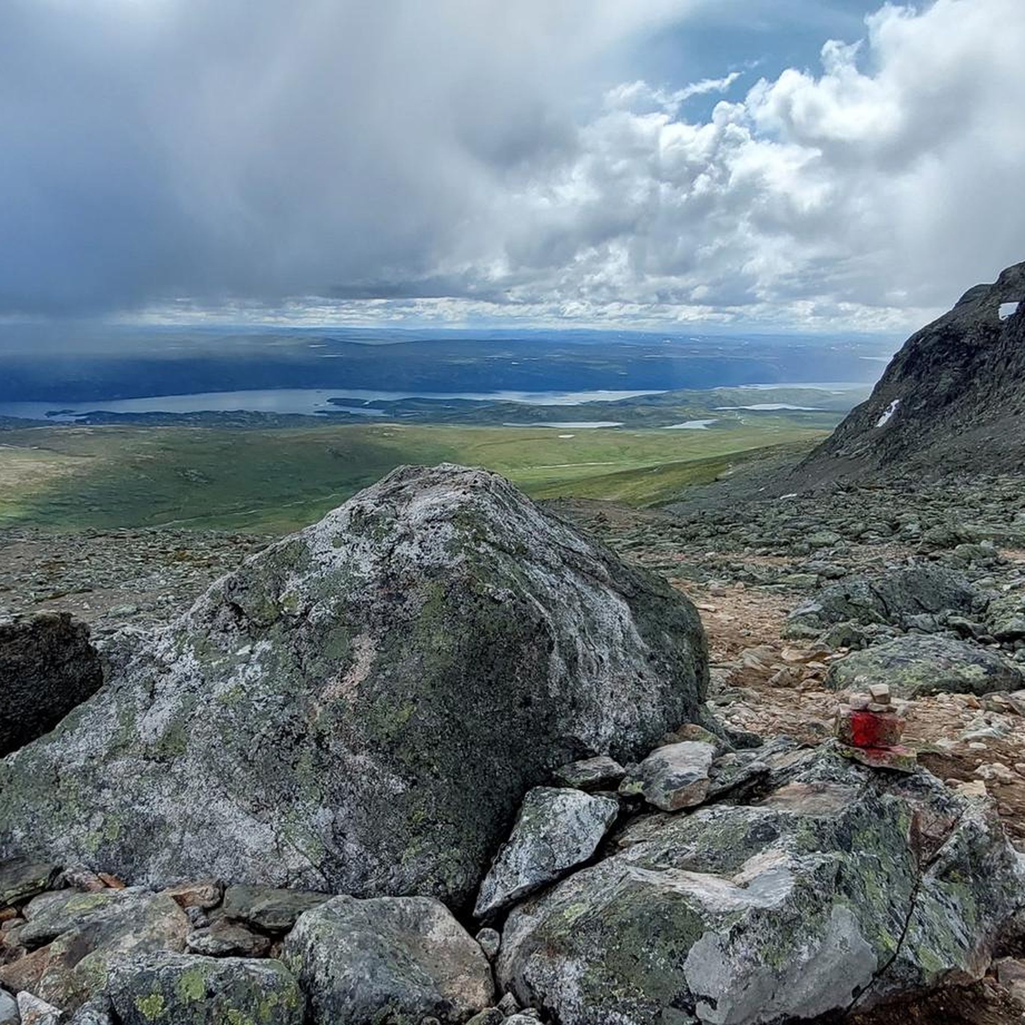
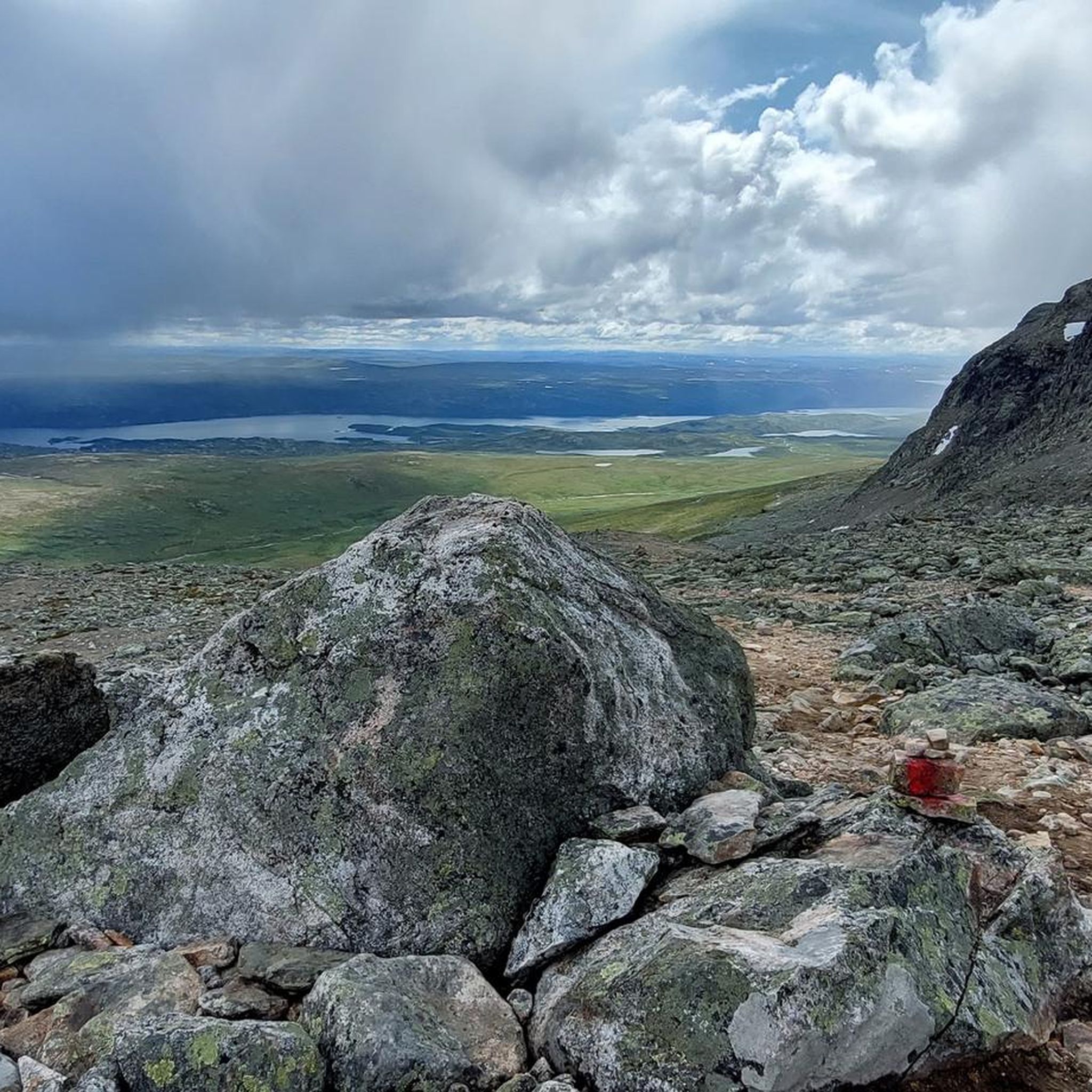
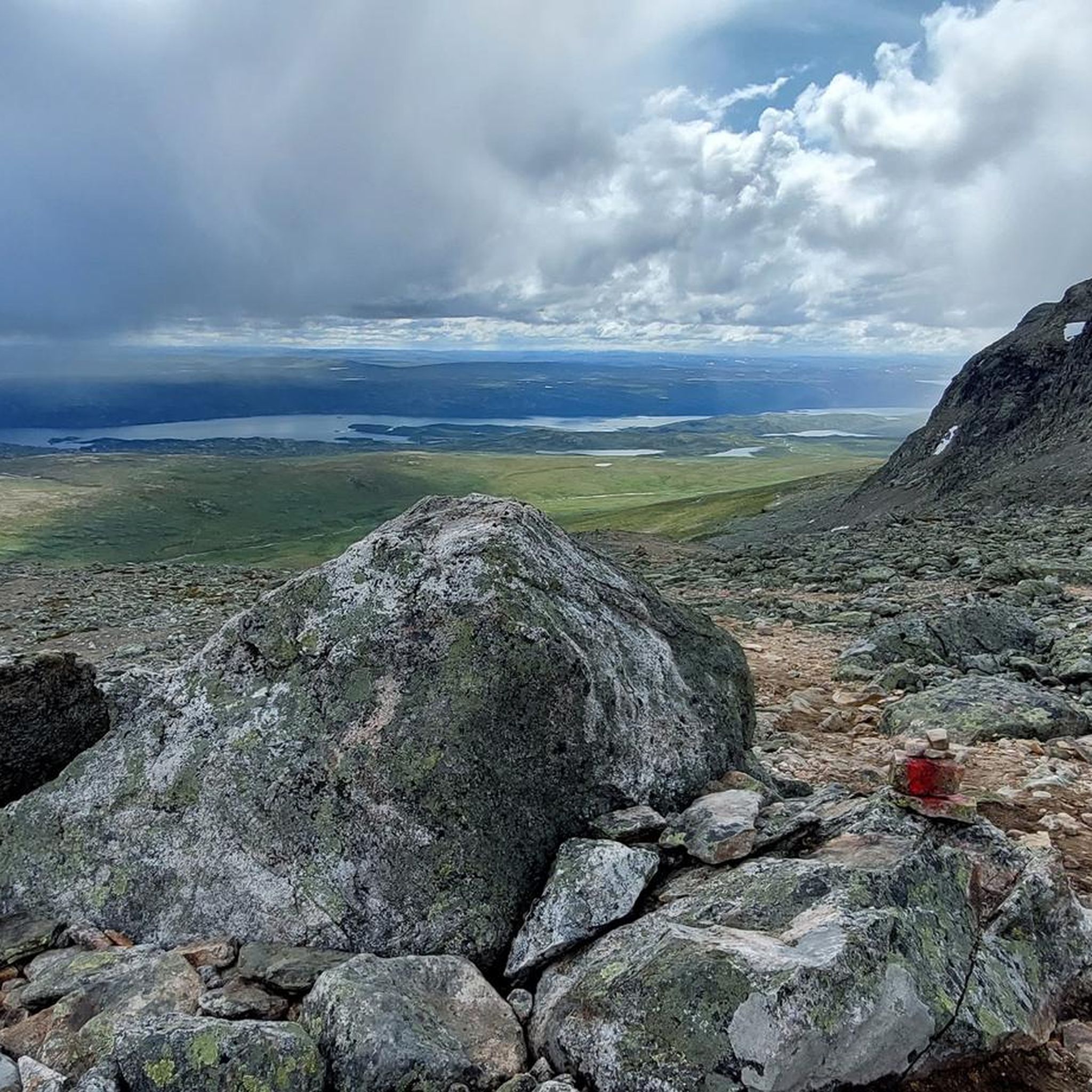
Sønstevatn is a large reservoir situated high in the mountains. The road runs along part of its edge, providing expansive views across the water and the open, stark, mountain landscape.
0
0
Starting from the Stølo area, the road climbs steadily towards Sønstevatn lake. This ascent takes you into higher mountain terrain, requiring a consistent effort to get up. The reward is reaching the expansive landscape around the lake, which offers wide views.
0
0
Frequently Asked Questions
How many road cycling routes are available around Hallingskarvet?
Komoot features several road cycling routes around Hallingskarvet. Currently, there are 4 distinct routes, ranging from moderate to difficult, offering diverse experiences through the region's unique landscape.
What kind of terrain can I expect on road cycling routes in Hallingskarvet?
The terrain around Hallingskarvet is characterized by dramatic high-mountain landscapes, vast plateaus, steep cliffs, and deep valleys. Lower elevations transition into heathlands and alpine meadows. You'll encounter significant elevation changes, with routes traversing varied surfaces, from paved roads to sections with gravel, especially on routes like the Rallarvegen.
Are there any family-friendly or easier road cycling options in Hallingskarvet?
While many routes feature significant climbs, the region does offer options for varying abilities. The Rallarvegen, for instance, has a section from Haugastøl to Finse (27 km) that is generally considered easier and more family-friendly, though it is a gravel path. For a moderate road cycling experience, consider the Slåttahølen – Huldreskogen loop from Geilomoen, which is 25.3 km long.
What are some of the most scenic points or landmarks I can see while road cycling in Hallingskarvet?
Hallingskarvet offers breathtaking scenery. Along routes like the Rallarvegen, you can enjoy views of Lake Tungevatn and the impressive Kjosfossen Waterfall. The Storurevatnet Lakeside Gravel Road also provides stunning vistas. The region is home to the Hallingskarvet National Park, with its rugged, glacially sculpted terrain. You might also encounter the Sherpa Steps to Skarvsenden, a unique stone-stepped trail.
When is the best time of year to go road cycling in Hallingskarvet?
The cycling season in Hallingskarvet typically runs from July to the end of September. During this period, snowdrifts are less likely, and the weather is generally more favorable for exploring the high-mountain areas. However, conditions can vary, so it's always advisable to check local weather forecasts before heading out.
Are there any challenging road cycling routes for experienced riders?
Yes, Hallingskarvet offers several challenging routes. The Ismalfossen – Highland Bakery loop from Geilo is a difficult 124.5 km path with substantial climbs and descents. Another demanding option is the Halne – Dyranut Fjellstova loop from Geilo, a 110.7 km route featuring significant elevation changes through high-mountain areas.
What is the Rallarvegen, and can I cycle it with a road bike?
The Rallarvegen is Norway's most beautiful cycling route, a historic construction road built for the Bergen Railway. While it offers magnificent nature and history, it's largely unmodernized and features gravel sections. The full 82 km route from Haugastøl to Flåm can be challenging for a pure road bike, especially the rougher sections and the descent to Flåm with loose gravel. A gravel bike or mountain bike might be more suitable for the entire route, though the Haugastøl to Finse section is more manageable.
Are there any circular road cycling routes around Hallingskarvet?
Yes, many of the routes around Hallingskarvet are designed as loops. For example, the Highland Bakery loop from Geilo is a 34.5 km trail leading through high-mountain scenery. The Halne – Dyranut Fjellstova loop from Geilo and the Ismalfossen – Highland Bakery loop from Geilo are also popular circular options for longer rides.
What can I expect regarding elevation changes on Hallingskarvet's road cycling routes?
Hallingskarvet's road cycling routes are known for significant elevation changes due to the high-mountain environment. Routes like the Ismalfossen – Highland Bakery loop from Geilo can feature over 2,400 meters of ascent, while even moderate routes like the Highland Bakery loop from Geilo include over 570 meters of climbing. Be prepared for substantial climbs and descents.
Where can I find parking for road cycling routes in the Hallingskarvet area?
Geilo serves as a natural starting point for many activities and offers various services, including parking options. For routes like the Rallarvegen, parking is available at key access points such as Haugastøl, Finse, and Flåm. It's advisable to check specific starting points for routes for detailed parking information.
Are there any natural monuments or unique geological features to explore near the cycling routes?
Absolutely. The Hallingskarvet National Park itself is a major natural monument, characterized by rugged, glacially sculpted terrain. You can find highlights like the Rocky Gorge Route in Hallingskarvet National Park and areas with Snowfields and Icefields. The region also features numerous small lakes, tarns, and glacial rivers, including Flakavatnet, Norway's highest lake.
What do other road cyclists enjoy most about road cycling in Hallingskarvet?
Road cyclists frequently praise the dramatic high-mountain scenery, the sense of remoteness, and the unique challenge presented by the varied terrain. The opportunity to cycle through a national park with vast plateaus and deep valleys is a significant draw. The historical aspect of routes like the Rallarvegen also adds a unique cultural dimension to the cycling experience.
Most popular routes around Hallingskarvet
Most popular attractions around Hallingskarvet

Get inspired with the komoot mobile app


Explore more
Browse the best Road cycling routes in other regions.
