The best walks and hikes around Ohrum
4.5
(3644)
15,489
hikers
27
hikes
Hiking around Ohrum offers diverse natural features, situated near the Harz Mountains. The region is characterized by idyllic forests, including the prominent Oderwald, and winding rivers like the Oker. Trails provide access to tranquil lakes and varied terrain, with elevations such as the Hungerberg reaching 205 meters. This landscape provides a range of hiking experiences for different fitness levels.
Best hiking trails around Ohrum
- The most popular hiking route is Old School of Ohrum – View between the Oderwald and…
Last updated: July 23, 2026
4.7
(6)
23
hikers
8.28km
02:15
110m
110m
Moderate hike. Good fitness required. Easily-accessible paths. Suitable for all skill levels.
4.8
(5)
27
hikers
5.02km
01:20
50m
50m
Easy hike. Great for any fitness level. Easily-accessible paths. Suitable for all skill levels.

Sign up for free
12
hikers
Easy hike. Great for any fitness level. Easily-accessible paths. Suitable for all skill levels.
11
hikers
2.07km
00:31
0m
0m
Easy hike. Great for any fitness level. Easily-accessible paths. Suitable for all skill levels.
4.0
(3)
7
hikers
7.00km
01:51
50m
50m
Easy hike. Great for any fitness level. Easily-accessible paths. Suitable for all skill levels.
Get access to more routes and recommendations from other explorers.
Sign up for free
Already have an account?
Our route recommendations are based on thousands of hikes, rides, and runs completed by other people on komoot.
Start today with a free account
Your next adventure awaits.
Login or Signup
Tips from the Community

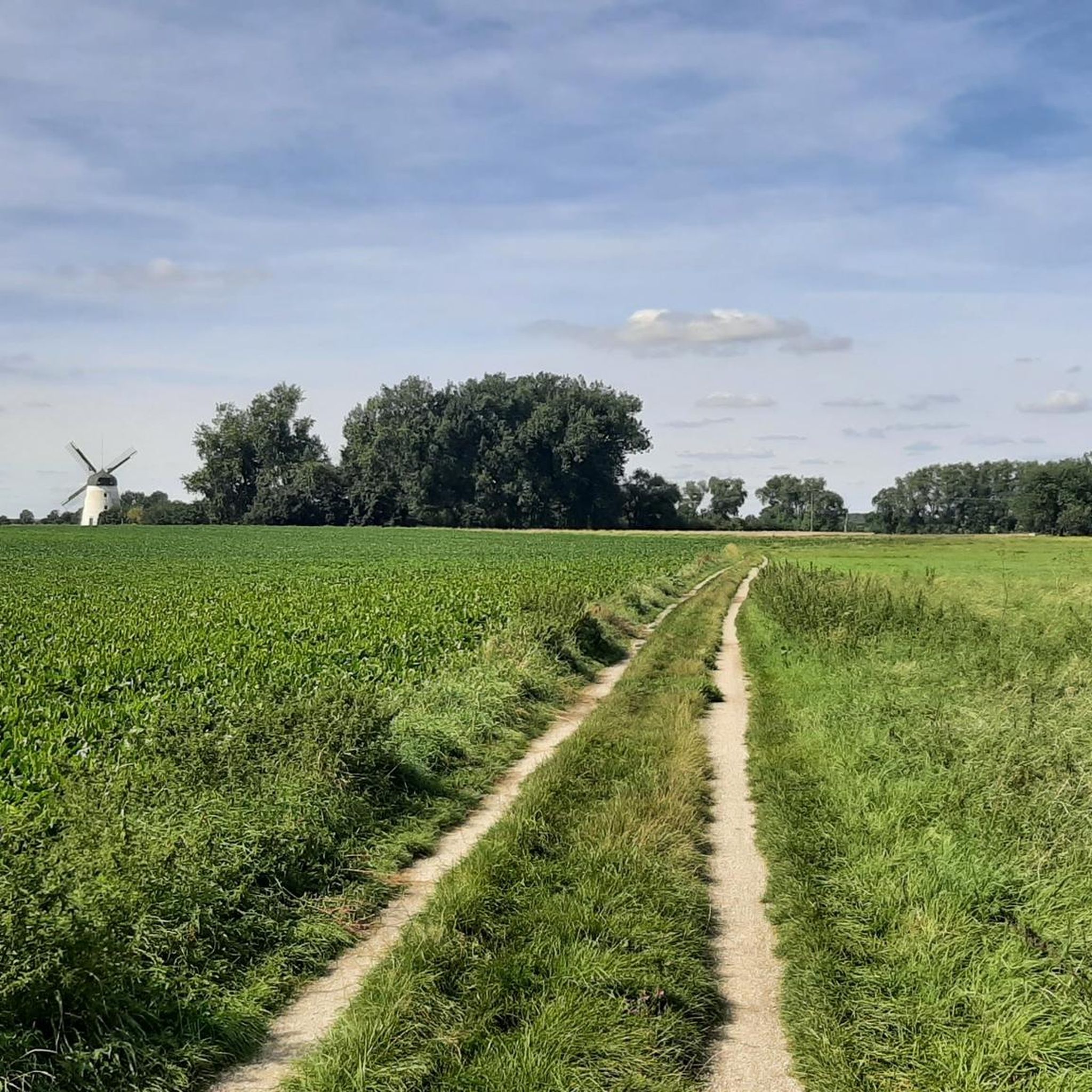
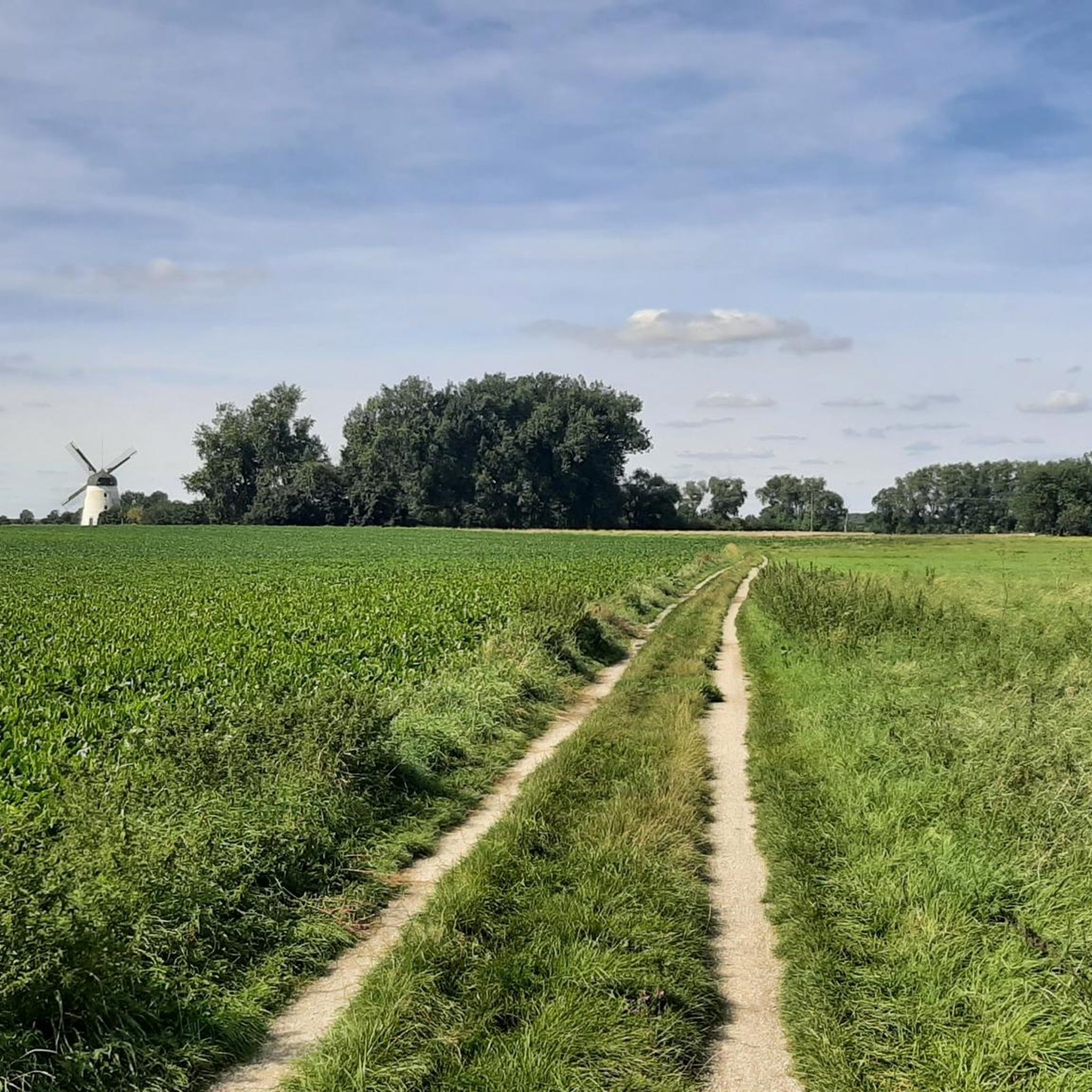
The windmill can be seen from afar when coming from the village of Ohrum. Here is the stamp box for the leisure stamp - Pass Nördliches Harzvorland No. 2 ;-) Very nice photo motif
0
0

A significant monument in Ohrum that commemorates the establishment of the German Empire under Kaiser Wilhelm I. The stone also bears the names of those from Ohrum who participated in the campaign against France in 1870-71. An interesting place for a short historical excursion in the middle of the village.
0
0
⛪ Where history was made: The church in Ohrum Anyone cycling past here reaches one of the most historic places in the entire Braunschweiger Land. The church in Ohrum stands on ground that was the focus of world politics over 1200 years ago. A place full of legends: The Baptism of the Saxons: Ohrum is known as one of the oldest places in the region. It was first mentioned in documents as early as 747. It is handed down that Charlemagne had Saxons baptized here at the Oker ford – a turning point in European history. Historic Wehrkirche (Fortified Church): The simple, massive construction of the church testifies to its long past. It looks almost like a small fortress and blends wonderfully into the tranquil village scene directly on the Oker. Significant Oker ford: Long before there were bridges, Ohrum was the strategic point for crossing the river. You can still feel this today in the village's special location. Why you should stop here: Enjoy the silence: The church square radiates incredible tranquility – perfect for a short pause on a tour. Culture & Nature: The combination of ancient sacred architecture and the directly adjacent Oker landscape is unique. Ideal route point: Whether on the way to Wolfenbüttel or further into the Harzvorland – Ohrum is the perfect place for a short cultural stop. My tip: Take a moment to read the information boards in the village. It is fascinating to know that you are traveling exactly where emperors and kings once set the course for the Middle Ages. 🚴♂️📜
0
0
🏰 Strategic foresight: Parking at the Bungenstedter Turm This spot is the ideal "basecamp" point for explorations in southern Wolfenbüttel. Located directly on the Lower Saxony Mill Road (Niedersächsische Mühlenstraße), this place combines a modern nature experience with a historically rich backdrop. What makes this place special: Historical watchtower: The Bungenstedter Turm was once an important watchtower of the Wolfenbüttel landwehr. It served to secure the trade routes – today, it primarily secures a phenomenal panoramic view over the Okerland all the way to the Harz mountains. Mill romance: As part of the Lower Saxony Mill Road, the parking lot is a great starting point to explore the surrounding historical mills of the region. Perfect location: Situated directly between Halchter and Ohrum, you are immediately in the green. The paths from here are ideal for extended hikes or relaxed bike rides along the Oker. My tip for explorers: Park here if you are planning a tour to the Oker-Oker Canal or into the
0
0
🌾 Technical monument with a view: The mill at the Bungenstedter Turm This imposing Dutch windmill from 1880 is a true landmark south of Wolfenbüttel. The mill cap alone weighs a proud 17 tons and, along with the enormous sails, can be turned completely into the wind – a fascinating piece of technical history! The mill stands on a slight hill between the Oker river and the former B4 road and offers a fantastic view of the Harz foothills in clear weather. My tip: Collectors beware! Right by the mill is stamp point no. 32 of the Nördliches Harzvorland. Those who want to see the technical marvel from the inside usually have the opportunity on Whit Monday (German Mill Day) or at the Mill Festival in September.
0
0

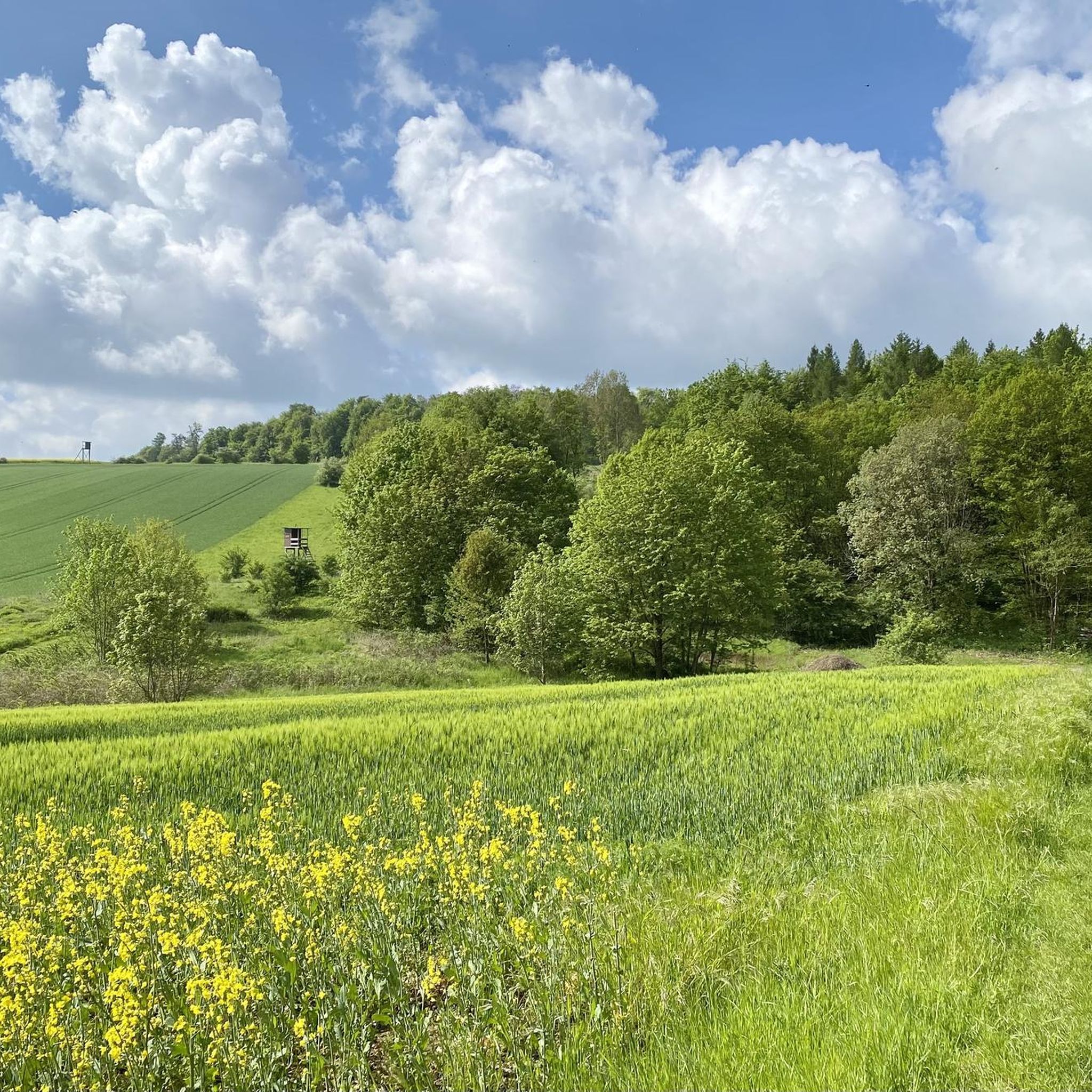
Great photo motif in rapeseed blossom
0
0
old Dutch windmill near Halchter
0
0

The windmill at the Bungenstedter Turm stands south of the Wolfenbüttel village of Halchter, between the Oker River and the former Bundesstraße 4 (Federal Highway 4). It was built in 1880 as a Dutch windmill. Due to its construction and operation, this mill represents a unique example in our region of the transition from artisanal to industrial technology. Its grinding mechanism has remained virtually unchanged and in good condition since its construction. For these reasons, it is considered a particularly valuable architectural monument. It is also one of the most striking rural cultural monuments in the city and district of Wolfenbüttel. The mill was in operation until 1956, most recently with a diesel engine. Source: https://www.lessingstadt-wolfenbuettel.de/vor-ort/poi/windmuehle-am-bungenstedter-turm
1
0
Frequently Asked Questions
What kind of terrain can I expect on hiking trails around Ohrum?
Hiking around Ohrum offers a diverse landscape, characterized by idyllic forests, winding rivers like the Oker, and tranquil lakes. You'll find paths through the prominent Oderwald forest, with some routes leading to elevations such as the Hungerberg, which reaches 205 meters. While most paths offer a pleasant experience, some trails might be natural, overgrown, or muddy due to forestry vehicles at certain times.
Are there many easy hiking trails suitable for beginners or casual walkers?
Yes, Ohrum has a good selection of easy trails. Out of the 27 available routes, 17 are classified as easy. For example, the Ohrum Church – Parking Lot in Ohrum loop from Ohrum is an easy 5.0 km path that takes about 1 hour 20 minutes, passing local landmarks and following parts of the Oker River. Another easy option is the Hedwigsburg Oker Mill – Okerweg Cobblestone Path loop from Ohrum, a 3.3 km trail through the Oker River area.
Are there any circular hiking routes in Ohrum?
Many of the hiking routes around Ohrum are designed as loops, offering varied experiences without retracing your steps. A notable circular route is the Old School of Ohrum – View between the Oderwald and the Asse loop from Ohrum, a moderate 8.3 km trail that takes about 2 hours 15 minutes and provides views between the Oderwald and Asse. The region also features the popular Hungerberg Circular Route in the Oderwald.
What natural features or landmarks can I see while hiking in Ohrum?
Ohrum's trails offer access to several natural and historical highlights. You can explore the extensive Oderwald forest, walk along the scenic River Oker, or discover tranquil lakes. Notable landmarks include the Kaiserpfalz Werla Archaeological Park, the Old Brickworks Pond Natural Monument, and the Chalk Cliff in Southern Oderwald Geopark. There's also a rest area with a giant sequoia in Oderwald.
Is Ohrum a good place for family-friendly hikes?
Yes, Ohrum offers several options suitable for families. The region's easy trails, such as the 2.1 km Ohrum Church loop from Ohrum, are great for shorter outings with children. Additionally, the presence of picnic and rest areas, including one with a play hut, makes it convenient for families to take breaks and enjoy the outdoors.
Are there any dog-friendly hiking trails around Ohrum?
The natural environment of Ohrum, with its extensive forests and riverside paths, is generally welcoming for dogs. Many trails through the Oderwald and along the Oker River are suitable for walks with your canine companion. Always ensure your dog is under control and check for any local regulations regarding pets in specific areas or nature reserves.
What is the best time of year to go hiking in Ohrum?
Ohrum offers pleasant hiking experiences throughout much of the year. Spring and autumn provide comfortable temperatures and beautiful scenery, with lush greenery or vibrant fall colors. Summer is also popular for hiking, though some paths might be more exposed. While winter sports are available in the nearby Harz mountains, the local trails around Ohrum can be enjoyed for winter walks, though some paths might be muddy or natural.
How many hiking routes are available in the Ohrum area?
There are over 25 hiking routes available around Ohrum, catering to various preferences and fitness levels. This includes 17 easy trails, 8 moderate trails, and a couple of more difficult options, ensuring a diverse range of experiences for hikers.
What do other hikers say about the trails in Ohrum?
The hiking routes in Ohrum are highly rated by the komoot community, with an average score of 4.5 stars from over 900 reviews. Hikers often praise the diverse natural features, including the Oderwald forest and the Oker River, as well as the variety of trails suitable for different abilities. Over 5000 hikers have used komoot to explore Ohrum's varied terrain.
Are there places to eat or rest along the hiking trails in Ohrum?
Yes, there are options for resting and dining. You can find huts and cabins in the area, such as the Assewirtschaft — Waldhaus at the Asse, which serves as a restaurant. Additionally, there are dedicated picnic and rest areas with wooden shelters, providing convenient spots to take a break during your hike.
What is the highest point I can reach on a hike near Ohrum?
The highest elevation directly accessible on a hike near Ohrum is the Hungerberg, located within the Oderwald forest, which reaches 205 meters. There's a popular circular route that allows hikers to ascend the Hungerberg, offering a varied hiking experience.
Most popular routes around Ohrum
Most popular attractions around Ohrum

Get inspired with the komoot mobile app


Explore more
Browse the best Hikes in other regions.
