The best MTB trails around Oberdiebach
4.6
(1283)
4,110
riders
311
rides
Mountain bike trails around Oberdiebach offer a diverse landscape for outdoor enthusiasts. The region is characterized by rolling hills, dense forests, and scenic routes along the Rhine River. Mountain bikers can expect varied terrain, including paths through picturesque vineyards and the Upper Middle Rhine Valley, a UNESCO World Heritage site. This area provides a range of trails suitable for different skill levels, from river-side paths to more challenging ascents through vineyards.
Best mountain bike trails around Oberdiebach
- The most…
Last updated: October 4, 2026
4.6
(66)
211
riders
41.9km
02:48
420m
420m
Moderate mountain bike ride. Good fitness required. Suitable for all skill levels.
4.9
(34)
86
riders
46.3km
04:22
1,140m
1,140m
Hard mountain bike ride. Very good fitness required. Advanced riding skills necessary.

4.8
(48)
245
riders
Moderate mountain bike ride. Good fitness required. Suitable for all skill levels.
4.7
(18)
80
riders
Moderate mountain bike ride. Good fitness required. Suitable for all skill levels.
4.7
(15)
69
riders
44.6km
02:33
150m
150m
Moderate mountain bike ride. Good fitness required. Suitable for all skill levels.
Get access to more routes and recommendations from other explorers.
Already have an account?
Our route recommendations are based on thousands of hikes, rides, and runs completed by other people on komoot.
Start today with a free account
Your next adventure awaits.
Tips from the Community

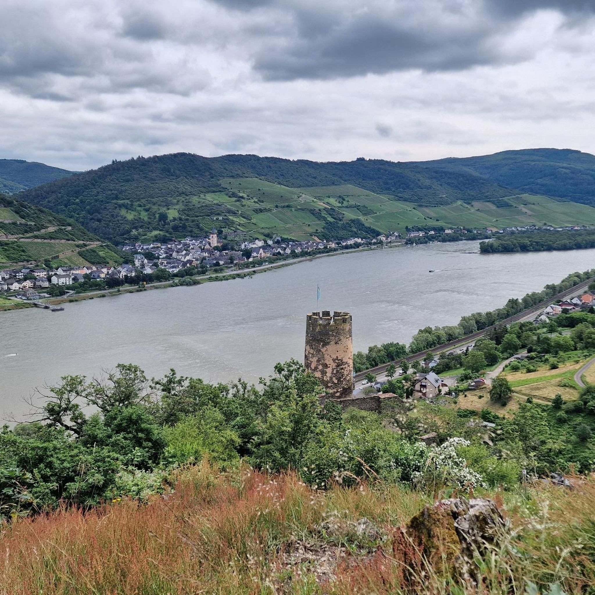
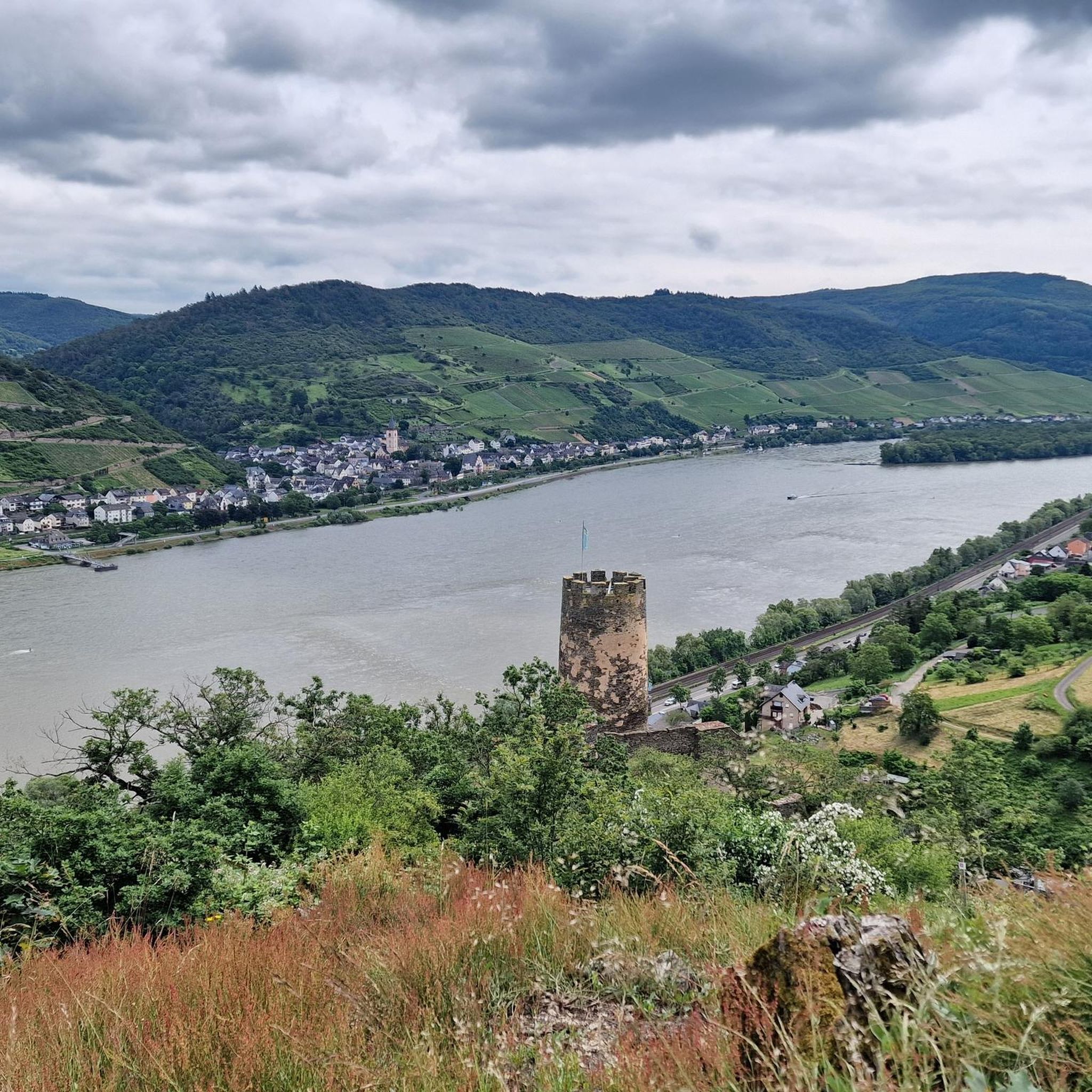
The Binger Mäuseturm is one of the landmarks here in the upper Middle Rhine Valley and, although smaller and easier to overlook, it factually has the same status as the Pfalzgrafenstein in Kaub. From the Rheingau side, only a view is possible, from the Bingen side, you can walk to the island at low water in the Rhine. Exciting: Several, partly bloody legends surround the Mäuseturm. More here: https://www.mittelrheinentdecken.de/de/sehenswuerdigkeiten/binger-maeuseturm/
0
0
The Binger Mäuseturm is one of the landmarks here in the upper Middle Rhine Valley and, although smaller and easier to overlook, it factually has the same status as the Pfalzgrafenstein in Kaub. From the Rheingau side, only a view is possible, while from the Bingen side, you can walk to the island at low water in the Rhine. Exciting: Several, partly bloody legends surround the Mäuseturm. More info here: https://www.mittelrheinentdecken.de/de/sehenswuerdigkeiten/binger-maeuseturm/
0
0


From the village center in Weiler, continuing the Heilig Kreuz-Weg, a Stations of the Cross with Stations of the Cross leads north into the Binger Wald. It ends at the "Gedenkstätte Belle Kreuz" in the middle of the forest. The site is equipped with an open-air altar and a 10-meter-high wooden cross. The altar area serves as a memorial for the victims of the Second World War. The first Holy Mass took place here in 1955. As early as 1949, the community was founded to establish a Stations of the Cross. In 1951/52, the Stations of the Cross, made of Mayen basalt, could be erected. The Mainz sculptor Adam Winter created the relief panels for the niches of the stations. Since 1961, the remaining work has been completed.
1
0

Flood levels of the last 100 years
0
0

And again a very beautiful castle complex
0
0

HISTORY OF THE PILGRIMAGE CHURCH Around the year 1400, a knight named Johannes Brömser von Rüdesheim lived. He had inherited the Sterrenberg Castle above Bornhofen. By now he had built two churches: the parish church of Rüdesheim and the pilgrimage church “Noth Gottes” near Rüdesheim. Now he also began in Bornhofen, at the foot of his newly acquired castle, to build a church by extending the already existing church. He died in 1416. The construction of the church was continued after his death until its completion (1435). Thus the present-day pilgrimage church came into being.
2
0
Frequently Asked Questions
How many mountain bike trails are available around Oberdiebach?
There are over 320 mountain bike trails around Oberdiebach, offering a wide range of options for all skill levels. This includes 35 easy routes, 264 moderate routes, and 30 difficult trails for experienced riders.
What is the best time of year for mountain biking in Oberdiebach?
The optimal seasons for mountain biking in Oberdiebach are spring and autumn. During these times, you'll find pleasant temperatures and stable weather conditions, making the trails more accessible and enjoyable than in the potentially very hot summer or snowy winter months.
Are there family-friendly mountain bike trails in Oberdiebach?
Yes, Oberdiebach offers several family-friendly mountain bike trails. Many routes wind through picturesque vineyards and along the Rhine River, providing a scenic and less strenuous experience. For an easy option, consider the Rheinstein Castle – Rhine-Nahe-Eck loop from Niederheimbach, which is 27.9 km long and features views of historic castles.
Can I find circular mountain bike routes in Oberdiebach?
Absolutely. Many of the mountain bike trails around Oberdiebach are designed as circular routes, allowing you to start and end at the same point. A popular moderate circular route is the View over Bacharach loop from Niederheimbach, which covers 35.2 km through vineyards and forests.
What kind of scenery can I expect on mountain bike trails in Oberdiebach?
Mountain bike trails in Oberdiebach offer diverse and picturesque scenery. You'll ride through rolling hills, dense forests, and extensive vineyards, often with breathtaking views of the Rhine River. The region is part of the UNESCO World Heritage Upper Middle Rhine Valley, ensuring stunning natural beauty and historic landscapes.
Are there any challenging mountain bike routes for advanced riders?
Yes, for advanced riders seeking a challenge, Oberdiebach has difficult routes with significant elevation changes. An example is the Niederheimbach–Lorch Ferry – Nollig Castle Ruins loop from Niederheimbach, a 35.7 km route with substantial ascents and descents.
What do other mountain bikers say about the trails in Oberdiebach?
The mountain bike trails in Oberdiebach are highly regarded by the komoot community, with an average rating of 4.7 stars from over 950 reviews. Riders frequently praise the diverse terrain, the scenic views of the Rhine Valley and vineyards, and the well-maintained paths that cater to various skill levels.
Are there places to eat or drink along the mountain bike trails?
Yes, you can find several huts, restaurants, and forest lodges near the trails where you can stop for refreshments. Notable options include the Heiligkreuz Forest Inn, the Lauschhütte Restaurant & Outdoor Park, and the Jägerhaus Forest Lodge.
What historical landmarks or viewpoints can I see while mountain biking?
The trails often pass by or offer views of significant historical landmarks and scenic viewpoints. You can spot structures like the Rossel Ruins, Rheinstein Castle, and the impressive Pfalzgrafenstein Castle. Don't miss the Rotweinlaube — Pavilion with views over the Rhine Valley for panoramic vistas.
Are there long-distance mountain bike routes available?
Yes, for those looking for longer rides, Oberdiebach offers extensive routes. The View of the Loreley Rock – View of Marksburg Castle loop from Niederheimbach is a substantial 83.8 km trail, providing a full day's adventure with expansive views of the Rhine Valley.
Where can I find parking for mountain biking in Oberdiebach?
While specific parking areas are not detailed for every trail, a popular starting point for many excursions is the local sports center, which typically offers parking facilities. You'll find various access points to the trail network from there.
Are dogs allowed on the mountain bike trails?
Generally, dogs are welcome on most public trails in the Oberdiebach region, especially if kept on a leash. However, it's always advisable to check local regulations or specific trail signage, particularly in nature reserves or protected areas, to ensure compliance.
Most popular routes around Oberdiebach
Most popular attractions around Oberdiebach

Get inspired with the komoot mobile app


Explore more
Browse the best MTB trails in other regions.
