The best walks and hikes in the New England Range
4.6
(137)
1,954
hikers
38
hikes
Hiking in the New England Range offers diverse landscapes, characterized by dramatic gorges, waterfalls, granite formations, and extensive forests. The region features a mix of challenging trails and more accessible paths through national parks and wilderness areas. Hikers can explore varied terrain, from high-altitude lookouts to lush rainforests and coastal sections.
Best hiking trails in the New England Range
- The most popular hiking route is Granite Arch via Pyramid track, a 2.5 miles (4.1 km) trail that takes 1…
Last updated: May 19, 2026
4.8
(12)
216
hikers
4.08km
01:38
180m
180m
Moderate hike. Great for any fitness level. Mostly accessible paths. Sure-footedness required.
8.11km
03:32
720m
720m
Moderate hike. Good fitness required. Easily-accessible paths. Suitable for all skill levels.

Sign up for free
4.9
(25)
348
hikers
7.57km
02:15
230m
230m
Moderate hike. Good fitness required. Easily-accessible paths. Suitable for all skill levels.
4.6
(16)
133
hikers
Easy hike. Great for any fitness level. Easily-accessible paths. Suitable for all skill levels.
4.8
(13)
92
hikers
Easy hike. Great for any fitness level. Easily-accessible paths. Suitable for all skill levels.
4.7
(3)
64
hikers
5.91km
01:37
60m
60m
Moderate hike. Great for any fitness level. Mostly accessible paths. Sure-footedness required.
4.5
(2)
53
hikers
Easy hike. Great for any fitness level. Easily-accessible paths. Suitable for all skill levels.
5.0
(4)
50
hikers
5.20km
01:58
180m
180m
Moderate hike. Great for any fitness level. Mostly accessible paths. Sure-footedness required.
4.6
(5)
33
hikers
3.07km
00:55
90m
90m
Easy hike. Great for any fitness level. Easily-accessible paths. Suitable for all skill levels.
5.0
(1)
31
hikers
Moderate hike. Good fitness required. Easily-accessible paths. Suitable for all skill levels.
Get access to more routes and recommendations from other explorers.
Sign up for free
Already have an account?
Our route recommendations are based on thousands of hikes, rides, and runs completed by other people on komoot.
Start today with a free account
Your next adventure awaits.
Login or Signup

Tips from the Community

Very nice hike, definitely wear good hiking boots, preferably in the morning and not in wet weather! You should also be comfortable with heights.
0
0

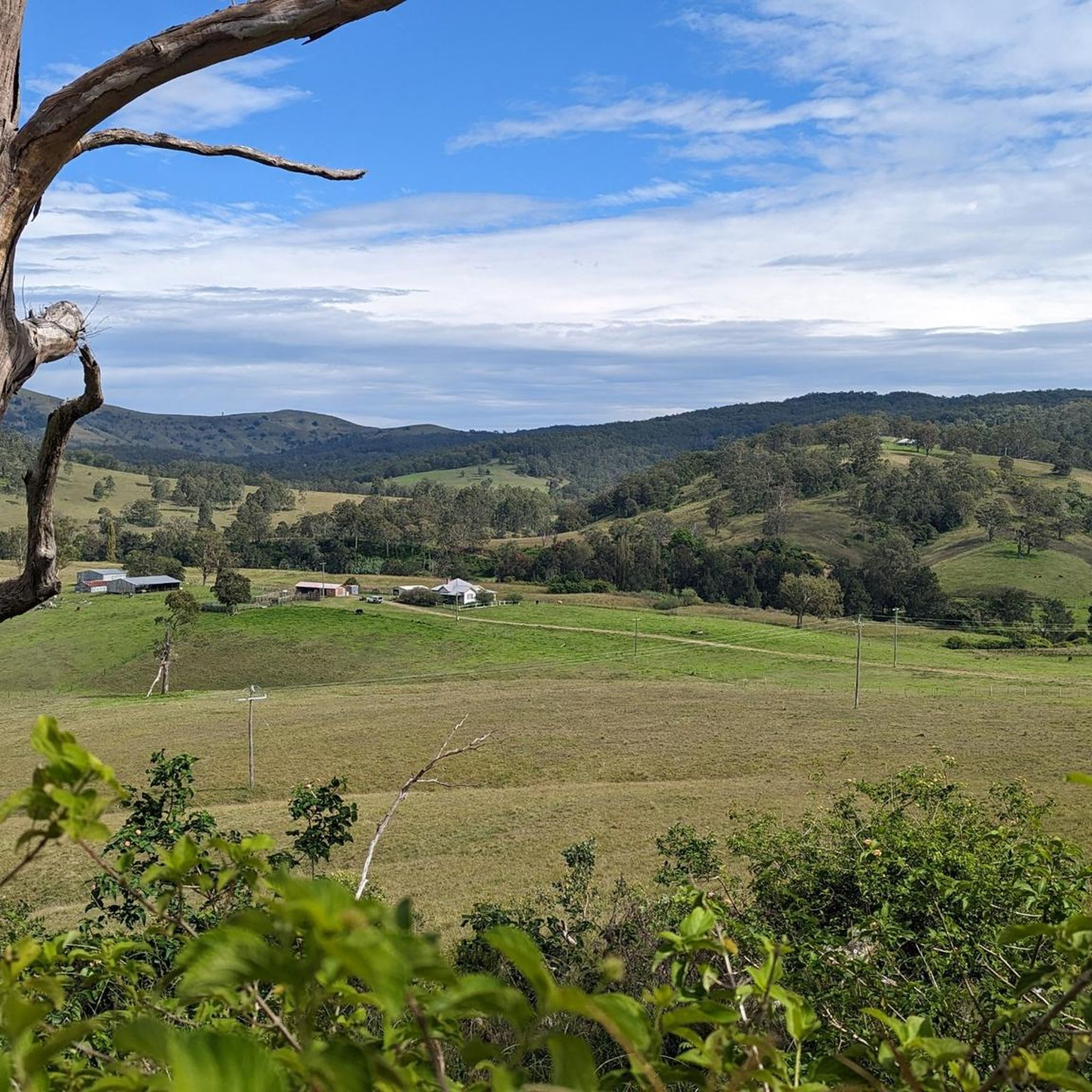
This scenic viewpoint overlooks the forested valleys of Bindarri National Park, which extend across the park’s rugged ridges and deep valleys shaped by the Urumbilum River. The elevated vantage point offers a unique perspective of the dense rainforest and eucalypt forest that cover most of the park, and it is a fantastic spot for a rewarding break before heading back onto the track.
0
0
Bindarri National Park protects a rugged, beautiful landscape of rainforest, rivers and forested ranges west of Coffs Harbour on the NSW Mid North Coast. Covering around 7,000 hectares, the park forms part of the Gondwana Rainforests region and supports diverse plant and animal life. There are plenty of walking tracks and lookouts throughout the park, allowing visitors to experience its remote valleys, waterfalls and subtropical forest environments.
0
0
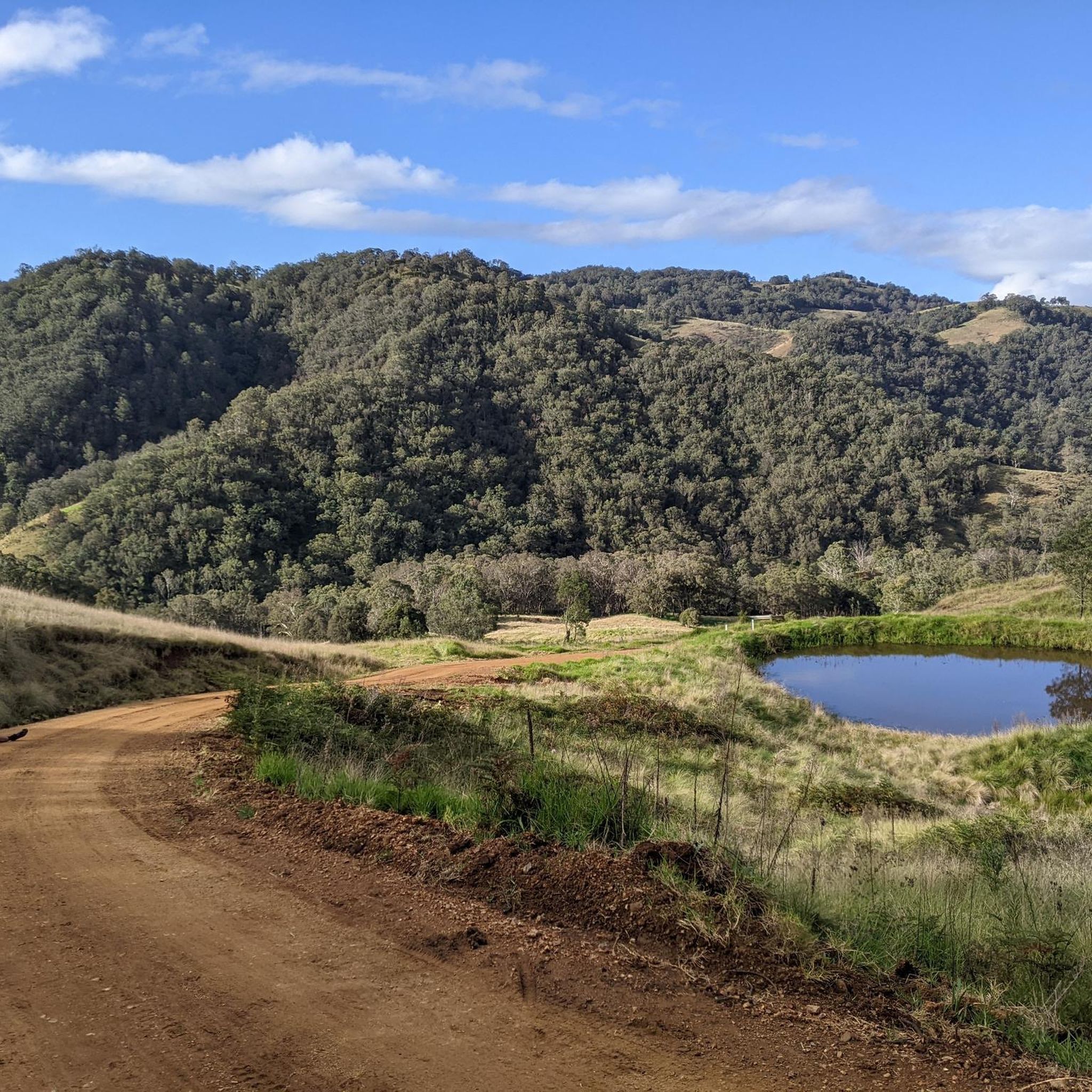
Devos Trail is a 4WD management track suitable for walkers and mountain bikers that runs through dense rainforest and tall eucalypt forest in the rugged ranges west of Coffs Harbour. The wide track climbs steadily along forested slopes, with occasional views across the surrounding valleys through breaks in the canopy. Its remote setting and quiet bushland offer a sense of the wild, subtropical landscape that defines this part of the hinterland. After heavy rainfall, the rock and clay on the path can be slippery, so it’s a good idea to plan ahead if you’re visiting during wet weather.
0
0
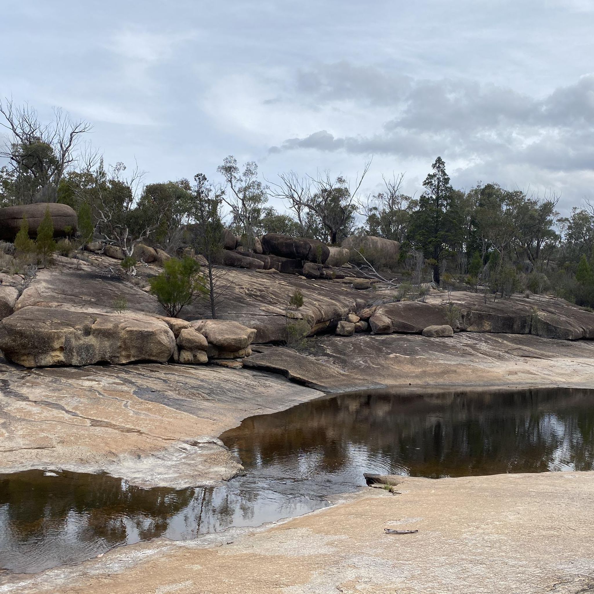
Pyramid Summit is the highest peak in Girraween National Park and one of its most recognisable landmarks. As you climb the final section, the track follows wide granite slabs that lead directly to the summit. Rounded domes and rocky peaks rise across the park, forming a series of pyramid-shaped mountains that give the area its name. From this exposed granite summit, forested valleys and distant ridgelines stretch across the horizon, offering one of the most expansive viewpoints in the park.
0
0
Pyramid track climbs steadily through open woodland and granite outcrops toward one of the park’s most recognisable peaks. As you follow the track, the path moves across smooth granite slabs and between large boulders, gradually gaining elevation as the landscape opens around you. The exposed granite surfaces and scattered eucalypts are characteristic of Girraween’s rugged terrain, with occasional views across the beautiful surrounding bushland as you approach the upper slopes of The Pyramid.
0
0
Granite Arch is an impressive natural rock formation created by the weathering of the park’s massive granite outcrops. The arch forms where large granite blocks have eroded and shifted over time, leaving a curved opening beneath the rock. As you pass underneath the formation and look at the surrounding boulders, you get a true appreciation for the scale of the slow geological processes that have shaped the unique granite landscape of Girraween.
0
0

Natural stone archway made up of balancing boulders.
0
0
Frequently Asked Questions
What kind of landscapes can I expect to see while hiking in the New England Range?
The New England Range offers a remarkably diverse landscape, characterized by dramatic gorges, cascading waterfalls, distinctive granite formations, and extensive forests. You'll find a mix of high-altitude lookouts, lush rainforests, and even some coastal sections, providing a wide array of natural beauty to explore.
How many hiking trails are available in the New England Range?
There are over 35 hiking trails in the New England Range, catering to various skill levels. You'll find 14 easy routes, 23 moderate trails, and 1 challenging option, ensuring there's something for everyone.
Are there any easy, family-friendly hikes in the New England Range?
Yes, the New England Range has several easy trails suitable for families. An excellent option is the Three Brothers Lookout – Kylie's Beach Lookout loop from Indian Head Camping Area, which is just over 3.5 km and takes about an hour. Another easy choice is the Crystal Shower Falls loop from Bellingen Shire Council, a 3 km trail leading to a beautiful waterfall.
What are some popular circular walks in the New England Range?
Many hikers enjoy circular routes for their convenience. A popular choice is the Hardwood Lookout – Crystal Shower Falls loop from Bellingen Shire Council, which is 7.6 km and takes about 2 hours 15 minutes. Another great option is the Granite Arch loop from Girraween National Park, a moderate 5.9 km trail.
Are there any trails that feature waterfalls in the New England Range?
Absolutely! The region is known for its cascading waterfalls. You can visit the notable Crystal Shower Falls via the Hardwood Lookout – Crystal Shower Falls loop from Bellingen Shire Council. Another beautiful spot is Dangar Falls, which you can find more information about at Dangar Falls.
What are some notable landmarks or natural features to see on a hike?
The New England Range is home to several unique natural monuments. The distinctive Granite Arch is a must-see, accessible via the Granite Arch via Pyramid track. You can also explore formations like the Eye of the Needle, Mt Norman and Turtle Rock.
What do other hikers enjoy most about the New England Range trails?
The trails in the New England Range are highly rated by the komoot community, with an average score of 4.6 stars from over 130 reviews. Hikers often praise the diverse terrain, from dramatic gorges to lush rainforests, and the well-maintained paths that lead to stunning lookouts and waterfalls.
Are there any trails with expansive views or lookouts?
Yes, many trails offer breathtaking vistas. The Legge lookout via Devos Trail is a moderate 8.1 km path specifically known for its expansive views over the New England wilderness. Another great option is the Gorge Lookout – Chandler Falls Lookout loop from Wollomombi Gorges Picnic Area.
What is a good moderate hike for someone looking for a bit of a challenge?
For a moderate challenge, consider the Legge lookout via Devos Trail. This 8.1 km route involves a significant elevation gain of over 700 meters, offering a rewarding workout and spectacular views.
Are there any trails that pass through rainforests?
Yes, the New England Range features trails that wind through beautiful rainforest environments. The Hardwood Lookout – Crystal Shower Falls loop from Bellingen Shire Council is a prime example, taking you through lush rainforest sections and past a notable waterfall.
How long do hikes in the New England Range typically take?
Hike durations vary depending on the trail and your pace. Shorter, easy trails like the Granite Arch via Pyramid track can be completed in about 1 hour 38 minutes. Moderate loops such as the Hardwood Lookout – Crystal Shower Falls loop typically take around 2 hours 15 minutes, while longer moderate routes like Legge lookout via Devos Trail can take over 3.5 hours.
Most popular routes in the New England Range
Most popular attractions in the New England Range

Get inspired with the komoot mobile app


Explore more
Browse the best Hikes in other regions.
