The best waterfall hikes and walks around Alberni-Clayoquot
4.6
(1743)
13,526
hikers
3
hikes
Waterfall hiking trails around Alberni-Clayoquot traverse a region characterized by dramatic natural landscapes, including old-growth forests, mountains, and a varied coastline. The Alberni Valley is nestled between vast forest-covered mountains and the deep waters of the Alberni Inlet. This area features numerous waterfalls, often accessible via trails through gorges and dense forest paths, offering various viewpoints.
Best waterfall hiking trails around Alberni-Clayoquot
- The most popular waterfall hiking route is China Creek Falls Trail, a 1.7 miles (2.7 km) trail that takes 44 minutes to complete. This easy route leads to the notable China Creek Falls.
- Another top favourite among local hikers is Stamp Falls Trail, an easy 0.7 miles (1.2 km) path. This trail provides access to Stamp Falls, known for its salmon runs and surrounding riparian old-growth forest.
- Local hikers also love the Weiner Falls, a 2.4 miles (3.9 km) trail leading through forested terrain, often completed in about 1 hour 6 minutes.
- Hiking around Alberni-Clayoquot is defined by old-growth forests, river valleys, and coastal features. The network offers options for different ability levels, with all listed waterfall trails being easy.
- The routes in Alberni-Clayoquot are highly rated by the komoot community with an average score of 4.6 stars from over 1,700 reviews. More than 13,500 hikers have used komoot to explore Alberni-Clayoquot's varied terrain.
Last updated: October 26, 2026
5.0
(3)
33
hikers
2.69km
00:44
50m
50m
Easy hike. Easily walkable paths.
5.0
(2)
5
hikers
1.18km
00:19
10m
10m
Easy hike. Easily walkable paths.

5.0
(1)
5
hikers
3.89km
01:06
80m
80m
Easy hike. Easily walkable paths.
Our route recommendations are based on thousands of hikes, rides, and runs completed by other people on komoot.
Start today with a free account
Your next adventure awaits.
Popular around Alberni-Clayoquot
Other adventures around Alberni-Clayoquot

Tips from the Community

This rough logging road provides the main approach to Weiner Falls, climbing gradually beneath the power lines before narrowing into an old forest road. The route is straightforward initially, but several smaller tracks branch towards the creek without reaching the falls. Continue uphill until the road begins to fade, then watch for a small cairn and trail markers leading into the forest towards Weiner Falls.
0
0
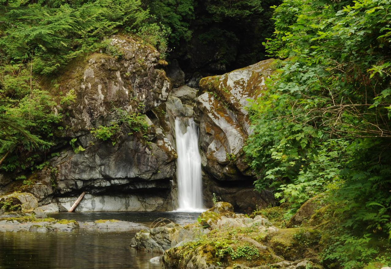
Weiner Falls plunges into a clear, grotto-like pool surrounded by mossy rock and dense forest. The short approach follows an old logging road before reaching the top of the falls, where the drop is exposed and requires care. Reaching the pool below involves a very steep, rope-assisted descent over roots and uneven ground. The slope becomes particularly slippery after rain, but the upper viewpoint offers an easier alternative.
0
0

This easy, well-marked path leads you through a forest of tall cedar and fir trees to a beautiful waterfall. The most interesting thing you can see here happens in the late summer and autumn. If you look down into the river from the viewing platforms, you will see thousands of salmon swimming upstream.
0
0
You can watch salmon leap over the waterfalls or use the special "fish ladder" built into the rocks to help them reach their spawning grounds. It is an amazing sight to see so many fish jumping through the white water at once.
0
0

China Creek Trailhead sits at a pull-off along Bamfield Main, identifiable by a yellow gate and a small trail sign that can be easy to miss if you’re not watching for it. Parking is limited, and there are no facilities available, so be sure to come prepared. Access is free, but the trailhead is on an active logging road, so it’s best to go on weekends when operations are paused. As you set off from the trailhead, the path quickly immerses you in a lush coastal forest, following China Creek upstream toward the falls.
1
0
This trail is a relatively short path that climbs through mossy forest along China Creek, with ropes to assist on the final descent to the beautiful China Creek Falls. Expect slippery rocks and roots, but the reward comes quickly, as it typically takes just under an hour to complete the trek.
0
0
China Creek Falls is beautiful, plunging roughly 30 meters into a rocky gorge, fed by the clear waters of China Creek. It’s most impressive after heavy rain or spring runoff, and is a great spot to relax and take some gorgeous photos before heading back on the trail.
0
0

The waterfall can be reached by easy walking trails that wind through the lush forest and past rapids. The park is named after the pioneer who built the earliest sawmill in Port Alberni. One of the park's main attractions is the annual migration of thousands of Pacific salmon that circle in the pool below Stamp Falls before ascending the fish ladders on their way to the spawning grounds. Viewpoints along the river offer excellent views of the salmon battling their way up the falls. This natural phenomenon occurs every year, beginning in late August with sockeye salmon and continuing with coho and chinook salmon through December. Salmon are also the reason black bears come to the river.
1
0
Frequently Asked Questions
How many waterfall hiking trails are available in the Alberni-Clayoquot region?
The Alberni-Clayoquot region offers a variety of outdoor experiences, including several dedicated waterfall hiking trails. This guide features 3 easy routes that lead to impressive waterfalls, such as China Creek Falls Trail, Stamp Falls Trail, and Weiner Falls. Beyond these, the broader region boasts numerous other waterfalls like Della Falls (Canada's highest), Stokes Creek Falls, and the 'Hole in the Wall' on the Rogers Creek Nature Trail, offering a wide range of options for waterfall enthusiasts.
What kind of terrain can I expect on waterfall hikes in Alberni-Clayoquot?
Waterfall hikes in Alberni-Clayoquot often traverse diverse and lush landscapes. You can expect paths through old-growth forests with towering trees, alongside rivers and streams, and sometimes through gorges. Trails like the China Creek Falls Trail and Weiner Falls offer relatively gentle elevation changes, making them accessible for many hikers. The region is known for its primeval rainforests and dramatic natural features, providing a scenic backdrop to the cascades.
Are there any family-friendly waterfall hikes in the area?
Yes, the Alberni-Clayoquot region has several family-friendly options for enjoying waterfalls. The trails featured in this guide, such as Stamp Falls Trail, are rated as easy, with minimal elevation gain and shorter distances, making them suitable for families with children. These routes often provide well-maintained paths and clear viewpoints to safely enjoy the natural beauty.
Can I bring my dog on these waterfall trails?
Many trails in the Alberni-Clayoquot region are dog-friendly, but it's always best to check specific regulations for each park or trail. Generally, dogs are welcome on leash on most public trails. For instance, the easy routes like China Creek Falls Trail are often suitable for well-behaved dogs, allowing your furry companion to enjoy the outdoor adventure with you.
What is the best time of year to see the waterfalls at their fullest?
The waterfalls in Alberni-Clayoquot are often at their most impressive during the spring months (April to June) when snowmelt from the mountains contributes to higher water levels. Fall (September to November) can also offer strong flows due to increased rainfall. While beautiful year-round, these seasons provide the most dramatic views of the cascades.
Are there any notable landmarks or viewpoints near the waterfall trails?
Absolutely! The region is rich with natural beauty. While hiking to waterfalls, you might find yourself near stunning peaks like Mount Arrowsmith or serene bodies of water such as Sproat Lake Provincial Park. Many trails offer viewpoints overlooking the surrounding forests, mountains, and the Alberni Inlet, enhancing the overall hiking experience.
What do other hikers enjoy most about the waterfall trails in Alberni-Clayoquot?
The komoot community highly rates the hiking experiences in Alberni-Clayoquot, with an average score of 4.6 stars from over 1700 ratings. Hikers frequently praise the accessibility of the trails, the stunning natural beauty of the old-growth forests, and the rewarding views of the powerful waterfalls. The peaceful atmosphere and opportunities for wildlife spotting are also commonly highlighted.
Are there any facilities or amenities near the waterfall hiking areas?
The Alberni-Clayoquot region, particularly around Port Alberni, offers various amenities. Depending on the specific trail, you may find parking areas, restrooms, and picnic spots. For more extensive services like cafes, restaurants, and accommodation, you can visit nearby towns. For more information on local services, you can check Alberni Valley Tourism.
Are there any opportunities for swimming or wading near the waterfalls?
While the sight of cascading water can be inviting, swimming or wading directly at the base of waterfalls can be dangerous due to strong currents, slippery rocks, and hidden hazards. It's generally recommended to admire waterfalls from designated viewpoints. However, the region does have numerous lakes and rivers, such as those within Sproat Lake Provincial Park, where swimming is safe and encouraged in appropriate areas.
How accessible are the viewpoints for the waterfalls?
The waterfall trails highlighted in this guide, including Stamp Falls Trail, are generally easy and feature well-maintained paths, making the viewpoints quite accessible. Many trails are designed to provide safe and clear perspectives of the waterfalls, often with designated viewing platforms. While some paths may have natural roots or uneven surfaces, they are typically manageable for most visitors.
Can I combine multiple waterfall visits into a single day trip?
Yes, given the relatively short distances and easy difficulty of many waterfall trails in the Alberni-Clayoquot region, it is possible to visit multiple waterfalls in a single day. For example, you could explore China Creek Falls Trail and Weiner Falls, which are both easy and offer distinct experiences. Planning your route to include a few nearby cascades can make for a rewarding day of exploration.
Is parking readily available at the trailheads for waterfall hikes?
For most popular waterfall trails in the Alberni-Clayoquot region, including those near Port Alberni, parking is generally available at or near the trailheads. These areas are often managed by regional parks or local authorities. It's always a good idea to arrive earlier during peak seasons to secure a spot, especially for well-known locations like Stamp Falls Provincial Park.
Most popular attractions around Alberni-Clayoquot

Get inspired with the komoot mobile app


Explore more
Browse the best Hikes in other regions.
