The best traffic-free bike rides around Raschau-Markersbach
4.6
(252)
4,310
riders
10
rides
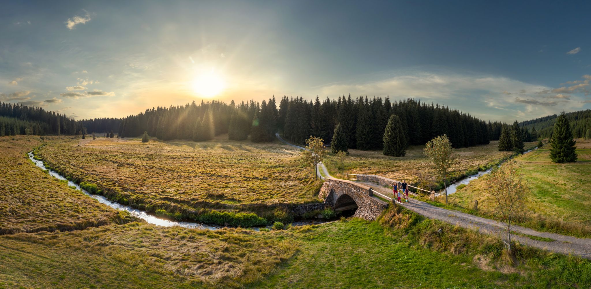
No traffic road cycling routes around Raschau-Markersbach traverse the mountainous landscapes of the Erzgebirge (Ore Mountains) in Saxony, Germany. The region is characterized by rolling hills, picturesque valleys, and dense spruce forests, providing a dynamic terrain for road cyclists. These routes often feature both demanding climbs and exhilarating descents, with surfaces ranging from well-paved roads to some unpaved segments. The area's topography offers varied cycling experiences across different elevation profiles.
Best no traffic road cycling routes around Raschau-Markersbach
- The most…
Last updated: July 20, 2026
16
riders
Moderate road ride. Great for any fitness level. Some segments of this route may be unpaved and difficult to ride.
18
riders
9.04km
00:31
200m
200m
Moderate road ride. Great for any fitness level. Some segments of this route may be unpaved and difficult to ride.
14
riders
33.4km
02:05
460m
460m
Moderate road ride. Good fitness required. Some segments of this route may be unpaved and difficult to ride.
Get access to more routes and recommendations from other explorers.
Sign up for free
Already have an account?
Our route recommendations are based on thousands of hikes, rides, and runs completed by other people on komoot.
Start today with a free account
Your next adventure awaits.
Login or Signup



Tips from the Community

The present-day All Saints' Church dates back to a reconstruction in 1698: a nave with extensions on three sides. However, finds in the floor suggest a predecessor building from the 12th century. The interior has two gallery levels with boxes and a coffered flat ceiling. The ceiling paintings, depicting angels, are particularly noteworthy. The altarpiece shows Christ guiding a blind man in front of a view of Raschau and All Saints' Church. https://www.stiftung-kiba.de/kirchen/allerheiligen-raschau
0
0

The Markersbach pumped-storage power plant is open to visitors. Guided tours lasting approximately two to two and a half hours are offered, providing insight into the power plant's engine cavern and operational procedures.
1
0

Very beautiful, wooded area. I live here, and if anyone would like to explore the area, I'd be happy to accompany them...please contact me. Cyclist Chris
0
0

There is a very beautiful view from the dam.
0
0

top, a nice corner
2
1
The "Markersbach Dam", dammed by the Mittweida River, serves as a lower reservoir for the pumped storage power plant near Markersbach in Saxony. This pumped storage power plant was built between 1970 and 1981 near Markersbach in the Ore Mountains and consists of a lower reservoir, an upper reservoir and the technical power plant facilities. An earth dam at a height of approx. 57 m above the foundation base - forms the main dam of the "Markersbach Lower Reservoir". The subsequent hiking trail around the Markersbach Dam is ideal for hiking and cycling. Along this hiking trail there are wonderful views of the lower reservoir and the surrounding landscape of the Ore Mountains. Source:https://www.dein-erzgebirge.de/talsperren-seen/unterbecken.html
1
0

A trip is worthwhile at any time of year. A hike around the Markersbach dam is very relaxing at around 6.5 km and promises many sights (it's worth taking a closer look!).
0
1

A beautiful hiking trail leads around the lower reservoir. At low water levels, the reservoir turns into a muddy heap.
3
0
Frequently Asked Questions
How many no-traffic road cycling routes are available in Raschau-Markersbach?
There are 10 dedicated no-traffic road cycling routes around Raschau-Markersbach, offering a variety of experiences for different skill levels. You'll find 2 easy routes and 8 moderate routes, ensuring there's something for everyone looking for a peaceful ride.
Are there any easy no-traffic road cycling routes for beginners or families?
Yes, Raschau-Markersbach offers 2 easy no-traffic road cycling routes, perfect for beginners or families looking for a relaxed ride. These routes typically feature less elevation gain and smoother surfaces, allowing for an enjoyable experience through the scenic Erzgebirge landscape.
What kind of terrain can I expect on no-traffic road cycling routes in Raschau-Markersbach?
The no-traffic road cycling routes in Raschau-Markersbach traverse the diverse terrain of the Erzgebirge. You can expect a mix of rolling hills, picturesque valleys, and dense spruce forests. While these routes aim for no traffic, the mountainous landscape means you'll encounter both demanding climbs and exhilarating descents, providing a dynamic and engaging ride.
What do other cyclists enjoy most about road cycling in Raschau-Markersbach?
The komoot community highly rates the road cycling experience in Raschau-Markersbach, with an average score of 4.63 out of 5 stars from 252 ratings. Cyclists frequently praise the quiet, scenic roads, the challenging yet rewarding climbs, and the stunning panoramic views over the Ore Mountains.
Are there any circular no-traffic road cycling routes in the area?
Yes, many of the no-traffic road cycling routes in Raschau-Markersbach are designed as loops. For example, the Markersbach Upper Basin – Anton Günther Mural loop from Raschau-Markersbach offers a moderate 12.45 km ride with scenic views, while the Markersbach Lower Reservoir – All Saints Church Raschau loop from Raschau provides a longer 33.42 km option.
What natural attractions can I see along the no-traffic road cycling routes?
Along the no-traffic road cycling routes, you can discover several natural attractions. The region is home to prominent water bodies like the Cranzahl Dam and the Lower Basin of the Markersbach Pumped Storage Plant. You might also encounter the majestic Fichtelberg, Saxony's highest mountain, offering expansive views.
Are there any notable landmarks or points of interest near the cycling routes?
Beyond the natural beauty, you can find interesting landmarks. The Fichtelberghaus Restaurant & Hotel is a great stop after an ascent, and the impressive Markersbach Viaduct is a distinctive engineering marvel. You can also visit the Fichtelberg Peace Bell for a moment of reflection.
Where can I find parking for no-traffic road cycling routes in Raschau-Markersbach?
Parking options are generally available in and around the main towns and starting points of routes in Raschau-Markersbach. Look for designated parking areas near trailheads or public parking facilities within the villages, especially close to the Markersbach Upper and Lower Basins, which are common starting points for many routes.
Can I reach the no-traffic road cycling routes using public transport?
While specific public transport connections directly to every trailhead might vary, Raschau-Markersbach and surrounding towns in the Erzgebirge are generally accessible by regional bus services. It's advisable to check local bus schedules to plan your journey to a convenient starting point for your chosen route.
What is a good moderate no-traffic road cycling route to try?
A great moderate option is the Markersbach Upper Basin loop from Unterbecken. This route is approximately 9 km long with about 197 meters of elevation gain, offering a pleasant ride through the scenic landscape without heavy traffic.
Are there any specific considerations for road cycling in the Erzgebirge region?
When road cycling in the Erzgebirge, be prepared for varied terrain, including significant climbs and descents, even on no-traffic routes. The region's dense spruce forests can offer shade but also mean some areas might be cooler. Always check weather conditions, especially for higher elevations like the Fichtelberg, as they can change rapidly.
Most popular routes around Raschau-Markersbach
Most popular attractions around Raschau-Markersbach

Get inspired with the komoot mobile app


Explore more
Browse the best Road cycling routes in other regions.
