The best traffic-free bike rides around Burgrieden
4.4
(824)
11,470
riders
169
rides
No traffic road cycling routes around Burgrieden are situated within the scenic Upper Swabia and Württembergisches Allgäu regions, offering diverse landscapes for cycling. The terrain features rolling hills, dense forests, and open meadows, with routes often following river courses like the Riß River and the Iller. Cyclists can expect mostly paved surfaces, winding country lanes, and side roads with minimal traffic, providing a safe and enjoyable riding experience. The region's elevation changes are generally moderate, making it accessible for various…
Last updated: July 20, 2026
3.0
(1)
12
riders
59.9km
02:25
320m
320m
Moderate road ride. Good fitness required. Mostly well-paved surfaces and easy to ride.
4.0
(7)
22
riders
48.0km
01:59
260m
260m
Easy road ride. Great for any fitness level. Mostly well-paved surfaces and easy to ride.
6
riders
54.9km
02:27
280m
280m
Moderate road ride. Good fitness required. Some segments of this route may be unpaved and difficult to ride.
Get access to more routes and recommendations from other explorers.
Sign up for free
Already have an account?
Our route recommendations are based on thousands of hikes, rides, and runs completed by other people on komoot.
Start today with a free account
Your next adventure awaits.
Login or Signup
Popular around Burgrieden
Tips from the Community

From there a cycle path continues directly
0
0


The asphalted road from Schönebürg to Mietingen runs along the Rottum and is easy to navigate.
0
0

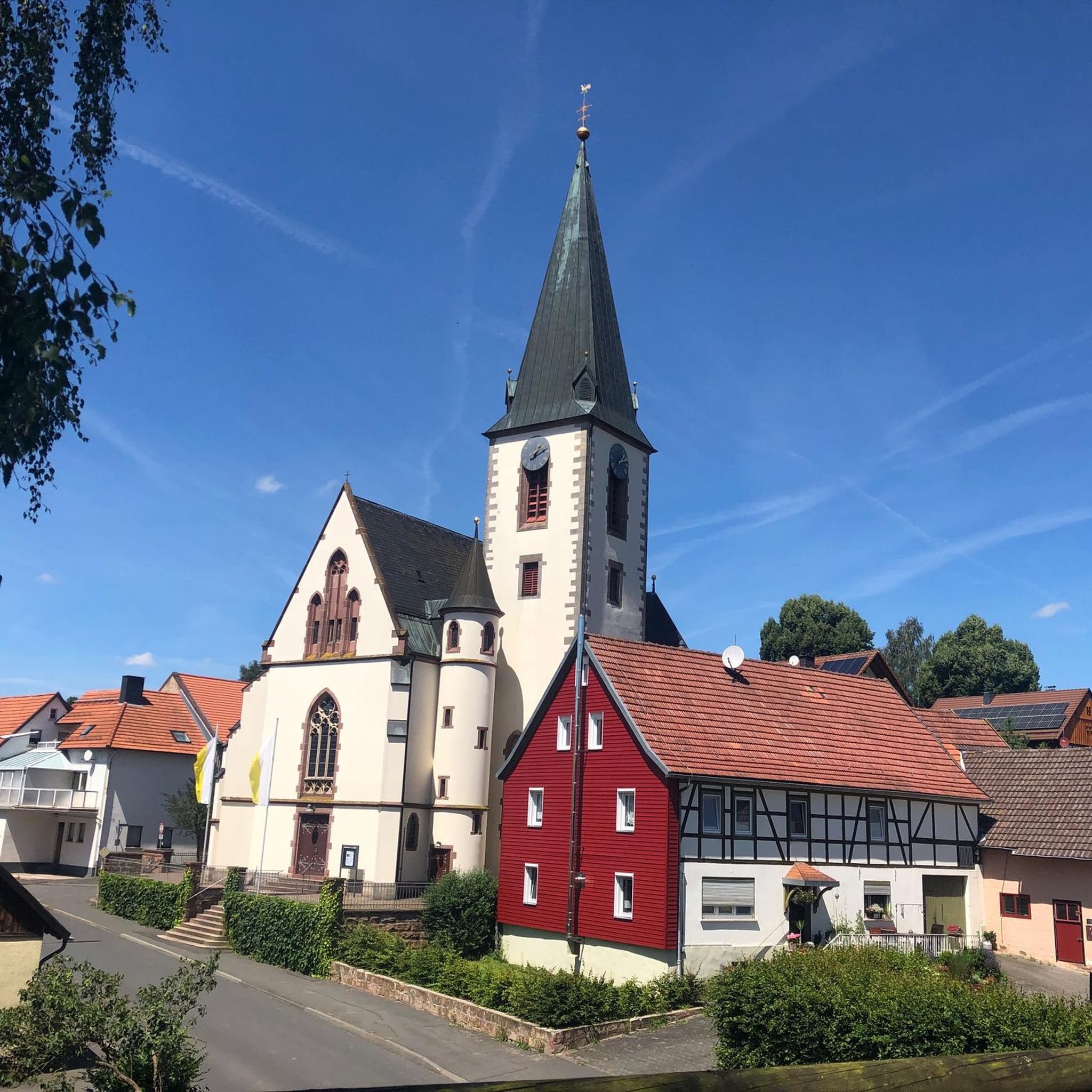
a beautiful church: neo-Gothic.
0
0


Niegel Nagel New cycle path 🫶 At the moment there is no sign in Maselheim that draws attention to the cycle path. Probably still coming.
0
0
Frequently Asked Questions
How many no traffic road cycling routes are available around Burgrieden?
There are over 160 dedicated no traffic road cycling routes around Burgrieden. These routes cater to various skill levels, with a good mix of easy, moderate, and challenging options to explore the scenic Upper Swabia and Württembergisches Allgäu regions.
What kind of terrain can I expect on the no traffic road cycling routes in Burgrieden?
Cyclists can expect mostly paved surfaces, winding country lanes, and side roads with minimal traffic, ensuring a safe and enjoyable ride. The routes often follow river courses like the Rauschende Iller, providing picturesque scenery and generally flat sections, ideal for making good mileage.
Are there any easy, family-friendly no traffic road cycling routes in Burgrieden?
Yes, Burgrieden offers several easy no traffic road cycling routes suitable for families. For instance, the Mobi Park Laupheim – Path Along the Rottum loop from Burgrieden is an easy 48 km route that provides a pleasant experience for all skill levels.
What do other road cyclists enjoy most about cycling in Burgrieden?
The komoot community highly rates the no traffic road cycling routes around Burgrieden, with an average score of 4.4 stars from over 800 ratings. Reviewers often praise the well-maintained paths, the peaceful, low-traffic environment, and the diverse landscapes, from rolling hills to riverside scenery.
What are some notable natural features or viewpoints along the no traffic road cycling routes?
Many routes offer views of the Rauschende Iller River and the Illerkanal. You might also catch distant views of the Alps on clear days. The region is characterized by rolling hills, dense forests, and open meadows, providing a varied natural backdrop for your ride.
Are there any circular no traffic road cycling routes available?
Yes, many of the no traffic road cycling routes around Burgrieden are designed as loops, allowing you to start and end in the same location. An example is the moderate Laupheim Swimming Lake – Mobi Park Laupheim loop from Burgrieden, covering nearly 60 km.
Can I find any historical landmarks or attractions near the cycling routes?
Absolutely. Beyond the natural beauty, you can explore historical sites such as the Baroque historic center of Oberdischingen, known for its unique architecture. The view of Erbach Castle (Donau), a Renaissance patrician castle, also offers historical insights and picturesque vistas.
Are there any lakes accessible from the no traffic road cycling routes?
Yes, several lakes are within reach. The Laupheim Swimming Lake is a popular spot, and you might also encounter the Laupheim Quarry Lake or the Großer Ersinger Lake. These can be pleasant stops during your ride.
What is the best time of year to enjoy no traffic road cycling in Burgrieden?
While cycling is enjoyable for much of the year, many users particularly enjoy the routes in June and July. The region's diverse landscapes and well-maintained paths make it suitable for cycling from spring through autumn, with pleasant weather for exploring.
Are there any challenging no traffic road cycling routes for experienced riders?
Yes, while many routes are easy to moderate, there are also more challenging options. The region offers routes with varying elevation gains to test experienced riders. For example, the Riß River – Water Buffalo Pond loop from Burgrieden is a moderate route covering nearly 55 km with over 280 meters of elevation gain.
Is there public transport available to reach the starting points of these routes?
Burgrieden is well-connected within the region. While specific public transport options for each route's starting point vary, the broader Baden-Württemberg region has an extensive network. It's advisable to check local bus or train schedules for connections to Burgrieden and nearby towns.
Where can I find information about cycling in the wider Baden-Württemberg region?
The Baden-Württemberg region offers an extensive network of cycling routes, including long-distance paths. For more general information about cycling in the state, you can visit visit-bw.com.
Most popular routes around Burgrieden
Most popular attractions around Burgrieden

Get inspired with the komoot mobile app


Explore more
Browse the best Road cycling routes in other regions.
