The best walks and hikes around Nurri
5.0
(4)
13
hikers
4
hikes
Hiking around Nurri, located in central-southern Sardinia, offers diverse natural landscapes for outdoor enthusiasts. The region is characterized by a mix of rolling hills and valleys, some cultivated and others covered in Mediterranean scrub, holm oaks, and cork oaks. Nurri is situated at an altitude of 600 meters on the crest of an extinct volcano, contributing to its distinct topography. The area also features two significant artificial basins, Lake Flumendosa and Lake Mulargia, which provide additional scenic elements to the terrain.
Best hiking trails around Nurri
- The most popular hiking route is Piscina 'e Licona Waterfall – View of the Sa Pranedda Gorge loop from Sàdili/Sadali, an 8.2 miles (13.2 km) trail that takes 3 hours 48 minutes to complete. This difficult route features significant elevation changes and views of the Sa Pranedda Gorge.
- Another top favourite among local hikers is Nuraghe Is Paras loop from Isili, a moderate 8.5 miles (13.6 km) path. This route explores the area around Isili, offering views of the local landscape and historical sites.
- Local hikers also love the Guradia sa Stiddiosa loop from Punta Pranedda Ollastru, a 6.4 miles (10.2 km) trail leading through varied terrain, often completed in about 2 hours 52 minutes.
- Hiking around Nurri is defined by volcanic hills, verdant valleys, and the presence of large artificial lakes. The network offers options for different ability levels, from moderate to difficult routes.
- The routes in Nurri are highly rated by the komoot community with an average score of 5.0 stars from over 2 reviews. More than 7 hikers have used komoot to explore Nurri's varied terrain.
Last updated: July 29, 2026
5.0
(2)
5
hikers
11.6km
03:15
220m
220m
Moderate hike. Good fitness required. Easily-accessible paths. Suitable for all skill levels.
5.0
(1)
6
hikers
Hard hike. Good fitness required. Sure-footedness, sturdy shoes and alpine experience required.

Sign up for free
1
hikers
4.79km
01:27
170m
170m
Easy hike. Great for any fitness level. Easily-accessible paths. Suitable for all skill levels.
5.0
(1)
1
hikers
10.2km
02:52
200m
200m
Moderate hike. Good fitness required. Easily-accessible paths. Suitable for all skill levels.
5.69km
01:37
120m
120m
Easy hike. Great for any fitness level. Easily-accessible paths. Suitable for all skill levels.
Our route recommendations are based on thousands of hikes, rides, and runs completed by other people on komoot.
Start today with a free account
Your next adventure awaits.
Login or Signup
Popular around Nurri
Tips from the Community


Nurahge with a central tower, partially enclosed by a three-lobed bastion dating back to the 15th-14th century BC. It is beautifully preserved and can be visited.
0
0
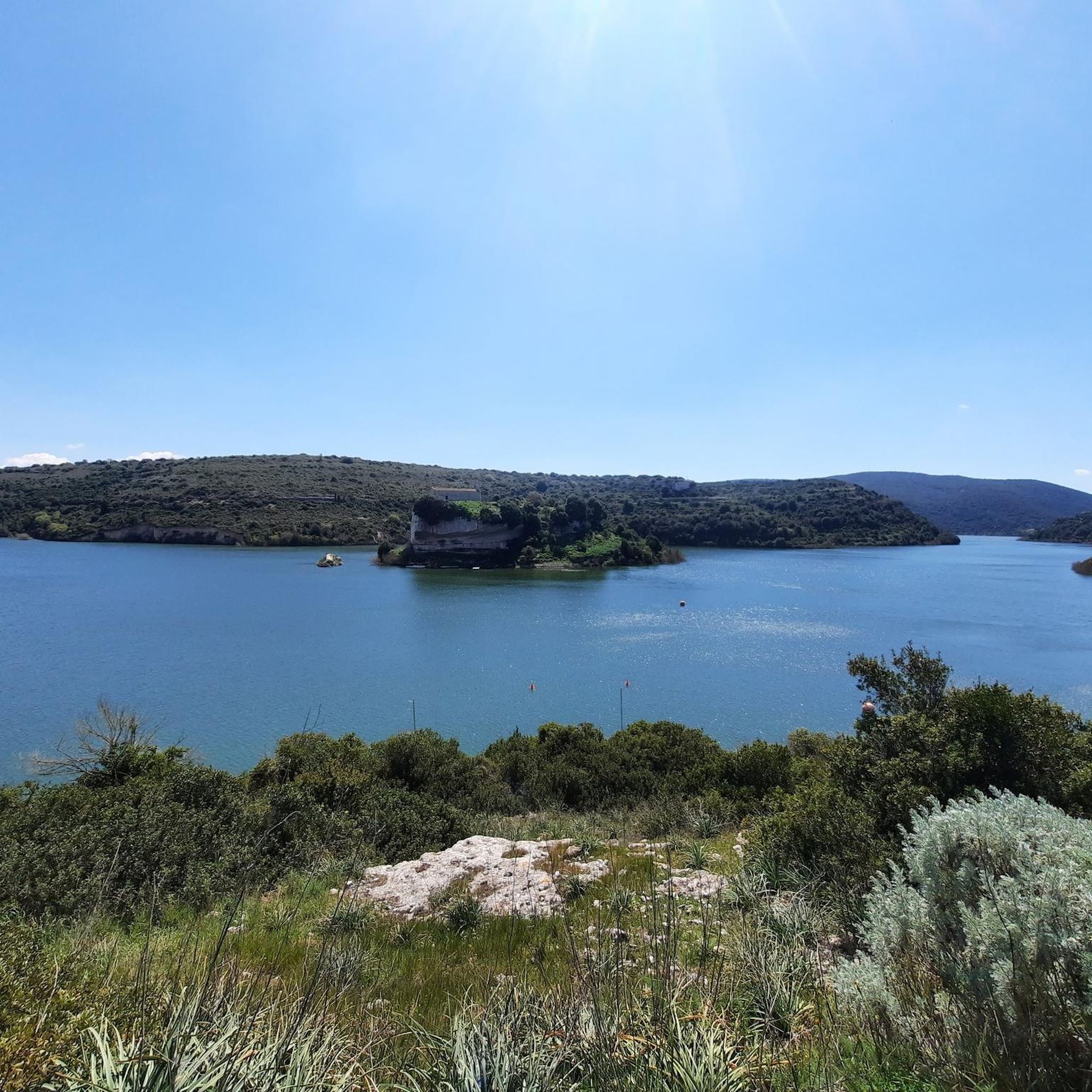
The dam blocks the Fluminimannu river in the Is Barrocus area, in the Isili area. Originates from the artificial reservoir of the same name (also known as Lake San Sebastiano) which has "trapped" the nearby church of San Sebastiano in the middle of the lake.
0
0

This is the Cascata di Su Stampu 'e Su Turrunu waterfall.
2
0

6 euros entrance fee, which is really worth it. Opening times: Only with a guided tour, approx. 45 minutes - at the following times: 10:00 a.m., 11:00 a.m., 3:00 p.m., 4:00 p.m. and 5:00 p.m https://www.escursionisadali.it/ There are 5 rooms to visit. In contrast to the well-known grottos, the lighting is more temporary and the paths are more adventurous. The following legend surrounds the grotto: The cave is called “Is Janas”, which is a Sardinian name for “fairies”. According to a legend, three fairies lived in this cave. The fairies loved food and enjoyed cooking. This is also how you cook during Lent. A priest surprised the fairies while they were eating and was hanged by them (broken stalagtite in the first room). As punishment, God turned the fairies into three stalgmites (room 2). In the fourth room the skeleton of a "Prolagus Sardus" was discovered as well as ceramic shards from the Neolithic period (3000 BC) which can be viewed in the Museum of Caglari. Geological and historical information: The cave dates back 5 million years and was discovered in the 19th century. The cave is approx. 240 meters long and has a constant temperature of 12° and a humidity of 99 - 100%. The colors of the cave are: red (iron oxide and clay), gray (manganese) and black (guano - bat excrement).
5
1
By the way, the waterfall is called "Piscina 'e Licona" - it is a very mystical, idyllic place. You can jump into the pool for a little refreshment ;-)
1
0
In autumn there is only a thin waterfall so that you can take a shower ;-) I wouldn't stand under the pictures in spring. Exciting to see the waterfall falling through a hole
0
1

A bit difficult to get to, but very idyllic! Best from the northern side of the valley. Good shoes are strongly recommended!
0
0
Frequently Asked Questions
How many hiking trails are available around Nurri?
Nurri offers a selection of hiking trails, with over 3 routes currently available on komoot. These routes cater to various fitness levels, from easy walks to more challenging treks through the diverse landscapes of the Sarcidano area.
Are there easy hiking options suitable for beginners or families in Nurri?
Yes, Nurri has easy hiking options perfect for beginners or families. For instance, the Monte Santa Vittoria loop from Perda Lepori is an easy route, offering a pleasant experience without demanding terrain. The region's varied landscape includes rolling hills and verdant valleys, providing accessible paths for all.
What kind of natural attractions can I expect to see while hiking in Nurri?
Nurri is rich in natural beauty, featuring landscapes shaped by its volcanic origins and proximity to significant waterways. You can explore picturesque waterfalls like the San Valentino Waterfall and the Funtana Is Arinus Waterfalls. The area is also known as the 'land of lakes,' with trails often leading to views of Lake Mulargia and the Lower Lake of the Flumendosa, which are home to various bird species.
Are there any circular hiking routes in the Nurri area?
Yes, Nurri offers several circular hiking routes that allow you to start and end in the same location. Examples include the Nuraghe Is Paras loop from Isili and the Guradia sa Stiddiosa loop from Punta Pranedda Ollastru, both offering moderate challenges and scenic views. The Monte Santa Vittoria loop from Perda Lepori is another excellent circular option, suitable for an easier outing.
What is the best time of year to go hiking in Nurri?
Given Sardinia's Mediterranean climate, the best time to hike in Nurri is typically during the spring (April to June) and autumn (September to October) months. During these periods, temperatures are milder, and the natural landscapes are at their most vibrant, with lush vegetation and comfortable conditions for exploration. Summers can be very hot, while winters are generally mild but can bring more rainfall.
Are there any historical or archaeological sites to discover on hikes around Nurri?
Yes, Nurri's rich history is reflected in its landscape. You can find ancient sites like the Domus de janas and the impressive Nuraghe Adoni. These historical sites offer a glimpse into Sardinia's past and are often integrated into hiking routes, adding a cultural dimension to your outdoor adventure.
What are the typical durations and distances for hikes in Nurri?
Hiking routes in Nurri vary in length and duration. You can find shorter, easier walks like the Monte Santa Vittoria loop from Perda Lepori, which is about 4.8 km. Longer, more challenging routes, such as the Piscina 'e Licona Waterfall – View of the Sa Pranedda Gorge loop from Sàdili/Sadali, can extend over 13 km and take several hours to complete, offering a full day's adventure.
What do other hikers say about the trails in Nurri?
The komoot community highly rates the hiking experiences in Nurri, with an average score of 5.0 stars. Hikers often praise the diverse and striking natural landscapes, the unique geological features from its volcanic origins, and the serene beauty of the lakes and waterfalls. The variety of terrain, from Mediterranean scrub to holm oak forests, also receives positive feedback for providing engaging and scenic routes.
Are there any specific routes that feature waterfalls?
Absolutely! Nurri is home to beautiful waterfalls. While specific routes might not be named after them, many trails in the region will lead you close to or offer views of natural gems like the San Valentino Waterfall, located within the town, and the scenic Funtana Is Arinus Waterfalls, nestled in a lush forest. Exploring these natural monuments is a highlight for many hikers.
Can I find trails that offer views of the lakes around Nurri?
Yes, many trails in the Nurri area provide stunning views of the region's artificial basins. The landscape slopes down to the banks of Lake Mulargia and the Lower Lake of the Flumendosa. You can find routes that follow the lake shores or offer panoramic viewpoints, allowing you to appreciate the tranquil waters and the diverse birdlife they support.
Are there any challenging hikes for experienced trekkers in Nurri?
For experienced trekkers seeking a challenge, Nurri offers routes with more demanding terrain. The Piscina 'e Licona Waterfall – View of the Sa Pranedda Gorge loop from Sàdili/Sadali is classified as a difficult hike, featuring significant elevation changes and a longer distance, providing a rewarding experience for those looking for a strenuous adventure.
Most popular routes around Nurri
Most popular attractions around Nurri

Get inspired with the komoot mobile app


Explore more
Browse the best Hikes in other regions.
